Bus Rapid Transit
description: a public transport system using buses in a manner similar to a light rail or metro system, often using exclusive lanes and elevated platforms
43 results

Streetfight: Handbook for an Urban Revolution
by
Janette Sadik-Khan
Published 8 Mar 2016
But buses in the twenty-first century have been transformed from transportation-choice-of-last-resort to become the surface subway of the world’s cities, as fast and reliable as trains, and more convenient and economical than a car. Bus rapid transit (known as BRT) has exploded in popularity since the 1970s when, in Curitiba, Brazil, Mayor Jaime Lerner created a network of buses that ran in dedicated lanes with passengers who paid their fares at train-like platforms. Today, more than 561,000 residents take bus rapid transit daily in Curitiba, 30 percent of the city’s population. This success helped inspire similar systems in Bogotá, Melbourne, Seattle, and Ottawa. BRT systems now operate in 194 cities worldwide and move 32 million daily passengers along 3,200 miles of streets, overwhelmingly in Latin America and Asia.
…
Cost is why so much of this innovation came from less economically developed nations, which have fewer resources and greater incentive for planners to design efficient, inexpensive networks. Bus Rapid Transit station in Curitiba, Brazil. Passengers enter and depart like a surface subway onto high-capacity buses, paying their fare beforehand and boarding via all doors. Mariana Gil/EMBARQ Brasil Bogotá’s bus rapid transit system, TransMilenio, was a pillar of Mayor Enrique Peñalosa’s administration, and its effects resonate beyond the bus route. In his first term, Peñalosa combined TransMilenio with strategies to increase public space, reduce car circulation on city streets, and improve traffic in Bogotá.
…
These forces—planners, elected officials, transportation leaders, and ordinary citizens—are redefining the battle itself with their strategies and focus on cities’ economy, safety, and long-term sustainability goals instead of how many lanes and parking spaces can be crammed onto streets. Globally, new generations of transportation leaders and visionary mayors are rethinking the city and its relationship with its cars and the infrastructure that supports them. Cities on every continent are rebuilding their streets with bus rapid transit networks in months instead of years. Cities like San Francisco, Buenos Aires, and Mexico City are creating pocket parks atop former triangles of asphalt or reclaiming and activating forlorn spaces beneath highways, giving new life and creating the “small change” of street contacts from which public life can grow.
Straphanger
by
Taras Grescoe
Published 8 Sep 2011
At Avenida Jiménez, we changed lines, walking through subway-like corridors between platforms, before boarding a bus that actually had a few empty seats. I asked Jeff Ncgobo, the manager of Johannesburg’s Rea Vaya bus rapid transit system, what he thought of TransMilenio. “It’s pretty slick,” he conceded. “In Joburg, we don’t have anywhere near this ridership. We still have less than fifty buses, and we’re only carrying forty thousand passengers a day.” Johannesburg’s 15-mile bus rapid transit line, which carries mostly black workers from Soweto to downtown, faces special challenges. Until recently, commuters relied on the relatively expensive private minibus taxis that clogged the streets.
…
One change is that Kotkin, originally from New York, now lives in a neighborhood of single-family homes on the West Coast, the kind of place where house numbers are neatly stenciled onto the curb. Yet Valley Village is not your typical American suburb. “I guess I live in a single-family house in an urban area,” Kotkin acknowledged, as he showed me to the front door, “I can walk to bus rapid transit, which is two blocks away. I’m five minutes from the subway. I ride my bicycle all over, even downtown. We can walk to restaurants.” People who live in the sprawled subdivisions Kotkin writes about so glowingly can’t do any of these things. Kotkin’s house, a rambling ranch-style bungalow that dates from 1937, sits on a corner lot.
…
A 2009 merger between Veolia Transportation and its rival Transdev created the world’s largest private urban transport company, a $48 billion multinational with 119,000 employees in twenty-eight countries that carries 3.3 billion riders a year (equal to the combined ridership of Paris’s métro and New York’s subway). Among the French conglomerate’s recent acquisitions are New Orleans’s buses and streetcars, Las Vegas’s bus rapid transit system, Boston’s Massachussets Bay Commuter Railroad, and San Diego’s Sprinter light-rail system. Free-market pundits could claim this as a triumph of the private sector—if such corporations were truly private. But Keolis is a subsidiary of SNCF, France’s passenger rail company. Veolia Transdev is owned by a company that was founded by Napoléon III as the Compagnie des Eaux in 1853.
Human Transit: How Clearer Thinking About Public Transit Can Enrich Our Communities and Our Lives
by
Jarrett Walker
Published 22 Dec 2011
Although transit’s costs and markets differ in the developing world, the same limitations of urban space do apply. Often, the abundance of minibuses and shared taxis is enough to create near gridlock even without many private cars. Today, the developing world is the site of frenetic development of modern bus systems, bus rapid transit, and sometimes rail transit. As these countries grow more prosperous, they face many of the same issues that we in the wealthier countries face now, so I hope readers in the developing world will find the book useful as well. 10 | HUMAN TRANSIT WHO ARE “WE”? WHO DECIDES? Throughout this book, I use “we” to mean you and your fellow citizens in a democratically governed city, along with me as your hired transit planning expert.
…
Rail transit includes not just the high-capacity rapid transit of big-city subways, for example, but also the streetcar or tram, which may run in local-stop mode just like a local bus.6 Buses can be local, but they can also be rapid. When they are the latter, they’re called limited-stop or rapid bus or Bus Rapid Transit. When capitalized, the term Rapid increasingly means “not just rapid stop spacing, but also high all-day frequency,” a meaning drawn from the term rapid transit.7 The word Rapid, capitalized, is often used as a brand in North America, especially for services that provide rapid transit with buses.
…
Still, you will hear term express in many contexts where it means nothing more than “relatively fast.” 66 | HUMAN TRANSIT Table 5-1 Stopping Patterns, Rail versus Bus Rapid ( faster, fewer stops) Local (slower, more stops) Express (a long nonstop segment) Rail Subway, “Metro,” some commuter rail and light rail Tram, streetcar Some commuter rail Bus “Bus Rapid Transit,” “Rapid Bus,“ “limited-stop bus” Typical local bus Commuter express bus (e.g., on freeway) necessarily a long span or high frequency. In Los Angeles, for example, a service that runs a high frequency all day with rapid stop spacing is called a “Metro Rapid,” while a service that runs rapid stop spacing but with less frequency, or only during the peak, is called a “limited”.
Street Smart: The Rise of Cities and the Fall of Cars
by
Samuel I. Schwartz
Published 17 Aug 2015
She was doing things I had just dreamed about or had to abort: creating pedestrian plazas, adding physically separated bicycle lanes on Manhattan avenues (mine, implemented in September 1980, were ordered removed in November after Mayor Ed Koch, riding in President Jimmy Carter’s limousine, watched as Governor Hugh Carey told the president to look out the window at the unused bike lanes, saying, “See how Ed is pissing away your money”) and speeding buses through the densest parts of the city with a form of Bus Rapid Transit.i I swallowed my jealousy and helped and supported Janette throughout. And she needed the support. Before her appointment in 2007, Janette had already spent fifteen years preparing for the job. She was a member of the Mayor’s Office of Transportation during the administration of David Dinkins, had served as deputy administrator at the Federal Transit Administration, and as a globe-trotting executive for the engineering firm Parsons Brinckerhoff.
…
Bigger vehicles are more efficient than small ones, at least when they’re full. Fixed routes are more efficient than those variable ones. The more predictable the times for departure and arrival, the more efficient it gets. This is why, as routes get longer, heavy rail is more efficient than light rail; light rail and streetcars are more efficient than Bus Rapid Transit; and all of them are more efficient—passenger mile efficient, that is, in terms of cost, energy, and any other way you can measure efficiency—than automobiles. On the other hand, the private automobile, whether owner-driven or in the form of a taxicab, is the most flexible mode of non-muscle-powered transportation.
…
SeaBus, TransLink’s ferry system, carries four hundred passengers every fifteen minutes (during rush hour, anyway) from terminals at the downtown waterfront to Lonsdale Quay on the other side of Burrard Inlet, connecting the city with dozens of different bus routes servicing North Vancouver. Two different kinds of Bus Rapid Transit technologies are on offer as well: electric trolleybusesb on the north-south arteries, diesel-powered on the east-west lines that terminate at the University of British Columbia. The city’s monorail system, SkyTrain, the world’s largest system of fully automated—that is, driverless—metro trains, is composed of three (soon to be four) different lines running from the base of the hitchhiker’s thumb that is Vancouver’s downtown, one running due south, across the Fraser River on the SkyBridge, the world’s longest cable-supported, transit-only bridge.
Peak Car: The Future of Travel
by
David Metz
Published 21 Jan 2014
Also important are online timetables and real-time information about performance; coordination with linking bus routes; smartcard ticketing, such as London’s Oyster that you swipe at the barrier, best if it works for all public transport modes over a wide area. In short, rail has good prospects in competition with road if it can offer a quality journey free from hassle. Two other technologies should be included in the broad category ‘rail’ since they offer unimpeded travel. To PRT mentioned above, we can add BRT, Bus Rapid Transit. These look like buses but run, largely or entirely, on dedicated guideways. Such systems were pioneered in Latin America and are growing in popularity worldwide, in part on account of lower costs compared with rail. The sixteen mile guided busway in Cambridge, opened in 2011, is the longest in the world, with passenger numbers well in excess of expectation and half those travelling in from outside the city previously having used a car.
…
My proposition is that a medium density city of ten million inhabitants can be successful, economically and socially, if car trips are limited to around 30 per‑cent of all journeys, based on current and anticipated experience in London. The main policy requirement to reach such an outcome would be to offer a rail alternative to road for work journeys, or, as a cheaper substitute, Bus Rapid Transit, which looks like a bus but behaves like a tram because it runs on dedicated road space. Speedy and reliable travel on a well‑integrated public transport network allows a city to function. To keep the roads sufficiently uncongested to allow buses, taxis, goods delivery and emergency vehicles to operate efficiently, car‑parking needs to be controlled, particularly during working hours.
…
To be successful they must invest in rail‑based transport. Increased urban rail use reduces the need for car ownership and use, resulting in increased demand for inter‑urban rail travel. Rail travel takes a number of forms, including standard heavy rail, various light rail types such as metros and trams, underground, overground, Bus Rapid Transit, as well as Personal Rapid Transit such as the ‘pods’ at Heathrow Airport, in effect driverless taxis on dedicated guideways. The need is to integrate all these forms of rail travel into a network that offers convenient journeys, with advice on optimal routes, real‑time and predictive information, easy interchanges and swipe card ticketing.
The End of Traffic and the Future of Transport: Second Edition
by
David Levinson
and
Kevin Krizek
Published 17 Aug 2015
However, on freeways the space can be deployed more dynamically to increase either safety (by increasing spacing) or capacity (by reducing spacing), simultaneously adjusting speed and spacing accordingly. Dynamically reversible lanes are possible once humans are out of the loop. On local streets, roadspace no longer required for motor vehicle movement can be reallocated to other uses (pedestrians, bicyclists, transit, parks and so on). But for purposes of reliability and safety, bikes, bus-rapid transit, and the newly emerging micro-transit benefit from priority lanes. Nomadism. For a select few, driverless vehicles may bring back the recreational vehicle, as some choose the fully nomadic lifestyle, spending much if not most of their lives in motion, especially if energy costs are low. Ownership.
…
Certainty is important, but it is quite possible for transit to become certainly unreliable. Improving the reliability of transit services is another step to increasing ridership. Transit signal pre-emption and priority are two technologies that help keep on-road transit moving, providing a leg-up to macro-transit bus rapid transit systems, vans, and other micro-transit services. Transit engineers like to talk about others.229 Reducing uncertainty is certainly a key characteristic for the success of any transport mode's ability to attract users.230 Land Use. The critical issue dictating the success of these systems lies in the land use conditions surrounding the stations.
…
But that is offset by information technologies making matching people with others going to almost the same place at almost the same time much more feasible, lowering the penalty associated with ridesharing. How this nets out will determine which technologies will be more successful. There is room for both, but one will undoubtedly be more successful than the other. What about traditional fixed-route, scheduled bus service? We see it as scaling up to macro-transit bus rapid transit with high frequency on exclusive or prioritized rights-of-way, or scaling down into the more flexible micro-transit market, depending on the route. Real-time, multi-party ride-sharing (MaaS transport) will shave off the very low end of fixed route transit buses that are today provided because a constituency demanded the route decades ago and no one has bothered to remove it.
Order Without Design: How Markets Shape Cities
by
Alain Bertaud
Published 9 Nov 2018
See specific cities; specific countries Asian Development Bank, 365 Atlanta, 353 Atlas of Urban Expansion (Angel), 116, 339–340, 340f Auckland (New Zealand), 228 Auditing, 365, 367–369 Banking Asian Development Bank, 365 Banco Interamericano de Desarrollo, 365 equity loans in, 305 for land development, 364–367 mortgages in, 226–227, 254–255, 255f, 356 in urban economics, 318 Barcelona (Spain), 66–67 Barker, Kate, 18, 305–306, 337 Barr, Jason, 318–319 Beaune (France), 120–122, 121f–122f Beijing (China) transit in, 173–175, 174f transport in, 162–165, 163f, 166–168, 167t urban planning in, 73–77, 74t, 75f–76f, 352 Bertaud, Marie-Agnes, 10–11, 101 Bibliothèque Nationale de France (Paris), 310 Blinking light indicators, 355–358, 357f Brazil, 77–78, 77f Brexit, 375 BRT. See Bus rapid transit Brueckner, Jan, 18, 335–336, 339 Bruegmann, Robert, 116 Buenos Aires (Argentina), 156–158, 158f, 389n12 Building permits, 4–7 Building the Skyline (Barr, Jason), 318 Bulk regulations, 393n8 Bus rapid transit (BRT), 274–275. See also Transit congestion pricing and, 185, 212 dwell time and, 186, 192, 195 headways for, 191–197, 192f, 194f, 196f for mobility, 191–197, 192f, 194f, 196f urban planning for, 155, 160–162, 162f Cairncross, Frances, 150–152 Canada, 375 Carbon Dioxide.
…
Figure 5.17 BRT use of road space per passenger when headways vary. Dashed horizontal line indicates the road area per passenger for a car moving at 30 km/h with a headway of 2 seconds. Figure 5.18 Transport system speed and capacity versus speed, BRT and Metro. Sources: BRT data are from Walter Hook, “Bus Rapid Transit: An International View,” Institute for Development & Transport Policy, New York, 2008; “Mass Transit Railway: Business Overview, Operations and Services,” www.MTR.com.HK, Hong Kong, 2014. Figure 5.19 Evolution of vehicular speeds at peak hours, Singapore. Source: Data are from “Singapore Land Transport Statistics, 2005–2014,” Land Transport Authority, Singapore, 2015.
…
However, the mobility and welfare of this worker shifting from walking to a collective taxi ride would have increased. We should therefore measure and monitor the variations in mobility for different income groups. While congestion is usually measured for car traffic only, congestion can occur at bus and Bus Rapid Transit (BRT) stops and in metro stations. While attempting to use the BRT in Mexico City in 2014, I saw three buses pass the station where I was waiting without being able to board, the buses being able to take only a few passengers among the more than 100 individuals waiting on the platform. This is also congestion, which planners should measure.
City on the Verge
by
Mark Pendergrast
Published 5 May 2017
It makes far more sense to create dedicated bus lanes for bus rapid transit that would link with BeltLine streetcars. Completion of the entire BeltLine trail within the next five years is unlikely, even though voters have approved the new T-SPLOST tax. Paul Morris lobbied for using the entire sum to secure the complete BeltLine right-of-way and finish building the trail, but he got less than 20 percent, with most of the tax revenue going toward street improvements, bike lanes, and sidewalks. The list for the forty-one-year MARTA tax funding need not be as specific. In my view, that money could best be used for creating bus rapid transit lanes throughout the city as Tim Keane suggests, putting streetcars on the BeltLine, building a new in-fill MARTA station (and multimodal node) in Armour/Ottley, extending rail along the “Clifton Corridor” to the Centers for Disease Control and Prevention and Emory University (though only a mile of that Clifton Corridor lies inside the city limits), installing more protected bike lanes, putting Wi-Fi on trains, and many other possibilities.
…
Atlanta winters are mild; springtime explodes with daffodils, azaleas, and dogwoods; and the autumn is long and mellow. Atlanta offers diversity in all senses of the word. It is a troubled, dynamic, appealing, contradictory city, and the BeltLine project has the potential to envelope it with a livable new urbanism where people can walk and bike, enjoy parks, and get around on streetcars (or bus rapid transit) and rapid transit. The BeltLine will link to new urban farms whose fresh food can contribute to better health, along with an active lifestyle. As an Atlanta native with a profound personal involvement with the city, I now live far away in northern Vermont. Yet I have continued to monitor the problems and progress of my birthplace through the years as I have returned to visit family and friends, as well as to research two other Atlanta-related books (For God, Country, and Coca-Cola and Inside the Outbreaks).
…
The short streetcar loop might not have accomplished much, but if it was really the beginning of a network that would run on the BeltLine and connect to a spiderweb of transit within it, then streetcars, in conjunction with the faster-moving MARTA system, really might help get people out of their cars. On the other hand, bus rapid transit lanes—that is, buses in their own dedicated lanes—would be cheaper and equally effective. MARTA itself was undergoing a remarkable transformation under the leadership of new CEO Keith Parker, who had previously turned around the San Antonio rapid transit system. When he took charge of the troubled Atlanta agency in December 2012, Parker inherited a projected annual deficit of $33 million.
Urban Transport Without the Hot Air, Volume 1
by
Steve Melia
If public transport use could be doubled as a direct result of a reduction in car use, the distance covered by cars would fall by one sixth. But how many car journeys would be replaced in reality? Buses, trams and trains attract new passengers for several different reasons. The first two columns in Table 5.1 show the impacts of a tram network (in Manchester) and a bus rapid transit (BRT) network (the Kent Fastlink, which runs partly on separate bus-ways). Passengers were asked how they had previously made that journey. The final column shows a projection by the DfT of where the customers of the planned HS2 high-speed rail network would come from. The circumstances and methods of each study were different, but all illustrate the key point: that substitution of car (or air) journeys forms only a small part (between 8 per cent and 21 per cent) of the total effect.
…
Figure 15.16 Cambridgeshire busway guide wheels In the debate about busways versus trams, the Cambridge busway provides ammunition for both sides. Even with the legal costs, the £150m price tag was still considerably lower than a tram scheme would have cost in Britain, although many continental countries have built tramlines for less. Some advocates of bus rapid transit argue that it can match trams at lower cost.404 That may be almost true in theory but politics prevent it in practice. A tram system would have forced the authorities to take road space and provide a dedicated route into the centre. A heavy rail line would have required either reinstated level crossings or – because the UK national rail authorities dislike level crossings – a combination of bridges and road closures, providing opportunities for filtered permeability.
…
Presumably most of us would also like to see cities with much less traffic congestion but how many of us would accept the measures needed to make that happen? Congestion will always be with us Whenever politicians and business leaders mention transport, the word ‘congestion’ usually follows. Road building, rail expansion, bus rapid transit (BRT) and road pricing are all portrayed as weapons in the fight against the evil of congestion; and yet congestion never seems to get much better. After a brief improvement during the recession of 2008 to 2012, average speeds on the roads of Britain’s core cities have continued their long-term downward trend.413 (The ‘peak car’ fall in driving per person has been offset by more people and more cars.)
Radical Cities: Across Latin America in Search of a New Architecture
by
Justin McGuirk
Published 15 Feb 2014
Its effectiveness has diminished in recent years (following a swing to the right in the 2004 local elections), but Porto Alegre is now a touchstone of bottom-up urban management, and the policy has been implemented by more than 140 municipalities across the country, and 3,000 across the world. Also in Brazil, we might cite Curitiba, where in the 1970s and 80s Mayor Jaime Lerner (an architect) brought in a series of often unorthodox policies that transformed its public transportation and made the city, in current parlance, more sustainable. Most famous of these is the so-called Bus Rapid Transit system, which revolutionised mobility in the city, but his reforms also included offering slum dwellers free bus passes and groceries in return for collecting their own trash. The Curitiba experience was highly influential on Mayor Enrique Peñalosa’s implementation of the TransMilenio bus service in Bogotá, just as Antanas Mockus’s programme of civic education in Bogotá helped pave the way for the rehabilitation of the public realm that was so transformative in Medellín.
…
Driving along the elevated highway above Avenida Brasil, you can peer through the broken windows of one derelict warehouse after another. All these will go, as will the elevated highway itself, which is scheduled to be dynamited any day now. Replacing the flyover, city officials are proud to announce, will be the world’s most extensive Bus Rapid Transit (BRT) network, one of whose four corridors has already opened. This system of public transport with its own traffic lane was pioneered in Brazil, in Curitiba, then championed in Bogotá and exported as far afield as Cape Town. So it feels appropriate that it should find its fullest expression yet in Rio.
…
He built 270 kilometres of cycle lanes, creating the most extensive bicycle network in the developing world. He introduced restrictions to car use during peak hours, based on license plate numbers. Most famously, though, he built the TransMilenio bus service, a public transport network to replace the private buses that had had a virtual monopoly on public transport in the capital. Modelled on the Bus Rapid Transit system developed in Curitiba two decades earlier, the TransMilenio had dedicated lanes in which buses could leave the traffic eating its proverbial dust. Together with the cycle lanes, they meant that it was now the poor who moved fastest in Bogotá. As Peñalosa was fond of saying, ‘An advanced city is not a place where the poor move about in cars, rather it’s where even the rich use public transportation.’
The Metropolitan Revolution: How Cities and Metros Are Fixing Our Broken Politics and Fragile Economy
by
Bruce Katz
and
Jennifer Bradley
Published 10 Jun 2013
See also Boyd Cohen, “Singapore Is on Its Way to Becoming an Icon Smart City,” Fast Company, May 2012 (www.fastcoexist.com/1679819/singapore-is-on-its-wayto-becoming-an-iconic-smart-city); Greg Lindsay, “Cisco’s Big Bet on New Songdo: Creating Cities from Scratch,” Fast Company, February 1, 2010 (www.fastcompany. com/1514547/ciscos-big-bet-new-songdo-creating-cities-scratch). 15. “Latin America’s Bus Rapid Transit Boom: Lessons for U.S. Public Transportation,” panel discussion, Brookings, March 8, 2011 (www.brookings.edu/ events/2011/03/08-bus-rapid-transit). 16. David King, Michael Manville, and Donald Shoup, “The Political Calculus of Congestion Pricing,” Transport Policy 14, no. 2 (2007), p. 114. 17. Janna Anderson, Jan Lauren Boyles, and Lee Rainie, “The Future of Higher Education” (Washington: Pew Internet and American Life Project, July 2012). 18.
…
Across the United States, fledgling innovation districts are beginning to take hold in this new urban geography of innovation. In Houston, a new light-rail system connects the strong central business district (with its phalanx of energy company headquarters) with the Museum District, the Houston Medical Campus, and the University of Houston. In Cleveland, the new Euclid Corridor Bus Rapid Transit system connects the traditional downtown with University Circle (with Case Western, Cleveland Clinic, and key cultural institutions). In Buffalo, the rapid expansion of the Larkin District and the Buffalo-Niagara Medical Campus in the midtown area is also connected by transit with the central business district and the burgeoning waterfront.
…
In the November 2008 election, voters in Los Angeles County passed Measure R, a ballot initiative requiring a two-thirds majority to raise county sales taxes by one-half cent for thirty years to pay for major transportation projects and improvements (similar to what voters in Denver approved to pay for FasTracks). With projected revenues of $40 billion, the referendum provided sufficient funds for a state-of-the-art rail and bus rapid transit network as well as improvements like new carpool lanes for the area’s overstressed highways. These projects were fit to L.A.’s form and scale. (Although derided as the sprawl capital of the world, the Los Angeles metropolitan area is actually quite dense.)43 The passage of Measure R coincided with the collapse of the U.S. economy.
Walkable City: How Downtown Can Save America, One Step at a Time
by
Jeff Speck
Published 13 Nov 2012
With expedited paths, trains are almost always faster, and most trains are way cuter than your average diesel-belching bus. Even the latest zero-emissions buses are typically an intimidating presence in the streetscape compared to a delicate tram car. That’s why trains cost more. Or do they? Hartford is now building a Bus Rapid Transit (BRT) system that costs over $60 million per mile.34 That’s almost twice the cost of the average American light-rail project.● But Hartford is an exception that proves the rule, and points to the sometimes high costs of doing BRT properly, which means giving the bus its own dedicated pathway, much like a train.
…
Surface Transit. 30. Ibid. 31. Andres Duany, Elizabeth Plater-Zyberk, and Jeff Speck, Suburban Nation, 202–203. 32. Darrin Nordahl, My Kind of Transit, ix. 33. Ibid., 126–43. 34. Mark Jahne, “Local Officials Find Fault with Proposed Hartford–New Britain Busway.” 35. U.S. Government Accounting Office, “Bus Rapid Transit Shows Promise.” 36. Morgan Clendaniel, “Zipcar’s Impact on How People Use Cars Is Enormous.” STEP 5: PROTECT THE PEDESTRIAN 1. Wesley Marshall and Norman Garrick, “Street Network Types and Road Safety,” table 1. 2. Andres Duany, Elizabeth Plater-Zyberk, and Jeff Speck, Suburban Nation, 160n. 3.
…
Department of Agriculture. “Benefits of Trees in Urban Areas.” Forest Service Pamphlet #FS-363. U.S. Environmental Protection Agency. “Location Efficiency and Housing Type—Boiling It Down to BTUs.” USEPA Report prepared by Jonathan Rose Associates, March 2011. U.S. Government Accounting Office. “Bus Rapid Transit Shows Promise.” September 2001. “The Value of Trees to a Community.” Arbor Day Foundation, arborday.org/trees/benefits.cfm. Van Gleson, John. “Light Rail Adds Transportation Choices on Common Ground.” National Association of Realtors (2009): 4–13. Vlahos, James. “Is Sitting a Lethal Activity?”
The Slow Fix: Solve Problems, Work Smarter, and Live Better in a World Addicted to Speed
by
Carl Honore
Published 29 Jan 2013
Instead of waiting outdoors at conventional bus stops, passengers use swipe cards to enter enclosed stations made of metal and glass. Like a train or subway, the TransMilenio pulls up alongside the platform and opens all its doors at once, allowing large numbers of people, including the elderly, the disabled and parents with push-chairs, to embark and disembark quickly and easily. The name of this system is bus rapid transit, or BRT. Ortega takes the H13 route, and when I catch up with him he looks like a poster boy for public transport. Trim and dapper in a charcoal suit and yellow tie, he is poring over a quarterly report spread out on his lap. A call comes in on his Blackberry from a colleague eager to schedule a meeting.
…
Behind her, Victoria Delgado, a young biology student travelling to the Universidad de los Andes, is texting her boyfriend. “It’s a good social mix,” she says. “Everyone is equal here.” But bogotanos do not rack up nearly 2 million trips every day on the TransMilenio in order to boost social solidarity. They have embraced bus rapid transit because it offers something that did not exist before: a comfortable and efficient way to travel across this anarchic city of 8 million souls. Delgado’s journey to university takes 25 minutes instead of three times longer by car. Using the TransMilenio has slashed Ortega’s daily commute from two hours to 40 minutes a day.
…
In the early 1990s Bogotá was a basket case, blighted by kidnappings, terrorist attacks and one of the highest murder rates in the world. Its infrastructure was poor even by Latin American standards thanks to years of underinvestment and unfettered immigration from the countryside. Parachuting a shiny bus rapid transit system into such anarchy would have been the worst sort of quick fix. Other cities in the developing world have learned that lesson the hard way. New Delhi erected its own BRT without re-educating local motorists, who promptly subverted the system by invading the dedicated bus lanes. In Johannesburg, taxi drivers blocked BRT routes and vandalised buses and stations because they saw the network as a threat to their livelihood.
Mobility: A New Urban Design and Transport Planning Philosophy for a Sustainable Future
by
John Whitelegg
Published 1 Sep 2015
In addition to measures to restrict car use there are measures to improve urban public transport: “On the other hand, priority has now been transferred towards developing Urban Public Transport (UPT) at the national strategy level, especially Rapid Mass Transit (RMT) through the Twelfth Five-Year Plan. RMT, which includes Subway/Metro, Bus Rapid Transit (BRT) within cities, as well as inter-city High-Speed Rail (HSR), is now undergoing massive growth (Newman, Kenworthy and Glazebrook, 2013). Take the Chinese urban rail transport as an example. It was initially established in 1969 in Beijing, 106 years after the London Underground/Tube was first constructed in London (Strickfaden and Devlieger, 2011).
…
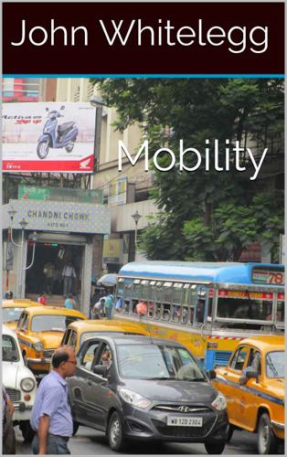
Although developing urban rail transport was primarily embraced in the Tenth Five-Year Plan in China (2001-2005), Chinese investment in urban rail transport mushroomed from RMB 12 billion (2001) to RMB 260 billion (2012), with a 32.3% compound annual growth rate (2012-2013 China Urban Rail Transport Development Report). By the end of 2013, there were 87 urban rail lines in service among nineteen Chinese cities, with a total network length of 2,539 km.” Both China and India have made progress with bus rapid transit systems (Gadpelli, 2014). These systems offer a significant improvement in the quality of bus services with segregated road space for the buses, modern low floor vehicles and safe infrastructure for passengers to board and alight. These are a considerable improvement on the familiar buses to be seen in cities like Kolkata (Calcutta) which are old, dirty, stuck in traffic and expose passengers to road traffic danger as they board and alight.
…
Fulton, L M and Replogle, M (2014) A global high shift scenario: impacts and potential for more public transport, walking and cycling with lower car use, ITDP, New York. Gao, Y, Kenworthy, J and Newman, P (2014) Growth of a Giant: A Historical and Current Perspective on the Chinese Automobile Industry Paper presented to the European Transport Conference, Frankfurt, September 29 to October 1, 2014. Gadpelli, S (2014) Bus Rapid Transit for Indian Cities, ITDP, New York. Garrard, J. (2008) Safe Speed: promoting safe walking and cycling by reducing traffic speed, Melbourne: Heart Foundation. Gate, D (2014) The Heysham M6 Link Road, World Transport Policy and Practice, volume 20, number 2/3, 33-42. Gehl Architects (2004) Melbourne: places for people.
Smart Cities: Big Data, Civic Hackers, and the Quest for a New Utopia
by
Anthony M. Townsend
Published 29 Sep 2013
Country: Tom Peters & George Gilder debate the impact of technology on location,” Forbes ASAP, February 27, 1995, http://business.highbeam.com/392705/article-1G1-16514107/city-vs-country-tom-peters-george-gilder-debate-impact. 26David McCandless, “Financial Times Graphic World,” display at Grand Central Station, New York, March 27–29, 2012. 27Robert Caro, The Power Broker: Robert Moses and the Fall of New York (New York: Vintage, 1975), 849. 28Caro, The Power Broker, 508. 29“Global Investment in Smart City Technology Infrastructure to Total $108 Billion by 2020,” Pike Research, last modified May 23, 2011, http://www.pikeresearch.com/newsroom/global-investment-in-smart-city-technology-infrastructure-to-total-108-billion-by-2020. 30Daniel Fisher, “Urban Outfitter,” Forbes, May 9, 2011, 92. 31Sascha Haselmeyer, lecture, INTA33 World Urban Development Congress, Kaoshiung, Taiwan, October 5, 2009. 32“The Explosive Growth of Bus Rapid Transit,” The Dirt, blog, American Society of Landscape Architects, last modified January 27, 2011, http://dirt.asla.org/2011/01/27/the-explosive-growth-of-bus-rapid-transit/. 33Peter Jamison, “BART Jams Cell Phone Service to Shut Down Protests,” SF Weekly: The Snitch, blog, August 12, 201, http://blogs.sfweekly.com/thesnitch/2011/08/bart_cell_phones.php; BlackBerry: Josh Halliday, “David Cameron considers banning suspected rioters from social media,” The Guardian, August 11, 2011, http://www.guardian.co.uk/media/2011/aug/11/david-cameron-rioters-social-media; social media: Chris Hogg, “In wake of London riots, UK considers social media bans,” Future of Media, blog, http://www.futureofmediaevents.com/2011/08/11/in-wake-of-london-riots-uk-considers-social-media-bans/#ixzz24xS7KHKP. 34Solomon Benjamin et al., “Bhoomi: ‘E-Governance,’ Or, An Anti-Politics Machine Necessary to Globalize Bangalore?”
…
For the last few decades, as the pace of globalization accelerated, multinational corporations were the primary means by which technological innovation spread from place to place. Industry would love to play the role of Johnny Appleseed again with smart-city technology. But cities have become highly adept at sharing and copying new innovations on their own, as evidenced in an accelerating diffusion of good ideas. Bus rapid transit, a scheme for improving the capacity of bus lines with dedicated lanes and other clever tweaks, has taken forty years to spread from its birthplace in Curitiba, Brazil, in 1974 to over 120 cities all over the world.32 Public bike sharing, which surged onto the global stage with the launch of Paris’s Vélib system in 2007, has reached a similar footprint in just a few years.
…
But, as we saw in chapter 3, professional urban planning and the peaceful and systematic exchange of best practices between cities is barely a hundred years old. Recently, this flow has gone global. Rather than just borrow ideas from neighboring communities or national leaders, innovations are crossing borders at an increasing clip. Bus rapid transit, which combines curbside payment to expedite boarding with dedicated lanes to bypass traffic, began in Brazil in the 1970s but in the last decade has been implemented in Europe, Asia, and North America. Public bicycle sharing schemes have spread even faster, popping up all over the world after the launch of Paris’s massive Vélib system in 2007.
Retrofitting Suburbia, Updated Edition: Urban Design Solutions for Redesigning Suburbs
by
Ellen Dunham-Jones
and
June Williamson
Published 23 Mar 2011
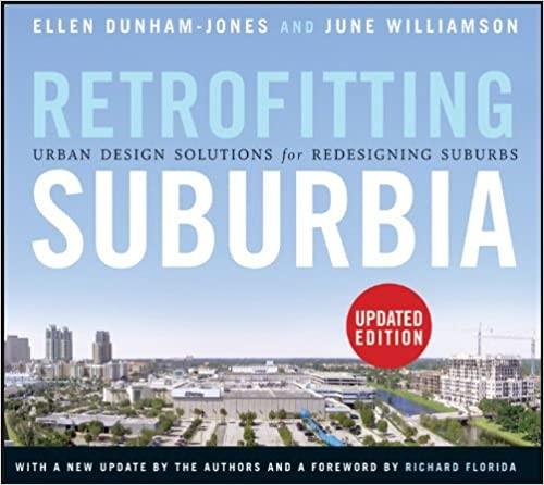
What additional re-inhabitations or corridor improvements might improve livability without spurring displacement through gentrification? Each city’s Red Fields to Green Fields proposal is unique. Miami proposes to establish a transit-oriented park system, targeting 130 of the 750 acres of greyfield sites adjacent to existing and planned transit lines—as in this regreening proposal for a Jeep dealership site along a Bus Rapid Transit (BRT) line. The design integrates the BRT station, the public space, and the adjacent new development with crosswalks, shelters, and landscape. Credit: Rendering by Rocco Ceo, Andrew Georgiadeis, and Christopher Podstawski for the Miami-Dade Parks and Recreation Department, courtesy of Dover, Kohl & Partners Town Planning.
…
Reserving a right-of-way for later transit is a good strategy, but it means that new development will have to be built with parking ratios that continue to support auto dependency. More often, the arrival of transit (or at least its promise) precedes development. Whether light or heavy rail, bus rapid transit, or streetcar, transit has been the trigger for higher-density zoning, transit-oriented development, and corridor retrofitting in examples such as Ballston, Virginia; Downtown Kendall/Dadeland in Kendall, Florida; and the planning for Denver’s new light-rail system. Figure 4–30 Sequence of simulations showing retrofitting along Columbia Pike, from commercial strip to urban building with street trees and transit once critical mass is achieved.
…
Many of the condominiums in the Metropolis towers were purchased by wealthy Latin Americans to use as second homes; their habit of visiting Miami for shopping sprees has made the Dadeland Mall extremely profitable.9 Now they can walk to shop. Also, about 15% of the units were sold to people who work in the Datran office complex, so they too can now walk.10 These “captured” trips are essential to realizing the benefits of urbanism, benefits that edge-city conglomerations do not provide. Another piece will be adding bus rapid transit along Kendall Drive. As it is, the Metrorail stations were developed to a suburban prototype, with large park-and-ride structures and weak pedestrian connections. The required colonnades are facilitating interconnections by providing continuous shaded zones for walking, although we found that some colonnades as built are awkwardly linked to the streetscape.
Data Action: Using Data for Public Good
by
Sarah Williams
Published 14 Sep 2020
The data helped multilateral agencies understand that the matatu system was well organized, and they could work to develop collaborative projects to ensure safety and improve the quality of transport in Nairobi. In collaboration with the World Bank, the Nairobi city and county government used the data to plan for a Bus Rapid Transit (BRT) system on the most traveled routes. Data from Citizens: Why Governments Collect It We most often think of participatory sensing projects as developed outside of formal institutions, but many governments seek to collect highly localized data so they can draft better local legislation.
…
In due course, it won Kenya's Vision 2030 ICT Innovation Award in April 2014. 4.8 Hackathon at the University of Nairobi with the local technology community. The Institute for Transportation and Development Policy (ITDP) and consultants at UN Habitat also used Digital Matatus data as the basis of the planning of Bus Rapid Transit (BRT) Service Plans for the city. Nairobi city planners used the data to develop a map of the BRT system that looked like a copy of our map. The city planners were smart to borrow the visual language of our map to earn support for the BRT project because the Digital Matatus map had become an icon in the city (figure 4.9). 4.9 UN Habitat Map that copied the style of the Digital Matatus Map for a proposed BRT system.16 4.10 The maps went viral on social media and the internet, and were printed in the local newspaper.
…
The Digital Matatus map was shown to those seeking to influence transportation policy in Nairobi, such as the World Bank, to demonstrate that working with the matatu association would be essential for any transportation plan for the city, including the integration of more formalized systems like the Bus Rapid Transit. It is important that we acknowledge maps as a tool for control, and the Digital Matatus project shows how we also used maps to control the narrative around matatus in Nairobi. Our team used the maps as an advocacy tool, representing our ideological positions toward helping those on the margins.
Arbitrary Lines: How Zoning Broke the American City and How to Fix It
by
M. Nolan Gray
Published 20 Jun 2022
The literature varies widely on this issue, but there is a reasonable consensus among transportation planners that a city needs densities of at least seven dwelling units per acre to support the absolute baseline of transit: a bus that stops every thirty minutes. To get more reliable service, like bus rapid transit or light-rail service, a city needs just over double those densities, or approximately fifteen units per acre.17 The standard detached single-family residential district—which forms the basis of zoning and remains mapped in the vast majority of most cities—supports a maximum density of approximately five dwelling units per acre.18 That is to say, zoning makes efficient transit effectively illegal in large swaths of our cities, to say nothing of our suburbs.
…
All else being equal, this will likely increase demand for housing out in the exurb, resulting in a low-density, auto-oriented development pattern. On the flip side, imagine that a city proposes to close a lane of traffic along a major corridor to accommodate an overburdened bus line, turning it into a full-service bus rapid transit system, increasing frequencies and halving bus commutes all along the corridor. All else being equal, this will likely raise demand for housing close to the stations, resulting in nodes of townhouses and apartments along the corridor. You can imagine how other high-profile capital investments—such as a brand-new library or an upgraded park—would similarly drive urban form independent of zoning.
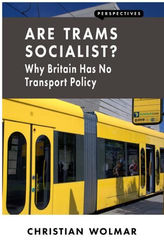
Are Trams Socialist?: Why Britain Has No Transport Policy
by
Christian Wolmar
Published 19 May 2016
Trams are a collective form of transport that is economically efficient. Oddly, it is the roads that are run on a socialist basis, as they operate like the queues for fresh bread in Soviet Russia. This is not a sensible way of allocating resources. Investing in trams or indeed in better bus services such as the now very widely adopted system of Bus Rapid Transit would be a far more efficient use of the limited funds available for transport investment. It would not, though, be socialism. The Swiss experience, too, suggests that perhaps we can be a bit more optimistic about how a democratic system can deliver a coherent transport policy without the authoritarian approach of Singapore, or indeed of China, which is beginning to recognize the damaging impact of its support for the motorization of its cities and to take measures such as banning private cars on bad smog days.

Ghost Road: Beyond the Driverless Car
by
Anthony M. Townsend
Published 15 Jun 2020
In 2019, Daimler suddenly got cold feet, claiming that the efficiency gains offered by platooning weren’t enough to offset the extra cost of self-driving equipment. We may need to wait awhile longer before we see these physical couplings severed by software—in trucking at least. But as often happens with new technologies, platooning may yet become the best solution to an altogether different problem. Over the last two decades, bus rapid transit (BRT, for short) has helped cash-strapped cities around the world roll out train-like transit capacity for a fraction of the cost of building railroads and subways. Following early success in Brazil in the 1970s and 1980s, the idea has spread widely—today more than 33 million people in 195 cities worldwide use it daily.
…
“automated” vehicles, 39 Autonomy (Burns), 214 autonomy, defined, 42 Autophobia (Ladd), 80 Autopilot (Tesla), 26–29 Autor, David, 150, 151, 152, 155 Baidu, 54 Bezos, Jeff, 221 Big Dog (Boston Dynamics), 79 big mobility, 239–47 bike sharing Bird Rides, 65, 66, 67 dockless bike-share, 64–65, 66, 67 docks, 64 Lime Bike, 67 microsprawl and, 202 rebalancing problem, 64–65 smartphone apps, 64 Vélib system (Paris), 63 VeoRide, 67 “white bikes,” 63 Bird Rides, 65, 66, 67 “block captain” ushers, 78 Bloomberg Philanthropies, 214 Blue Apron, 141, 145–46 Blue Gene/L (IBM), 36 Blueprint for Autonomous Urbanism, 193–94, 196, 242 Boston Dynamics, 79 Bostrom, Nick, 236–37, 238 Brooks, Rodney, 235 Brown, Joshua, 28 Burns, Larry, 214 buses bus rapid transit (BRT), 69–70, 72 CityPilot system, 72 driverless city buses, 216 platoons and platooning, 69–70, 70–71 software trains, 70–71, 70–72, 197, 200–201, 202, 204, 206 BVG (Berlin), 216 CalPers, 182–83 Calthorpe, Peter, 202 Caltrans, 170 carbon emissions AVs as tool for reducing, 19, 137 driverless shuttles and, 105 from manufacturing of clothing, 148 microsprawl and, 200, 202, 203, 204 platooning and, 68 software trains and, 72 Careem, 177 car-lite communes, 14–15, 60, 121, 244, 253, 254 Charles I (king), 161 Charlier, Frederic, 170–71 Cheetah 3 (MIT), 79 Chicago parking-meter contract, 173 Chin, Ryan, 62–63 Christine (King), 42 circular economies, 146–49, 196, 221 Citi Bike docks (New York City), 64 CityMobil2, 102–5 CityPilot system, 72 civic caravans, 73–75, 76–77, 77, 199 Clarke, Randy, 72 ClearRoad, 169–72, 216 clothing AirCloset, 148 carbon emissions from manufacturing, 148 in circular economies, 148–49 Rent the Runway, 140–41, 145 CloudKitchens, 140 coal and Jevons effect, 143–45 Coal Question, The (Jevons), 144 code and programming for AVs malleability of, 228, 245, 248 pushing code, 227 role in shaping driverless revolution, 227–28, 247–49 writing compared to coding, 226–27 see also computers and self-driving vehicles Cody (IDEO), 125 cognitive tasks and automation, 150–51, 151, 152–53 complete streets (shared streets), 208–9 computers and self-driving vehicles data exhaust, 108–12 data logged daily, 35, 108 microtransit mesh, 107–8, 111, 157 Pegasus onboard AV computer, 35–36 scan, study, and steer as basic tasks, 34–38 supercomputer location under seat, 84 vehicular variety increase, 53 see also code and programming for AVs; deep learning; reprogramming mobility computer vision, 152, 230, 231 congestion pricing at the curb, 223 electronic tolling, 169–72 mobility policy and, 182 in New York City, 165–67, 167, 168, 172–73 speculation or perverse incentives, 172–73 support for, 167–69 Uber, 179, 181 Vickrey’s study of, 165–66 weaponization by speculators, 17 see also financialization of mobility continuous delivery compared to historical shopping habits, 115–16, 120–21 and last mile logistics, 121–29 costs decline in twentieth century, 130 deskilling of delivery, 124 effect of instant delivery, 218 efficiency improvements and rebound effect, 145–47 free or cheap delivery and, 116–17, 204 freight AVs and, 125–26 fulfillment centers, 121, 123, 132, 136–37, 152, 158 impact on jobs, 155 impact on local businesses, 140–42 kippleization and, 142–43 nighttime delivery, 128–29, 130 overview, 120–21 package lockers and, 127, 130, 219, 221 piggybacking deliveries, 126–27 same-day delivery, 119, 123–24, 132–33, 138 see also e-commerce conveyors in circular economies, 148 deep learning, 57 Kiwibots, 57 last-mile deliveries, 124–25 maintenance, repair, and remote monitoring, 132 overview, 56–57, 60–61 Starship conveyors, 55–56, 57, 125, 192 Coord, 232–33 Cops (TV show), 24 Coresight Research, 117 core (urban core), 187, 188, 188–96, 194–95 Costco, 116 Could This Be You (TV show), 24 creative destruction, defined, 137 Credit Suisse, 117 cruise control, 24–25, 26 curb pricing and curb-access fees, 220–21, 222–23, 232 Curbs API, 232–33 Cushman & Wakefield, 117 Daimler, 6, 68, 69, 72, 190 Daley, Richard, 173 DARPA (Defense Advanced Research Projects Agency) Grand Challenges, 6–7, 68, 104, 133, 230 data collaboratives, 233 data exhaust, 108–12 Death and Life of Great American Cities, The (Jacobs), 57 deaths caused by motor vehicles, 9, 38, 156 deep learning advances in, 39, 42 computer power consumption, 37 conveyors, 57 fleet learning, 37 human intelligence tasks (HITs) required, 41 limits of, 235–36 neural networks, 36–37, 84, 235 occupancy grid, 37 overview, 36–37 and task model, 152 training, 37, 41, 153, 235 see also artificial intelligence; machine learning Deliveroo, 56, 124 delivery, continuous.
Our Lives in Their Portfolios: Why Asset Managers Own the World
by
Brett Chistophers
Published 25 Apr 2023
The Future Notes Acknowledgements Index Abbreviations APPR Société des Autoroutes Paris-Rhin-Rhône (France) ASCE American Society of Civil Engineers AUM assets under management BAM Brookfield Asset Management BREIT Blackstone Real Estate Income Trust BREP Blackstone Real Estate Partners BRI Belt and Road Initiative (China) BRT bus rapid transit BTR build to rent CEO chief executive officer COP26 2021 United Nations Climate Change Conference CPP Canada Pension Plan CPPIB Canada Pension Plan Investment Board DfE Department for Education (UK) ESG environmental, social and governance G20 Group of Twenty G7 Group of Seven GIIA Global Infrastructure Investor Association GIP Global Infrastructure Partners GND Green New Deal GP general partner GSE government-sponsored enterprise HUD Department of Housing and Urban Development (US) IFC International Finance Corporation IIJA Infrastructure Investment and Jobs Act (US) IMF International Monetary Fund INREV European Association for Investors in Non-Listed Real Estate Vehicles IPO initial public offering IRR internal rate of return LP limited partner MAp Macquarie Airports MEIF3 Macquarie European Infrastructure Fund III MIM Manulife Investment Management MIRA Macquarie Infrastructure and Real Assets MKIF Macquarie Korea Infrastructure Fund MOIC multiple of invested capital MSIP Morgan Stanley Infrastructure Partners NHP Nursing Home Properties OECD Organisation for Economic Co-operation and Development OMERS Ontario Municipal Employees Retirement System PFI Private Finance Initiative (UK) PGII Partnership for Global Infrastructure and Investment PIF Public Investment Fund of Saudi Arabia PPA power-purchase agreement PPP public–private partnership PSERS Pennsylvania Public School Employees’ Retirement System REIT real-estate investment trust RTC Resolution Trust Corporation (US) S&L savings and loan SEK Swedish kronor SHP Swedish Hospital Partners SIB Washington State Investment Board SMG Seoul Metropolitan Government SPV special purpose vehicle SVT Sveriges Television SWF sovereign wealth fund UKIB UK Infrastructure Bank UNDP United Nations Development Programme Introduction Summer House Plenty of stories about the modern world are told through the lens of Silicon Valley, the famous region nestled at the southern end of the San Francisco Bay.
…
The key limiting factor in the Chicago parking-meter case, Farmer suggests, has been the true-up penalties mentioned above, which must be paid to MSIP and its investment partners if existing meters are removed from the system and replacements of equal value are not provided elsewhere. Consider the impact on bus rapid transit (BRT), which the Chicago Transit Authority first introduced in 2012, with an eventual target of twenty routes. The city’s BRT systems use dedicated traffic lanes designed for curb-side boarding. But BRT planners, Farmer found, had to take ‘great pains’ to avoid true-up penalties. For example, planning the first two routes required finding comparable replacement parking spaces for 116 existing spaces that needed to be removed.
Cities Are Good for You: The Genius of the Metropolis
by
Leo Hollis
Published 31 Mar 2013
Rhinehart, N., ‘Public Spaces in Bogotá: An Introduction’, University of Miami Inter-America Law Review, Winter 2009, p. 200. 12. Ibid., p. 201. 13. www.pps.org/articles/epenalosa-2 14. www.planetizen.com/node/17468 15. Rhinehart, N., 2009, p. 203. 16. Cain, A., ‘Applicability of Bogotá’s Transmilenio BRT System to the United States’, National Bus Rapid Transit Institute, May 2006, pp. 41–2. 17. www.pps.org/articles/epenalosa-2 18. Thompson, C., ‘Why New Yorkers Last Longer’, 13 August 2007, nymag.com/news/features/35815/index1.html 19. www.walkonomics.com/blog/2011/04/getting-our-obese-cities-walking-again 20. Florida, R., ‘America’s Most Walkable Cities’, 10 December 2010, www.theatlantic.com/business/archive/2010/12/americas-most-walkable-cities/67988/ 21. www.telegraph.co.uk/news/worldnews/europe/france/7590210/Expressway-roads-along-Seine-to-be-closed-after-40-years.html 22. www.preservenet.com/freeways/FreewaysPompidou.html 23. www.guardian.co.uk/world/2012/aug/02/paris-seine-riverside-expressway-pedestrian Chapter 10: How Many Lightbulbs Does It Take To Change A City?
…
A. et al, The Etymologies of Isidore of Seville, CUP, 2006 Barros, J. and Sobeiera, F., City of Slums: Self Organisation Across Scales, CASA Working Paper 55, June 2002 Batty, M., Cities and Complexity: Understanding Cities with Cellular Automata, Agent-based Models and Fractals, MIT Press, 2005 Batty, M., Complexity in City Systems: Understanding, Evolution and Design, UCL Working Paper 117, March 2007 Beavan, C., No Impact Man, Piatkus, 2011 Bergdoll, B. and Martin, R., Foreclosed: Rehousing the American Dream, MoMA, 2012 Bettencourt, L. and West, G., ‘A Unified Theory of Urban Living’, Nature, 21 October 2010 Bettencourt, L., Lobo, J. et al, Growth Innovation, Scaling and the Pace of Life in Cities, PNAS, 16 April 2007 Bound, K. and Thornton, I., Our Frugal Future, NESTA, July 2012 Brand, S., Whole Earth Discipline: An Ecopragmatist Manifesto, Atlantic Books, 2010 Bratton, W. and Tumin, Z., Collaborate or Perish: Reaching Across Boundaries in a Networked World, Crown Business, 2012 Brugman, J., Welcome to the Urban Revolution: How cities are changing the world, Bloomsbury Press, 2010 Bucher, U. and Finka, M., The Electronic City, BWV, 2008 Burdett, R. and Rode, P., Cities: Towards a Green Economy, UNEP, 2011 Burnham, S., Trust Design, Part Four, ‘Public Trust’ supplement to Volume 30, 2011, www.premsela.org Burra, S., Towards a Pro-poor Framework for Slum Upgrading in Mumbai, India, Environment and Urbanisation, 2005 Burra, S., Community-based, Built and Managed Toilet Blocks in Indian Cities, Environment and Urbanisation, 2003 Burrell, J., Livelihoods and the Mobile Phone in Rural Uganda, Grameen Foundation, USA, January 2008 Burrows, E. G. and Wallace, M., Gotham: A History of New York City to 1898, OUP, 1999 Cacioppo, J. and Patrick, W., Loneliness: Human Nature and the Need for Social Connection, W. W. Norton, 2009 Cain, A., ‘Applicability of Bogotá’s Transmilenio BRT System to the United States’, National Bus Rapid Transit Institute, May 2006 Calabrese, F., Smordeda, Z., Blondel, V. and Ratti, C., ‘Interplay Between Telecommunications and Face-to-Face Interactions: A Study Using Mobile Phone Data’, PLoS ONE, July 2011 Campanella, T., The Concrete Dragon: China’s Urban Revolution and What it Means for the World, Princeton Architectural Press, 2008 Canetti, E., Crowds and Power, Penguin, 1992 Chang, L.
World Cities and Nation States
by
Greg Clark
and
Tim Moonen
Published 19 Dec 2016
New York City’s current Mayor Bill de Blasio and the New York City Con gressional delegation continue to lobby Washington to encourage federal funding support for subways, light rail, buses, bridges and ferries. In 2015 they success fully argued to stop an $80 million annual cut to public transport in New York City up until the 2020s, highlighting the already high commuter congestion in the city. The FAST Act supports additional funding for Bus Rapid Transit and the second phase of the Second Avenue Subway (Freemark, 2014; Young, 2014; New York City, 2015b). The federal government has also acknowledged the need for a regional high‐ speed rail system connecting New York to Boston and beyond. In principle, this could reduce travel time between these two cities to less than one hour, and to one and a half hours between New York and Washington DC.
…
At the same time, rapid population growth, the imperatives for managed density and the re‐ordering of land use that goes with internationalisation depend upon excellent internal connections, especially public transport. The finance and agreement of public transport is a pressing issue in many high‐demand world cities. Metro, bus rapid transit and light rail projects provide relief from congestion, and in many cities are viewed as the major mechanism to stimulate development patterns that are less dependent on city centres. National government financial contributions are often the critical bridge to enabling transport projects to go ahead, but political support is also necessary to deliver projects that are on time and bankable.
City: A Guidebook for the Urban Age
by
P. D. Smith
Published 19 Jun 2012
In 2010, the city’s mayor, Bertrand Delanoe, proposed permanently changing stretches of the road on the Left Bank and part of the Right Bank from a ‘motorway’ into a ‘human, lived-in boulevard’, with parks, foot and cycle paths.62 Despite its love affair with the car, Shanghai has also embraced car-free urban zones, as in the recent redevelopment of Xintiandi in the Shikumen neighbourhood.63 In the twenty-first century, the threat of climate change and concerns about pollution have turned the car from saviour to villain. As well as walking and cycling, public transport is enjoying a renaissance in many cities. In the southern hemisphere, Bogotá, the capital of Colombia, has pioneered bus rapid transit (BRT) schemes that have revolutionised transport in the city in a way comparable to the railways in nineteenth-century British cities. Bogotá is a city of seven million people. Since 1997 it has vigorously pursued a campaign to improve safety on its streets, investing in public transport and redesigning streets rather than in new urban motorways.
…
Thanks to the policies of mayors Antanas Mockus and Enrique Peñalosa, who ran the city from 1995 to 2003, the number of deaths from traffic accidents in Bogotá has been almost halved, falling from 914 fatalities in 1998 to 553 in 2006. Mayor Mockus even employed mime artists to draw attention to bad driving. The sight of mime artists pretending to pull vehicles that were dangerously parked became common on Bogotá’s streets. Most importantly, Mayor Peñalosa brought in a new bus rapid transit system (called TransMilenio), with dedicated lanes, modelled on the successful one at Curitiba, Brazil. It now carries 1.3 million passengers a day, 18 per cent of transit trips in the city.64 (In the United States, 4.7 per cent of commuters used public transport to travel to work in 2005, while 77 per cent drove alone.)65 Bogotá also actively encourages its citizens to walk and cycle.
Circus Maximus: The Economic Gamble Behind Hosting the Olympics and the World Cup
by
Andrew Zimbalist
Published 13 Jan 2015
The next month, John Coates, IOC vice president, stated, “We've become very concerned, to be quite frank. They really are not ready in many, many ways.”56 The plans include extensive construction in four separate clusters of Rio (following one defining feature of Barcelona's Olympic plan),57 encompassing sports facilities, bus rapid transit (BRT) lanes, metro connections, cleaning up of the port, a new golf course, an Olympic Village in Barra da Tijuca, new sewer systems, new parks, airport upgrades, and a museum, among other things. The Olympic village is scheduled to include 3,600 apartments, and all are slated to become luxury housing.
The Option of Urbanism: Investing in a New American Dream
by
Christopher B. Leinberger
Published 15 Nov 2008
In 2004, the new mayor, John Hickenlooper, supported a sales tax proposal to expand the system, while also supporting more road infrastructure. The voters approved a $4.7 billion, twelve-year bond measure to create an expanded system22 that will be the largest new transit system in the country since the Metro in Washington, D.C. The bond will fund the addition of another 119 miles of light rail track, eighteen miles of bus rapid transit, and fifty-seven new stations. Planning is ongoing for the areas around most of the proposed stations for walkable urban development at a density and scale seen only in downtown until now. Over eighty percent of the funding for this $4.7 billion expansion has been raised locally; the federal portion is less than twenty percent.
Bikenomics: How Bicycling Can Save the Economy (Bicycle)
by
Elly Blue
Published 29 Nov 2014
What does it take, then, I asked, thinking about the country’s history of revolution. “If the politicians do something new, then the people will decide to do it too,” she said. Perhaps she was thinking of Mexico City where recent mayors have been tackling the city’s gridlock and smog by instituting a bike share program, bus rapid transit, and other driving reduction strategies. Another new friend had a different perspective. “If it is seen as being for families,” she suggested, then bicycling could take hold in Mexico. It’s hard not to believe that change is possible when you’re riding through city streets at night surrounded by hundreds of smiling families, and spend the next day in a courtyard packed with several hundred of the most determined and spirited advocates you’ve ever met.
Transport for Humans: Are We Nearly There Yet?
by
Pete Dyson
and
Rory Sutherland
Published 15 Jan 2021
Cities like Lagos, Manila, Karachi and Lima will more than double in size. Perhaps the biggest question is how far these cities simply get up to speed by adopting familiar technologies, and how far they might leapfrog other existing cities by pioneering new ways of getting around. Recent history proves it’s more likely to be the former: see Bogota’s Bus Rapid Transit system and bicycle lanes, for example, or Istanbul’s and Ankara’s trolleybus networks and the Maghreb’s high-speed rail lines. We hope these places invest in behavioural science expertise as well as technology, which would enable them to forge their own blend of active, public and private transport that works for their people and environment.
Key to the City: How Zoning Shapes Our World
by
Sara C. Bronin
Published 30 Sep 2024
In the years since Buffalo’s reforms, other major cities have enacted similar reforms or expanded suites of changes. San Diego, Nashville, and Chicago have eliminated minimum parking requirements around transit, in and around the downtown, and near certain commercial corridors, respectively. The thinking behind these changes has been that people taking light rail or bus rapid transit, or people living or working in more densely populated mixed-use areas probably don’t need a car to get around. The rural Idaho town of Sandpoint—the one that required a bank to build 118 parking spaces—also repealed parking minimums for its downtown. That repeal allowed a local taqueria to add new seating, while a growing tech startup remained in town, both impossible before, because they could not pack the additional parking required onto their lots.
Road to Nowhere: What Silicon Valley Gets Wrong About the Future of Transportation
by
Paris Marx
Published 4 Jul 2022
It will require more frequent services that are extended to underserved neighborhoods so that transit is reliable and people will not be stuck waiting for twenty or thirty minutes if they miss their bus or train. In some cities, it will mean a further buildout of subway systems, such as the significant expansion in China over the past several decades that has equipped twenty-five cities with metro lines; while in others, lower-cost bus rapid transit systems will be more appropriate, such as those that have swept Latin America since the Brazilian city of Curitiba built its first line in 1974. But even providing dedicated lanes on existing bus routes can make a big difference, as New York City found when its 14th Street busway increased ridership by up to 30 percent and slashed commute times by up to 47 percent.
Left Behind
by
Paul Collier
Published 6 Aug 2024
Once people have bought the legal title to their plot, enabled by the sites-and-services approach, they have an incentive to use their land efficiently, gradually building a structure of two or three storeys. This reconciles higher density of occupancy of the land with less crowded living conditions. At this density of occupation, a higher rung on the ladder of transport technology becomes economically viable. Bus-rapid-transit (BRT) is a useful gadget for a large, low-income city: a low-cost version of an urban rail system with buses instead of trains and roads or bus lanes replacing the rail track. It needs higher density than shack-land, because for speed the buses cannot keep stopping everywhere: they need a few designated stations with sufficient people living nearby.

How Big Things Get Done: The Surprising Factors Behind Every Successful Project, From Home Renovations to Space Exploration
by
Bent Flyvbjerg
and
Dan Gardner
Published 16 Feb 2023
PROJECT TYPE(A) MEAN COST OVERRUN (%)* (B) % OF PROJECTS IN TAIL (≥ 50% OVERRUN) (C) MEAN OVERRUN OF PROJECTS IN TAIL (%) Nuclear storage 238 48 427 Olympic Games 157 76 200 Nuclear power 120 55 204 Hydroelectric dams 75 37 186 IT 73 18 447 Nonhydroelectric dams 71 33 202 Buildings 62 39 206 Aerospace 60 42 119 Defense 53 21 253 Bus rapid transit 40 43 69 Rail 39 28 116 Airports 39 43 88 Tunnels 37 28 103 Oil and gas 34 19 121 Ports 32 17 183 Hospitals, health 29 13 167 Mining 27 17 129 Bridges 26 21 107 Water 20 13 124 Fossil thermal power 16 14 109 Roads 16 11 102 Pipelines 14 9 110 Wind power 13 7 97 Energy transmission 8 4 166 Solar power 1 2 50 SOURCE: FLYVBJERG DATABASE APPENDIX B FURTHER READINGS BY BENT FLYVBJERG If you’re interested in learning more about my research on project leadership, below is a list of recommended readings.
Paved Paradise: How Parking Explains the World
by
Henry Grabar
Published 8 May 2023
Bogotá had pioneered Ciclovía in the 1970s, opening miles of streets every Sunday for families, joggers, cyclists, and vendors. More than two million people participated. Dozens of cities followed suit. In Brazil, cities like Rio de Janeiro, São Paulo, and Brasilia routinely closed highways to cars. Curitiba, Brazil, is renowned as the birthplace of bus rapid transit—a low-cost way to move large numbers of people down what had once been congested avenues. Mexico City adopted a Ciclovía-type event every Sunday on its grand Paseo de la Reforma and eliminated parking minimums. All along the streets of our cities, and in a good many public plazas and parks as well, we had consigned a vast amount of public space to the long-term storage of cars.
City Limits: Infrastructure, Inequality, and the Future of America's Highways
by
Megan Kimble
Published 2 Apr 2024
TxDOT had made major commitments to increase drainage and flood mitigation as part of the highway design; that was good, Molly thought. It had agreed to accommodate more street crossings over the highway and to build wider sidewalks and bike lanes. It would “coordinate” with Houston’s transit agency and include bus rapid transit lanes. But TxDOT had not agreed to make the highway narrower, committing only to “evaluate the design…to reduce the footprint and rebuild within the current footprint where feasible.” Almost every commitment included the phrase “where feasible.” Mostly, for Molly, the agreements were underwhelming.
Happy City: Transforming Our Lives Through Urban Design
by
Charles Montgomery
Published 12 Nov 2013
Additional information: Quirk, Vanessa, “BIG’s Waste-to-Energy Plant Breaks Ground, Breaks Schemas,” ArchDaily, March 5, 2013, www.archdaily.com/339893 (accessed April 30, 2013); Woodward, Richard B., “Building a Better Future,” Wall Street Journal Magazine, October 28, 2011, http://online.wsj.com/article/SB10001424052970204644504576653421385657578.htmlixzz1kPqwl62S (accessed March 3, 2012). By nearly 250,000 tons: “Bus Rapid Transit Systems Reduce Greenhouse Gas Emissions, Gain in Popularity,” Worldwatch Institute/Eye on Earth, www.worldwatch.org/node/4660 (accessed January 11, 2011). After the charge was: “Central London Congestion Charging: Impacts Monitoring,” Transport for London, fifth annual report, July 2007. Paris Plages has seen: Mairie de Paris, “Paris Climate Protection Plan,” Paris, 2007.

It's Better Than It Looks: Reasons for Optimism in an Age of Fear
by
Gregg Easterbrook
Published 20 Feb 2018
Publicly funded sports stadia, which are popular with local politicians who want to pose for pictures with star athletes, are superfluous to economic growth: in a 2015 study, Ted Gayer and Alex Gold of the Brookings Institution concluded there is “no discernible positive relationship between sports facility construction and economic development.” Roads, bridges, and bus rapid transit, by contrast, have clear multiplier effects. To take out loans to improve infrastructure can make good sense, in the same way that home improvement loans can make good sense. Yet while Washington borrows lavishly to subsidize interest groups, construction and repair are overlooked. In 2014, President Barack Obama lamented of American infrastructure, “We are not spending enough.”
Invisible Women
by
Caroline Criado Perez
Published 12 Mar 2019
And they don’t have any. This isn’t even an issue of resources. It’s an issue of priorities. Brazil spent millions on public transport infrastructure in the run-up to the 2014 World Cup and 2016 Olympics. The money was there, it was just being spent elsewhere. LSE Cities research found that the new Bus Rapid Transit corridors tended to privilege areas where Olympic facilities were located, leaving ‘the problem of collective transport between the poorer resettlements and downtown [. . .] unattended’.52 Furthermore, according to residents, government relocation priorities seemed to be less about helping those who needed better housing and more about making way for the upcoming World Cup and Olympics infrastructure development.
Life Inc.: How the World Became a Corporation and How to Take It Back
by
Douglas Rushkoff
Published 1 Jun 2009
While cities such as London, Paris, Chicago, and Portland were rolling out innovative transportation reforms and ambitious long-term sustainability plans, New York’s streets were still mostly ruled by a 1950s traffic-engineering mind-set aimed at maximizing the city’s capacity for motor vehicles. While other world cities were building new bike infrastructure, pedestrian plazas, bus rapid transit, and congestion pricing systems, New York City government still treated motor vehicle traffic as something akin to the weather—a force beyond the control of mere mortals. Though few issues touch New Yorkers’ lives more personally on a more regular basis, transportation was a third-tier issue at City Hall.
Connectography: Mapping the Future of Global Civilization
by
Parag Khanna
Published 18 Apr 2016
As the economy of Lagos swells to the size of Kenya’s, it is becoming ever more a quasi-independent city-state and regional capital. Devolution also drives the city’s self-reliance as the federal government in Abuja cuts its budgetary contribution to the city while Fashola increases municipal tax rates and collection, spending 60 percent of the city’s budget on roads, garbage trucks, a China-inspired bus rapid transit system, and an enlarged civil service to administer them.7 Nigeria needs Lagos more than Lagos needs Nigeria. Nigeria is at best a federation, and certainly not a nation. Of the country’s more than three hundred major ethnic groups, the Yoruba dominate the southwest, the Hausa the north, and the Igbo the southeast.

Lonely Planet China (Travel Guide)
by
Lonely Planet
and
Shawn Low
Published 1 Apr 2015
Xiamen & Gulang Yu 1Sights 1Bo'ai HospitalB3 Consulate InnB3 2Ecclesia CatholicaB3 3Former Japanese ConsulateA3 Former Spanish ConsulateA3 Guancai LouA3 4Haoyue GardenB4 5Huang Rongyuan VillaB3 6Kaihe Lu Fish MarketB1 7Koxinga Memorial HallA3 8Law CourtA3 9Nanputuo TempleD4 10Organ MuseumA3 11Overseas Chinese MuseumC3 12Sanyi ChurchA3 13Shuzhuang GardenA4 14Sunlight Rock ParkA3 15Xiamen UniversityD4 Yizu ShanzhuangA3 4Sleeping 16Gulang Yu Lu Fei International Youth HostelB3 17Hotel Indigo Xiamen HarbourB2 18Liangzhu Boutique Lifestyle HotelC1 19Lujiang Harbourview HotelB2 20Miryam Boutique HotelA3 21Xiamen International Youth HostelD3 22Xiamen Locanda International Youth HostelB3 23Yangtao HotelA3 24Yue HotelC3 5Eating 32/HOW cafeC1 25Dafang SucaiguanD4 26Huangzehe Peanut Soup ShopB2 27Longtou FishballA3 28Lucky Full City Seafood Dim SumA2 Seaview RestaurantB2 29The Chu Family CoffeeA3 30Tianhe Ximen TusundongC1 31Wutang ShachamianC3 7Shopping 32Xinhua BookshopB2 1Sights & Activities The town of Xiamen is on the island of the same name. It’s connected to the mainland by a 5km-long causeway bearing a railway, a Bus Rapid Transit (BRT) line, road and footpath. The most absorbing part of Xiamen is near the western (waterfront) district, directly opposite the small island of Gulang Yu. This is the old area of town, known for its colonial architecture, parks and winding streets. Nanputuo TempleBUDDHIST (Nanputuo Si MAP GOOGLE MAP ; Siming Nanlu; h8am-6pm)F This Buddhist temple complex on the southern side of Xiamen is one of the most famous temples among the Fujianese, and is also considered a pilgrimage site by dedicated followers from Southeast Asia.
…
AFuzhou ¥66 to ¥85, two hours AHangzhou ¥282 to ¥357, seven hours AQuanzhou ¥21 to ¥25, 30 minutes AShanghai ¥328 to ¥413, 7½ hours AWuyi Shan ¥144 to ¥223, 13½ hours 8Getting Around To/From the Airport Xiamen airport is 15km from the waterfront district. Taxis cost about ¥45. Bus 27 travels from the airport to Diyi ferry terminal (but not vice versa). From the city centre, airport shuttle buses (¥10) leave from Chunguang Hotel, opposite the Lundu ferry terminal. Public Transport Bus Rapid Transit (BRT) line 1 links the waterfront to both train stations via Xiahe Lu (¥1). Bus 19 runs to the train station from the ferry terminal (¥1). Buses to Xiamen University leave from the train station (bus 1) and from the ferry terminal (bus 2). Taxis start at ¥8 plus ¥3 fuel surcharge. WORTH A TRIP KINMEN, TAIWAN If you have a multiple-entry China visa, it’s worth making a detour to the island of Kinmen (Jinmen) in Taiwan.
…
In the city centre, an airport shuttle (¥15, free for China Southern passengers) leaves from the Southern Airlines Pearl International Hotel every 30 minutes starting at 7.30am. You’ll need to arrive 10 minutes early to get a seat. A subway system was under construction at the time of writing and as this is expected to disrupt bus lines for years to come, regard the following as mere guidelines. The fastest and most useful buses are the BRT (Bus Rapid Transit) expresses, which dodge traffic by having their very own bus lanes. BRT 1 runs from the railway station to Hongshan Intersection and then north up Beijing Nanlu. BRT 3 runs from the south bus station to People's Sq and the South Lake Sq. Fares are a flat ¥1. See www.chinabrt.org for a route map.

Lonely Planet Colombia (Travel Guide)
by
Lonely Planet
,
Alex Egerton
,
Tom Masters
and
Kevin Raub
Published 30 Jun 2015
TransMilenio The ambitiously named TransMilenio (www.transmilenio.gov.co), modeled after a similar groundbreaking system in Curitiba, Brazil, has revolutionized Bogotá's public transportation. After numerous plans and studies drawn up over 30 years to build a metro, the project was eventually buried and a decision to introduce a fast urban bus service called TransMilenio was taken instead. Today, it is the largest BRT (Bus Rapid Transit) system in the world. It is, in essence, a bus system masquerading as a subway. Covering 112km with a fleet of 1400 buses, TransMilenio counts 12 lines and 144 dedicated self-contained stations at time of writing, which keeps things orderly and safe (and some have wi-fi). Buses use dedicated lanes, which keeps them free from auto traffic.

The Rough Guide to South America on a Budget (Travel Guide eBook)
by
Rough Guides
Published 1 Jan 2019
Special direct buses (R$36.20 one-way; around 2hr) operated by Saritur leave from the rodoviária in Belo Horizonte (Sat, Sun & hols at 8.15am, returning at 5.30pm; saritur.com.br). Converted golf carts whisk visitors around the park if walking gets too much (R$28/day). Cafés and restaurants on-site. getting around By bus The city’s bus system (bhtrans.pbh.gov.br) works along the same lines as elsewhere in Brazil (pay as you enter), with the exception of the MOVE bus rapid transit (BRT) system, which works like a subway, with dedicated bus lanes and stations – its main use for visitors is for travelling between the centre and Pampulha (p.265). You need to buy a BHBUS card or a stored value “Cartão Unitário” to go through the electronic turnstiles (buy them at kiosks outside the station), with single rides R$4.05.
…
Bogotá Bike Tours runs informative guided tours of the city (C$40,000, 10.30am & 1.30pm daily, 4hr). Getting around Most of Bogotá’s attractions are in or near La Candelaria and can be reached on foot from there. The area west of Cra 10 below Av Jiménez is best avoided. Buses As well as minibuses, Bogotá is covered by a “Bus Rapid Transit” system with dedicated lanes called TransMilenio (daily 5am–11pm; www.transmilenio.gov.co), with a flat fare of C$2200 per journey; to use it, buy a card (C$3000) which you can load up with credit at any station. Bus lines are a little confusing, with all-stops and limited-stop services, and bus routes have different letter prefixes for each direction.

The Rough Guide to Brazil
by
Rough Guides
Published 22 Sep 2018
Saritur also runs three daily buses to Brumadinho (7am, 11am & 3pm; 1hr 35min; R$20.30), from where taxis charge around R$20 to Inhotim (only one bus returns, though, at 8.35am; R$16.55). GETTING AROUND BY BUS The city’s bus system (bhtrans.pbh.gov.br) works along the same lines as elsewhere in Brazil (pay as you enter), with the exception of the MOVE bus rapid transit (BRT) system, which works like a subway, with dedicated bus lanes and stations – its main use for visitors is for travelling between the centre and Pampulha. You need to buy a BHBUS card or a stored value “Cartão Unitário” to go through the electronic turnstiles (buy them at kiosks outside the station), with single rides R$4.05.