Eyjafjallajökull
description: ice cap in Iceland covering the caldera of a volcano
38 results
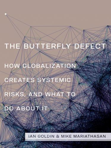
The Butterfly Defect: How Globalization Creates Systemic Risks, and What to Do About It
by Ian Goldin and Mike Mariathasan · 15 Mar 2014 · 414pp · 101,285 words
.S. programs, 2011 89 Figure 3.7. The propagation of default cascades in a production network 93 Figure 4.1. The global impact of the Eyjafjallajökull eruption 103 Figure 4.2. The Northeast blackout of 14 August 2003 107 Figure 4.3. Potential causes of power blackouts 108 Figure 4.4
…
car and computer manufacturers all over the world because profit-driven outsourcing had led many firms to the same cost-efficient location. When the Icelandic Eyjafjallajökull volcano halted European air traffic for almost a week in April 2010, the loss of business and delays in parcel delivery caused an estimated US
…
numerous examples of hazards striking the transport network and hence being turned into systemic events. The largest-scale example is the impact of Icelandic volcano Eyjafjallajökull’s eruption on 14 April 2010. The resulting ash cloud was carried across Europe and had effects worldwide. The particles of volcanic ash consisted of
…
about $5 billion in global GDP, with the negative impact not restricted to Europe (figure 4.1). Figure 4.1. The global impact of the Eyjafjallajökull eruption. Oxford Economics implies that these costs relate to the immediate disruption of air traffic in the weeks following the eruption. Oxford Economics, 2010, The
…
Economic Impacts of Air Travel Restrictions Due to Volcanic Ash, report prepared for Airbus (Oxford, UK: Oxford Economics), 5. Used with permission. Although Eyjafjallajökull’s eruption was a particularly large-scale event, disruptions of transport infrastructure from natural disasters are not rare. In February 2012, worsening weather conditions caused
…
/2008 and the example of Europe have shown this, and so have the responses to swine and bird flu, to the Fukushima crisis and the Eyjafjallajökull volcano, to global warming, and to the war on terror and cybercrime. The forces of globalization require active management at the global, national, and local
…
, 123, 130–31 extinctions, 2, 137. See also biodiversity extremist crimes. See right-wing extremist crimes extremist political parties, 186, 187, 188, 190–92, 191t Eyjafjallajökull, 30, 102–3, 103f Facebook, 13, 14, 15f, 117, 118, 147–48 FAO. See Food and Agriculture Organization of the United Nations farming. See agriculture
Lonely Planet Iceland (Travel Guide)
by Lonely Planet, Carolyn Bain and Alexis Averbuck · 31 Mar 2015
shimmering cascades of Skógafoss, hike up into the hinterland to discover a veritable parade of waterfalls, then gingerly tiptoe over the steaming remnants of the Eyjafjallajökull eruption before hiking along the stone terraces of a flower-filled kingdom that ends in silent Þórsmörk, a haven for campers, hemmed by a crown
…
months). Active bodies will enjoy the stunning Fimmvörðuháls hike from Skógar up through the ridge between two brooding ice caps (and the site of the Eyjafjallajökull eruption in 2010) then down into Þórsmörk, a forested valley dotted with wild Arctic flowers. Or you can take a super-Jeep tour or amphibious
…
10am-9pm) This modern theatre with a lava exhibit in the foyer screens a 55-minute pair of films about the Westman Island volcanoes and Eyjafjallajökull. They show in German once daily in summer. DómkirkjaCHURCH ( MAP GOOGLE MAP ; www.domkirkjan.is; Kirkjustræti; h10am-4.30pm Mon-Fri, mass 11am Sun) Iceland
…
7b; adult/child Ikr1500/750) A tiny theatre perches in the top of one of the rehabbed Old Harbour warehouses. Nature films include volcanoes (Hekla, Eyjafjallajökull, Westmann Islands), the creation of Iceland, þingvellir and the Northern Lights, and are mostly shown in English with occasional German screenings. See schedule online. THREE
…
destinations a lot faster, and you can get out further into wild terrain. Prices are correspondingly higher than bus trips (eg Þórsmörk for Ikr36,900, Eyjafjallajökull for Ikr39,900). Icelandic Mountain Guides also offers super-Jeep trips. The tourist office has brochures for loads more. Mountaineers of IcelandADVENTURE TOUR (%580 9900
…
-ons (snowmobiling, quad-biking etc). Into the WildJEEP TOUR (%866 3301; www.intothewild.is) Full roster of super-Jeep excursions, from the Golden Circle to Eyjafjallajökull and Landmannalaugar. Caving & Lava Tunnel Tours Exploring the wild underground world of Iceland’s volcanic terrain is a wonderful way to experience the geology of
…
TOUR (%854 4105; www.flightseeing.is; Reykjavík Domestic Airport) Offers flightseeing tours from Reykjavík, Bakki Airport and Skaftafell. From Reykjavík Domestic Airport you can overfly Eyjafjallajökull crater or Reykjanes Peninsula, or take a day-trip with tours around Skaftafell and Jökulsárlón glacial lagoon. Reykjavík HelicoptersFLIGHT TOUR (%589 100; www.rehe.is
…
; Reykjavík Domestic Airport; tours from Ikr69,000) Helicopter trips all over: including Glymur (Iceland's tallest waterfall) and volcanoes such as Eyjafjallajökull and Hekla. NorðurflugFLIGHT TOUR (%562 2500; www.helicopter.is) Helicopters fly over Reykjavík, or zip to craters, waterfalls, glaciers and beyond. Their multitude of trips
…
Þingvellir are just beyond the capital. Churning seas lead to the Vestmannaeyjar archipelago offshore. At the region's far reaches lie the powerful Hekla and Eyjafjallajökull volcanoes, hopping Skógar and Vík, and the hidden valleys of Þórsmörk and Landmannalaugar. Road Distances (km) Best Places to Eat ALindin ASlippurinn AVið Fjöruborðið AVitinn
…
suddenly begins to grow wonderfully jagged, after Hella and Hvolsvöllur. Mountains thrust upwards on the inland side, some of them volcanoes wreathed by mist (Eyjafjallajökull, site of the 2010 eruption), and the first of the awesome glaciers appears, as enormous rivers like the Þjórsá cut their way to the black
…
of Selfoss, just 8km off the Ring Road. Here you’ll find over 30 sun-filled bedrooms scattered throughout a sweeping farmstead with views to Eyjafjallajökull, Hekla, Vestmannaeyjar and the steaming earths at Hveragerði. Bike rentals, a restaurant, a menagerie of animals (including Elvis the dancing goat) and an elaborate playground
…
area well and is a great bet for guided hikes along Fimmvörðuháls or Laugavegurinn. Loads of day tours with pick-up include super-Jeep trips (Eyjafjallajökull Ikr31,900; Landmannalaugar Ikr37,900), canyoning and ice climbing. Winter trips too. 4Sleeping & Eating Sleeping and eating options in town aren’t brilliant; stay in
…
leaves for Vestmannaeyjar; and the third is Rte 249 north to Þórsmörk. Staying on the Ring Road, will bring you along the base of hulking Eyjafjallajökull, made famous with its ashy 2010 explosion. Fljótshlíð Rte 261 follows the mossy green edge of the lush Fljótshlíð hills, offering great views of their
…
waterfalls, such as Gluggafoss, on one side, and the Markarfljót river delta and Eyjafjallajökull on the other. The surfaced section of the road ends soon after the farm and church at Hlíðarendi, once the home of Gunnar Hámundarson from
…
South Iceland Adventures runs hiking and canyoning tours in Tindfjöll and the region. ÓbyggðaferðirQUAD-BIKE (%661 2503; www.atvtravel.is; Lambalæk) Quad-bike tours around Eyjafjallajökull, Þórsmörk and beyond. A three to four-hour trip per single/double rider costs Ikr18,000/25,000; day trips per single/double rider cost
…
.is) From Bakki Airport, on the coast 5km northwest of Landeyjahöfn, Atlantsflug offers 30-minute to 75-minute overflights (Ikr22,300 to lkr44,000) of Eyjafjallajökull, glaciers and highlands. Flights also run to Heimaey, Vestmannaeyjar Islands (one-way Ikr8000) and also depart from Skaftafell and Reykjavík. Route 249/F249 (To Þórsmörk
…
has some rooms with private bathrooms, a large kitchen and dining room with excellent mountain-to-sea views. Two new cottages, too. Rte 1 (Under Eyjafjallajökull) The Ring Road (Rte 1) goes directly through the flood zone that was inundated with muddy ash during the infamous
…
-ya-fiat-la-yo-gootl) eruption in 2010. There's a loose string of guesthouses and farmsteads. 1Sights Eyjafjallajökull Visitor CentreEXHIBITION (Þorvaldseyri Visitor Center – Iceland Erupts; GOOGLE MAP ; %487 8815; www.icelanderupts.is; Þorvaldseyri; adult/child Ikr750/free; h9am-6pm Jun-Aug, 10am-4pm
…
May & Sep, 11am-4pm Oct-Apr) This centre, about 7km before Skógar, is on a farm on the southern flanks of Eyjafjallajökull which was impacted by the 2010 eruption. A 20-minute film (usually in English) tells the family's story, from the ominous warnings to the
…
offer but a top sample. The excellent, free regional map Rangárþing Mýrdalur shows everything (available at tourist offices). Skógar pop 20 Skógar nestles under the Eyjafjallajökull ice cap just off the Ring Road. This little tourist settlement is the start (or occasionally end) of the hike over the Fimmvörðuháls Pass to
…
somewhat equal length. Figure around 10 hours to complete the trek, which includes stops to rest, and to check out the steaming remnants of the Eyjafjallajökull eruption. It’s best to tackle the hike from July to mid-September. Pack wisely; you can experience all four seasons over the course of
…
crossing the crude bridge onto the left side of the moving water you start to enter the gloomy heart of the pass between two glaciers: Eyjafjallajökull and Mýrdalsjökull. The weather can be quite variable here – it could be raining in the pass when there is sunshine in Skógar. Expect to bundle
…
clients; book ahead). Unfortunately, in bad weather it can be difficult to find. There’s no campsite. Continuing on, the initial eruption site from the Eyjafjallajökull eruption reveals itself; here you’ll find steaming earth and the world’s newest mountains – Magni and Móði. Climb up to the top of Magni
…
the northern spur of the Kaldaklofsfjöll ice cap for vistas from the summit. Walking into Álftavatn you’ll see looming Tindfjallajökull, Mýrdalsjökull and the infamous Eyjafjallajökull before reaching the serenely beautiful lake where you’ll spend the night. Part 3: Álftavatn to Emstrur (16km; six to seven hours) To reach Emstrur
…
nature reserve, Þórsmörk is a verdant realm of forest and flower-filled lees that looks onto curling gorges, icy rivers, and three looming glaciers (Tindfjallajökull, Eyjafjallajökull and Mýrdalsjökull). The glaciers protect the quiet spot from some of the harsher weather; it is often warmer or drier in Þórsmörk than nearby. Be
…
sharing local geological and cultural insights. For example, Gígjökull glacial tongue with its formerly enormous morraine was one of the main sites of flooding when Eyjafjallajökull erupted; you can get close enough to lick it. 4Sleeping & Eating There are three lodging areas in the Þórsmörk area: Langidalur (sometimes referred to as
…
.is) extends from Hvolsvöllur northeast to the great Vatnajökull and down to the volcanic black-sand beaches. It includes its namesake Katla volcano, the infamous Eyjafjallajökull and the tortured earth at Lakagígar. All told, that's about 9% of Iceland. Of all the volcanoes in Iceland, it is thought that Katla
…
many of them lie under thick ice. When their fire-breathing fury is unleashed, the world often has no choice but to take notice (remember Eyjafjallajökull?). Vatnajökull The island’s ice queen is Europe’s largest ice cap and the namesake for its largest national park. Don’t miss the chance
…
to explore this endless kingdom of white aboard a snowmobile. Ice cave, Vatnajökull ELLI THOR MAGNUSSON/ GETTY IMAGES © Eyjafjallajökull We’ve all heard the name (or at least heard people try to pronounce the name) of the treacherous eruption that spewed impenetrable tufts of
…
ash over Europe in 2010, causing the cancellation of thousands of flights. Eruption under Eyjafjallajökull MARK HAMBLIN/GETTY IMAGES © Hekla & Katla Like wicked stepsisters from some Icelandic fairytale, Hekla and Katla are volatile beasts that dominate many of the southern
…
May 2011, when a huge ash plume was released into the atmosphere, disrupting air traffic (but with nowhere near the disruption caused by 2010’s Eyjafjallajökull eruption). There was no jökulhlaup on any of these three occasions. From August 2014, scientists have been monitoring seismic activity around Bárðarbunga caldera, under the
…
that occur under ice present danger of glacier melt, causing destructive jökulhlaup (meltwater floods), and a likelihood of ashcloud – potentially along the lines of the Eyjafjallajökull eruption of 2010, which grounded air traffic in Europe for six days (and tripped up newsreaders around the world). There is no way of knowing
…
spotlight, and tourism has boomed. Tourism: the 'New Klondike'? Earth-rending eruptions are par for the course in Iceland, so the international attention garnered by Eyjafjallajökull's ash-filled outburst was truly unusual to the local population. The Iceland tourism board quickly capitalised on the event by launching its ‘Inspired By
…
then (and continues to be now) a contentious issue. Iceland again hit global headlines in April 2010, when the ash cloud from the eruption under Eyjafjallajökull ice cap shut down European air traffic for six days, causing travel chaos across much of the continent. In comparison to the
…
Eyjafjallajökull eruptions, the Grímsvötn volcano, which erupted the following year, was a mere trifle – its ash cloud only managed to cause three days of air-traffic
…
accession talks begin in 2010 but are suspended in 2013, and the application is withdrawn by a new government in 2014. 2010 The volcano under Eyjafjallajökull glacier begins erupting in March. In April its 9km-high ash plume brings European flights to a standstill for six days. The eruption is declared
…
12m. Several of Iceland’s liveliest volcanoes are found beneath glaciers, which makes for dramatic eruptions as molten lava and ice interact. The main 2010 Eyjafjallajökull eruption was of this type: it caused a jökulhlaup (flooding caused by volcanic eruption beneath an ice cap) that damaged part of the Ring Road
Lonely Planet Iceland
by Lonely Planet
the shimmering cascades of Skógafoss; hike up into the hinterland to discover a veritable parade of waterfalls; gingerly tiptoe over the steaming remnants of the Eyjafjallajökull eruption; and hike along the stone terraces of a flower-filled kingdom that ends in silent Þórsmörk, a haven for campers, hemmed by a crown
…
months). Active bodies will enjoy the stunning Fimmvörðuháls hike from Skógar up through the ridge between two brooding ice caps (and the site of the Eyjafjallajökull eruption in 2010) then down into Þórsmörk, a forested valley dotted with wild Arctic flowers. Or you can take a super-Jeep tour or amphibious
…
) This modern theatre with a hands-on lava exhibit in the foyer screens a 55-minute pair of films (hourly) about the Vestmannaeyjar volcanoes and Eyjafjallajökull. They show in German once daily in summer. DómkirkjaCHURCH ( MAP GOOGLE MAP ; www.domkirkjan.is; Kirkjustræti; h10am-4.30pm Mon-Fri, Mass 11am Sun) Iceland
…
(snowmobiling, quad-biking etc). Into the WildDRIVING (%866 3301; www.intothewild.is) Full roster of super-Jeep excursions, from the Golden Circle (kr34,900) to Eyjafjallajökull and Landmannalaugar (kr37,900). Caving & Lava-Tunnel Tours Exploring the wild underground world of Iceland’s volcanic terrain is a wonderful way to experience the
…
TOUR (%854 4105; www.flightseeing.is; Reykjavík Domestic Airport) Offers flightseeing tours from Reykjavík, Bakki Airport and Skaftafell. From Reykjavík Domestic Airport you can overfly Eyjafjallajökull crater or Reykjanes Peninsula, or take a day trip with tours around Skaftafell and Jökulsárlón glacial lagoon. Also scheduled flights to Vestmannaeyjar. Eagle Air IcelandFLIGHT
…
Domestic Airport; tours from kr47,000, Reykjavík tour kr27,000) Helicopter trips all over, including Glymur (Iceland's tallest waterfall; kr77,000) and volcanoes like Eyjafjallajökull and Hekla. NorðurflugFLIGHT TOUR (%562 2500; www.helicopter.is; tours from kr32,000, Reykjavík tour kr27,900) Helicopters fly over Reykjavík, or zip to craters
…
, 3, 6, 11, 12, 13, 14) A tiny theatre perches in the top of one of the rehabbed Old Harbour warehouses. Nature films include volcanoes (Eyjafjallajökull, Westmann Islands), the creation of Iceland, and the Northern Lights, and are mostly shown in English with occasional German screenings. See schedule online. oBíó ParadísCINEMA
…
Þingvellir are just beyond the capital. Churning seas lead to the Vestmannaeyjar archipelago offshore. At the region's far reaches lie the powerful Hekla and Eyjafjallajökull volcanoes, busy Skógar and Vík, and the hidden valleys of Þórsmörk and Landmannalaugar. Road Distances Best Places to Eat A Slippurinn A Við Fjöruborðið A
…
suddenly begins to grow wonderfully jagged, after Hella and Hvolsvöllur. Mountains thrust upwards on the inland side, some of them volcanoes wreathed by mist (Eyjafjallajökull, site of the 2010 eruption), and the first of the awesome glaciers appears, as enormous rivers such as the Þjórsá cut their way to the
…
, just 8km off the Ring Road. Here you’ll find over 30 sun-filled bedrooms and cottages scattered throughout a sweeping farmstead with views to Eyjafjallajökull, Hekla and Vestmannaeyjar. It does buffet meals, too. Bike rentals, a restaurant, a menagerie of animals (including Elvis the dancing goat) and an elaborate playground
…
Vestmannaeyjar; and the third is Rte 249 north to Þórsmörk passing Seljalandsfoss. Staying on the Ring Road, will bring you along the base of hulking Eyjafjallajökull, made famous with its ashy 2010 explosion. BOOK AHEAD Moving west from Hella all the way to Vík, many local farms have pretty, rural guesthouses
…
green edge of the lush Fljótshlíð hills, offering great views of their waterfalls, such as Gluggafoss, on one side, and the Markarfljót river delta and Eyjafjallajökull on the other. The surfaced section of the road ends soon after the farm and church at Hlíðarendi, once the home of Gunnar Hámundarson from
…
Adventure run hiking and canyoning tours in Tindfjöll and around the region. ÓbyggðaferðirQUAD-BIKE TOURS (%661 2503; www.atvtravel.is; Lambalæk) Quad-bike tours around Eyjafjallajökull, Þórsmörk and beyond. A day trip per single/double rider costs kr69,500/55,000. 4Sleeping & Eating Along the length of the valley there is
…
playground. Find it 11km east of Hvolsvöllur on Rte 261. Rte 249 to Þórsmörk You'll see glistening Seljalandsfoss thundering off the lower escarpments of Eyjafjallajökull volcano from miles away. It's a popular stop on the Ring Road and a pick-up point for Þórsmörk-bound buses (Þórsmörk is impossible
…
FLIGHTS (%854 4105; www.flightseeing.is) From Bakki Airport, on the coast 5km northwest of Landeyjahöfn, Atlantsflug offers overflights (kr26,900 to kr52,900) of Eyjafjallajökull, glaciers and highlands. Flights also run to Heimaey, Vestmannaeyjar (Westman Islands; one-way kr8500). 4Sleeping & Eating Head to Hvolsvöllur or Skógar for eating options. oHamragarðarCAMPGROUND
…
and Reykjavík Excursions buses from Reykjavík to Skógar and beyond, or to Þórsmörk, stop at Seljalandsfoss. South of Eyjafjallajökull The Ring Road (Rte 1) goes directly through the flood zone south of Eyjafjallajökull (ay-ya-fiat-la-yo-gootl) volcano that was inundated with muddy ash during the infamous eruption in 2010
…
. The gorgeous area skirts its lower cliffs and foothills, and is scored by waterfalls and dotted with farms. 1Sights & Activities Eyjafjallajökull Visitor CentreMUSEUM (Þorvaldseyri Visitor Center – Iceland Erupts; GOOGLE MAP ; %487 8815; www.icelanderupts.is; Þorvaldseyri; adult/child kr800/free; h9am-6pm Jun-Aug, 10am-4pm
…
-4pm Mon-Fri Oct-Apr) This centre, about 7km west of Skógar on the Ring Road, is on a farm on the southern flanks of Eyjafjallajökull that was impacted by the 2010 eruption. A 20-minute film (usually in English) tells the family's story, from the ominous warnings to the
…
with antiques and embroidered bedspreads. The hotel and its little restaurant (open 6.30pm to 9pm; mains kr4200 to kr5200) sit at the foot of Eyjafjallajökull volcano on Rte 246. 5Eating Heimamenn Cafe & MinimartCAFE€ (Rte 1, Skarðshlíð 2; snacks kr390-1790; h11am-7pm Jun-Aug) This small cafe with burgers, hot
…
Reykjavík to Skógar and beyond, pass through here, but you'll need to arrange for them to stop. Skógar Pop 20 Skógar nestles under the Eyjafjallajökull ice cap just off the Ring Road. This little tourist settlement is the start (or occasionally end) of the hike over the Fimmvörðuháls Pass to
…
somewhat equal length. Figure around 10 hours to complete the trek, which includes stops to rest, and to check out the steaming remnants of the Eyjafjallajökull eruption. It’s best to tackle the hike from late June to early September, but get local advice on conditions, and check www.safetravel.is
…
crossing the crude bridge onto the left side of the moving water you start to enter the gloomy heart of the pass between two glaciers: Eyjafjallajökull and Mýrdalsjökull. The weather can be quite variable here – it could be raining in the pass when there is sunshine in Skógar. Expect to bundle
…
halfway through the walk (it can be difficult to find in bad weather). There’s no campsite. Continuing on, the initial eruption site from the Eyjafjallajökull eruption reveals itself; here you’ll find steaming earth and the world’s newest mountains – Magni and Móði. Climb up to the top of Magni
…
the northern spur of the Kaldaklofsfjöll ice cap for vistas from the summit. Walking into Álftavatn you’ll see looming Tindfjallajökull, Mýrdalsjökull and the infamous Eyjafjallajökull before reaching the serenely beautiful lake where you’ll spend the night. Part 3: Álftavatn to Emstrur-Botnar (15km; six to seven hours) To reach
…
nature reserve, Þórsmörk is a verdant realm of forest and flower-filled lees that looks onto curling gorges, icy rivers and three looming glaciers (Tindfjallajökull, Eyjafjallajökull and Mýrdalsjökull). The glaciers protect this quiet spot from some of the region's harsher weather; it is often warmer or drier in Þórsmörk than
…
sharing local geological and cultural insights. For example, Gígjökull glacial tongue, with its formerly enormous moraine, was one of the main sites of flooding when Eyjafjallajökull erupted; you can get close enough to lick it. 4Sleeping There are three lodging areas in Þórsmörk: Langidalur, with huts as well at nearby Slyppugil
…
°37.320’, W 19°27.093’; per person kr6000; hmid-Jun–Aug) The 20-bed hut at Fimmvörðuskáli at 1000m altitude on the pass between Eyjafjallajökull and Mýrdalsjökull lies 600m west of the main trail and is easy to miss in poor weather. Útivist tour groups have priority here, so it
…
Geopark extends from Hvolsvöllur northeast to the great Vatnajökull and down to the volcanic black-sand beaches. It includes its namesake Katla volcano, the infamous Eyjafjallajökull and the tortured earth at Lakagígar. All told, that's about 9% of Iceland. There is no park office, but the geopark website offers information
…
many of them lie under thick ice. When their fire-breathing fury is unleashed, the world often has no choice but to take notice (remember Eyjafjallajökull?). Farmhouse at foot of Hekla volcano | Lottie Davies/lonely planet © Vatnajökull The island’s ice queen is Europe’s largest ice cap and the namesake
…
its largest national park. Don’t miss the chance to explore this endless kingdom of white aboard a snowmobile. Ice cave, Vatnajökull | OZZO Photography/500px © Eyjafjallajökull We’ve all heard the name (or at least heard people try to pronounce the name) of the treacherous eruption that spewed impenetrable tufts of
…
ash over Europe in 2010, causing the cancellation of thousands of flights. Eyjafjallajökull glacier | StockWithMe/Shutterstock © Hekla & Katla Like wicked stepsisters from some Icelandic fairy tale, Hekla and Katla are volatile beasts that dominate many of the southern
…
May 2011, when a huge ash plume was released into the atmosphere, disrupting air traffic (but with nowhere near the disruption caused by 2010’s Eyjafjallajökull eruption). There was no jökulhlaup on any of these three occasions. Skaftafell (Vatnajökull National Park – South) Skaftafell, the jewel in the crown of Vatnajökull National
…
the crash, and the populace is pressuring the government to respond to high-profile scandals. Tourism Boom Curious travellers started to arrive following the 2010 Eyjafjallajökull eruption and a smart publicity campaign led by the Iceland tourism board, which helped spread word of Iceland's charms. The tourism boom saw a
…
membership was then and continues to be a contentious issue. Iceland again hit global headlines in April 2010, when ash cloud from the eruption under Eyjafjallajökull ice cap shut down European air traffic for six days, causing travel chaos across much of the continent. In comparison, the Grímsvötn volcano, which erupted
…
population. Formal accession talks begin in 2010, are suspended in 2013, and the application withdrawn by a new government in 2014. 2010 The volcano under Eyjafjallajökull glacier begins erupting in March. In April its 9km-high ash plume brings European flights to a standstill for six days. The eruption is declared
…
12m. Several of Iceland’s liveliest volcanoes are found beneath glaciers, which makes for dramatic eruptions as molten lava and ice interact. The main 2010 Eyjafjallajökull eruption was of this type: it caused a jökulhlaup (flooding caused by volcanic eruption beneath an ice cap) that damaged part of the Ring Road
Lonely Planet Iceland
by Lonely Planet · 394pp · 104,952 words
lava and volcanic activity. The Lava Centre in Hvolsvöllur, a 40-minute drive from Selfoss, sits in the shadows of several volcanoes, including the notorious Eyjafjallajökull, whose 2010 eruption caused the closure of large swaths of European airspace; Katla, one of Iceland’s largest volcanoes; and Hekla, one of Iceland’s
…
’t leave before heading to the building’s roof to check out the volcano views. On a clear day, you can see Hekla, Katla and Eyjafjallajökull and more from the roof. Lava Centre | ARCTIC IMAGES/ALAMY STOCK PHOTO © BEST PLACES TO STAY IN HELLA Hotel Rangá Icelandic luxury with fine dining
…
during the day. The journey takes about 15 minutes. SKóGAFOSS Skógafoss waterfall is located in Skógar, a tiny village at the southern edge of the Eyjafjallajökull glacier. Skógar is renowned for its waterfall, but in the summer it is a gateway to the majestic mountains and colourful valleys of the highlands
…
best, but prepare to get wet; this area is always misty and walking paths can get slippery. The water leading into Seljalandsfoss comes from the Eyjafjallajökull glacier that sits on top of the volcano that erupted in 2010 and disrupted European air traffic. A 2km trail connects Seljalandsfoss with Gljúfrafoss, a
…
is one of Iceland’s most spectacular and challenging hiking routes. Some people complete the trail in seven to 10 hours. It cuts between the Eyjafjallajökull and Mýrdalsjökull glaciers, delivering epic scenery along the way. Or try the longer 55km Laugavegur Trail from Landmannalaugar in the Fjallabak Nature Reserve to the
…
trip. The village sits in the shadow of the Mýrdalsjökull glacier, which is on top of the Katla volcano. Vík was blanketed with ash when Eyjafjallajökull erupted in 2010 and is a hub of volcanic research. Head to the Vík í Mýrdal church for a bird’s-eye view of Vík
…
provide thermal suits and helmets. These are typically full-day excursions, so plan your time accordingly. DON’T MISS Katla Visitor Center Katla Ice Cave Eyjafjallajökull Sólheimajökull Eyjarhóll, Pétursey Dverghamrar Fjaðrárgljúfur Go Glacier Hiking Spend a half-day hiking on a small-group tour of Sólheimajökull, a massive chunk of the
…
larger Mýrdalsjökull glacier. Sólheimajökull is between the volcanoes Katla and Eyjafjallajökull. It isn’t surrounded by tall mountains like other glaciers and is a rare spot for landscape views from an ice cap. Sólheimajökull is about
…
beginners and available year-round. To get to the hike site, you’ll have to walk across a field of ash and sand from the Eyjafjallajökull volcanic eruption in 2010. The glacier itself is retreating, and hiking it offers a fascinating geology lesson. GLACIER TOUR COMPANIES Tröll Expeditions offers glacier and
…
’re full of nuts-and-bolts information and valuable insights to help you understand and navigate Iceland and get the most out of your trip. Eyjafjallajökull eruption | ARCTIC-IMAGES/GETTY IMAGES © Arriving Getting Around Money Accommodation Family Travel Health & Safe Travel Food, Drink & Nightlife Responsible Travel LGBTIQ+ Travellers Accessible Travel Take
…
is occasionally used for official events. Visitors can walk around the outside of the building and check out a chunk of the Berlin Wall. 15. Eyjafjallajökull ICELAND’S BEST-KNOWN VOLCANO In April 2010, this stratovolcano in South Iceland became a household name few people could pronounce when its eruption forced
…
chancellor Angela Merkel and French president Nicolas Sarkozy were among those affected. As a result of the eruption, Eyjafjallajökull became Iceland’s most famous volcano. A glacier sits on top of the caldera, and Eyjafjallajökull is part of a volcano chain that stretches across Iceland. Before 2010, its last recorded eruptions were
…
played with and the gas that accumulates can prove life threatening. Historical Eruptions Subglacial eruptions are usually more dangerous. In 2010, a phreatic eruption in Eyjafjallajökull in South Iceland grounded aircraft around the world. Ashfall and massive flooding caused problems for farmers in the region, and part of the Ring Road
…
the remaining people moved back to the lowlands when the vegetation recovered. The Eldgjá eruption is believed to have slowed down the settlement of Iceland. Eyjafjallajökull eruption | PAUL SOUDERS/GETTY IMAGES © Ash Analysis Now, thanks to volcanoes, the story of Iceland’s settlements may have to be rewritten. Archaeologists use ash
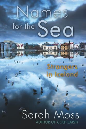
Names for the Sea
by Sarah Moss · 27 Apr 2018
First Seen 2 Leave of Absence 3 Vestmannaeyjar 4 Back to School 5 Pétur’s Saga 6 Winter 7 The Icesave Thing 8 Spring 9 Eyjafjallajökull 10 Vilborg 11 The Hidden People 12 A Small Farm Under a Crag 13 In Search of the Kreppa 14 Knitting and Shame 15 Last
…
fly to the Westman Islands. The Westman Islands are the tops of volcanoes sticking out of the sea, along the same fault as the volcanoes Eyjafjallajökull and Katla. The largest island, Heimaey, has been inhabited since Irish slaves took refuge there early in the settlement period, and in the seventeenth century
…
the boot and the car doors, the sound echoes over the low roofs of Hveragerði, and we drive away like thieves in the night. 9 Eyjafjallajökull On the 22nd of March, the Icelandic papers report a small eruption in the south. The farms in the valley below the volcano have been
…
, a pancake for a volcano, a biscuit for the town. ‘The fault just goes along like this. It’s all in a line. Surtsey, Eldfell, Eyjafjallajökull. And then Katla. Just one line.’ He looks up and switches to Icelandic. Something about a shipwreck. Teddi takes over. ‘He’s saying that as
…
beginning to understand why Icelanders seem unperturbed by economic collapse, the swine flu epidemic which has swept Europe over the winter and the eruption of Eyjafjallajökull. Amalia Lindal’s theory about fishing makes more sense after talking to Theódór. Fishing means that all plans and livelihoods are always dependent on the
…
compliment of sorts. In a nice way, of course, he says, and he and Matthew, who’s stopped by to explain the latest developments of Eyjafjallajökull and the Icesave Thing, look at each other and laugh. The answer, I think later, might be that we both talk a lot. On the
…
long way, much further out of the city than I’ve been before, and half the roads are gravel tracks. It’s also rather near Eyjafjallajökull. I drive out of the city. I couldn’t eat breakfast, and can feel my heart banging as I join the freeway. It takes me
…
from one wing-mirror to the other), and there it is: a wooden chalet with a wraparound verandah looking out over the lava field to Eyjafjallajökull. Þórunn comes to welcome me, a small woman in her sixties with dark blonde hair in a rough bob and oversized, plastic-rimmed glasses. She
…
, and returning ash instead of cash, jokes that are not quite jokes about showing the world what happens if you mess with Iceland, as if Eyjafjallajökull is enacting the will of the Icelandic people not only by erupting but by erupting 30,000 feet into a south-east wind, as if
…
the resulting famine. Katla has erupted roughly every eighty years since records began, and is now ten years overdue and rumbling. Every previous eruption of Eyjafjallajökull, which comes from the same underground source as Katla, has been followed by Katla within two years. We’ve all been given notice. I haven
…
Cornwall, reasonably enough, won’t wait for the volcano to subside so I can visit Singapore before making a decision and so, in the end, Eyjafjallajökull decides for us. I like Cornwall. The job will suit me well, and there are good schools. The imagined smell of flowers heavy with tropical
…
in prison. The headlines in the English language Iceland Review and on the English pages of Morgunblaðið were about a cycle-to-work scheme and Eyjafjallajökull’s most recent contribution to international airspace. I don’t think there’s any conspiracy; these sites are meant for and used by tourists, who
Insight Guides Iceland
by Insight Guides · 6 Dec 2024 · 415pp · 110,831 words
. Magni and Móði, Fimmvörðuháls. Take a bus or super-jeep tour to see these two smoking craters, created during the first phase of the 2010 Eyjafjallajökull eruption and named after the sons of Thor. For more information, click here. SUSTAINABLE TRAVEL Given its remote location and wild terrain, Iceland is never
…
photogenic eruption of Mount Hekla in 1991 – “tourist eruptions”, in local parlance. Others can cause a little more trouble, like the 2010 eruption under the Eyjafjallajökull glacier. The resulting ash cloud, which reached a height of 10km (6 miles), brought airplanes across Europe to a standstill for six days in April
…
active volcano, followed suit; however, kinder air currents carried its 20km (12-mile)-high plume away to the northeast, causing less disruption to air traffic. Eyjafjallajökull volcanic eruption. Shutterstock In the shadow of disaster Despite an apparently flippant attitude towards volcanoes, Icelanders do not forget the threat they live with. The
…
the country is plunged into a severe recession. 2009 Iceland applies for EU membership. 2010 In April, the ash cloud from a volcanic eruption under Eyjafjallajökull glacier brings most of Europe’s air traffic to a standstill for six consecutive days; the following year, Grímsvötn erupts for five days, releasing 10
…
it in when the glacial rivers are low, usually in the early morning. Puffins at Dyrhólaey. Shutterstock Tip As evidenced by the volcanic eruptions at Eyjafjallajökull and Grímsvötn, Iceland’s landscape is prone to the occasional lively outburst. The Department of Civil Protection and Emergency Management (www.almannavarnir.is) issues the
…
wagtails. The Ring Road continues south along a narrow plain of farmland between the black-sand coast and rugged cliffs that lead to the icecap Eyjafjallajökull $ [map] . This placid-looking glacier was brought to the world’s attention in the spring of 2010 when its underlying volcano erupted, throwing a black
…
waterfall Skógafoss, whose tumbling waters offer one of south Iceland’s best photo opportunities. The trek from Skógar to Þórsmörk, passing between the icecaps of Eyjafjallajökull and Mýrdalsjökull over the Fimmvörðuháls pass, is very popular with the hardy between June and September, and the trail can become quite crowded in July
…
the walk to finish in Skógar on the coast, passing by the new ground at Fimmvörðuháls, still hot to the touch, created by the 2010 Eyjafjallajökull eruption. Returning to the coast Travellers are faced with several routes from Landmannalaugar. It is possible to take a track southwestwards on routes 26 or
…
. Scheduled flights from Reykjavík to six destinations around Iceland; plus sightseeing flights along the south coast, including over Landmannalaugar, Hekla, the Vestmannaeyjar and the 2010 Eyjafjallajökull eruption site. Mýflug Air Service, Reykjahlíð airport, Lake Mývatn, www.myflug.is. Offers sightseeing flights around Lake Mývatn from the airfield behind the Hlíð camp
New Dark Age: Technology and the End of the Future
by James Bridle · 18 Jun 2018 · 301pp · 85,263 words
same thing and seeking ways to articulate it. Some of the most spectacular sunsets seen in Europe in recent times occurred after the eruption of Eyjafjallajökull, the Icelandic volcano that filled the heavens with ash in April of 2010. These sunsets are also caused by aerosols in the atmosphere, particularly sulfur
…
were cancelled, almost half the world’s air traffic, and 10 million passengers were stranded. Apart from the sunsets, the most unsettling thing about the Eyjafjallajökull event was its silence. For the first time in decades, the skies over Europe were quiet. The poet Carol Ann Duffy noted its stillness: Britain
…
Like Tambora before it, it took several months for news of the eruption to reach Europe: in the meantime, apocalyptic predictions flourished. The eruption of Eyjafjallajökull provided an opportunity to lay certain misconceptions about volcanic carbon dioxide to rest. The volcano was estimated to have emitted between 150,000 and 300
…
ETAS (epidemic type aftershock sequence) model, 145–6 Euronext Data Center, 104, 105, 106 Evangelismos Hospital, 130–1 evolution, theory of, 78 exploitation, 229–30 Eyjafjallajökull, eruption of, 200–1, 202 F Facebook, 39–40, 156–7 facial recognition, 141 Fairchild Semiconductor, 80 Farage, Nigel, 194 Fat Man bomb, 25 Fermi
On Time and Water
by Andri Snaer Magnason · 15 Sep 2021 · 272pp · 77,108 words
. We see and perceive volcanoes, their ferociousness and their thundering din, but we don’t see that we are Earth’s largest volcano. When the Eyjafjallajökull eruption began in 2010, putting a stop to European air traffic for six days, the volcano’s emissions constituted about 40 percent of daily European
…
by the 150,000 tons that our volcano emitted, we get the devilish number 666. The emissions of the earth’s inhabitants are like 666 Eyjafjallajökull eruptions, day and night, all year-round. If we convert U.S. emissions into volcanic eruptions, one hundred volcanos like Iceland’s
…
Eyjafjallajökull erupt there every day, every night—practically two volcanoes per state.46 We are the eruption, but we don’t see flames when we look
…
a significant section of our economy in recent years, bigger than the fisheries or any other industry. We had experienced a boom ever since the Eyjafjallajökull eruption put Iceland on the map as a tourist destination. Now it was totally wiped out, nobody knowing when travel would be permitted again. Still
…
.com/article/earthtalks-volcanoes-or-humans/. 45 “Planes or Volcano?,” https://informationisbeautiful.net/2010/planes-or-volcano. 46 Calculations based on the assumption that the Eyjafjallajökull emissions were 150,000 tons of CO2 per day, U.S. emissions amount to 5.4 gt and UK emissions to 400mt. Then methane and
…
expedition melting wilderness north of Viking Seaman’s Magazine (Sjómannabladid Víkingur) Vikings, impact of Christianization virus, Covid-19 volcanic eruptions Askja (1875) carbon dioxide from Eyjafjallajökull (2010) under glaciers Hekla (1947) Laki (eighteenth-century) record of historic Völuspá W Warhol, Andy warm-heartedness, education in water changing nature predicted shortages supply

How Bad Are Bananas?: The Carbon Footprint of Everything
by Mike Berners-Lee · 12 May 2010 · 264pp · 71,821 words
effect of the carbon, so the question of whether the warming effect or the cooling effect is greater is not clear-cut. Iceland 2010 When Eyjafjallajökull erupted, it was estimated to have belched out 150,000 tons CO2e per day. This climate change impact was offset by its effect on aviation
…
-carbon alternatives. The second effect is the possibility that flying through even low-level dust permanently damages jet engine efficiency. If this is the case, Eyjafjallajökull could haunt the aviation industry for many years. Overall, was the Iceland incident good or bad for the climate? We don’t know. My hunch
…
aviation: air-freighted foods, 26–27, 85–86, 135, 177; and climate change mortality, 14; compared with other carbon sources, 40, 72, 116–18, 169; Eyjafjallajökull and, 158; fuel costs, 60; high-altitude emissions, 7–8, 60–61, 196n4, 217n6, 221n10; long-haul travel, 133–35, 217n5, 217–18n10; nitrous oxide
…
Etna, Mount, 157, 158 Europe, 33, 75, 104, 195, 199n7, 203n12. See also specific countries Eurostar train, 43–44 Executive Order on Federal Sustainability, 197n5 Eyjafjallajökull, 158 family planning, 150, 188 feed-in tariffs, 130–31, 145–47, 189 fertilizer, 136–37, 218n11 Feynman, Richard, 154 F gases, 171 financial services
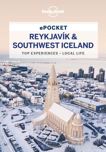
Lonely Planet Pocket Reykjavík & Southwest Iceland
by Lonely Planet · 135pp · 31,818 words
Peninsula. Reykjadalur Bathe in hot rivers in a geothermal valley. Best Volcanoes Hekla Once thought to be the gates of hell; you can climb it. Eyjafjallajökull Stopped Europe’s air traffic in 2010. Kerið An multi-hued crater with red earth and a green lake. Eldfell Small, but almost smothered Heimaey
…
This modern theatre with a hands-on lava exhibit in the foyer screens a 55-minute pair of films (hourly) about the Vestmannaeyjar volcanoes and Eyjafjallajökull. They show in German, French, Icelandic or Swedish once daily during the summer. (%555 1900; www.volcanohouse.is; Tryggvagata 11; adult/child 1990/1000kr; h9am
…
wide coastal plains before the landscape grows wonderfully jagged near Skógar and Vík. Inland, mountains thrust upwards and volcanoes are wreathed by mist (such as Eyjafjallajökull, which erupted in 2010, disrupting much of Europe). Here awesome glaciers glimmer as rivers carve their way to black-sand beaches and the sea. The
…
at Sólheimajökull. Zip along to Vík’s magnificent coastline at Dyrhólaey and Reynisfjara. Book ahead for dinner at Suður-Vík before powering back to Reykjavík. Eyjafjallajökull | BRIAN MAUDSLEY/SHUTTERSTOCK © Getting There & Around Almost all Reykjavík-based tour companies head to the south; many local operators also pick up in Reykjavík. u
…
. Subglacial & Submarine Eruptions Several of Iceland’s liveliest volcanoes lie beneath glaciers, which makes for drama as molten lava and ice interact. The eruption of Eyjafjallajökull in 2010 caused a jökulhlaup (flooding caused by volcanic eruption beneath an ice cap) before throwing up the famous ash plume that grounded Europe’s
Lonely Planet Pocket Reykjavík & Southwest Iceland
by Lonely Planet · 139pp · 34,917 words
Aerotropolis
by John D. Kasarda and Greg Lindsay · 2 Jan 2009 · 603pp · 182,781 words
The Mini Rough Guide to Iceland (Travel Guide eBook)
by Rough Guides · 11 Mar 2022 · 128pp · 32,434 words

Scandinavia
by Andy Symington · 24 Feb 2012
Fire and Ice: The Volcanoes of the Solar System
by Natalie Starkey · 29 Sep 2021 · 309pp · 97,320 words
The Pyramid of Lies: Lex Greensill and the Billion-Dollar Scandal
by Duncan Mavin · 20 Jul 2022 · 345pp · 100,989 words
Found in Translation: How Language Shapes Our Lives and Transforms the World
by Nataly Kelly and Jost Zetzsche · 1 Oct 2012 · 274pp · 73,344 words

Decoding the World: A Roadmap for the Questioner
by Po Bronson · 14 Jul 2020 · 320pp · 95,629 words
The End of Growth
by Jeff Rubin · 2 Sep 2013 · 262pp · 83,548 words
The God Species: Saving the Planet in the Age of Humans
by Mark Lynas · 3 Oct 2011 · 369pp · 98,776 words
Foolproof: Why Safety Can Be Dangerous and How Danger Makes Us Safe
by Greg Ip · 12 Oct 2015 · 309pp · 95,495 words

Pinpoint: How GPS Is Changing Our World
by Greg Milner · 4 May 2016 · 385pp · 103,561 words
Age of Discovery: Navigating the Risks and Rewards of Our New Renaissance
by Ian Goldin and Chris Kutarna · 23 May 2016 · 437pp · 113,173 words
Jared Bibler
by Iceland's Secret The Untold Story of the World's Biggest Con-Harriman House (2021)
Stephen Hawking
by Leonard Mlodinow · 8 Sep 2020 · 209pp · 68,587 words

50 Future Ideas You Really Need to Know
by Richard Watson · 5 Nov 2013 · 219pp · 63,495 words

Wonders of the Universe
by Brian Cox and Andrew Cohen · 12 Jul 2011

Peers Inc: How People and Platforms Are Inventing the Collaborative Economy and Reinventing Capitalism
by Robin Chase · 14 May 2015 · 330pp · 91,805 words
The Iceberg: A Memoir
by Marion Coutts · 2 Jul 2014 · 249pp · 89,012 words

This Is Service Design Doing: Applying Service Design Thinking in the Real World: A Practitioners' Handbook
by Marc Stickdorn, Markus Edgar Hormess, Adam Lawrence and Jakob Schneider · 12 Jan 2018 · 704pp · 182,312 words

The Best Business Writing 2013
by Dean Starkman · 1 Jan 2013 · 514pp · 152,903 words

The Iceberg
by Marion Coutts · 249pp · 89,012 words
The Content Trap: A Strategist's Guide to Digital Change
by Bharat Anand · 17 Oct 2016 · 554pp · 149,489 words
Lonely Planet Switzerland
by Lonely Planet · 3,002pp · 177,561 words
Filterworld: How Algorithms Flattened Culture
by Kyle Chayka · 15 Jan 2024 · 321pp · 105,480 words
The Default Line: The Inside Story of People, Banks and Entire Nations on the Edge
by Faisal Islam · 28 Aug 2013 · 475pp · 155,554 words
A Brief History of Everyone Who Ever Lived
by Adam Rutherford · 7 Sep 2016
Secrets of the Sprakkar
by Eliza Reid · 15 Jul 2021