description: series of annual OpenStreetMap conferences
1 results
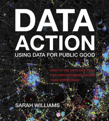
Data Action: Using Data for Public Good
by
Sarah Williams
Published 14 Sep 2020
Map parties created a place for map enthusiasts to socialize and share information on the latest mapping technologies, and resulted in a strong open-source mapping community. Attending map parties was a way to learn from peers while generating data under the ethos of open-source principles and practices. In 2007 OpenStreetMap held its first “State of the Map” conference, which has since become one of the main gatherings for the open-source map community.16 Recently at this conference the Red Cross, USAID, and a number of other humanitarian organizations demonstrated techniques for building data for disaster relief using OpenStreetMap tools. For example, the Red Cross developed OpenMapKit, a tool that allows its staff to collect data in remote areas where limited internet and cell networks make accessing and uploading data to OpenStreetMap's database difficult.
…
See also specific applications and content interactive 167–168 power of 155–164 as tools of surveillance 21 urban planning and 42 uses of 42 “Maps as Social Construction: Power, Communication, and Visualization” (Crampton) 166 Markey, Edward J. 69 Matatus Owners Association 146–147 Matatu system xvii, 77–78, 143, 156–157, 220 stylized map of 149, 150, 154 University of Nairobi students collect data on 148 workshop to engage transportation stakeholders 149 McDonald, Sean 198, 208–209 McLuhan, Marshall 192 McPhail, Tom 192 Measurement, visualization and 61, 62–64, 66 Meier, Patrick 82 Mejias, Ulises 192 Mexico land-use patterns in 95 transit data in 155 Mexico City, Mexico, Global Resource Center for the Development of Informal Transit Data 155 Miami, Florida, obliteration of Overtown (historic African American neighborhood) in 36–37, 38, 39 Michigan 174 Microsoft 47–48, 190–191, 191, 208–209 Million Dollar Blocks project 157–162, 165, 183, 219 Australia and 165 Brooklyn map (prison expenditures) 161 Chicago map 159 neighborhoods of incarcerated people 157–158 New Haven map 162 New Orleans maps 162 New York maps 162 Phoenix maps 162 Wichita maps 162 Ministry of Transport 152 MIT (Massachusetts Institute of Technology) 44, 70, 89–90, 147 Mobile phones 53, 74, 85 Mobile World Congress 2018 in Barcelona 207 Mobilize (smartphone-based sensing platform) 85 Montana 6 Moses, Robert 39–41 Multidisciplinary teams xix Mumford, Lewis 166 Munro, Robert 82 Nairobi, Kenya 77, 152, 154–155 City Hall 147 data on roads and land use 144, 146 data set for 145 improved mobility in 143 maps and 184 post-election crisis in 80–81 Public Lab mapping and 71, 72 transportation model for 143 National Spatial Data Infrastructure (NSDI) project 144 National Vital Statistics System (NVSS) 176 Navteq 54–55 Nelson, Michael 208 Nepal Earthquake Response Team 2015, GIS data and 80 New Hampshire 8 New Haven, Connecticut, Million Dollar Blocks project and 162 New Orleans, Louisiana 69, 162 News stories, interactive 173–183 New York 6, 39–40 311 calls in 218 air quality 63, 66, 78–79, 79 art and entertainment world in 114–115 first zoning plan 30 map of fashion-related events 118 map of “Gilded Age” in 23 Million Dollar Blocks project and 162 New York City Fire Department 45 New York Civil Liberties Union (NYCLU) 178, 179, 216 New York Police Department (NYPD) 177, 180–181, 184 New York State Lottery Commission 168, 184 New York Times 56, 65, 66, 71, 174–175, 178, 181, 197, 199 Nichol housing 17 Noble, Safiya xii–xiii Nongovernmental organizations (NGOs) 191, 198 “The Notion of Life” (Geddes) 166, 166 “Nowcasting,” 130, 132 Obama, Barack 177, 183 Odinga, Raila 80 Olympics, Beijing 2008, 61, 62, 66 O’Neil, Cathy xii–xiii Online media, interactive “data stories,” 173–174 On the Mode of Communication of Cholera (Snow) 12 Open data 127, 140, 144, 148, 152, 177, 192 OpenMapKit 55 Open-source data 48 OpenStreetMap 54–56, 80, 83, 85–86, 146, 216 Open Street Map Foundation 55 “State of the Map” conference 55 Open Transport Partnership (OTP) 204 Open Trip Planner application 147, 149 Orange, call detail record (CDR) 208–209 Ordnance Survey, Britain 10, 14, 54 Overtown (historic African American neighborhood, Miami, Florida) 36–37, 37, 38, 39 Ownership, of data 194, 195 Oxfam 199 Parcel data, xiv.