Pinpoint: How GPS Is Changing Our World
by Greg Milner · 4 May 2016 · 385pp · 103,561 words
discovered islands through uncontrolled drift. Their ability to know where they were and where they were going, across a seemingly faceless ocean, is baffling. A Polynesian navigator would have several tools at his disposal to set a course for travel. Chief among these was a sidereal compass, a complex ingrained mental image
…
today, and we are still piecing together its components. The most celebrated European explorer of the Pacific could not understand the map of the world Polynesian navigators had in their heads, even when he had the good fortune to meet someone willing to sketch its contours. In the early sixteenth century, Ferdinand
…
and customs” than anyone else they had met on the island. Perhaps because of his dispossessed status, Tupaia was willing to share closely guarded navigational skills that no Polynesian had previously taught to a European. On September 9, Cook recorded, the Endeavour set sail, “in search of what chance and Tupia might
…
group was covered. The map not only displayed Tupaia’s extensive geographical knowledge, it was also a tacit argument for the power and precision of Polynesian navigation. Tupaia’s sophisticated expertise, passed down from generation to generation, argued for the ability of his ancestors to travel great distances, even back to islands
…
physician, adventurer, and master sailor, had won a university fellowship to sail the Pacific in search of anyone who still practiced the ancient art of Polynesian navigation. It was a dispiriting experience, as Lewis discovered that the practices had died out, superseded by modern methods. Then he met Tevake, a man in
…
of 300 miles or more. Age had slowed Tevake somewhat, but he still traveled solo between his atoll and nearby islands. Tevake was “the first Polynesian navigator I ever sailed with,” Lewis remembered, as well as “one of the greatest.” This gifted navigator lived on an atoll in the Santa Cruz Islands
…
lands without quadrant, compass, or chart,” he wrote. “The view that they were supermen is not satisfactory basis for a theory of Polynesian long navigation.” Rather than evidence of navigational prowess, Sharp believed Tupaia’s map reflected the accumulated geographic knowledge of people who had drifted to Tahiti, compiled and synthesized by the
…
their migratory achievements in actual methodology. Lewis felt he had the seafaring knowledge—and, in Tevake, an invaluable resource—to discover the inner workings of Polynesian navigation that made the migration possible. During his time with Tevake, Lewis learned how the older man was taught to memorize star positions, and how he
…
map. He suspected it represented a way of conceiving space that was similar to Tevake’s—literally, a completely different worldview. Some principles of ancient Polynesian navigation are incredible to behold, but conceptually simple to grasp—that is, we can imagine how they would work. We understand that any navigator must first
…
set a course. The Polynesian navigator’s primary tool would be his sidereal compass. Not a compass in the way we understand the term, the sidereal compass cannot be held in
…
of travel, and the course heading. By counting wheel rotations, the odometer provides a way to conceptualize your location, to understand what “here” means. The Polynesian navigator has set a course defined by a series of star-points. To execute the course, to know when to stop following one star and start
…
him to gauge the passage of time. The ability to solve for those two variables—the rate of travel and the elapsed time—makes the Polynesian navigator a powerful dead reckoner. But he still needs a way to visualize where he is and how much he has progressed on his journey, in
…
the odometer’s calculations give you a sense of how close you are to my house. One reason it is so difficult to understand the Polynesian navigator’s method of pinpointing himself is that we are no longer really talking about navigation. Navigation is the process of determining a route. The way
…
geographer Reginald Golledge put it, wayfinding is the way we “embed the route to be taken in some larger reference frame.” A full understanding of Polynesian navigation requires us to poke our heads through a completely new frame. Imagine the earliest human society—not so much a village as an encampment. For
…
relation to our homes. Dead reckoning is kept to a minimum. The center of our world is us. Gatty, who had some knowledge of ancient Polynesian navigation, identified a third system, which he called “local-reference.” This defines location in relation to a prominent environmental feature, such as a mountain, coastline, or
…
wrote. “A study of etak will not give us the answer. Rather, we must look back to his instruction in the star courses.” If the Polynesian navigator errs in his estimates of how far the canoe has traveled, etak will not save him and his crew. “The system is workable,” Lewis concurred
…
Manuscripts by J. C. Beaglehole for the Hakluyt Society, 1955–67 (London: Penguin Books, 2003), ccclxvi. 7 “the Machiavelli”: Joan Druett, Tupaia: Captain Cook’s Polynesian Navigator (Santa Barbara, CA: Praeger, 2011), xii. 8 arioi, an elite society: Anne Salmond, The Trial of the Cannibal Dog: Captain Cook in the South Seas
…
alive: David Lewis, We, the Navigators: The Ancient Art of Landfinding in the Pacific (Honolulu: University of Hawai‘i Press, 1994), 55. 11 “the first Polynesian navigator”: Ibid., 31. 11 “almost alone”: Ibid. 11 “I became his pupil”: Ibid. 12 the mysteries of Polynesian migration: On the history of the various
…
Polynesian navigation theories, see Ben Finney, Voyage of Rediscovery: A Cultural Odyssey Through Polynesia (Berkeley: University of California Press, 1994), 18–23; and Finney, “Myth, Experiment, and
…
Press, 1964), 53. 13 “would be nothing for a seaman of his caliber”: Lewis, We, the Navigators, 355–6. 14 The Polynesian navigator’s primary tool: For an excellent concise overview of Polynesian navigation techniques, see Oliver Kuhn, “Polynesian Navigation,” CSEG Recorder, September 2008, http://csegrecorder.com/features/view/science-break-200809. 17 “embed the route
…
not necessarily been visited.” 17 He contrasted home-center systems: Gatty, Nature Is Your Guide, 47. Gatty’s writing on wayfinding is discussed in Kuhn, “Polynesian Navigation,” and in Lewis, We, the Navigators. 19 “into which the navigator’s”: Quoted in Lewis, We, the Navigators, 179. 19 “Everything passes by”: Ibid., 176
The Boundless Sea: A Human History of the Oceans
by David Abulafia · 2 Oct 2019 · 1,993pp · 478,072 words
seas all the way up to Korea and Japan have interacted strongly since ancient times. These seas have looked away from the Pacific of the Polynesian navigators, which was a separate world consisting of often tiny islands scattered across a vast and, it must have seemed, unbounded space. For this reason the
…
Zealand (Aotearoa) are well out of sight of the nearest landfall, and in the last two cases some way removed from the main lines of Polynesian navigation. Within this vast space, however, there are extraordinary signs of unity. Captain Cook and the natural historian Joseph Banks explored immense tracts of the Pacific
…
Pacific was a sea of constant surprises and uncertainty. There is a simple point that sums up the mastery over the seas accomplished by the Polynesian navigators: apart from a northern route across the Atlantic, managed for several centuries by the Vikings and their descendants, western European sailors did not venture deep
…
different types of plant – yams flourished best in Melanesia. (Another arrival was the sweet potato, apparently from South America, which raises the question of whether Polynesian navigators at some stage reached the opposite side of the Pacific.) The proto-Oceanic vocabulary, reconstructed by philologists, offers words for planting, weeding, harvesting and the
…
this expansion quite fast, even, in the timescale of prehistorians, explosive. The motives behind this movement of people are hard to fathom. One historian of Polynesian navigation, David Lewis, identified a spirit of adventure – a ‘restless urge’ – among Polynesians, citing the Raiateans from Tahiti, who would go voyaging for several months, touring
…
South Equatorial Current, as with the winds, the broad shape of movement from Samoa westwards very roughly coincides with the zone of Lapita settlement. Evidently, Polynesian navigators perfected the art of sailing against the wind; they needed to ensure that they could return from their explorations, and the best way to do
…
do than European sailors, who had to await the invention of the chronometer in the eighteenth century to be sure of their longitude. Tupaia, a Polynesian navigator who accompanied Captain Cook, astonished Cook’s companions by his almost instinctive awareness of where the ship stood, without instruments or written records. The
…
Polynesian navigators proved that one can solve some challenging problems without any technology at all, just the super-computer of the human brain.38 As for latitude,
…
they had achieved this, he asked how they knew where the island was. ‘Why,’ they replied, ‘it has always been there.’42 The extraordinary confidence Polynesian navigators possessed in their methods can also be judged from an interview with a navigator from the Marshall Islands conducted in 1962: ‘we older Marshallese people
…
map of the heavens.46 It is therefore completely wrong to conclude that without writing there can be no exact science, even if the navigational science of the Polynesians had a good share of incantations, magical practices and invocation of the gods. The extraordinary understanding that Polynesian sailors developed of the sea
…
southwards to New Zealand, the last part of Oceania to be settled, a question about contacts right across the Pacific needs to be addressed. Since Polynesian navigators reached as far east as Rapa Nui, isolated in vast tracts of open ocean, is it conceivable that some reached further still and arrived in
…
could see Native American influence on innumerable Polynesian artefacts. The raft he constructed, Kon-Tiki , bore no resemblance to the type of vessel used by Polynesian navigators all the way across Oceania; it was copied from Peruvian sailing rafts deployed after the Spanish conquest of the Inca Empire.15 Nonetheless, in 1947
…
important questions. And the question about links between Oceania and South America is a real one. There is evidence for contact in the era of Polynesian navigation, though it is not easy to decipher. Most of the supposed similarities between objects produced in Oceania and along the American coastline have functional explanations
…
. While it is possible to imagine birds carrying seeds across many thousands of miles, tubers are another story. It is therefore safe to say that Polynesian navigators extended their range right across the Pacific during this extraordinarily ambitious second phase of expansion. Even more remarkable than possible contact with the admittedly vast
…
deliberately; whether or not it was found by accident, it remained off the mental map of the Polynesian navigators. Like Hawai’i and New Zealand, it did not feature on the hand-drawn map the Polynesian navigator Tupaia prepared for Captain Cook, which only extended as far east as the Marquesas.26 Pitcairn Island
…
population of what the descendants of the original settlers still call Aotearoa, a name attributed to Hine-te-aparangi, the wife of Kupe, the first Polynesian navigator to reach North Island – the mountainous, often cold, South Island was visited and was lightly settled over the centuries, but the great majority of Māoris
…
‘Columbus, Magellan or Cook’ of the Māoris, a historical figure who certainly existed and who was the most eminent representative of hundreds of generations of Polynesian navigators in the Pacific.29 A Māori song began: Ka tito au, ka tito au, Ka tito au ki a Kupe, Te tangata nana i hoehoe
…
; however, his two grandsons, Turahui and Whatonga, did join the tournament. The race took the canoes far out to sea, and for once the learned Polynesian navigators did not read the weather signs with due care and attention; winds and fogs dispersed the canoes and several disappeared entirely. Consultation of the gods
…
Indies was a space in which human beings moved impressive distances far out of sight of land. They may not have possessed the extraordinary navigational skills of the Polynesians (though conceivably the discoverers of Madagascar possessed some of that knowledge), but the navigators of the Indian Ocean required and acquired a detailed
…
, South America, Africa and Europe.1 At first sight there is nothing in prehistoric and ancient times to compare with the astonishing feats of the Polynesian navigators, nor with the mastering of the monsoons by those who crossed the open Indian Ocean. There are plenty of crackpot theories about ancient Egyptians or
…
again it is important to remember that science was being deployed in the service of trade and empire. Cook, like Bougainville, appreciated the skills of Polynesian navigators. He persuaded Tupaia, a highly skilled navigator, priest and local nobleman, to come on board, and Tupaia accompanied Cook around the Polynesian islands, even drawing
…
down by word of mouth, so that much of the detail was in place long before Hawai’i, Aotearoa and Rapa Nui were settled by Polynesian navigators. Just as it had taken these navigators a long while to cross the band of winds that separated the southern from the northern Pacific, so
…
, because the Hawai’ians were dependent on unscrupulous agents in Canton who saw a good opportunity to exploit innocent newcomers.51 A new generation of Polynesian navigators familiarized themselves with European rather than Pacific shipping, and became an essential element in the crew of foreign ships as well as Hawai’ian ones
…
sail, and an outrigger is attached, adding greatly to its stability. Such boats have sailed the Pacific for millennia. 2. By the ninth century AD Polynesian navigators had settled the Hawai’ian archipelago. This early image of a boat with a claw sail, carved on a rock in Maui, may date back
…
Tranquebar from a south Indian ruler. Much of its business consisted of ‘country trade’ within the Indian Ocean and the South China Sea. 60. The Polynesian navigator Tupaia accompanied Captain Cook around the Pacific islands. His very detailed map was drawn from memory, but he had no knowledge of Hawai’i and
…
; also Lewis, We, the Navigators , pp. 139–91. 39. Irwin, ‘Voyaging and Settlement’, p. 73. 40. Finney and Low, ‘Navigation’, pp. 170–71; J. Evans, Polynesian Navigation and the Discovery of New Zealand (Auckland, 2011; rev. edn of The Discovery of Aotearoa , Auckland, 1998), pp. 55–8. 41. Lewis, We, the Navigators
…
, 36–7. 35. Ibid., p. 7. 36. Simmons, Great New Zealand Myth , pp. 341–53; Hiroa, Coming of the Maori , pp. 5–6; J. Evans, Polynesian Navigation and the Discovery of New Zealand (Auckland, 2011; rev. edn of The Discovery of Aotearoa , Auckland, 1998), pp. 33–7. 37. Hiroa, Coming of the
…
Kra Isthmus 137 , 144 , 273 Krakatoa 119 Kronstadt, Baltic 807 , 809 Kruzenshtern, Johann-Anton von 806–9 Kulami 182 Kumiai Indians 28 Kunemura 232 Kupe, Polynesian navigator 32–6 Kuril Islands 797 , 803 , 804 Kurland 715–16 , 719 Kuroshio current xv Kuwait 54 , 67 Kuy (war-god) 26 Kwallŭk 194 Kylsant, Owen
…
26 Tuareg Berbers 500 Tudors 534 Tun-sun 144 tuna 196 , 467 tunny-fishing 54 Tunisia 173 , 182 , 184 , 186 Tupac Inca Yupanqui 727 Tupaia (Polynesian navigator) 16–17 , 31 , 812–13 Tupí Indians 553 , 560 , 561 Tupinambá Indians 519 Turks/Ottomans 318 , 456 , 536 , 537 , 601–10 and Basra 604 , 606

Hawaii Travel Guide
by Lonely Planet
and play with three floors of interactive multimedia exhibits. The Bishop Museum is also home to Oʻahu’s only planetarium, which highlights traditional Polynesian methods of wayfaring (navigation), using wave patterns and the position of the stars to travel thousands of miles across the open ocean in traditional outrigger canoes, as
…
, and a grab bag of souvenirs indoors. Stonewashed (pohaku means stone in Hawaiian) T-shirt designs are printed with Hawaiian themes such as petroglyphs, Polynesian carvings and navigational maps. Art HouseARTS & CRAFTS ( GOOGLE MAP ; %808-742-1400; www.arthousehawaii.com; 3440 Poʻipu Rd; h11am-6pm) Local artists show their plein-air
…
' and becoming one of the most widespread nations on earth. Although the discovery of Hawaii may have been accidental, subsequent journeys were not. Polynesians were highly skilled seafarers, navigating over thousands of miles of open ocean without maps, and with only the sun, stars, wind and waves to guide them. In double
Pacific: Silicon Chips and Surfboards, Coral Reefs and Atom Bombs, Brutal Dictators, Fading Empires, and the Coming Collision of the World's Superpowers
by Simon Winchester · 27 Oct 2015 · 535pp · 151,217 words
—seemed to want to learn, and he fully expected that his knowledge would die with him. He would be among the last of the navigators in the Polynesian world. Then came a curious concatenation of circumstances. He took a job as a seaman on an inter-island steamship—by now he had
…
. Much background to the story can be found in Sam Low’s book on the Hawaiian Renaissance, Hawaiki Rising; in Ben Finney’s explanations of Polynesian navigation, Sailing in the Wake of the Ancestors; and most fascinating of all, in David Lewis’s account, We, the Navigators. BIBLIOGRAPHY Armitage, David, and Alison
…
. See also specific colonies and colonial powers end of, 27–28, 201, 190, 211–29 Hawaii and, 351–52 Micronesia and, 8–9, 43–45 Polynesian navigation and, 433–34 Columbia Pictures, 123 Communism. See Cold War; and specific countries Compact of Free Association, 16 computers, 111 consumer electronics, 110–19 container
…
movement, 352n marine protected zones, 367 missionaries and, 44, 130–31 Navarre Plan and, 206 NSA and, 157 Polynesian culture and, 4–6, 9, 127 Polynesian navigation skills and, 4–5, 427–40 Pueblo and, 160 statehood and, 5 surfing and, 27, 122, 127–33, 139–40, 142, 144–45, 149 Typhoon
…
–37 end of colonialism in, 189–229 ENSO and El Nino and, 249–64 finding pivotal moments in story of, 22–29 Hokule‘a and Polynesian navigation of, 429–40 hydrothermal vents and, 306, 318–27 maps of, viii-ix, 152–56, 212, 256–58, 309–10, 313, 315–18, 390–91
…
Port Edward, 414 Port Moresby, 5 Portugal, 28, 228–29, 273, 414, 424 Poseidon aircraft, 404n Potsdam conference (1945), 203, 393 ppwo and ppalu (Polynesian navigation and navigators), 433–34, 434 President, USS (frigate), 152 Prinz Eugen (German cruiser), 12–13, 13n, 57 Project 4.1, 74 “Prokaryotic Cells in the Hydrothermal Vent
…
–96, 98–100, 103 renamed Sony, 106 Tomahawk missile, 418 Tonga, 25, 31, 333 colonialism and, 212–14, 272 deep-sea mining and, 333, 334 Polynesian navigation and, 431, 437, 439 Tores Strait, 300 Torishima volcano, 358–62, 375 tornadoes, 236n Torres Strait, 343 Toshiba company, 99, 113 Toyota company, 11, 115

Hawaii
by Jeff Campbell · 4 Nov 2009
an erupting volcano or take a minisub dive. The museum is also home to O′ahu’s only planetarium (848-4136), which highlights traditional Polynesian methods of wayfaring (navigation), along with astronomy and the telescope observatories atop Mauna Kea. Shows are usually held at 11:30am, 1:30pm and 3:30pm, and
Horizons: The Global Origins of Modern Science
by James Poskett · 22 Mar 2022 · 564pp · 168,696 words
and wide to offer tribute and learn the ways of the sea. Tupaia studied astronomy, navigation, and history. Indeed, these three subjects all went together. Polynesian navigators needed to be able to sail, sometimes for weeks, out of sight of land. They did so without the aid of charts or navigational instruments
…
left Southeast Asia around 4,000 years ago, gradually spreading across the Pacific, reaching Tahiti in around the year 1000 ce.43 The idea behind Polynesian navigation was simple, but extremely effective. Instead of calculating his exact position at sea, Tupaia would recall a specific route: for example, the stars to follow
…
to a different star, particularly if it was a long voyage. After days or even weeks at sea, they would eventually reach their destination.44 Polynesian navigators preferred to sail at night. But if they had to, a navigator like Tupaia could also sail by day. In the southern hemisphere, a shadow
…
. It was therefore relatively easy to get a good sense of the direction you were travelling in based on the position of the Sun. But Polynesian navigators didn’t just watch the heavens. They also paid close attention to the rise and fall of the ocean. These ocean swells are modified by
…
land, bouncing back off a large island or sometimes bending around it. Polynesian navigators were trained to recognize these subtle differences in the rise and fall of the ocean, and the interaction between different swell patterns. In the Marshall
…
example of cultural exchange in action.49 Sitting at the chart table of HMS Endeavour, Tupaia began to draw a map. As we’ve seen, Polynesian navigators tended not to use maps or charts; they simply memorized star paths. So the idea of drawing a map, divided by a grid representing lines
…
area equivalent to the size of the entire continental United States today. This was an enormous expanse of ocean, a testament to the depth of Polynesian navigational knowledge.50 18. Tupaia’s chart of the Society Islands, copied on paper in ink by Captain James Cook in 1769. At first glance, the
…
Tahitian words for sunset and sunrise, as well as the Tahitian words for northerly and southerly winds. The chart now started to resemble a Polynesian understanding of navigation. This is how it worked. First, you would identify which island you were on, say, Tahiti. You would then draw a straight line to
…
the shadow cast by the Sun on the ship’s mast at noon. What Tupaia had created was utterly unique. He had combined European and Polynesian navigational techniques to create, not only a chart of the Pacific, but one that effectively acted as a calculating device.51 There was another subtle difference
…
true at sea. The winds and currents mean that sailing times are always relative to the direction you’re travelling in. Once again, a Polynesian approach to navigation was perfectly adapted to the Pacific, with distances indicating sailing times rather than the number of miles. Understood like this, historians have recently shown
…
Continent. Having completed his mission, Cook spent a few months exploring the Australian coast, before beginning the return voyage to Britain. Sadly, Tupaia – the great Polynesian navigator – passed away en route. He died, most likely from malarial fever, whilst HMS Endeavour docked at Batavia.53 Nonetheless, Tupaia’s impressive knowledge of the
…
the end of the century, anyone in London with a bit of money to spare could purchase a copy of a map drawn by a Polynesian master navigator.54 In Tupaia’s map, we can ultimately see both sides of eighteenth-century science. On the one hand, European explorers increasingly depended upon
…
the stars, memorizing sequences in order to use them as bearings between particular islands. However, there were also a number of subtle differences between Polynesian and Arctic navigation. For a start, the seasons are much more extreme in the far north. In the summer months, the Sun does not set, whilst for
…
scientific cultures of their own. In Peru, French surveyors unwittingly depended upon Inca astronomical traditions. In the Pacific, Captain Cook relied on the navigational expertise of a Polynesian priest. And in the Arctic, Russian explorers recruited Indigenous people to guide them across the frozen landscape. Recognizing the contributions of these individuals helps
…
Mantar astronomical observatory, overlooking the River Ganges, built in 1737 in Varanasi, India. 7. An oil painting of Tahitian boats in Matavai Bay, Tahiti. The Polynesian navigator Tupaia joined the crew of HMS Endeavour in Tahiti in 1769. 8. Scientific exchange between Chinese, Japanese, and Dutch scholars in the eighteenth century. Note
…
in the Pacific (Honolulu: University of Hawaii Press, 1994). 43Salmond, Trial, 38–9, Lewis, We, the Navigators, 7–8, Joan Druett, Tupaia: Captain Cook’s Polynesian Navigator (Auckland: Random House, 2011), 1–11, and Lars Eckstein and Anja Schwarz, ‘The Making of Tupaia’s Map: A Story of the Extent and Mastery
…
of Polynesian Navigation, Competing Systems of Wayfinding on James Cook’s Endeavour, and the Invention of an Ingenious Cartographic System’, The Journal of Pacific History 54 (2019): 4
…
observatory 47–8, 55, 66; Newton and see Newton, Isaac; Ottoman 2, 6, 7, 59, 61, 63–70, 65, 73, 92, 93, 234–6, 367; Polynesian navigation and 112–25, 120, 122; Renaissance Europe and 51–2, 56–63, 64, 68, 69, 70, 72, 84, 88, 92; shape of the Earth, French
The Year 1000: When Explorers Connected the World―and Globalization Began
by Valerie Hansen · 13 Apr 2020
their course by careful observation of waves, seaweed, birds’ flying patterns, and the contours of land. Mau Piailug, a Micronesian who studied the traditional Polynesian system of navigation, taught it in the 1980s to Steve Thomas, then an avid navigator, and later the host of the television show This Old House. When
…
. At present we have no way of knowing whether these early sailors used double canoes or larger boats with multiple sails. We are certain that Polynesian navigators ventured east into the Pacific at the same time as the Malay voyages to Madagascar. Starting from Micronesia, the Polynesians gradually fanned out, reaching Fiji
…
how knowledgeable Tupaia was about local geography, but Cook didn’t record precisely how the Polynesian found his way around the islands. Detailed information about Polynesian navigation techniques came in the late twentieth century from anthropologists working on the more remote Pacific islands. These scholars recorded traditions that had died out on
…
others. When James Cook arrived in the South Seas in the late 1700s, he realized the importance of the priest Tupaia’s knowledge of traditional Polynesian navigation and geography. Together, the two men made a map of the region, a crucial aid that enabled Cook to find his way to the many
…
and cord. Such vessels could carry up to 600,000 ceramic dishes. National Library of Australia By observing the waves, birds, and stars, traditional Polynesian mariners navigated their way across the Pacific using no instruments at all. They made their vessels by lashing two canoes to a wooden frame and attaching a
…
Philippines, 23, 177, 224, 228, 231 Piailug, Mau, 24, 176–77 Polo, Marco, 222–23 Polynesia Cook’s exploration of, 230 languages in, 172–73 Polynesian navigators canoes and routes used by, 20, 174 exploration by, 174, 176–78 navigation techniques of, 24, 176–77 Ponce, Alonso, 59 Popol Vuh, 65 Portuguese
The Human Cosmos: A Secret History of the Stars
by Jo Marchant · 15 Jan 2020 · 544pp · 134,483 words
astounded by the presence of thriving communities on the tiny, scattered islands of the Pacific, separated by hundreds if not thousands of miles. Unlike Western navigators, Polynesian sailors had no instruments or charts; no telescopes, sextants or lunar tables. How could they possibly have reached the islands over such great stretches of
…
New Zealand, perhaps as late as AD 1200. But although stories brought home by Cook and other explorers initially inspired romantic ideas about the Polynesians being expert ocean navigators guided by the stars, by the 1950s this was replaced by skepticism. Tupaia’s chart looked all wrong, for example. Once the geography
…
together to support a deck, two masts with brown, crab-claw sails and a crew of sixteen. In 1976, guided by a Micronesian navigator named Mau Piailug (no Polynesians could be found with the necessary expertise), Hokule’a sailed two thousand nautical miles from Hawaii to Tahiti without the help of modern
…
we do when we follow a map today. But in 2007, Di Piazza and Pearthree pointed out that this is not at all how a Polynesian navigator like Tupaia would have traveled. Generations of scholars with Western eyes and brains, they argued, had been looking at his chart all wrong. Although many
…
aspects of Polynesian navigation are still poorly understood, a key concept is that of etak, or “moving island” navigation, in which a sailor thinks of his canoe as being
…
approach is the best—if not the only—way to learn about the “real,” physical world. Yet instead of discarding their experience of the cosmos, Polynesian navigators maximized its potential in order to explore millions of square miles of ocean. A mix of stories and songs, senses and instinct, enabled them to
…
we see humanity. Even if an alien signal never comes, the very concept gives us an “other” against which to locate ourselves, just as the Polynesian navigators visualized unseen islands to find their way against the stars. * * * Despite all the discoveries since 1996, we still don’t have a single proven example
…
–1771, ed. John Beaglehole (London: Hakluyt Society, 1955), entries for March 30 to April 13, 1769. “floating coal bucket”: Joan Druett, Tupaia: Captain Cook’s Polynesian Navigator (Santa Barbara, CA: Praeger, 2010), 58. crowd of canoes: Accounts of Endeavour’s stay at Tahiti: Anne Salmond, The Trial of the Cannibal Dog: Captain
…
chant: Teuira Henry, “Birth of the Heavenly Bodies,” Journal of the Polynesian Society 16 (1907): 101–4. teaching schedule for priests: Stan Lusby et al., “Navigation and Discovery in the Polynesian Oceanic Empire: Part One,” Hydrographic Journal 131/132 (2010): 17–25. Rua-Nui’s pillars: Stan Lusby et al
…
., “Navigation and Discovery in the Polynesian Oceanic Empire: Part Two,” Hydrographic Journal 134 (2010): 15–25. “a way of being”: Di Piazza and Pearthree, “History of an Idea.” Cook’s chart
…
directions from each center point, not distances. Cook and his colleagues recorded, however, that Tupaia also quoted sailing times to different islands (more relevant for Polynesian navigators than absolute distances because they incorporate information about currents and winds). * Timbuktu in Mali, a center of Islamic culture in the fifteenth and sixteenth centuries

Collapse: How Societies Choose to Fail or Succeed
by Jared Diamond · 2 Jan 2008 · 801pp · 242,104 words
, Pitcairn group, and Easter. Only after a “Long Pause” of about 1,500 years was that gap finally breached—whether because of improvements in Polynesian canoes and navigation, changes in ocean currents, emergence of stepping-stone islets due to a drop in sea level, or just one lucky voyage. Some time around
Lonely Planet Kauai
by Lonely Planet, Adam Karlin and Greg Benchwick · 18 Sep 2017 · 831pp · 110,299 words
on a Na Pali Zodiac tour. Kayak Hanalei Rent a kayak or SUP and paddle the serene Hanalei River. Island Sails Kauaʻi Learn to navigate a Polynesian sailing canoe on Hanalei Bay. Wailua River State Park ( MAP GOOGLE MAP ) Paddle up Kauaʻi's most sacred river to secret falls on
…
, and a grab bag of souvenirs indoors. Stonewashed (pohaku means stone in Hawaiian) T-shirt designs are printed with Hawaiian themes such as petroglyphs, Polynesian carvings and navigational maps. 8Information Koloa Post OfficePOST ( GOOGLE MAP ; %808-742-1319; www.usps.com; 5485 Koloa Rd; h9am-4pm Mon-Fri, to 11am Sat) Serves
…
://pvs.kcc.hawaii.edu/) committed themselves to building and sailing a replica of an ancient Hawaiian voyaging canoe, to prove that the first Polynesian settlers were capable of navigating the Pacific without the use of Western technology such as sextants and compasses. When the Hokuleʻa made its maiden 4800-mile round

Collapse
by Jared Diamond · 25 Apr 2011 · 753pp · 233,306 words
Sextant: A Young Man's Daring Sea Voyage and the Men Who ...
by David Barrie · 12 May 2014 · 366pp · 100,602 words
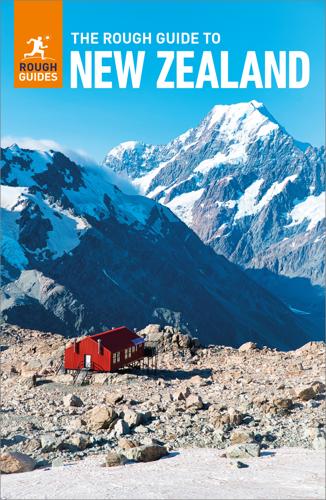
The Rough Guide to New Zealand: Travel Guide eBook
by Rough Guides · 1 Jan 2024 · 1,383pp · 367,401 words
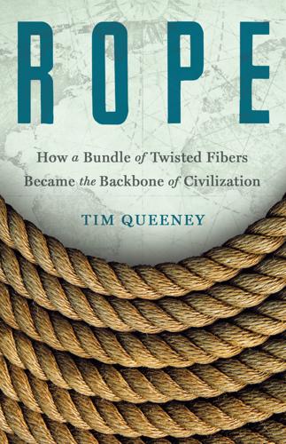
Rope: How a Bundle of Twisted Fibers Became the Backbone of Civilization
by Tim Queeney · 11 Aug 2025 · 264pp · 88,907 words
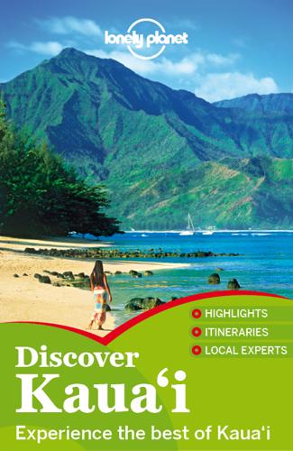
Discover Kaua'i Travel Guide
by Lonely Planet
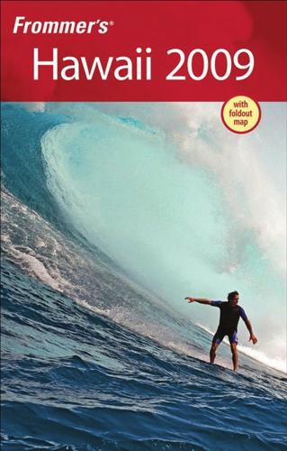
Frommer's Hawaii 2009
by Jeanette Foster · 2 Jan 2008 · 675pp · 344,555 words
Lonely Planet Best of Hawaii
by Lonely Planet · 453pp · 79,218 words

Fodor's Hawaii 2012
by Fodor's Travel Publications · 15 Nov 2011

The Evolution of God
by Robert Wright · 8 Jun 2009
Fodor's Hawaii 2013
by Fodor's · 22 Jul 2012
You Are Here: Why We Can Find Our Way to the Moon, but Get Lost in the Mall
by Colin Ellard · 6 Jul 2009 · 293pp · 97,431 words
The Age of Wonder
by Richard Holmes · 15 Jan 2008 · 778pp · 227,196 words
Fodor's Big Island of Hawaii
by Fodor’s Travel Guides · 1 Aug 2022
You Are Here: From the Compass to GPS, the History and Future of How We Find Ourselves
by Hiawatha Bray · 31 Mar 2014 · 316pp · 90,165 words

Arriving Today: From Factory to Front Door -- Why Everything Has Changed About How and What We Buy
by Christopher Mims · 13 Sep 2021 · 385pp · 112,842 words
The Interstellar Age: Inside the Forty-Year Voyager Mission
by Jim Bell · 24 Feb 2015 · 310pp · 89,653 words

Masters of Scale: Surprising Truths From the World's Most Successful Entrepreneurs
by Reid Hoffman, June Cohen and Deron Triff · 14 Oct 2021 · 309pp · 96,168 words
Top 10 Maui, Molokai and Lanai
by Bonnie Friedman · 16 Feb 2004 · 137pp · 43,960 words
Atlantic: Great Sea Battles, Heroic Discoveries, Titanic Storms & a Vast Ocean of a Million Stories
by Simon Winchester · 27 Oct 2009 · 522pp · 150,592 words

Nuts and Bolts: Seven Small Inventions That Changed the World (In a Big Way)
by Roma Agrawal · 2 Mar 2023 · 290pp · 80,461 words
The Last Stargazers: The Enduring Story of Astronomy's Vanishing Explorers
by Emily Levesque · 3 Aug 2020

Nonviolence: The History of a Dangerous Idea
by Mark Kurlansky · 7 Apr 2008 · 186pp · 57,798 words

The Milky Way: An Autobiography of Our Galaxy
by Moiya McTier · 14 Aug 2022 · 194pp · 63,798 words

Felaheen
by Jon Courtenay Grimwood · 1 Jan 2003 · 407pp · 107,343 words