streetcar suburb
description: residential community whose growth and development was strongly shaped by the use of streetcar lines as a primary means of transportation
31 results
Once the American Dream: Inner-Ring Suburbs of the Metropolitan United States
by
Bernadette Hanlon
Published 18 Dec 2009
Hudnut (2003) deems the term “first-tier” most precise in describing these areas, since it accentuates their stage of development as well as the spatial location of these suburbs right outside the central city. 30 / Chapter 3 TABLE 3.1 TERMS USED TO DESCRIBE INNER-RING SUBURBS Terms Examples of relevant work(s) Inner-ring or inner suburb Baldassare 1986, 1992 Smith, Caris, and Wyly 2001 Downs 1997 Jackson 1985 Madden 2003 First-tier or first-ring suburb Fishman 2000 Hudnut 2003 Ohio First Suburbs Consortium 2006 Puentes and Orfield 2002 Older, old, or mature suburb Bollens 1988 Hayden 2003 Kotkin 2001 Listokin and Beaton 1983 Sitcom suburb Hayden 2003 Streetcar suburb Warner 1978 Town and country suburb Lang, LeFurgy, and Nelson 2006 Post–World War II suburb Lucy and Phillips 2000b The term “older suburb” demonstrates their historical nature. For the Ohio First Suburbs Consortium, these first settlements are suburbs that were built adjacent to or near central cities before 1960. Within this categorization are, for instance, “streetcar suburbs” (Warner 1978), “town and country suburbs” (Lang, LeFurgy, and Nelson 2006), and “sitcom suburbs” (Hayden 2003), denoting different types and stages of suburban development.
…
Within this categorization are, for instance, “streetcar suburbs” (Warner 1978), “town and country suburbs” (Lang, LeFurgy, and Nelson 2006), and “sitcom suburbs” (Hayden 2003), denoting different types and stages of suburban development. Tied to their histories are the architectural design and style of housing, with “sitcom suburbs” representing the postwar period of mass production of tract housing; “streetcar suburbs” representing much earlier middle-class subdivisions along streetcar transportation routes; and, in the case of “town and country suburbs,” early settlements representing those that were serviced by horse-drawn streetcars. The postwar period often receives the most emphasis. William Lucy and David Phillips (2000b: 1) suggest inner-ring suburbs are areas composed primarily of “single-use residential-only subdivisions of the type constructed in every metropolitan area from the end of World War II through 1970.”
…
Some evolved around the mid-nineteenth century, when industry first located in the outskirts of large cities (Lewis 2004). At this time, heavy industry located in fringe areas of such cities as Chicago, Pittsburgh, Philadelphia, Detroit, Boston, Los Angeles, St. Louis, Cleveland, and others. In his classic study of streetcar suburbs, Samuel Warner (1962) notes that by Different Types of Inner-Ring Suburbs / 123 1900, the Boston metropolitan area was split between the central city and a suburban ring of industrial subcenters as well as residential homes. Old textile suburbs of Philadelphia emerged around the same time, as did the steel-manufacturing suburbs of Chicago.
Straphanger
by
Taras Grescoe
Published 8 Sep 2011
Tokyu, Tokyu, Tokyu Before the First World War, America’s street railway companies extended their tracks to “electric parks,” the fairgrounds they owned miles from the center of great cities; the space in between was filled in by streetcar suburbs. In early twentieth-century Japan, the attractions at the end of the lines tended to be outdoor baths, giant statues of seated Buddhas, and parks where you could sip sake while watching the cherry blossoms fall. While freeways in the United States supplanted streetcars, in Japan they never stopped laying tracks. Modern Tokyo is the streetcar suburb, writ large. The pattern for all development to come was set in Osaka. In 1910, the Hankyu rail company built a department store at its Umeda terminus and a hot spring resort at the other end; along the tracks, they built housing estates, office towers, and hotels, turning a barely profitable line into a huge moneymaker.
…
Kotkin’s house, a rambling ranch-style bungalow that dates from 1937, sits on a corner lot. When it was built Yellow Cars still rumbled down nearby Chandler Boulevard, and developers were still making a nod to community life by building in features like parks and sidewalks. In fact, Valley Village started out as a classic streetcar suburb, the transit-oriented development of its day. As I left, I started walking down the sidewalk at the edge of Kotkin’s lot, but the pavement ended in the high hedges marking his property line. The rest of the houses on his block, more typical of ticky-tacky postwar construction, had no sidewalks at all.
…
Such master-planned communities were the exception. Suburbs that predate freeways most often consist of small houses built on a grid, close to city centers; lately, they have become highly sought-after urban neighborhoods. Cleveland’s Shaker Heights, Berkeley’s Ashby Station, Boston’s Roxbury, and the Glebe in Ottawa are all classic streetcar suburbs, with lively mixes of row houses, closely spaced bungalows with front porches, and small shops, located within walking distance of the main arteries where electric trolleys used to run. The American suburb, version 2.0, was another matter entirely. In the immediate aftermath of the Second World War, when housing shortages meant that six million American families were forced to share living quarters, all pretense of elevating the masses vanished.
Key to the City: How Zoning Shapes Our World
by
Sara C. Bronin
Published 30 Sep 2024
It’s fair to say that the entire country-music industry owes its existence to Music Row. And Music Row owes its existence to zoning. In the early twentieth century, in the era preceding zoning, the blocks along Sixteenth and Seventeenth Avenues—which would later become Music Row—were developed as a “streetcar suburb” of Nashville’s bustling downtown. At the time, downtown was bursting with banks, insurance companies, department stores, grand hotels, and the full constellation of institutions and businesses doing work at the State Capitol. Of course, it hosted the theaters and honky-tonks where musicians played too.
…
Most of Georgetown was assigned to the residential district, but the lots on Wisconsin and the north side of M were relegated to the two commercial districts and the dozen or so blocks nearest the waterfront to the industrial district. Partly driven by the confidence in future growth patterns that the zoning code provided, young New Dealers began buying and fixing up Georgetown’s Federal, classical, Georgian townhouses and mansions. Encouraged by rents lower than those in the newer streetcar suburbs, and by the presence of quaint urban dwellings full of character, up-and-coming families invested in restoring the physical integrity of the historic properties. These residents took notice of local preservation ordinances that were adopted in several other cities, and they petitioned the city to follow suit.
…
Louis, MO, 40 Standard State Zoning Enabling Act of 1926, 7–8, 36, 40, 145, 179, 183 Stapleton, Chris, 109, 119 State Capitol building in Hartford, 123 State Capitol building in Nashville, 47, 59 state laws governing zoning, 7, 22, 146, 179, 187. See also specific states and cities stepbacks, 143, 171, 204 Stockton, CA, 179 Stony Island Arts Bank, Chicago, 44, 45, 46 Stowe, Harriet Beecher, 2–3 Strait, George, 49 Strand, the, Galveston, TX, 157–58 streetcar lines, 30, 55, 100, 138 “streetcar suburbs,” 47, 169 streets and roads, 136–51 asphalt, 1, 2, 4, 98, 107, 129, 137, 141 “complete-streets” policies, 139–41, 147–48, 203 curb extensions (bulb-outs), 149, 150 measuring a road’s success, 147 megablocks, 26 narrowing existing, 141 “neighborhood streets,” 149, 150 right-of-way, 138, 143–44 traffic management, 2, 24, 44, 58, 65, 108, 137–39, 146–47, 204 See also automobiles; bicycling; pedestrians strip malls, 3, 15, 44, 153, 154, 165 Sublime (band), 98 suburbs, 3–5, 21 American sprawl, 19, 25, 92–93, 126–28, 129, 134, 158, 161 flight, 60 health outcomes, 178 lawns, 126, 128, 130, 142 Levittown, 92 malls, 24–27 office districts in the, 28 stagnation of the, 31 “streetcar suburbs,” 47, 169 swimming pools, 15, 16, 87, 130 “vehicle miles traveled,” 93, 101 See also automobiles; single-family housing subways, 6, 104, 170 Sullivan, Louis, 99, 102 “supergraphic” (very large) signs, 163, 207 Swift, Taylor, 49 swimming pools, 15, 16, 87, 130 Taliesin West, 128–30 tax revenues, 3, 18, 95, 160 TDRs (transferable development rights), 51–52, 171 “tenement” dwellings, 6, 63, 111–12, 178 Tennessee.
Happy City: Transforming Our Lives Through Urban Design
by
Charles Montgomery
Published 12 Nov 2013
It was invented not by utopian planners or sociologists, but by cunning men motivated by the constraints of technology and an old-fashioned wish to make as much money as they could. After the first electrical streetcar was introduced in Richmond, Virginia, in 1887, rail lines rapidly spread across hundreds of cities, luring commuters to new streetcar suburbs from Boston to Toronto to Los Angeles. Almost no one owned a car before World War I, so land developers wishing to attract homebuyers first had to build the rail lines, then offer homes within an easy walking distance from them. Buyers also demanded shops and services and schools, and sometimes parks, all within walking range.
…
I didn’t realize that these dimensions actually helped my house and my neighborhood achieve the delicate balance between privacy, conviviality, and biophilia. What mattered most was that house’s place in the system around it: the density of people per acre, the length of each block, the distance to the nearest market street, and the mixing of all kinds of different activities. The Streetcar Suburb Long after its streetcars were replaced by trolley buses, this district in East Vancouver balances density and land-use mix in a way that responds to human need for privacy, conviviality, convenience, and nature. The market street (bottom right) is not elegant, but it offers commercial destinations, transit, and apartment living.
…
There is no one perfect neighborhood for everyone. We all have our own tolerance for crowding or quietude, our own thirst for novelty or privacy or music or gardening, and our own complex associations with places, scents, and memories. But the systems in which we live undeniably influence our emotional lives. The lesson of the streetcar suburb or N Street is not that cities need to be organized in grids, or that they need streetcars, or that we must all tear down our fences or look a century back for a geometry that works. It is that we can find various geometries to save ourselves and the planet. They do not all involve stacking our lives into the sky, but they are almost all tighter than what the proponents of dispersal have been selling us. 7.
Arbitrary Lines: How Zoning Broke the American City and How to Fix It
by
M. Nolan Gray
Published 20 Jun 2022
For an excellent survey of the economics of skyscrapers, see Jason Barr, Building the Skyline: The Birth and Growth of America’s Skyscrapers (Oxford: Oxford University Press, 2016). 4. For a history of the Great Migration, see Isabel Wilkerson, The Warmth of Other Suns: The Epic Story of America’s Great Migration (New York: Vintage, 2011). 5. For a full history of the streetcar suburb phenomenon, see Sam Bass Warner, Streetcar Suburbs: The Process of Growth in Boston, 1870–1900, 2nd ed. (Cambridge, MA: Harvard University Press, 1978). 6. Sonia Hirt, Zoned in the USA: The Origins and Implications of American Land-Use Regulation (Ithaca, NY: Cornell University Press, 2014) refers to this tradition as “spatial individualism.” 7.
…
On the transportation front, the invention of the electric streetcar in the mid-1880s—and the rapid spread of new transit systems through roughly 1910—removed barriers to urban horizontal expansion. Often developed privately as part of a broader land development plan, streetcar lines soon stretched far outside cities and gave rise to streetcar suburbs, with apartments around stops gradually giving way to detached single-family homes.5 The democratization of the car, beginning in 1908, shifted this suburbanization into overdrive. The Anglo-American pastoral ideal of a detached single-family house surrounded by a yard dates back at least to Jefferson, with home life characterized by privacy and domesticity.6 Yet when the modern American suburb first began to take shape in the post–Civil War period, it was largely restricted to the wealthiest by high transportation costs.7 With a car, many middle-class households were no longer restrained to living within walking distance of work or transit, resulting in the rapid development of strictly low-density residential subdivisions at the edges of nearly every American city.
City on the Verge
by
Mark Pendergrast
Published 5 May 2017
Soon the corridor narrows as we walk down Warehouse Row, as Gravel calls it, a forlorn stretch of mostly abandoned industrial buildings, then through a gulley below street level, past Enota Park on the left (to be expanded as part of the BeltLine project), and under I-20 again, as the interstate runs west out of the city. A branch of Proctor Creek originates near here in the Mozley Park neighborhood, though it is often buried and terribly polluted as it runs north toward the Chattahoochee River. In the early twentieth century, most of these neighborhoods were upper-class white streetcar suburbs, as was Adair Park. After World War II, when whites fled to the suburbs and poorer African Americans moved in, neighborhood stores and industries failed, and the area fell into decline. Aside from the Kroger and Big Bear supermarkets in West End, the area is a “food desert,” with junk food and liquor far easier to find than fruits and vegetables.
…
One of these “nerve tonics,” created in Atlanta in 1886, contained mostly sugar water but also featured essential flavoring oils and extract of coca leaf and kola nut: it went by the name Coca-Cola. The combination medicine/soft drink would fund many Atlanta fortunes and philanthropies. Streetcar Suburbs In the late nineteenth and early twentieth centuries, trolley lines contributed mightily to the municipal expansion. In 1871 Richard Peters and George Adair inaugurated the first venture, the Atlanta Street Railway Company, a short stretch running west by Peters’s house and ending at Adair’s back door.
…
John, Warren, 255 Stanton Elementary School, 198 Stanton Park see D. H. Stanton Park Starr, Ashlee and Caleb, 200–202 Steele, Carrie, 66 Stockett, Kathryn, 291 Stokes, Jim and Esther, 233–234 Stone, Clarence, 274 Stone Mountain, 17, 76, 78, 183, 192, 254, 257–259 Storrs School, 65 Street Railway Journal, 36–37 streetcar suburbs, 7, 34–42 streetcars, 91, 100, 102, 109 Atlanta Streetcar, 158, 166–167, 192, 277, 281 Brian Leary and, 121–122, 127 C-Loop, 25 cost projection, 158 criticism of plans for, 58–59 downtown loop, 158, 166–167, 192, 277, 282 Ed McBrayer and, 280 electricity for, 36–37 Fred Yalouris and, 127 funding, 132–133, 158, 280–281, 281, 285 history in Atlanta, 34–42, 67 importance to the BeltLine concept, 282–283 Joel Hurt and, 67 Kasim Reed and, 125, 132, 166–167, 281 Northside Trail, 231–232, 235 racial tensions and, 67, 73, 79–80 Ryan Gravel and, 9, 15, 18–23, 51, 280 in Strategic Implementation Plan, 158 streetcar suburbs, 7, 34–42 Tim Keane and, 277, 283 Wayne Mason property and, 58, 94 Westside Trail, 157–158, 280 Street-to-Home program, 112 Studioplex, 15, 182, 252 suburbs automobile transport and, 41–43 new urbanism in, 269 streetcar, 34–38 See also specific locations subway system, 44 Summerhill neighborhood, 71, 195, 208, 219 sustainability, 144–145 Sutherland, Kit and Stuart, 176–177 Sutton, Starling, 14–15, 182 Suwanee, 246–247 Swaney, Lee, 255–256 Sweet, John and Midge, 183 SweetWater Brewing Company, 9, 235–236 SweetWater Design District, 236 Sylvan Hills, 41 Syphoe, Michael, 252–253 Tanyard Creek, 8, 100, 103, 126, 142–143, 228 Tanyard Creek Park, 229 Tapp, Helen, 99 tax allocation district (TAD), 54, 58–62 affordable housing and, 61–62, 92, 182, 274–275, 284–285 Alycen Whiddon and, 26–27, 29, 47 Atlanta Public Schools and, 93, 156, 164–166, 284–285 authorization, 85, 89 poor acceptance of issue, 97, 99, 122–123 revenue projections, 156, 165 tenth anniversary, 155 voter referendum (2008), 93 Woodham opposition to TAD bonds, 90–93, 156, 164 Tax Allocation District Advisory Committee (TADAC), 96, 103 Teasley, William, 198 Terminal Station, 43–44, 43 (photo), 191, 264 Terminus, 31–32, 64 Terry, Ted, 256 Thadani, Dhiru, 271 Them (McCall), 177 TIGER (Transportation Investment Generating Economic Recovery) grant, 125, 157, 160, 280 Toro, Mark, 123, 168–169, 269–270 Torpy, Bill, 243 Toton, Sarah, 194 Toxic Charity: How Churches and Charities Hurt Those They Help (and How to Reverse It) (Lupton), 193 traffic problems, 18, 39–42, 45, 60, 107, 132, 140–141, 167–168, 236, 243, 245–246, 277, 282 transit-oriented development (TOD), 168, 235 Travon Wilson Park, 252 Trees Atlanta, 128, 146, 175, 232, 239 Trolley Barn, 185 trolleys, 34–41 see also streetcars Trubey, J.
Retrofitting Suburbia, Updated Edition: Urban Design Solutions for Redesigning Suburbs
by
Ellen Dunham-Jones
and
June Williamson
Published 23 Mar 2011
Historically, America’s economic growth has hinged on its ability to create new development patterns, new economic landscapes that simultaneously expand space and intensify our use of it. Our rebound after the panic and long depression of 1873 was forged by our transition from an agricultural economy to an urban-industrial one organized around great cities and their early streetcar suburbs. Our recovery from the Great Depression saw the rise of massive metropolitan complexes of cities and suburbs. The drive to retrofit our suburbs today, to turn them into more vibrant, livable, people-friendly communities—and, most important to create the density required for innovation and productivity growth—may provide our own troubled era with the fix that it so desperately needs, while providing future generations with a more resilient and productive setting.
…
Suburbia was not viewed as a historical construct that changes over time.4 The so-called suburban myth, which posited that suburbs are homogenous landscapes of white middle-class conformity and uniformity, was forged in the immediate postwar period when suburban planned development experienced explosive growth. Fishman notes that this rapid growth just made it seem as if suburbanization had begun in 1945 when in fact it had been occurring for a century. Suburbs built in the nineteenth century and the first half of the twentieth century—railroad and streetcar suburbs—were not characterized in this way. The residents of earlier suburbs were diverse; despite the mobility offered by regional mass transit and the new “horseless carriages,” the wealthy residents of rustic but grand suburban “cottages” required domestic help, who for lack of mobility lived nearby, in neighborhoods made up of smaller, working-class dwellings.5 Historians have identified a number of factors that changed and accelerated the pattern of suburbanization in the mid-twentieth century: the wide availability of federally subsidized mortgage loans, the increasing sophistication of large-scale production builders like Levitt and Sons, severe overcrowding in urban ethnic neighborhoods coupled with urban renewal programs that actually decreased the number of available dwelling units in cities, and the increasing affordability of private automobiles.
…
Called the Beltline, the project emerged out of Ryan Gravel’s dual MArch and MCRP thesis at Georgia Tech. Gravel identified twenty-two miles of unused railroad lines that could be connected to form a new transit loop around the city. The loop more or less straddles the divide between the city’s more compact streetcar suburbs and its more automobile-oriented subdivisions and strips. The project has since grown to also incorporate a system of parks. A tax allocation district has been approved for redevelopment of the approximately 6,000 acres of underdeveloped industrial land along the Beltline, and the city is actively planning the public rights-of-way and street networks prior to rezoning.
The New Urban Crisis: How Our Cities Are Increasing Inequality, Deepening Segregation, and Failing the Middle Class?and What We Can Do About It
by
Richard Florida
Published 9 May 2016
Boston’s creative class is similarly tightly clustered in and around its downtown core, from the Financial District and Faneuil Hall to upscale Beacon Hill and Back Bay; the South End, the heart of the city’s gay community; and the Fenway-Kenmore area (see Figure 7.7). Following a pattern identified half a century ago by the historian Sam Bass Warner in his classic book Streetcar Suburbs, the metro has been shaped by its transit infrastructure.10 The Red Line passes through Cambridge and has drawn large numbers of high-tech companies and startups and huge concentrations of the creative class around its stops and stations. The creative class also extends far into the suburbs.
…
Miriam Zuk, Ariel Bierbaum, Karen Chapple, Karolina Gorska, Anastasia Loukaitou-Sideris, Paul Ong, and Trevor Thomas, Gentrification, Displacement, and the Role of Public Investment: A Literature Review, Federal Reserve Bank of San Francisco, 2015, www.frbsf.org/community-development/publications/working-papers/2015/august/gentrification-displacement-role-of-public-investment/. 17. Sam Bass Warner Jr., Streetcar Suburbs: The Process of Growth in Boston, 1870–1900 (Cambridge, MA: Harvard University Press, 1978). 18. Lena Edlund, Cecilia Machado, and Michaela Sviatchi, “Bright Minds, Big Rent: Gentrification and the Rising Returns to Skill,” NBER Working Paper no. 21729, National Bureau of Economic Research, November 2015, www.nber.org/papers/w21729.
…
See Michael Dear, “The Los Angeles School of Urbanism: An Intellectual History,” Urban Geography 24, no. 6 (2003): 493–509. 9. J. David Hulchanski, “The Three Cities Within Toronto: Income Polarization Among Toronto’s Neighborhoods, 1970–2005,” Cities Centre, University of Toronto, 2010, www.urbancentre.utoronto.ca/pdfs/curp/tnrn/Three-Cities-Within-Toronto-2010-Final.pdf. 10. Sam Bass Warner, Streetcar Suburbs: The Process of Growth in Boston, 1870–1900, 2nd ed. (Cambridge, MA: Harvard University Press, 1978). 11. AnnaLee Saxenian, Regional Advantage: Culture and Competition in Silicon Valley and Route 128 (Cambridge, MA: Harvard University Press, 1994). 12. Richard Florida, “Detroit Shows Way to Beat Inner City Blues,” Financial Times, April 9, 2013; Richard Florida, “Don’t Let Bankruptcy Fool You: Detroit’s Not Dead,” CityLab, July 22, 2013, www.theatlanticcities.com/jobs-and-economy/2013/07/dont-let-bankruptcy-fool-you-detroits-not-dead/6261; Tim Alberta, “Is Dan Gilbert Detroit’s New Superhero?”
The Rise and Fall of American Growth: The U.S. Standard of Living Since the Civil War (The Princeton Economic History of the Western World)
by
Robert J. Gordon
Published 12 Jan 2016
These newly built areas, two or three miles from the city center, were made possible by horse-drawn streetcars and from the beginning were called “streetcar suburbs.” Observers noted that the new streetcars could “‘enable everyone to have a suburban [home].’”30 Because they were the first step in the upgrading of living conditions for the working class, they were also called “the zone of emergence.”31 Even in the late nineteenth century, developers in places such as Chicago were building streetcar suburbs on large tracts of land and selling them on installment plans, and some developers had interlocking financial relationships with the developers of streetcar lines, for houses in the new developments could not be sold unless they could be reached by streetcar.32 What Bryce was observing in Chicago is called by architectural historians the “workingman’s cottage.”33 These were one-story structures containing four to six rooms, plainly built, featuring little or no ornamentation.
…
Instead of wood-carvers, a hydraulic press squeezed wood into intricate carved shapes.”42 About 10 percent of residents of major cities in the 1880s owned substantial homes large enough to require the services of at least one servant. Many of these houses were in the streetcar suburbs, which were laid out between 1850 and 1900. Suburban housing from the start was designed to house different classes and income levels in the same area so that workmen, retail merchants, and household servants would be able to tend to the needs of middle and upper-class families. “Unlike post-World War II suburbs, which are relatively homogenous socioeconomically, those of the tracked city [streetcar suburbs] were not restricted to a single economic class.”43 Early maps of these suburbs, such as of Hinsdale and Evanston, Illinois, show that they were divided up into a diverse set of lot sizes, with frontages ranging from thirty to as much as 200 feet, in contrast to narrower lots prevalent in the inner city.44 Most of these late nineteenth-century houses still exist, having benefited from continuous reequipping and improvements.45 A stark difference between development in 1870–1900 and after 1900 was the diversity of styles and sizes of housing within a given community.
…
See automobiles Caruso, Enrico, 188 cassette tape recorders, 428 catalogs: electronic, 580; mail-order, 63, 90–92 Caterpillar Corporation, 617 cathode ray tubes, 412 cattle, 264–65 CATV (community antenna television), 425 CBS World News Tonight (radio program), 196, 197 cell (mobile) phones, 411, 430–32, 577–78; smartphones, 437–38, 581 Census Bureau, U.S., 610–11 central heating, 125–26, 128 CEO compensation, 617, 619, 645 cereals, 74 Cette, Gilbert, 587 chain stores, 62–63, 78–81, 90, 92, 560 Chapin, Robert, 97, 102–3, 106 Chaplin, Charlie, 172, 199 Charles Schwab (firm), 598 chattel lending, 293 checks, 295 chemicals industry, 561 chemotherapy, 470 Chevrolets, 156, 374, 379, 559 Chicago (Illinois): air pollution in, 219; air travel between New York and, 396–97; bungalow movement housing in, 108–9; cable cars in, 146; as center of commerce, 311; elevated trains in, 147–48; Great Chicago Fire in (1871), 44, 308; housing in, 103–4; long-distance telephone service for, 183; mail-order catalog firms located in, 91; movie theaters in, 199; population of, 368; rail transport between New York and, 133, 135, 136, 140; residential segregation in, 369; slaughterhouses, 267; streetcars in, 147; streetcar suburbs in, 105; traffic flows through, 137 childbirth, 229–30; cost of, 231; in hospitals, 274; of low-birthweight infants, 484 children: births of, 229–30, 484; born after World War II (baby boom), 505, 507–8; born out of wedlock, 631; decline in work hours of, 260; early television viewed by, 415–16; health of, 219, 461; inequality among, 605; inequality in education of, 606; labor of, 58, 282–85; obesity among, 346–47; polio among, 467 China, 614 Chinese immigrants, 223 chlorination of water supply, 217–18 chronic diseases, 462, 468–72 cinema.
The End of the Suburbs: Where the American Dream Is Moving
by
Leigh Gallagher
Published 26 Jun 2013
Soon the railroad gave way to electric-powered streetcars, which were easier and cheaper to build, so they spread out wider and faster. Towns started to emerge around streetcar stations, forming now-iconic places like Medford outside Boston, Oakland outside San Francisco, Shaker Heights outside Cleveland, and thousands of other communities. Each of these early railroad and streetcar suburbs was unique, but they were similar in one important way: their design was compact. In the pre-automobile era, suburban residents had to walk once they disembarked from the railroad or streetcar, so houses needed to be located within a reasonable distance to the station. So while these early suburbanites lived in individual, single-family houses—that was, after all, the whole appeal of leaving the city—homes were built close together.
…
Going forward, this dynamic will only become more exaggerated: one-third of all suburbs saw an absolute decline in child populations from 2000 to 2010; by 2025, an estimated 72 percent of American homes will not contain any children, a figure that could reach 80 percent in the suburbs. “The traditional family structure is really the minority,” says Deborah Meyer of home builder Pulte. You can see this playing out. Where my father grew up in Drexel Hill, Pennsylvania, a 1920s streetcar suburb outside of Philadelphia, there were forty-one children living in the sixteen or so houses on his block alone: the Janssens (four kids), the Hayeses (three), the McNultys (four), the Lombardos (four), the McDermotts (five), the Hartmans (four), the Bancrofts (three), and, of course, the Gallaghers (seven), among many others.
Where We Want to Live
by
Ryan Gravel
Published 2 Feb 2016
While the belt line railroads likely played only background roles in this shift toward an expanding black middle class in Atlanta, the communities alongside them became the origin and anchor of a new African American west-side prosperity, helping to define an era of opportunity and eventually a more equitable, if still imperfect, capital of the American South. The network of private transit lines that originally brokered the development of Atlanta’s oldest streetcar suburbs like Inman Park and West End were consolidated into a more cohesive system owned by the Georgia Railway & Electric Company in 1902. By the time neighborhoods like Capitol View Manor were platted 20 years later, the system’s peak ridership had access to hundreds of miles of track with routes all over the city.
…
Along with its streets and sidewalks, it also offered a network for citywide water, sewer, and utility lines, as well as through-routes for school buses, transit, and emergency vehicles. Private market developers created new infrastructure that benefited their project but also contributed to the larger public good by creating a flexible system that can adapt for future generations. Sometimes we built according to an official city plan, but in later streetcar suburbs, like Atlanta’s Virginia-Highland, developers assembled walkable grids because that is what the market demanded. Residents wanted access to streetcar stops, and landowners near those stops captured value there with modest commercial clusters. In sprawl, by sharp contrast, the kneejerk reaction has been to solve the problem by “fixing” the public realm—by adding more lanes to the roadway.
The Race Underground: Boston, New York, and the Incredible Rivalry That Built America's First Subway
by
Doug Most
Published 4 Feb 2014
Boston: Studies in Urban Political Economy: Henry Whitney’s Streetcar Suburb: Beacon Street, Brookline, 1870–1910. Center for the Study of Metropolitan Problems, 1974. Strong, Samuel Meredith. The Great Blizzard of 1888. New York: Samuel Meredith Strong, 1938. Swanberg, W. A. Whitney Father, Whitney Heiress. New York: Charles Scribner’s Sons, 1980. Vrabel, Jim. When in Boston. Boston: Northeastern University Press, 2004. Walker, James Blaine. Fifty Years of Rapid Transit. New York: Law Printing, 1918. Warner, Sam Bass Jr. Streetcar Suburbs: The Process of Growth in Boston, 1870–1900. Cambridge: Harvard University Press, 1962.
…
“The car that was left behind would then fall back”: Prentiss Cummings, Street Railway System of Boston (Professional and Industrial History of Suffolk County, Massachusetts, 1894), 292. He was on his way toward investing more than $800,000: Barbara J. Sproat, “Boston Studies in Urban Political Economy, Henry Whitney’s Streetcar Suburb, Beacon Street, Brookline, 1870–1910,” (working paper, no date, c. 1973), 4. On August 9, 1886: Legislative Committee on Roads and Bridges, Beacon Street, Its Improvement in Brookline by Connection with Commonwealth Avenue (Chronicle Press, 1887), 3. He described Olmsted as “a man who stands second to none”: Brookline, Allston-Brighton and the Renewal of Boston (History Press, 2010), 26.
Paved Paradise: How Parking Explains the World
by
Henry Grabar
Published 8 May 2023
All of it was illegal to build, because none of these buildings had enough parking spaces. On a warm February day in 2020, I joined Vallianatos for a Forbidden City reprise. “We banned the parts of Los Angeles that people love the most,” Vallianatos said, walking up the hill into Highland Park, an early streetcar suburb near Pasadena. Dressed in a natty green suit and thick architect glasses, the square-faced Vallianatos looked a little out of place in the California sunshine, and a lot out of place as he skulked around gates and peeked over box hedges. He was looking for electrical meters and mailboxes. That’s how you figure out how many apartments sit behind a facade; it’s how you know when what looks like a single-family home is in fact a fourplex.
…
What makes this all the more strange is that for the most part, such parking-challenged structures—like Mark Vallianatos’s beloved Highland Park ex-hotel—no longer provide the naturally occurring affordable housing they did when those buildings, and neighborhoods, were widely considered obsolete. Instead, precisely because they offer access to places where car ownership is optional, buildings without sufficient parking are among the most in-demand structures we have. In virtually every U.S. city, the most expensive neighborhood is a prewar, mixed-use streetcar suburb that would be illegal to build today. That scarcity ensures their high price point. No one would think, for a second, that we had built too many places like Highland Park, like Los Feliz, like downtown LA . . . to say nothing of parking-challenged places like Brooklyn’s Fort Greene or Boston’s Back Bay or Chicago’s Lincoln Park.
City: Urbanism and Its End
by
Douglas W. Rae
Published 15 Jan 2003
Trenton, NJ 1870 1920 267,354 250,526 18,969 117,714 20,045 8,660 216,239 92,829 79,577 37,180 15,000 50,840 674,022 86,076 62,386 43,051 22,874 733,826 748,060 143,555 506,775 116,309 87,091 401,247 796,841 993,678 138,036 381,582 162,537 1,823,770 588,343 295,750 171,717 119,289 Percentage change 174.5 198.6 656.8 330.5 480.2 905.7 85.6 758.4 1,148.7 271.3 2,443.9 219.7 170.6 583.5 374.1 298.9 421.5 29. It should be added that in many cases street rail decentralized population even when industry remained centered. See, among others, Sam Bass Warner, Jr., Streetcar Suburbs (Cambridge: Harvard University Press, 1978). See also Kenneth T. Jackson, Crabgrass Frontier: The Suburbanization of the United States (New York: Oxford University Press, 1985). 30. Clark, “Transport.” 31. This general thesis is so well established in the urban history literature as to require little documentation.
…
Census of 1910. 39. This analysis is due entirely to Stephen Lassonde, “Learning to Forget: Schooling and Family Life in New Haven’s Working Class, 1870–1940” (Ph.D. diss., Yale University, 1994). 40. Sennett, Uses of Disorder, 53 –54. 41. For the Boston parallel, and an insightful interpretation, see Warner, Streetcar Suburbs. 42. Mitchell was also known by the pen name Ik Marvel. 43. See relevant city charter sections and Osterweis, Three Centuries of New Haven, 385. 44. Service began in early 1861, with separate runs from the center of the city to each of the two destinations on a one-track system. See also Mitchell, History of New Haven County, Connecticut, 596. 45.
…
“Rebuilding Communities: A National Study of Urban Community Development Corporations.” Community Development Research Center, Graduate School of Management and Urban Policy, New School for Social Research, 1992. Warner, Robert Austin. New Haven Negroes: A Social History. New Haven: Yale University Press, 1940. Warner, Sam Bass Jr. Streetcar Suburbs: The Process of Growth in Boston, 1870 –1900. Cambridge: Harvard University Press, 1978. “Water and Steam Power.” Scientific American 4 (1849): 269. Watkins, Harold M. Coal and Men: An Economic and Social Study of the British and American Coalfields. London: George Allen & Unwin, 1934. 495 B I B L I O G R A P H Y Watrous, George Dutton.
Curbing Traffic: The Human Case for Fewer Cars in Our Lives
by
Chris Bruntlett
and
Melissa Bruntlett
Published 28 Jun 2021
(Modacity) Chapter 4 The Feminist City Patriarchy in city planning is not just a failure of society—it is a failure of the imagination. — Dorina Pojani It didn’t take long for our family to settle into our new Dutch lives, enjoying the various advantages that come with moving not only to a smaller country but also to a smaller city. After 12 years of living in the heart of one of Vancouver’s diverse and vibrant streetcar suburbs, it was nice to be able to slow things down and take time to just enjoy our lives. Vancouver had been a wonderful home; the place where our children grew up, where we first found our passions as urban mobility advocates, and where we fell in love with two-wheeled travel. But after a decade of fighting against the status quo in a car-dominated region of 2.5 million people, and daily struggles with the hostile streets in our community (despite many investments in active travel), it was time to downsize.
Suburban Nation
by
Andres Duany
,
Elizabeth Plater-Zyberk
and
Jeff Speck
Published 14 Sep 2010
They can be natural or man-made, and include waterways, wildlife corridors, continuous greenways for pedestrians and bicycles, parkways for cars and trucks, and rights-of-way for rail lines. Rail corridor designations are particularly significant, as they provide an opportunity for transit-based development, the ideal way to organize growth. Whenever possible, future development should be organized along a transit corridor, in the manner of our historic streetcar suburbs. 5. Establish Priority Development Sectors, and an incentive program that eases development within them. The obvious goal here is to counteract the existing government and market forces that make it less profitable for developers to work in the city (“urban infill”) than on the rural “greenfield” fringe.
The Great Inversion and the Future of the American City
by
Alan Ehrenhalt
Published 23 Apr 2012
The urban historian Robert Bruegmann goes so far as to claim that deindustrialization has on the whole been good for downtowns because it has permitted so many opportunities for creative reuse of the buildings. I wouldn’t go quite that far; I doubt most of the residents of Detroit would, either. But it is true that the environmental factors that made middle-class people leave the central city for streetcar suburbs in the 1920s, and for station-wagon suburbs in the 1950s and gated enclaves in the 1970s, do not apply anymore. Nor, in general, does the scourge of urban life in the 1970s and 1980s: random street violence. The dramatic decline in all violent crime that took place over the past two decades does seem to have leveled off in the last few years.
The Autonomous Revolution: Reclaiming the Future We’ve Sold to Machines
by
William Davidow
and
Michael Malone
Published 18 Feb 2020
“Income Inequality in the United States,” Inequality.org, https://inequality.org/facts/income-inequality/ (accessed June 26, 2019). 39. Jennifer 8. Lee, “When Horses Posed a Public Health Hazard,” City Room (blog), New York Times, June 9, 2008, https://cityroom.blogs.nytimes.com/2008/06/09/when-horses-posed-a-public-health-hazard/?_r=0 (accessed June 26, 2019). 40. Sam Bass Warner, Jr., Streetcar Suburbs (Cambridge, Mass.: Harvard University Press, 1978), 1. 41. Alfred D. Chandler, Jr., The Visible Hand, 80. 42. Ibid., 98. 43. Ibid., 94. 44. Ibid., 488. 45. Schwab, The Fourth Industrial Revolution. 46. Wei Pan, Gourab Ghoshal, Coco Krumme, Manuel Cebrian, and Alex Pentland, “Urban Characteristics Attributable to Density-Driven Tie Formation” Nature Communications, June 4, 2013, https://www.nature.com/articles/ncomms2961 (accessed June 26, 2019); Brian Knudsen, Richard Florida, Gary Gates, and Kevin Stolarick, “Urban Density, Creativity, and Innovation,” Creative Class, May 2007, http://creativeclass.com/rfcgdb/articles/Urban_Density_Creativity_and_Innovation.pdf (accessed June 26, 2019); Richard Florida, “The Density of Innovation,” The Atlantic, September 21, 2010, https://www.theatlantic.com/business/archive/2010/09/the-density-of-innovation/62576/ (accessed June 26, 2019); and Gerald Carlino, Satyajit Chatterjee, and Robert Hunt, “Urban Density and the Rate of Invention,” Federal Reserve Bank of Philadelphia, August 2006 draft, http://citeseerx.ist.psu.edu/viewdoc/download?
A Brief History of Motion: From the Wheel, to the Car, to What Comes Next
by
Tom Standage
Published 16 Aug 2021
One reason was that streetcar companies were often required to maintain pavements and provide street lighting along their routes, and to pay city taxes, typically 1–2 percent of receipts. So if they were put out of business by jitneys, that would increase costs and reduce revenues for local governments. Second, streetcars’ flat-rate pricing meant that short-distance riders were subsidizing long-distance ones, making it more affordable to live in streetcar suburbs farther from city centers. Municipal governments liked this model because it allowed cities to expand by making commuting cheaper, thus increasing the taxable population. Jitneys, which generally provided short rides of two miles or so, could not offer long-distance journeys without raising their prices.
Road to Nowhere: What Silicon Valley Gets Wrong About the Future of Transportation
by
Paris Marx
Published 4 Jul 2022
Given the concerns about overcrowded living conditions in cities, expanding the urban footprint was attractive to reformers who wanted to address sanitation, overcrowding, and other issues, but also to streetcar operators and private construction interests who profited from building the new communities. Streetcars were run by private companies, and streetcar suburbs gave them reliable passengers. The suburbs of the time looked nothing like their modern counterparts since they did not need to make room for cars, but they began a trend that continued as new and faster transport options became available. Bicycles had been around for much of the nineteenth century, but until the late 1880s they were primarily used by men, with women often restricted to using two-seater tandem or sociable bikes with a man.
Supertall: How the World's Tallest Buildings Are Reshaping Our Cities and Our Lives
by
Stefan Al
Published 11 Apr 2022
New York’s Park Avenue, a once-undesirable location because of noise and pollution from steam locomotives, became prime real estate around Grand Central Terminal. This “Terminal City” included the Waldorf Astoria and the Chrysler Building. Now commuters could get to their urban destinations quicker. Commuter-friendly streetcar suburbs mushroomed as well. Several transit agencies built suburbs in addition to railways. In London, the Metropolitan Railway bought tracts of farmland around its own tracks to develop housing. After World War I, these suburban areas were marketed as an idyllic land of cottages for Londoners sick of urban life.
Culture works: the political economy of culture
by
Richard Maxwell
Published 15 Jan 2001
All these political choices privileged the general interests and goals of the large producers over the resistance of labor, farmers, smaller merchants, and consumer organizations.23 Shopping Moves to the Suburbs The shopping world would see another enormous expansion after the years of the Depression, one that would build an even more intense and now suburban landscape. As early as the 1920s, small shopping strips and “business blocks,” with drugstores, groceries, and movie theaters, sprouted in the streetcar suburbs. As car use grew, these blocks began to trace the automobile arteries as well. Suburbanization and investment in retail real estate went hand in hand. At first, the new shopping strips were developed a few buildings at a time, and on a neighborhood scale, in what was a slow, laborintensive, high-maintenance way for local businessmen to make money.24 Until the late 1940s, the collection of retail stores managed by a single landlord and designed to pull in shoppers from a large area was unknown.
The Human City: Urbanism for the Rest of Us
by
Joel Kotkin
Published 11 Apr 2016
The auto-centered nature of today’s metropolis reflects the essentially pragmatic and functional orientation common to American settlements.49 By the 1920s, noted National Geographic, the United States were “spreading out.”50 Once a nation of farms and cities, America was being transformed into a primarily suburban country. No longer confined to old towns or “streetcar suburbs” near the urban core, suburbanites increasingly lived in ever more spread-out new developments such as Levittown, which arose out on the Long Island flatlands in the late 1940s and early 1950s.51 The suburbs, noted historian Jon C. Teaford, provided more than an endless procession of lawns and carports as well as “a mixture of escapism and reality.”52 Although much of this building was uninspired, there were attempts to develop a better kind of community.

Stuck: How the Privileged and the Propertied Broke the Engine of American Opportunity
by
Yoni Appelbaum
Published 17 Feb 2025
A commemorative plaque in the community center that bears his name lauds his fight “against high-density development.” Today, the city’s bungalows, Victorians, and colonial homes have been lovingly restored, and their prices have shot up. Although Takoma Park is trying hard to hang on to its reputation for eccentricity, it largely resembles the affluent streetcar suburbs you can find on the outskirts of every major city, complete with the requisite cafés serving artisan sandwiches and handcrafted espressos. It has become a suburb for people who like to say they hate suburbs. The Metro station sits just across the D.C. border, within D.C.’s Takoma neighborhood—two jurisdictions sharing a single name.
The Big Roads: The Untold Story of the Engineers, Visionaries, and Trailblazers Who Created the American Superhighways
by
Earl Swift
Published 8 Jun 2011
Miller, Lewis Mumford: A Life (New York: Weidenfeld & Nicholson, 1989); and Robert Wojtowicz, Lewis Mumford and American Modernism (Cambridge: Cambridge University Press, 1996). [>] The modern metropolis ...: Flink, The Automobile Age; Kenneth T. Jackson, Crabgrass Frontier (Oxford: Oxford University Press, 1985); Sam Bass Warner Jr., Streetcar Suburbs (Cambridge, MA: Harvard University Press, 1962) and The Urban Wilderness (Berkeley: University of California Press, 1972). [>] What was needed ...: Mumford, Sketches from Life; Miller, Lewis Mumford: A Life. [>] In 1924, MacKaye and company ...: Ibid. [>] A small, one-family ...: Display advertisement, NYT of May 2, 1926. [>] With the success of Sunnyside Gardens ...: Mumford, Sketches from Life; Miller, Lewis Mumford; Wojtowicz, Lewis Mumford and American Modernism. [>] As the American City observed ...: Henry M.
Triumph of the City: How Our Greatest Invention Makes Us Richer, Smarter, Greener, Healthier, and Happier
by
Edward L. Glaeser
Published 1 Jan 2011
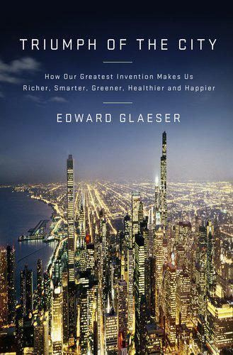
The mismatch between the car and the world’s dense older cities explains why cars have led to the construction of vast new low-density living spaces, sometimes on the edge of older cities and sometimes out on their own in the middle of the Sunbelt. Even the shifts in the late nineteenth century, when skyscrapers rose higher and streetcar suburbs were built, seem small relative to the massive creation of spaces built around the automobile. Some have suggested that American sprawl represents an English cultural heritage that puts an outsize value on single-family detached houses and backyards, but there are obvious reasons why Europeans have remained more urban than Americans.
The Great Railroad Revolution
by
Christian Wolmar
Published 9 Jun 2014
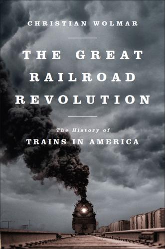
While large towns soon had tracks on every major thoroughfare, almost every town with a main street was getting in on the act: “Streetcar lines were designed with the express purpose of opening new residential tracts whose appeal would be to people of some means who were repelled by conditions in the central city. They were called streetcar suburbs.” Until the First World War, streetcars were highly profitable: “The expectation— actually, the faith—was that ridership and profits, even with the 5 cent fares seemingly inviolate, would continue to grow far into the future.” Most lines started out as local concerns but were soon consolidated, first into urban networks, and later into major streetcar corporations that owned systems in several cities and were regarded by the public with increasing suspicion since they were effectively monopolists.
In Pursuit of Privilege: A History of New York City's Upper Class and the Making of a Metropolis
by
Clifton Hood
Published 1 Nov 2016
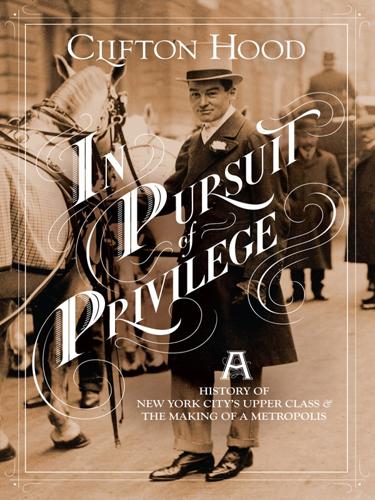
John Montresor,” 367, 368, in Collections of the New-York Historical Society for the Year 1881 (New York: New-York Historical Society, 1882). 63. New York Gazette (Weyman’s), May 26 and June 9, 1766; and New York Mercury, May 26 and June 9, 1766. 64. For the idea of the “pedestrian city” or the “walking city,” see Sam Bass Warner Jr., Streetcar Suburbs: The Process of Growth in Boston, 1870–1900 (Cambridge, Mass.: Harvard University Press, 1962), 2, 11–29, 63; and David Ward, Cities and Immigrants: A Geography of Change in Nineteenth Century America (New York: Oxford University Press, 1971), 87–89. For criticisms of this idea, see Diane Shaw, City Building on the Eastern Frontier: Sorting the New Nineteenth-Century City (Baltimore, Md.: Johns Hopkins University Press, 2004), 1–4, 157.

Ghost Train to the Eastern Star: On the Tracks of the Great Railway Bazaar
by
Paul Theroux
Published 9 Sep 2008
We’re overwhelmed by emotions! Armenians don’t make any distinctions between Turks and Azeris. Hey, it’s all about 1915. When I was at Harvard – visiting scholar, wonderful experience – I met Armenians from Yerevan and had no problems. But Armenians from Watertown were very belligerent.’ Watertown, a streetcar suburb of Boston, was an Armenian enclave. He hurried ahead, trotting past a low hedge to the centrepiece of a wintry garden of dusty ilex. ‘Look at this sculpture.’ As he approached a large, mottled sculpted head, Fuad’s mobile phone began to ring. The ringing did not deter him from telling me that it was the head of the esteemed Azeri poet Vahid – ‘real name Iskanderov, 1899–1965’.
Jim Henson: The Biography
by
Brian Jay Jones
Published 23 Sep 2013
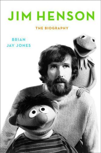
Only a little more than a year later, in early 1938, the Hensons moved back to Maryland, taking a house at 4012 Tennyson Road in Hyattsville. Founded just before the Civil War and straddling railroad tracks and the Baltimore and Washington Turnpike, Hyattsville was at an ideal location to funnel traffic and commerce between Baltimore and the nation’s capital. By the late 1930s, it was a bustling streetcar suburb with a thriving downtown—including a brand-new Woolworth’s—and like Leland, was already struggling with traffic and parking problems. For the next five years, between the constant bustle of bridge and tennis parties at the Browns’ a few blocks away, Paul Henson would make the short daily commute up Baltimore Avenue to the Beltsville Agricultural Research Center and its newly established Bureau of Plant Industry.
Public Places, Urban Spaces: The Dimensions of Urban Design
by
Matthew Carmona
,
Tim Heath
,
Steve Tiesdell
and
Taner Oc
Published 15 Feb 2010
As Calthorpe (2005: 34–6) observes:‘The armature of urbanism has and always will be its streets, from medieval donkey trails through the surveyor’s grid, Haussmann’s boulevards, the superblock, or the unholy alliance of Arterial and Collector Street. The structure of circulation is a fundamental postulate of community form. For example when the assumption was avenues with a mix of streetcars and autos the result was a form of low-rise mixed-use urbanism unique to America, the streetcar suburb. Likewise our historic fine-grained grid became the fixed framework for the evolution of almost all our cities.’ As the urban armature often consists of movement channels, both for circulation and distribution, transport infrastructure can be a powerful generator of new urbanisation and arguably also of re-urbanisation.