Iain M Banks - The Culture complete works
by Iain M. Banks · 5,095pp · 1,429,463 words
to the lush meadows and gleaming spires of the Perfumed Palace on the cliff. Now he reaped a little reward. The tent sits between the trade routes, outside turned in for the season, and in the tent sits a man, a soldier, back from uncounted wars, scarred and seared and broken and
The Insatiable Machine
by Trevor Jackson · 15 Mar 2026 · 270pp · 104,133 words
, complementing the Portuguese-dominated trade from Canton and Macao that had been established in the 1550s.28 From that moment on, a substantial and continuous trade route crossed the Pacific for the first time in human history, so 1571 is a plausible date for the specific year that the global economy was
We Are as Gods: A Survival Guide for the Age of Abundance
by Peter H. Diamandis and Steven Kotler · 13 Apr 2026 · 225pp · 76,418 words
in Kazakhstan figured out how to climb onto the back of an animal strong enough to carry a human at twenty miles an hour. Overnight, trade routes expanded, information traveled faster, and cultures connected. Genetic evidence shows that by 2200 BCE, innovations in equine breeding doubled the number of available animals. This
K2: Life and Death on the World's Most Dangerous Mountain
by Ed Viesturs and David Roberts · 13 Oct 2009
. Instead, Houston’s team drove to Srinagar, then hiked all the way not only to Skardu but to Askole, crossing high foothills by the legendary trade route over the Zoji La. The Duke of the Abruzzi had made the same journey in 1909, as had Crowley and Eckenstein in 1902. The total

Austin Like a Local
by DK · 171pp · 34,369 words
are proud to call it home. Here, cooks barbecue on pits their grandparents once used, artists create politically motivated works, and craftspeople continue the family trade. Route map n Double-tap image to read the labels 1. Listen and learn at the AFRICAN AMERICAN CULTURAL AND HERITAGE FACILITY 912 East 11th Street
Dark Summit: The True Story of Everest's Most Controversial Season
by Nick Heil · 3 Feb 2009
is the sixth-highest mountain in the world, but it is widely considered one of the easiest of the fourteen 8,000-meter giants. The trade route, a low-angle slog up the mountain’s northwest ridge, presents few technical challenges beyond one steep ice wall and a few rock bands, generally
In the Company of Heroes
by Michael J. Durant and Steven Hartov · 1 Dec 2006 · 402pp · 123,199 words
had built the canal that connected the Atlantic and Pacific oceans across Panama’s isthmus, and joint American-Panamanian military cooperation had kept that critical trade route open throughout many of the century’s upheavals. Still, over the years the people of Panama had eventually grown to resent our power and presence

Pocket Rough Guide Berlin (Travel Guide eBook)
by Rough Guides · 16 Oct 2019 · 212pp · 49,082 words
, now the site of the Museum Island, and Alt Berlin, formerly a fishing village – Berlin was formed in 1237. Located at the intersection of significant trade routes, it quickly prospered, rising to power as the seat of the Hohenzollern dynasty following the Thirty Years’ War. During the eighteenth century, Frederick the Great

It's Easier to Reach Heaven Than the End of the Street: A Jerusalem Memoir
by Emma Williams · 7 Nov 2012 · 466pp · 150,362 words
south to the Negev. The Negev sits in a wedge at Israel’s base, dotted with remnants of ancient civilizations. Here the Nabateans plied their trade routes, building khans to shelter camel trains from the elements and wild animals as they wended through the desert, loaded with exotic goods, flocks trailing in
The Trigger: Hunting the Assassin Who Brought the World to War
by Tim Butcher · 2 Jun 2013 · 302pp · 97,076 words
sight of St Paul’s,’ wrote Arthur Evans when he trekked here in 1875 at the end of Ottoman rule. Established as a hub on trade routes across the Balkan Peninsula, Sarajevo grew quickly through commerce, with one seventeenth-century visitor reporting that the population had already reached 80,000, making it
How We'll Live on Mars (TED Books)
by Stephen Petranek · 6 Jul 2015 · 70pp · 22,172 words

Wonders of the Universe
by Brian Cox and Andrew Cohen · 12 Jul 2011
Lions of Kandahar: The Story of a Fight Against All Odds
by Rusty Bradley and Kevin Maurer · 27 Jun 2011 · 289pp · 90,176 words

Are Trams Socialist?: Why Britain Has No Transport Policy
by Christian Wolmar · 19 May 2016 · 79pp · 24,875 words
Deep Time Reckoning: How Future Thinking Can Help Earth Now
by Vincent Ialenti · 22 Sep 2020 · 224pp · 69,593 words
The Last Ride of the Pony Express: My 2,000-Mile Horseback Journey Into the Old West
by Will Grant · 14 Oct 2023 · 246pp · 82,965 words
Chaos: Making a New Science
by James Gleick · 18 Oct 2011 · 396pp · 112,748 words

The rough guide to walks in London and southeast England
by Helena Smith and Judith Bamber · 29 Dec 2008

The Secrets of Station X: How the Bletchley Park codebreakers helped win the war
by Michael Smith · 30 Oct 2011 · 440pp · 109,150 words
Amazing Train Journeys
by Lonely Planet · 30 Sep 2018

Nashville Like a Local: By the People Who Call It Home
by Dk Eyewitness · 28 Sep 2021

Lonely Planet Lonely Planet's Best in Travel 2022
by Lonely Planet · 26 Oct 2021 · 147pp · 33,578 words
A Short Ride in the Jungle
by Antonia Bolingbroke-Kent · 6 Apr 2014 · 316pp · 100,329 words
To the Edges of the Earth: 1909, the Race for the Three Poles, and the Climax of the Age of Exploration
by Edward J. Larson · 13 Mar 2018 · 422pp · 119,123 words
Cows, Pigs, Wars, and Witches: The Riddles of Culture
by Marvin Harris · 1 Dec 1974 · 206pp · 67,030 words

Alone on the Wall: Alex Honnold and the Ultimate Limits of Adventure
by Alex Honnold and David Roberts · 2 Nov 2015 · 265pp · 77,084 words
Pale Rider: The Spanish Flu of 1918 and How It Changed the World
by Laura Spinney · 31 May 2017
Empire of Ants: The Hidden Worlds and Extraordinary Lives of Earth's Tiny Conquerors
by Susanne Foitzik and Olaf Fritsche · 5 Apr 2021 · 335pp · 86,900 words
Lonely Planet’s Best in Travel 2020
by Lonely Planet · 147pp · 33,580 words

Lonely Planet's Best in Travel 2020
by Lonely Planet · 21 Oct 2019 · 201pp · 33,620 words
Switzerland
by Damien Simonis, Sarah Johnstone and Nicola Williams · 31 May 2006
Machine: A White Space Novel
by Elizabeth Bear · 5 Oct 2020 · 537pp · 146,610 words
To the Edge of the World: The Story of the Trans-Siberian Express, the World's Greatest Railroad
by Christian Wolmar · 4 Aug 2014 · 323pp · 94,406 words

The Rough Guide to Jerusalem
by Daniel Jacobs · 10 Jan 2000
The Warmth of Other Suns: The Epic Story of America's Great Migration
by Isabel Wilkerson · 6 Sep 2010 · 740pp · 227,963 words
Discover Greece Travel Guide
by Lonely Planet

Lonely Planet Switzerland
by Lonely Planet · 3,002pp · 177,561 words
P53: The Gene That Cracked the Cancer Code
by Sue Armstrong · 20 Nov 2014 · 260pp · 84,847 words
The Map That Changed the World
by Simon Winchester · 1 Jan 2001 · 361pp · 105,938 words
A Short Walk in the Hindu Kush
by Eric Newby · 1 Jan 1957 · 296pp · 87,567 words
A History of the Bible: The Story of the World's Most Influential Book
by John Barton · 3 Jun 2019 · 904pp · 246,845 words
The Alps: A Human History From Hannibal to Heidi and Beyond
by Stephen O'Shea · 21 Feb 2017 · 322pp · 92,769 words
The Dictionary People: The Unsung Heroes Who Created the Oxford English Dictionary
by Sarah Ogilvie · 17 Oct 2023
The Places in Between
by Rory Stewart · 1 Jan 2004 · 299pp · 89,342 words
Galactic North
by Alastair Reynolds · 14 Feb 2006 · 436pp · 124,373 words

Fodor's California 2014
by Fodor's · 5 Nov 2013 · 1,540pp · 400,759 words
You Are Here: From the Compass to GPS, the History and Future of How We Find Ourselves
by Hiawatha Bray · 31 Mar 2014 · 316pp · 90,165 words

The Lion's Gate: On the Front Lines of the Six Day War
by Steven Pressfield · 5 May 2014 · 531pp · 139,948 words

White City, Black City: Architecture and War in Tel Aviv and Jaffa
by Sharon Rotbard · 1 Jan 2005 · 351pp · 94,104 words
The Burning Shore: How Hitler's U-Boats Brought World War II to America
by Ed Offley · 25 Mar 2014 · 309pp · 84,539 words
The Impossible Climb: Alex Honnold, El Capitan, and the Climbing Life
by Mark Synnott · 5 Mar 2019 · 389pp · 131,688 words

Mauritius, Réunion & Seychelles Travel Guide
by Lonely Planet · 1,429pp · 189,336 words
Discover Maui
by Lonely Planet
Some Remarks
by Neal Stephenson · 6 Aug 2012 · 335pp · 107,779 words
World Travel: An Irreverent Guide
by Anthony Bourdain and Laurie Woolever · 19 Apr 2021 · 366pp · 110,374 words
Apollo 13
by Jim Lovell and Jeffrey Kluger · 14 Jun 2000 · 538pp · 153,734 words
Persians: The Age of the Great Kings
by Lloyd Llewellyn-Jones · 15 Mar 2022 · 444pp · 143,843 words
The Apocalypse Factory: Plutonium and the Making of the Atomic Age
by Steve Olson · 28 Jul 2020 · 378pp · 103,136 words
Explorer's Guide Mexico City, Puebla & Cuernavaca: A Great Destination
by Zain Deane · 8 Sep 2011 · 490pp · 114,589 words
Lonely Planet Iceland
by Lonely Planet · 394pp · 104,952 words
Pandora's Star
by Peter F. Hamilton · 2 Mar 2004 · 1,234pp · 356,472 words
Judas Unchained
by Peter F. Hamilton · 1 Jan 2006 · 1,386pp · 379,115 words
The Evolutionary Void
by Peter F. Hamilton · 18 Aug 2010 · 857pp · 232,302 words
The Man Who Loved China: The Fantastic Story of the Eccentric Scientist Who Unlocked the Mysteries of the Middle Kingdom
by Simon Winchester · 1 Jan 2008 · 385pp · 105,627 words
Big Dead Place: Inside the Strange and Menacing World of Antarctica
by Nicholas Johnson · 31 May 2005 · 363pp · 109,417 words
Lonely Planet Cancun, Cozumel & the Yucatan (Travel Guide)
by Lonely Planet, John Hecht and Sandra Bao · 31 Jul 2013
Danube (Panther)
by Claudio Magris · 10 Jan 2011 · 459pp · 154,280 words
Use of Weapons
by Iain M. Banks · 14 Jan 2011 · 270pp · 132,960 words

Paris Revealed
by Stephen Clarke · 12 Aug 2012 · 309pp · 87,414 words
Happy City: Transforming Our Lives Through Urban Design
by Charles Montgomery · 12 Nov 2013 · 432pp · 124,635 words

One Day in August: Ian Fleming, Enigma, and the Deadly Raid on Dieppe
by David O’keefe · 5 Nov 2020 · 1,243pp · 167,097 words
Red Storm Rising
by Tom Clancy · 2 Jan 1986

Colorado
by Lonely Planet
Railways & the Raj: How the Age of Steam Transformed India
by Christian Wolmar · 3 Oct 2018 · 375pp · 109,675 words
The Bend of the World: A Novel
by Jacob Bacharach · 13 Apr 2014 · 266pp · 77,045 words

Permanent Record
by Edward Snowden · 16 Sep 2019 · 324pp · 106,699 words

Lonely Planet Best of Spain
by Lonely Planet · 1 Nov 2016

The Rough Guide to Cape Town, Winelands & Garden Route
by Rough Guides, James Bembridge and Barbara McCrea · 4 Jan 2018 · 641pp · 147,719 words

The Atlas of Disease
by Sandra Hempel · 15 Sep 2018

The Rough Guide to Berlin
by Rough Guides · 550pp · 151,946 words
The Next Great Migration: The Beauty and Terror of Life on the Move
by Sonia Shah

The Rough Guide to Switzerland (Travel Guide eBook)
by Rough Guides · 24 May 2022

Lonely Planet Wales
by Anna Kaminski;Hugh McNaughtan · 640pp · 160,013 words

The Mini Rough Guide to Malta (Travel Guide eBook)
by Rough Guides · 14 Mar 2022 · 130pp · 33,900 words
Fodor's Essential Israel
by Fodor's Travel Guides · 2 Aug 2023 · 695pp · 189,074 words

Lonely Planet Mongolia (Travel Guide)
by Lonely Planet, Trent Holden, Adam Karlin, Michael Kohn, Adam Skolnick and Thomas O'Malley · 1 Jul 2018
When It All Burns: Fighting Fire in a Transformed World
by Jordan Thomas · 27 May 2025 · 347pp · 105,327 words
Cyber War: The Next Threat to National Security and What to Do About It
by Richard A. Clarke and Robert Knake · 15 Dec 2010 · 282pp · 92,998 words

The Rough Guide to Vienna
by Humphreys, Rob · 311pp · 168,705 words
Ukraine
by Lonely Planet
The Hunt for Red October
by Tom Clancy · 2 Jan 1984 · 594pp · 165,413 words
Italy
by Damien Simonis · 31 Jul 2010
Frommer's Israel
by Robert Ullian · 31 Mar 1998
Roads: An Anthropology of Infrastructure and Expertise (Expertise: Cultures and Technologies of Knowledge)
by Penny Harvey and Hannah Knox · 22 Jun 2015 · 262pp · 73,439 words

Lonely Planet Andalucia: Chapter From Spain Travel Guide
by Lonely Planet · 31 May 2012

Lonely Planet Wales (Travel Guide)
by Lonely Planet · 17 Apr 2017 · 1,181pp · 163,692 words
Being Wrong: Adventures in the Margin of Error
by Kathryn Schulz · 7 Jun 2010 · 486pp · 148,485 words
The Virgin Way: Everything I Know About Leadership
by Richard Branson · 8 Sep 2014 · 315pp · 99,065 words
Coastal California Travel Guide
by Lonely Planet

Northern California Travel Guide
by Lonely Planet
The Rough Guide to Ireland
by Clements, Paul · 2 Jun 2015

Greece Travel Guide
by Lonely Planet

Lonely Planet Sri Lanka
by Lonely Planet

The Stonemason: A History of Building Britain
by Andrew Ziminski · 5 Mar 2020 · 256pp · 84,034 words
The Rough Guide to Paris
by Rough Guides · 1 May 2023 · 688pp · 190,793 words

Lonely Planet Peru
by Lonely Planet · 1,166pp · 301,688 words
Imagine a City: A Pilot's Journey Across the Urban World
by Mark Vanhoenacker · 14 Aug 2022 · 393pp · 127,847 words

Pocket Rough Guide Barcelona (Travel Guide eBook)
by Rough Guides · 1 Mar 2019 · 214pp · 50,999 words
The Rough Guide to Poland
by Rough Guides · 18 Sep 2018 · 976pp · 233,138 words

Lonely Planet Cancun, Cozumel & the Yucatan (Travel Guide)
by Lonely Planet, John Hecht and Lucas Vidgen · 31 Jul 2016
Moon Mexico City: Neighborhood Walks, Food & Culture, Beloved Local Spots
by Julie Meade · 7 Aug 2023 · 527pp · 131,002 words
Lonely Planet Western Balkans
by Lonely Planet, Peter Dragicevich, Mark Baker, Stuart Butler, Anthony Ham, Jessica Lee, Vesna Maric, Kevin Raub and Brana Vladisavljevic · 1 Oct 2019 · 990pp · 250,044 words

Moon Portugal
by Carrie-Marie Bratley · 15 Mar 2021 · 743pp · 193,663 words

Costa Rica
by Matthew Firestone, Carolina Miranda and César G. Soriano · 2 Jan 2008
Hunting in the Shadows: The Pursuit of Al Qa'ida Since 9/11: The Pursuit of Al Qa'ida Since 9/11
by Seth G. Jones · 29 Apr 2012 · 649pp · 172,080 words

Lonely Planet Panama (Travel Guide)
by Lonely Planet and Carolyn McCarthy · 30 Jun 2013
Greece
by Korina Miller · 1 Mar 2010
The Rough Guide to Prague
by Humphreys, Rob
Where Bigfoot Walks: Crossing the Dark Divide
by Robert Michael Pyle · 31 Jul 2017 · 413pp · 134,755 words
Never Enough: The Neuroscience and Experience of Addiction
by Judith Grisel · 15 Feb 2019 · 213pp · 68,363 words
The uplift war
by David Brin · 1 Jun 1987 · 789pp · 213,716 words
Fodor's Venice and Northern Italy
by Fodor's · 22 Mar 2011
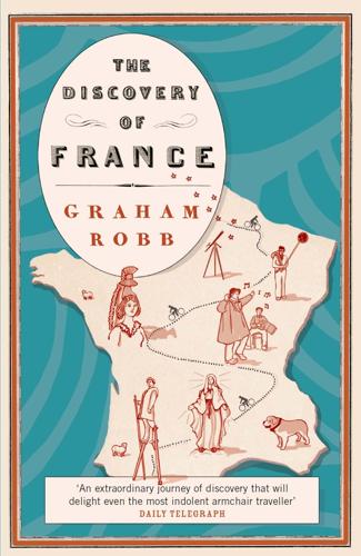
The Discovery of France
by Graham Robb · 1 Jan 2007 · 740pp · 161,563 words
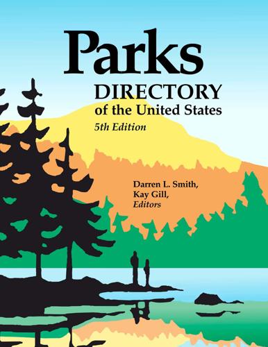
Parks Directory of the United States
by Darren L. Smith and Kay Gill · 1 Jan 2004
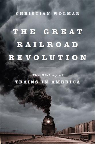
The Great Railroad Revolution
by Christian Wolmar · 9 Jun 2014 · 523pp · 159,884 words
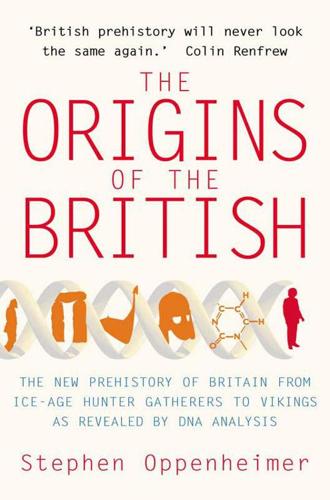
The Origins of the British
by Stephen Oppenheimer · 1 Jul 2007 · 852pp · 157,181 words
Crossing the Heart of Africa: An Odyssey of Love and Adventure
by Julian Smith · 7 Dec 2010 · 311pp · 89,785 words
Red Moon Rising
by Matthew Brzezinski · 2 Jan 2007 · 497pp · 124,144 words
Coastal California
by Lonely Planet

Western USA
by Lonely Planet
Anathem
by Neal Stephenson · 25 Aug 2009 · 1,087pp · 325,295 words
In the Devil's Garden: A Sinful History of Forbidden Food
by Stewart Lee Allen · 1 Jan 2002 · 270pp · 81,311 words

France (Lonely Planet, 8th Edition)
by Nicola Williams · 14 Oct 2010
Cadillac Desert
by Marc Reisner · 1 Jan 1986 · 898pp · 253,177 words

Erwin Schrodinger and the Quantum Revolution
by John Gribbin · 1 Mar 2012 · 287pp · 87,204 words

Lonely Planet France
by Lonely Planet Publications · 31 Mar 2013
Industry 4.0: The Industrial Internet of Things
by Alasdair Gilchrist · 27 Jun 2016

Physics in Mind: A Quantum View of the Brain
by Werner Loewenstein · 29 Jan 2013 · 362pp · 97,862 words

The Rough Guide to England
by Rough Guides · 29 Mar 2018
Devil Take the Hindmost: A History of Financial Speculation
by Edward Chancellor · 31 May 2000 · 860pp · 227,491 words

Lonely Planet Turkey (Travel Guide)
by Lonely Planet, James Bainbridge, Brett Atkinson, Steve Fallon, Jessica Lee, Virginia Maxwell, Hugh McNaughtan and John Noble · 31 Jan 2017 · 2,313pp · 330,238 words
A Brief History of Motion: From the Wheel, to the Car, to What Comes Next
by Tom Standage · 16 Aug 2021 · 290pp · 85,847 words
Great Continental Railway Journeys
by Michael Portillo · 21 Oct 2015
Lonely Planet Norway
by Lonely Planet

The the Rough Guide to Turkey
by Rough Guides · 15 Oct 2023

Gaza: An Inquest Into Its Martyrdom
by Norman Finkelstein · 9 Jan 2018 · 578pp · 170,758 words

Sweden Travel Guide
by Lonely Planet
The Rough Guide to Finland
by Rough Guides · 31 May 2010 · 493pp · 155,660 words
Into the Raging Sea
by Rachel Slade · 4 Apr 2018 · 390pp · 109,438 words

Lonely Planet Turkey
by Lonely Planet · 1,236pp · 320,184 words

Lonely Planet Poland
by Lonely Planet · 892pp · 229,939 words

The Rough Guide to France (Travel Guide eBook)
by Rough Guides · 1 Aug 2019 · 1,994pp · 548,894 words

The Rough Guide to Morocco (Travel Guide eBook)
by Rough Guides · 23 Mar 2019 · 1,058pp · 302,829 words
The Rough Guide to Chile & Easter Island (Travel Guide with Free eBook)
by Rough Guides · 15 Mar 2023 · 885pp · 238,165 words
Bosnia & Herzegovina--Culture Smart
by Elizabeth Hammond · 11 Jan 2011 · 105pp · 33,036 words
Moon Prague, Vienna & Budapest: Palaces & Castles, Art & Music, Coffeehouses & Beer Gardens
by Jennifer D Walker, Auburn Scallon and Moon Travel Guides · 15 Oct 2024 · 806pp · 221,571 words

Europe by Eurail 2023
by Laverne Ferguson-Kosinski and C. Darren Price · 8 Jan 2023 · 570pp · 186,017 words
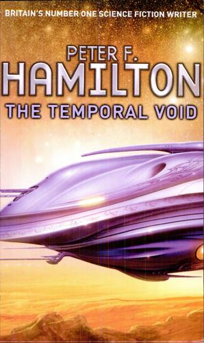
The Temporal Void
by Peter F. Hamilton · 1 Jan 2008 · 897pp · 242,580 words
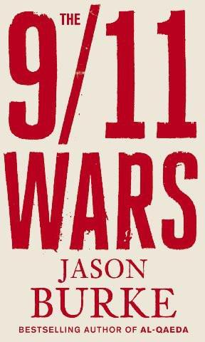
The 9/11 Wars
by Jason Burke · 1 Sep 2011 · 885pp · 271,563 words

Great Britain
by David Else and Fionn Davenport · 2 Jan 2007
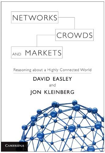
Networks, Crowds, and Markets: Reasoning About a Highly Connected World
by David Easley and Jon Kleinberg · 15 Nov 2010 · 1,535pp · 337,071 words
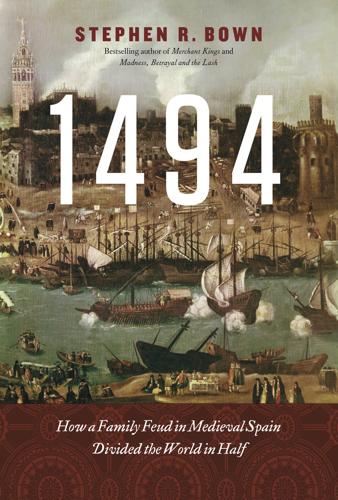
1494: How a Family Feud in Medieval Spain Divided the World in Half
by Stephen R. Bown · 15 Feb 2011 · 295pp · 92,670 words
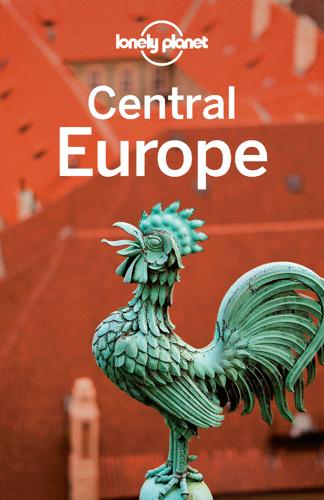
Central Europe Travel Guide
by Lonely Planet

A Short History of British Architecture: From Stonehenge to the Shard
by Simon Jenkins · 7 Nov 2024 · 364pp · 94,801 words

Scandinavia
by Andy Symington · 24 Feb 2012
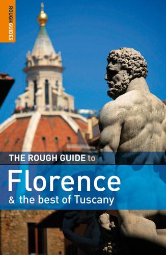
The Rough Guide to Florence & the Best of Tuscany
by Tim Jepson, Jonathan Buckley and Rough Guides · 2 Mar 2009 · 416pp · 204,183 words
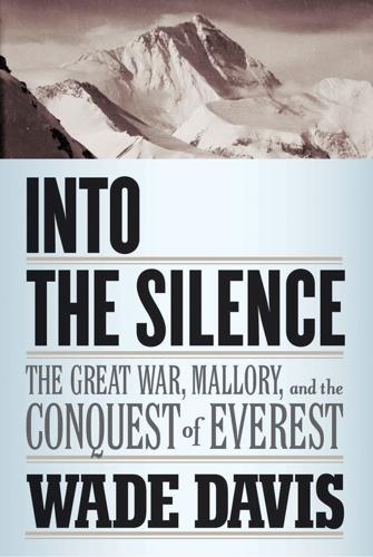
Into the Silence: The Great War, Mallory, and the Conquest of Everest
by Wade Davis · 27 Sep 2011

Egypt Travel Guide
by Lonely Planet
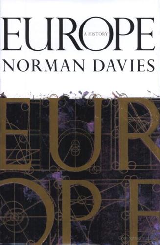
Europe: A History
by Norman Davies · 1 Jan 1996

Egypt
by Matthew Firestone · 13 Oct 2010

Southwest USA Travel Guide
by Lonely Planet
Is the Internet Changing the Way You Think?: The Net's Impact on Our Minds and Future
by John Brockman · 18 Jan 2011 · 379pp · 109,612 words
Germany
by Andrea Schulte-Peevers · 17 Oct 2010

USA Travel Guide
by Lonely, Planet
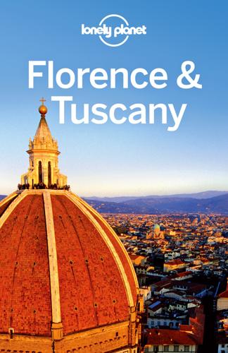
Lonely Planet Florence & Tuscany
by Lonely Planet, Virginia Maxwell and Nicola Williams · 1 Dec 2013 · 874pp · 154,810 words
The Guns of August
by Barbara W. Tuchman and Robert K. Massie · 1 Jan 1962 · 653pp · 205,718 words

The Rough Guide to Wales
by Rough Guides · 24 Mar 2010

Lonely Planet Chile & Easter Island (Travel Guide)
by Lonely Planet, Carolyn McCarthy and Kevin Raub · 19 Oct 2015
Germany Travel Guide
by Lonely Planet
Mapping Mars: Science, Imagination and the Birth of a World
by Oliver Morton · 15 Feb 2003 · 409pp · 129,423 words
On the Trail of Genghis Khan: An Epic Journey Through the Land of the Nomads
by Tim Cope · 23 Sep 2013 · 573pp · 180,065 words
Order Without Design: How Markets Shape Cities
by Alain Bertaud · 9 Nov 2018 · 769pp · 169,096 words

Lonely Planet Jamaica
by Lonely Planet

Lonely Planet Maldives (Travel Guide)
by Planet, Lonely and Masters, Tom · 31 Aug 2015 · 449pp · 85,924 words
Florence & Tuscany
by Lonely Planet · 928pp · 159,837 words
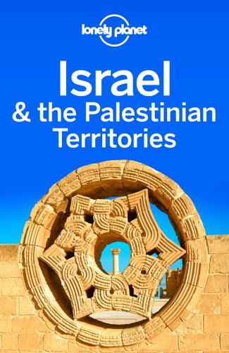
Israel & the Palestinian Territories Travel Guide
by Lonely Planet

The Rough Guide to Egypt (Rough Guide to...)
by Dan Richardson and Daniel Jacobs · 1 Feb 2013
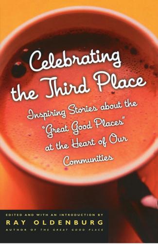
Celebrating the Third Place: Inspiring Stories About the Great Good Places at the Heart of Our Communities
by Ray Oldenburg · 30 Nov 2001 · 215pp · 71,155 words
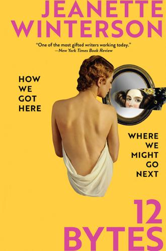
12 Bytes: How We Got Here. Where We Might Go Next
by Jeanette Winterson · 15 Mar 2021 · 256pp · 73,068 words
Lonely Planet Washington, Oregon & the Pacific Northwest
by Lonely Planet · 1,006pp · 243,928 words
Fantasyland
by Kurt Andersen · 5 Sep 2017
Berlitz Pocket Guide Cape Verde
by Berlitz Publishing · 1 May 2018 · 225pp · 41,269 words

The Rough Guide to Devon & Cornwall
by Robert Andrews

The Rough Guide To Devon & Cornwall
by Rough Guides · 29 Apr 2024 · 558pp · 147,947 words

The Rough Guide to Wales
by Rough Guides · 14 Oct 2024 · 882pp · 240,215 words
Why the Allies Won
by Richard Overy · 29 Feb 2012 · 624pp · 191,758 words
The Rough Guide to Australia (Travel Guide eBook)
by Rough Guides · 14 Oct 2023 · 1,955pp · 521,661 words
An Unexpected Light: Travels in Afghanistan
by Jason Elliot · 1 Aug 2011 · 535pp · 167,111 words
Into the Ice: The Northwest Passage, the Polar Sun, and a 175-Year-Old Mystery
by Mark Synnott · 14 Apr 2025 · 443pp · 140,219 words
The Name of the Rose
by Umberto Eco · 26 Sep 2006 · 1,166pp · 373,031 words
The Dark Cloud: How the Digital World Is Costing the Earth
by Guillaume Pitron · 14 Jun 2023 · 271pp · 79,355 words
The Rough Guide to New Zealand: Travel Guide eBook
by Rough Guides · 1 Jan 2024 · 1,383pp · 367,401 words

Bosnia and Herzegovina
by Tim. Clancy · 15 Mar 2022 · 716pp · 209,067 words
Lonely Planet Central Asia (Travel Guide)
by Lonely Planet, Stephen Lioy, Anna Kaminski, Bradley Mayhew and Jenny Walker · 1 Jun 2018 · 1,046pp · 271,638 words

The Rough Guide to Portugal (Travel Guide eBook)
by Rough Guides · 1 Mar 2023 · 919pp · 252,171 words

The Rough Guide to Peru
by Rough Guides · 27 Apr 2024 · 960pp · 267,168 words
The Eternal City: A History of Rome
by Ferdinand Addis · 6 Nov 2018
Connectography: Mapping the Future of Global Civilization
by Parag Khanna · 18 Apr 2016 · 497pp · 144,283 words

The Rough Guide to Brazil
by Rough Guides · 22 Sep 2018
The scramble for Africa, 1876-1912
by Thomas Pakenham · 19 Nov 1991 · 1,194pp · 371,889 words
Our Robots, Ourselves: Robotics and the Myths of Autonomy
by David A. Mindell · 12 Oct 2015 · 265pp · 74,807 words
Why geography matters: three challenges facing America : climate change, the rise of China, and global terrorism
by Harm J. De Blij · 15 Nov 2007 · 481pp · 121,300 words
The Rough Guide to Morocco
by Rough Guides
Why the West Rules--For Now: The Patterns of History, and What They Reveal About the Future
by Ian Morris · 11 Oct 2010 · 1,152pp · 266,246 words
The London Compendium
by Ed Glinert · 30 Jun 2004 · 1,088pp · 297,362 words
The Boundless Sea: A Human History of the Oceans
by David Abulafia · 2 Oct 2019 · 1,993pp · 478,072 words
Venice: A New History
by Thomas F. Madden · 24 Oct 2012 · 466pp · 146,982 words
Flash Boys: A Wall Street Revolt
by Michael Lewis · 30 Mar 2014 · 250pp · 87,722 words
California
by Sara Benson · 15 Oct 2010
The Power of Geography: Ten Maps That Reveal the Future of Our World
by Tim Marshall · 14 Oct 2021 · 383pp · 105,387 words
Sextant: A Young Man's Daring Sea Voyage and the Men Who ...
by David Barrie · 12 May 2014 · 366pp · 100,602 words
A Peace to End All Peace: The Fall of the Ottoman Empire and the Creation of the Modern Middle East
by David Fromkin · 2 Jan 1989 · 681pp · 214,967 words
Space Chronicles: Facing the Ultimate Frontier
by Neil Degrasse Tyson and Avis Lang · 27 Feb 2012 · 476pp · 118,381 words

Lonely Planet Mexico
by John Noble, Kate Armstrong, Greg Benchwick, Nate Cavalieri, Gregor Clark, John Hecht, Beth Kohn, Emily Matchar, Freda Moon and Ellee Thalheimer · 2 Jan 1992
Jerusalem: The Biography
by Simon Sebag-Montefiore · 27 Jan 2011 · 1,364pp · 272,257 words
The Ghost Map: A Street, an Epidemic and the Hidden Power of Urban Networks.
by Steven Johnson · 18 Oct 2006 · 304pp · 88,773 words

Spain
by Lonely Planet Publications and Damien Simonis · 14 May 1997
The World in 2050: Four Forces Shaping Civilization's Northern Future
by Laurence C. Smith · 22 Sep 2010 · 421pp · 120,332 words
The Great Game: On Secret Service in High Asia
by Peter Hopkirk · 2 Jan 1991 · 580pp · 194,144 words

Central America
by Carolyn McCarthy, Greg Benchwick, Joshua Samuel Brown, Alex Egerton, Matthew Firestone, Kevin Raub, Tom Spurling and Lucas Vidgen · 2 Jan 2001

Berlin
by Andrea Schulte-Peevers · 20 Oct 2010 · 638pp · 156,653 words
CultureShock! Egypt: A Survival Guide to Customs and Etiquette (4th Edition)
by Susan L. Wilson · 20 Dec 2011

Frommer's Egypt
by Matthew Carrington · 8 Sep 2008
Mistakes Were Made (But Not by Me): Why We Justify Foolish Beliefs, Bad Decisions, and Hurtful Acts
by Carol Tavris and Elliot Aronson · 6 May 2007 · 420pp · 98,309 words
Lonely Planet Greek Islands
by Lonely Planet, Alexis Averbuck, Michael S Clark, Des Hannigan, Victoria Kyriakopoulos and Korina Miller · 31 Mar 2012
QI: The Third Book of General Ignorance (Qi: Book of General Ignorance)
by John Lloyd and John Mitchinson · 28 Sep 2015 · 432pp · 85,707 words
Southeast Asia on a Shoestring Travel Guide
by Lonely Planet · 30 May 2012

Lonely Planet China (Travel Guide)
by Lonely Planet and Shawn Low · 1 Apr 2015 · 3,292pp · 537,795 words

Fantasyland: How America Went Haywire: A 500-Year History
by Kurt Andersen · 4 Sep 2017 · 522pp · 162,310 words
Gnomon
by Nick Harkaway · 18 Oct 2017 · 778pp · 239,744 words
Deep Sea and Foreign Going
by Rose George · 4 Sep 2013 · 402pp · 98,760 words

Nepal Travel Guide
by Lonely Planet

Lonely Planet Norway (Travel Guide)
by Lonely Planet and Donna Wheeler · 1 Apr 2015 · 1,510pp · 218,417 words
The Rough Guide to Chile
by Melissa Graham and Andrew Benson · 11 May 2003
The Phantom Atlas: The Greatest Myths, Lies and Blunders on Maps
by Edward Brooke-Hitching · 3 Nov 2016
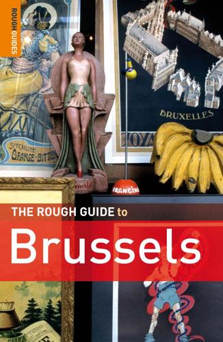
The Rough Guide to Brussels 4 (Rough Guide Travel Guides)
by Dunford, Martin.; Lee, Phil; Summer, Suzy.; Dal Molin, Loik · 26 Jul 2010
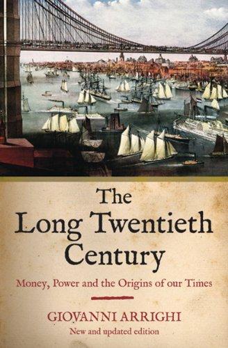
The Long Twentieth Century: Money, Power, and the Origins of Our Times
by Giovanni Arrighi · 15 Mar 2010 · 7,371pp · 186,208 words
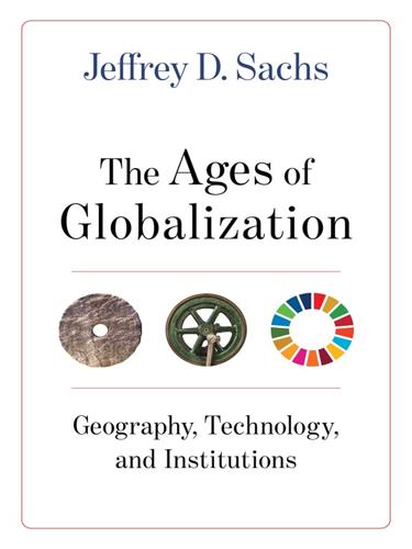
The Ages of Globalization
by Jeffrey D. Sachs · 2 Jun 2020
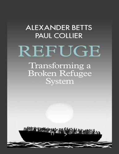
Refuge: Transforming a Broken Refugee System
by Alexander Betts and Paul Collier · 29 Mar 2017
Lonely Planet Amsterdam
by Lonely Planet
The Dawn of Eurasia: On the Trail of the New World Order
by Bruno Macaes · 25 Jan 2018 · 287pp · 95,152 words

Rick Steves Florence & Tuscany 2017
by Rick Steves · 8 Nov 2016 · 920pp · 237,085 words
Start With Why: How Great Leaders Inspire Everyone to Take Action
by Simon Sinek · 29 Oct 2009 · 261pp · 79,883 words
Lords of the Desert: The Battle Between the US and Great Britain for Supremacy in the Modern Middle East
by James Barr · 8 Aug 2018 · 539pp · 151,425 words
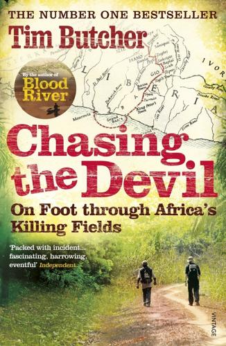
Chasing the Devil: On Foot Through Africa's Killing Fields
by Tim Butcher · 1 Apr 2011 · 347pp · 115,173 words
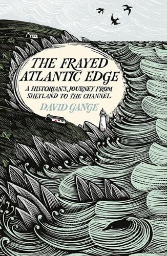
The Frayed Atlantic Edge: A Historian’s Journey From Shetland to the Channel
by David Gange · 10 Jul 2019

Finding the Mother Tree: Discovering the Wisdom of the Forest
by Suzanne Simard · 3 May 2021 · 392pp · 124,069 words
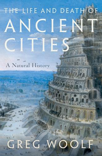
The Life and Death of Ancient Cities: A Natural History
by Greg Woolf · 14 May 2020

Egypt Travel Guide
by Lonely Planet
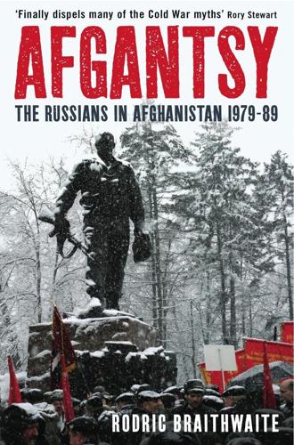
Afgantsy: The Russians in Afghanistan, 1979-89
by Rodric Braithwaite · 15 Jan 2011 · 618pp · 146,557 words
The Emperor's New Road: How China's New Silk Road Is Remaking the World
by Jonathan Hillman · 28 Sep 2020 · 388pp · 99,023 words
The Year 1000: When Explorers Connected the World―and Globalization Began
by Valerie Hansen · 13 Apr 2020
The Rough Guide to Sweden (Travel Guide eBook)
by Rough Guides · 1 Nov 2019
A Short History of Humanity: How Migration Made Us Who We Are
by Johannes Krause and Thomas Trappe · 8 Apr 2021 · 218pp · 62,621 words
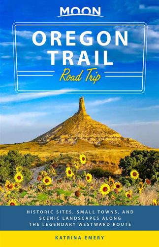
Moon Oregon Trail Road Trip: Historic Sites, Small Towns, and Scenic Landscapes Along the Legendary Westward Route
by Katrina Emery and Moon Travel Guides · 27 Jul 2020 · 608pp · 184,703 words
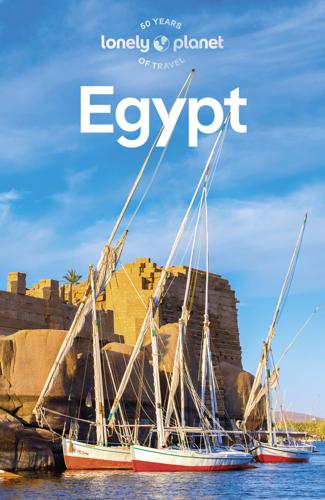
Lonely Planet Egypt
by Lonely Planet · 476pp · 132,840 words
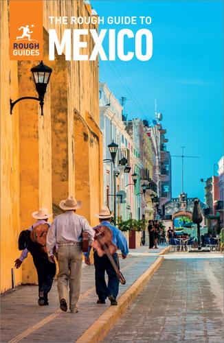
The Rough Guide to Mexico
by Rough Guides · 15 Jan 2022

The Rough Guide to South America on a Budget (Travel Guide eBook)
by Rough Guides · 1 Jan 2019 · 1,909pp · 531,728 words
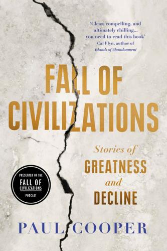
Fall of Civilizations: Stories of Greatness and Decline
by Paul Cooper · 31 Mar 2024 · 583pp · 174,033 words
Lonely Planet Singapore
by Lonely Planet · 14 May 2024 · 232pp · 61,272 words
Poland - Culture Smart!
by Allen, Gregory;Lipska, Magdalena;Culture Smart!; · 15 Jun 2023 · 125pp · 35,679 words
Exceptional People: How Migration Shaped Our World and Will Define Our Future
by Ian Goldin, Geoffrey Cameron and Meera Balarajan · 20 Dec 2010 · 482pp · 117,962 words
Money Changes Everything: How Finance Made Civilization Possible
by William N. Goetzmann · 11 Apr 2016 · 695pp · 194,693 words
The Power Makers
by Maury Klein · 26 May 2008 · 782pp · 245,875 words
Political Order and Political Decay: From the Industrial Revolution to the Globalization of Democracy
by Francis Fukuyama · 29 Sep 2014 · 828pp · 232,188 words
An Edible History of Humanity
by Tom Standage · 30 Jun 2009 · 282pp · 82,107 words
Immigration worldwide: policies, practices, and trends
by Uma Anand Segal, Doreen Elliott and Nazneen S. Mayadas · 19 Jan 2010 · 492pp · 70,082 words
Aerotropolis
by John D. Kasarda and Greg Lindsay · 2 Jan 2009 · 603pp · 182,781 words
A World Beneath the Sands: The Golden Age of Egyptology
by Toby Wilkinson · 19 Oct 2020
Diamonds, Gold, and War: The British, the Boers, and the Making of South Africa
by Martin Meredith · 1 Jan 2007 · 649pp · 181,179 words
The Codebreakers: The Comprehensive History of Secret Communication From Ancient Times to the Internet
by David Kahn · 1 Feb 1963 · 1,799pp · 532,462 words
The Human Cosmos: A Secret History of the Stars
by Jo Marchant · 15 Jan 2020 · 544pp · 134,483 words
The Weather of the Future
by Heidi Cullen · 2 Aug 2010 · 391pp · 99,963 words

England
by David Else · 14 Oct 2010
Iron Sunrise
by Stross, Charles · 28 Oct 2004 · 462pp · 142,240 words
The Wars of Afghanistan
by Peter Tomsen · 30 May 2011 · 1,118pp · 309,029 words

Frommer's New Mexico
by Lesley S. King · 2 Jan 1999 · 420pp · 219,075 words
The Rough Guide to Barcelona 8
by Jules Brown and Rough Guides · 2 Feb 2009 · 344pp · 161,076 words
The system of the world
by Neal Stephenson · 21 Sep 2004 · 1,199pp · 384,780 words
The Gun
by C. J. Chivers · 12 Oct 2010 · 845pp · 197,050 words
Vanished Kingdoms: The Rise and Fall of States and Nations
by Norman Davies · 30 Sep 2009 · 1,309pp · 300,991 words
Salt: A World History
by Mark Kurlansky · 28 Jan 2003 · 401pp · 122,457 words
Ghost Wars: The Secret History of the CIA, Afghanistan, and Bin Laden, from the Soviet Invasion to September 10, 2011
by Steve Coll · 23 Feb 2004 · 956pp · 288,981 words
Earth Wars: The Battle for Global Resources
by Geoff Hiscock · 23 Apr 2012 · 363pp · 101,082 words
After Tamerlane: The Global History of Empire Since 1405
by John Darwin · 5 Feb 2008 · 650pp · 203,191 words
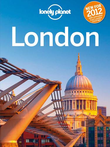
Lonely Planet London
by Lonely Planet · 22 Apr 2012
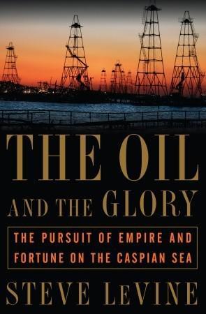
The Oil and the Glory: The Pursuit of Empire and Fortune on the Caspian Sea
by Steve Levine · 23 Oct 2007 · 568pp · 162,366 words
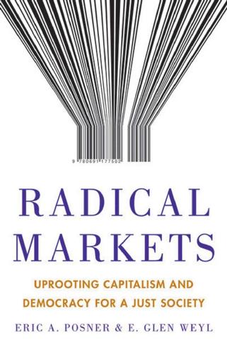
Radical Markets: Uprooting Capitalism and Democracy for a Just Society
by Eric Posner and E. Weyl · 14 May 2018 · 463pp · 105,197 words
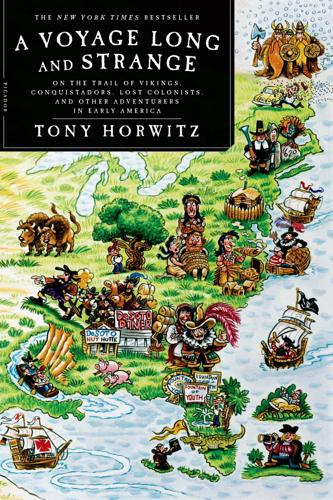
A Voyage Long and Strange: On the Trail of Vikings, Conquistadors, Lost Colonists, and Other Adventurers in Early America
by Tony Horwitz · 1 Jan 2008
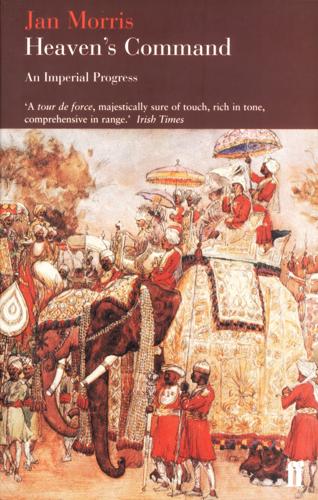
Heaven's Command (Pax Britannica)
by Jan Morris · 22 Dec 2010 · 699pp · 192,704 words
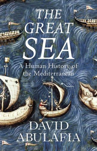
The Great Sea: A Human History of the Mediterranean
by David Abulafia · 4 May 2011 · 1,002pp · 276,865 words

Lonely Planet Morocco (Travel Guide)
by Lonely Planet, Paul Clammer and Paula Hardy · 1 Jul 2014 · 2,020pp · 267,411 words
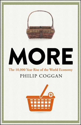
More: The 10,000-Year Rise of the World Economy
by Philip Coggan · 6 Feb 2020 · 524pp · 155,947 words
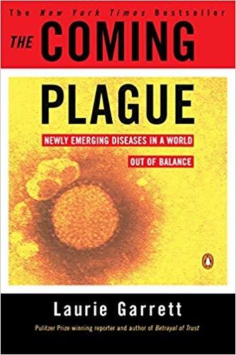
The Coming Plague: Newly Emerging Diseases in a World Out of Balance
by Laurie Garrett · 31 Oct 1994 · 1,293pp · 357,735 words
Atlas Obscura: An Explorer's Guide to the World's Hidden Wonders
by Joshua Foer, Dylan Thuras and Ella Morton · 19 Sep 2016 · 1,048pp · 187,324 words
Cage of Souls
by Adrian Tchaikovsky · 4 Apr 2019 · 703pp · 196,052 words
The Ice at the End of the World: An Epic Journey Into Greenland's Buried Past and Our Perilous Future
by Jon Gertner · 10 Jun 2019 · 488pp · 145,950 words
Paris 1919: Six Months That Changed the World
by Margaret Macmillan; Richard Holbrooke; Casey Hampton · 1 Jan 2001

Feral: Rewilding the Land, the Sea, and Human Life
by George Monbiot · 13 May 2013 · 424pp · 122,350 words
Americana: A 400-Year History of American Capitalism
by Bhu Srinivasan · 25 Sep 2017 · 801pp · 209,348 words
The Rough Guide to Jamaica
by Thomas, Polly,Henzell, Laura.,Coates, Rob.,Vaitilingam, Adam.
The Rise and Fall of the Great Powers: Economic Change and Military Conflict From 1500 to 2000
by Paul Kennedy · 15 Jan 1989 · 1,477pp · 311,310 words
Atlantic: Great Sea Battles, Heroic Discoveries, Titanic Storms & a Vast Ocean of a Million Stories
by Simon Winchester · 27 Oct 2009 · 522pp · 150,592 words
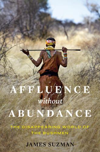
Affluence Without Abundance: The Disappearing World of the Bushmen
by James Suzman · 10 Jul 2017
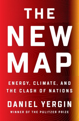
The New Map: Energy, Climate, and the Clash of Nations
by Daniel Yergin · 14 Sep 2020
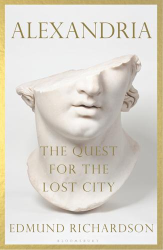
Alexandria: The Quest for the Lost City
by Edmund Richardson · 12 May 2021 · 399pp · 107,138 words
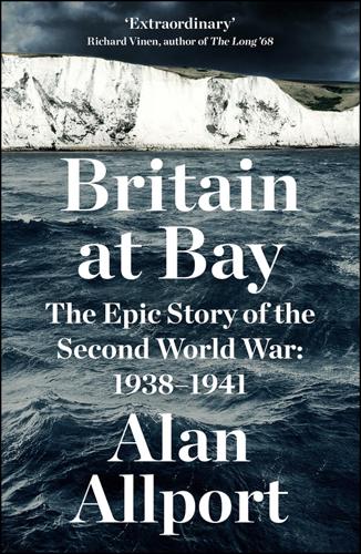
Britain at Bay: The Epic Story of the Second World War: 1938-1941
by Alan Allport · 2 Sep 2020 · 1,520pp · 221,543 words

Vanished Kingdoms: The History of Half-Forgotten Europe
by Norman Davies · 27 Sep 2011

The Rough Guide to Norway
by Phil Lee · 25 Nov 2013
The Quest: Energy, Security, and the Remaking of the Modern World
by Daniel Yergin · 14 May 2011 · 1,373pp · 300,577 words
The Pandemic Century: One Hundred Years of Panic, Hysteria, and Hubris
by Mark Honigsbaum · 8 Apr 2019 · 529pp · 150,263 words
Nature's Metropolis: Chicago and the Great West
by William Cronon · 2 Nov 2009 · 918pp · 260,504 words
1491
by Charles C. Mann · 8 Aug 2005 · 666pp · 189,883 words
On Paradise Drive: How We Live Now (And Always Have) in the Future Tense
by David Brooks · 2 Jun 2004 · 262pp · 79,469 words

Lonely Planet Kenya
by Lonely Planet
Insight Guides Pocket Cape Verde
by Insight Guides · 1 May 2018 · 128pp · 32,375 words

THE MINI ROUGH GUIDE TO CYPRUS
by Rough Guides · 26 Mar 2022
Narcotopia
by Patrick Winn · 30 Jan 2024 · 425pp · 131,864 words
Fodor's Essential Belgium
by Fodor's Travel Guides · 23 Aug 2022
Queens of Jerusalem: The Women Who Dared to Rule
by Katherine Pangonis · 17 Feb 2021 · 332pp · 105,387 words
The Secret History of the Mongol Queens
by Jack Weatherford · 14 Oct 2010
Strolling Through Istanbul
by Sumner-Boyd, Hilary.; Freely, John · 8 Jan 2011 · 521pp · 167,816 words
Second World: Empires and Influence in the New Global Order
by Parag Khanna · 4 Mar 2008 · 537pp · 158,544 words
Krakatoa: The Day the World Exploded
by Simon Winchester · 1 Jan 2003 · 582pp · 136,780 words
A Short History of Russia
by Mark Galeotti · 1 May 2020 · 163pp · 47,912 words
The Silk Roads: A New History of the World
by Peter Frankopan · 26 Aug 2015 · 1,042pp · 273,092 words
Fortune's Bazaar: the Making of Hong Kong: The Making of Hong Kong
by Vaudine England · 16 May 2023 · 308pp · 122,100 words
Drugs 2.0: The Web Revolution That's Changing How the World Gets High
by Mike Power · 1 May 2013 · 378pp · 94,468 words
In the Graveyard of Empires: America's War in Afghanistan
by Seth G. Jones · 12 Apr 2009 · 566pp · 144,072 words
How the Other Half Banks: Exclusion, Exploitation, and the Threat to Democracy
by Mehrsa Baradaran · 5 Oct 2015 · 424pp · 121,425 words
Super Continent: The Logic of Eurasian Integration
by Kent E. Calder · 28 Apr 2019
Amritsar 1919: An Empire of Fear and the Making of a Massacre
by Kim Wagner · 26 Mar 2019
The Rough Guide to Amsterdam
by Martin Dunford, Phil Lee and Karoline Thomas · 4 Jan 2010 · 537pp · 135,099 words
The Great Escape: Health, Wealth, and the Origins of Inequality
by Angus Deaton · 15 Mar 2013 · 374pp · 114,660 words

Ancestral Night
by Elizabeth Bear · 5 Mar 2019 · 596pp · 163,351 words
Water: A Biography
by Giulio Boccaletti · 13 Sep 2021 · 485pp · 133,655 words
Climbing Mount Improbable
by Richard Dawkins and Lalla Ward · 1 Jan 1996 · 309pp · 101,190 words
McMafia: A Journey Through the Global Criminal Underworld
by Misha Glenny · 7 Apr 2008 · 487pp · 147,891 words
The Box: How the Shipping Container Made the World Smaller and the World Economy Bigger
by Marc Levinson · 1 Jan 2006 · 477pp · 135,607 words
Executive Orders
by Tom Clancy · 2 Jan 1996
The Sushi Economy: Globalization and the Making of a Modern Delicacy
by Sasha Issenberg · 1 Jan 2007 · 534pp · 15,752 words
The Relentless Revolution: A History of Capitalism
by Joyce Appleby · 22 Dec 2009 · 540pp · 168,921 words
The Wealth and Poverty of Nations: Why Some Are So Rich and Some So Poor
by David S. Landes · 14 Sep 1999 · 1,060pp · 265,296 words
Africa: A Biography of the Continent
by John Reader · 5 Nov 1998 · 1,072pp · 297,437 words
Quicksilver
by Neal Stephenson · 9 Sep 2004 · 1,178pp · 388,227 words
The Prince of the Marshes: And Other Occupational Hazards of a Year in Iraq
by Rory Stewart · 1 Jan 2005 · 407pp · 123,587 words
Lila: An Inquiry Into Morals
by Robert M. Pirsig · 1 Jan 1991 · 497pp · 146,551 words

Drink: A Cultural History of Alcohol
by Iain Gately · 30 Jun 2008 · 686pp · 201,972 words
The First American: The Life and Times of Benjamin Franklin
by H. W. Brands · 1 Jan 2000 · 961pp · 302,613 words
The River at the Centre of the World
by Simon Winchester · 1 Jan 1996 · 498pp · 153,927 words
New World, Inc.
by John Butman · 20 Mar 2018 · 490pp · 146,259 words
Dawn of Detroit
by Tiya Miles · 13 Sep 2017 · 415pp · 127,092 words
A Splendid Exchange: How Trade Shaped the World
by William J. Bernstein · 5 May 2009 · 565pp · 164,405 words
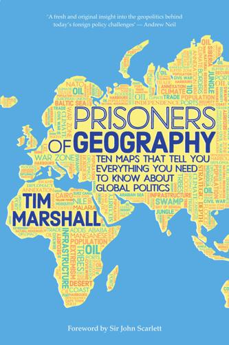
Prisoners of Geography: Ten Maps That Explain Everything About the World (Politics of Place)
by Tim Marshall · 10 Oct 2016 · 306pp · 79,537 words
The "Talmud"
by Wimpfheimer, Barry Scott. · 22 Jan 2018
Homo Deus: A Brief History of Tomorrow
by Yuval Noah Harari · 1 Mar 2015 · 479pp · 144,453 words

The Perfect House: A Journey With Renaissance Master Andrea Palladio
by Witold Rybczynski · 2 Sep 2002 · 317pp · 76,169 words
Cities Are Good for You: The Genius of the Metropolis
by Leo Hollis · 31 Mar 2013 · 385pp · 118,314 words
Against the Grain: A Deep History of the Earliest States
by James C. Scott · 21 Aug 2017 · 349pp · 86,224 words
Cities: The First 6,000 Years
by Monica L. Smith · 31 Mar 2019 · 304pp · 85,291 words
The Secret World: A History of Intelligence
by Christopher Andrew · 27 Jun 2018
Origins: How Earth's History Shaped Human History
by Lewis Dartnell · 13 May 2019 · 424pp · 108,768 words
Seapower States: Maritime Culture, Continental Empires and the Conflict That Made the Modern World
by Andrew Lambert · 1 Oct 2018 · 618pp · 160,006 words
Small Wars, Big Data: The Information Revolution in Modern Conflict
by Eli Berman, Joseph H. Felter, Jacob N. Shapiro and Vestal Mcintyre · 12 May 2018 · 517pp · 147,591 words
Extreme Economies: Survival, Failure, Future – Lessons From the World’s Limits
by Richard Davies · 4 Sep 2019 · 412pp · 128,042 words
Belt and Road: A Chinese World Order
by Bruno Maçães · 1 Feb 2019 · 281pp · 69,107 words
Money: Vintage Minis
by Yuval Noah Harari · 5 Apr 2018 · 97pp · 31,550 words
Around the World in 80 Trees
by Jonathan Drori · 28 May 2018
Empire of the Scalpel: The History of Surgery
by Ira Rutkow · 8 Mar 2022 · 509pp · 142,456 words
Superpower Interrupted: The Chinese History of the World
by Michael Schuman · 8 Jun 2020

Antwerp: The Glory Years
by Michael Pye · 4 Aug 2021 · 409pp · 107,511 words
Cloudmoney: Cash, Cards, Crypto, and the War for Our Wallets
by Brett Scott · 4 Jul 2022 · 308pp · 85,850 words
For Profit: A History of Corporations
by William Magnuson · 8 Nov 2022 · 356pp · 116,083 words
China: A History
by John Keay · 5 Oct 2009
Nonzero: The Logic of Human Destiny
by Robert Wright · 28 Dec 2010
Adriatic: A Concert of Civilizations at the End of the Modern Age
by Robert D. Kaplan · 11 Apr 2022 · 500pp · 115,119 words
A Pipeline Runs Through It: The Story of Oil From Ancient Times to the First World War
by Keith Fisher · 3 Aug 2022

Flight of the WASP
by Michael Gross · 562pp · 177,195 words
Paper Girl: A Memoir of Home and Family in a Fractured America
by Beth Macy · 6 Oct 2025 · 373pp · 97,653 words
The Mini Rough Guide to Helsinki
by Rough Guides · 9 Nov 2023
Who Will Defend Europe?: An Awakened Russia and a Sleeping Continent
by Keir Giles · 24 Oct 2024 · 296pp · 81,440 words
Genghis Khan and the Making of the Modern World
by Jack Weatherford · 21 Mar 2005
On Time and Water
by Andri Snaer Magnason · 15 Sep 2021 · 272pp · 77,108 words
The Taste of War: World War Two and the Battle for Food
by Lizzie Collingham · 1 Jan 2011 · 927pp · 236,812 words
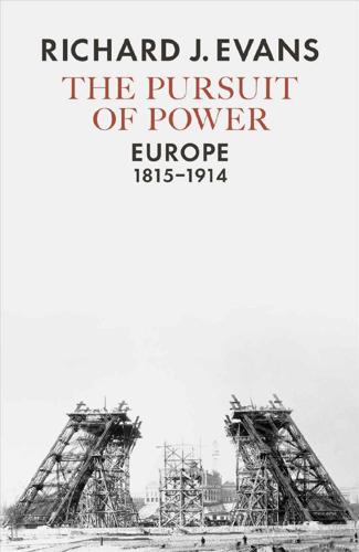
The Pursuit of Power: Europe, 1815-1914
by Richard J. Evans · 31 Aug 2016 · 976pp · 329,519 words
The Hunger Code: How to Reset Your Body's Fat Thermostat by Breaking the Ultra-Processed Food Habit
by Jason Fung · 3 Mar 2026 · 284pp · 76,656 words
The Domestic Revolution
by Ruth Goodman · 15 Apr 2020
The Dawn of Everything: A New History of Humanity
by David Graeber and David Wengrow · 18 Oct 2021
The AI Economy: Work, Wealth and Welfare in the Robot Age
by Roger Bootle · 4 Sep 2019 · 374pp · 111,284 words
The Costs of Connection: How Data Is Colonizing Human Life and Appropriating It for Capitalism
by Nick Couldry and Ulises A. Mejias · 19 Aug 2019 · 458pp · 116,832 words
Escape From Rome: The Failure of Empire and the Road to Prosperity
by Walter Scheidel · 14 Oct 2019 · 1,014pp · 237,531 words
Guns, germs, and steel: the fates of human societies
by Jared M. Diamond · 15 Jul 2005
Civilization: The West and the Rest
by Niall Ferguson · 28 Feb 2011 · 790pp · 150,875 words
The Rise and Fall of the Third Chimpanzee
by Jared Diamond · 2 Jan 1991 · 436pp · 140,256 words
Uncommon Grounds: The History of Coffee and How It Transformed Our World
by Mark Pendergrast · 2 Jan 2000 · 564pp · 153,720 words
To the Ends of the Earth: Scotland's Global Diaspora, 1750-2010
by T M Devine · 25 Aug 2011
This Changes Everything: Capitalism vs. The Climate
by Naomi Klein · 15 Sep 2014 · 829pp · 229,566 words
The World Without Us
by Alan Weisman · 5 Aug 2008 · 482pp · 106,041 words
Shadow of the Silk Road
by Colin Thubron · 1 Jan 2006 · 419pp · 124,522 words
The Sum of All Fears
by Tom Clancy · 2 Jan 1989
Pastwatch The Redemption of Christopher Colombus
by Orson Scott Card · 30 Jan 2012 · 211pp · 22,862 words
City: A Guidebook for the Urban Age
by P. D. Smith · 19 Jun 2012
Global Crisis: War, Climate Change and Catastrophe in the Seventeenth Century
by Geoffrey Parker · 29 Apr 2013 · 1,773pp · 486,685 words
Future Crimes: Everything Is Connected, Everyone Is Vulnerable and What We Can Do About It
by Marc Goodman · 24 Feb 2015 · 677pp · 206,548 words
Ghost Fleet: A Novel of the Next World War
by P. W. Singer and August Cole · 28 Jun 2015 · 537pp · 149,628 words
The Origins of Political Order: From Prehuman Times to the French Revolution
by Francis Fukuyama · 11 Apr 2011 · 740pp · 217,139 words
When Cultures Collide: Leading Across Cultures
by Richard D. Lewis · 1 Jan 1996
Lurking: How a Person Became a User
by Joanne McNeil · 25 Feb 2020 · 239pp · 80,319 words

The Moral Animal: Evolutionary Psychology and Everyday Life
by Robert Wright · 1 Jan 1994 · 604pp · 161,455 words
The Rise and Fall of Nations: Forces of Change in the Post-Crisis World
by Ruchir Sharma · 5 Jun 2016 · 566pp · 163,322 words
The Green New Deal: Why the Fossil Fuel Civilization Will Collapse by 2028, and the Bold Economic Plan to Save Life on Earth
by Jeremy Rifkin · 9 Sep 2019 · 327pp · 84,627 words
Augmented: Life in the Smart Lane
by Brett King · 5 May 2016 · 385pp · 111,113 words
The Bad-Ass Librarians of Timbuktu: And Their Race to Save the World's Most Precious Manuscripts
by Joshua Hammer · 18 Apr 2016 · 297pp · 83,563 words
American Kingpin: The Epic Hunt for the Criminal Mastermind Behind the Silk Road
by Nick Bilton · 15 Mar 2017 · 349pp · 109,304 words
An Empire of Wealth: Rise of American Economy Power 1607-2000
by John Steele Gordon · 12 Oct 2009 · 519pp · 148,131 words
Divided: Why We're Living in an Age of Walls
by Tim Marshall · 8 Mar 2018 · 256pp · 75,139 words
The Future We Choose: Surviving the Climate Crisis
by Christiana Figueres and Tom Rivett-Carnac · 25 Feb 2020 · 197pp · 49,296 words

Antonio-s-Gun-and-Delfino-s-Dream-True-Tales-of-Mexican-Migration
by Unknown
Arabs: A 3,000 Year History of Peoples, Tribes and Empires
by Tim Mackintosh-Smith · 2 Mar 2019
Destined for War: America, China, and Thucydides's Trap
by Graham Allison · 29 May 2017 · 518pp · 128,324 words
Worth Dying For: The Power and Politics of Flags
by Tim Marshall · 21 Sep 2016 · 276pp · 78,061 words
On Grand Strategy
by John Lewis Gaddis · 3 Apr 2018 · 461pp · 109,656 words
Decoding the World: A Roadmap for the Questioner
by Po Bronson · 14 Jul 2020 · 320pp · 95,629 words

A History of Judaism
by Martin Goodman · 25 Oct 2017 · 768pp · 252,874 words
Worn: A People's History of Clothing
by Sofi Thanhauser · 25 Jan 2022 · 592pp · 133,460 words
Unfinished Empire: The Global Expansion of Britain
by John Darwin · 12 Feb 2013
The Empire Project: The Rise and Fall of the British World-System, 1830–1970
by John Darwin · 23 Sep 2009
Test Gods: Virgin Galactic and the Making of a Modern Astronaut
by Nicholas Schmidle · 3 May 2021 · 342pp · 101,370 words

The Habsburgs: To Rule the World
by Martyn Rady · 24 Aug 2020 · 461pp · 139,924 words
Cuba: An American History
by Ada Ferrer · 6 Sep 2021 · 723pp · 211,892 words

Work! Consume! Die!
by Frankie Boyle · 12 Oct 2011
The Perfect Police State: An Undercover Odyssey Into China's Terrifying Surveillance Dystopia of the Future
by Geoffrey Cain · 28 Jun 2021 · 340pp · 90,674 words
Our Moon: How Earth's Celestial Companion Transformed the Planet, Guided Evolution, and Made Us Who We Are
by Rebecca Boyle · 16 Jan 2024 · 354pp · 109,574 words
Shantaram: A Novel
by Gregory David Roberts · 12 Oct 2004 · 1,222pp · 385,226 words
Nuts and Bolts: Seven Small Inventions That Changed the World (In a Big Way)
by Roma Agrawal · 2 Mar 2023 · 290pp · 80,461 words
Likewar: The Weaponization of Social Media
by Peter Warren Singer and Emerson T. Brooking · 15 Mar 2018
Accessory to War: The Unspoken Alliance Between Astrophysics and the Military
by Neil Degrasse Tyson and Avis Lang · 10 Sep 2018 · 745pp · 207,187 words
Nomads: The Wanderers Who Shaped Our World
by Anthony Sattin · 25 May 2022 · 412pp · 121,164 words
Nomad Century: How Climate Migration Will Reshape Our World
by Gaia Vince · 22 Aug 2022 · 302pp · 92,206 words

Uprooting: From the Caribbean to the Countryside - Finding Home in an English Country Garden
by Marchelle Farrell · 2 Aug 2023 · 217pp · 76,056 words
Belgium - Culture Smart!: The Essential Guide to Customs & Culture
by Bernadett Varga · 14 Aug 2022
Insight Guides Pocket Helsinki
by Insight Guides · 12 Dec 2017
Homeland: The War on Terror in American Life
by Richard Beck · 2 Sep 2024 · 715pp · 212,449 words
The River of Lost Footsteps
by Thant Myint-U · 14 Apr 2006

Alphabetical: How Every Letter Tells a Story
by Michael Rosen · 7 Nov 2013 · 321pp · 100,923 words
The End of Power: From Boardrooms to Battlefields and Churches to States, Why Being in Charge Isn’t What It Used to Be
by Moises Naim · 5 Mar 2013 · 474pp · 120,801 words
Cocaine Nation: How the White Trade Took Over the World
by Thomas Feiling · 20 Jul 2010 · 376pp · 121,254 words
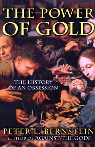
The Power of Gold: The History of an Obsession
by Peter L. Bernstein · 1 Jan 2000 · 497pp · 153,755 words
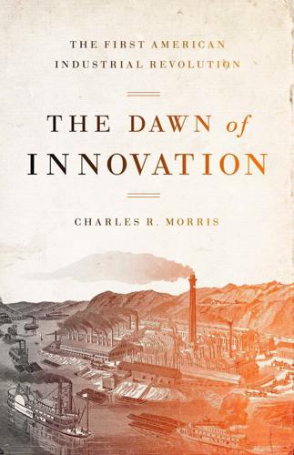
The Dawn of Innovation: The First American Industrial Revolution
by Charles R. Morris · 1 Jan 2012 · 456pp · 123,534 words
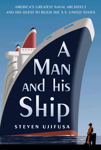
A Man and His Ship: America's Greatest Naval Architect and His Quest to Build the S.S. United States
by Steven Ujifusa · 9 Jul 2012 · 650pp · 155,108 words
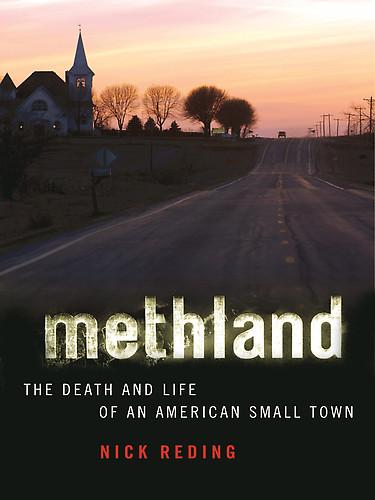
Methland: The Death and Life of an American Small Town
by Nick Reding · 1 Jul 2009 · 250pp · 83,367 words
Crucible: The Long End of the Great War and the Birth of a New World, 1917-1924
by Charles Emmerson · 14 Oct 2019 · 950pp · 297,713 words
The Wires of War: Technology and the Global Struggle for Power
by Jacob Helberg · 11 Oct 2021 · 521pp · 118,183 words
Growth: From Microorganisms to Megacities
by Vaclav Smil · 23 Sep 2019
The Sinner and the Saint: Dostoevsky and the Gentleman Murderer Who Inspired a Masterpiece
by Kevin Birmingham · 16 Nov 2021 · 559pp · 155,777 words
Collapse: How Societies Choose to Fail or Succeed
by Jared Diamond · 2 Jan 2008 · 801pp · 242,104 words
This Sceptred Isle
by Christopher Lee · 19 Jan 2012 · 796pp · 242,660 words
Triumph of the City: How Our Greatest Invention Makes Us Richer, Smarter, Greener, Healthier, and Happier
by Edward L. Glaeser · 1 Jan 2011 · 598pp · 140,612 words
Common Wealth: Economics for a Crowded Planet
by Jeffrey Sachs · 1 Jan 2008 · 421pp · 125,417 words
The Years of Rice and Salt
by Kim Stanley Robinson · 2 Jun 2003 · 762pp · 246,045 words
The Transparent Society: Will Technology Force Us to Choose Between Privacy and Freedom?
by David Brin · 1 Jan 1998 · 205pp · 18,208 words
The Knowledge: How to Rebuild Our World From Scratch
by Lewis Dartnell · 15 Apr 2014 · 398pp · 100,679 words
The Next 100 Years: A Forecast for the 21st Century
by George Friedman · 30 Jul 2008 · 278pp · 88,711 words
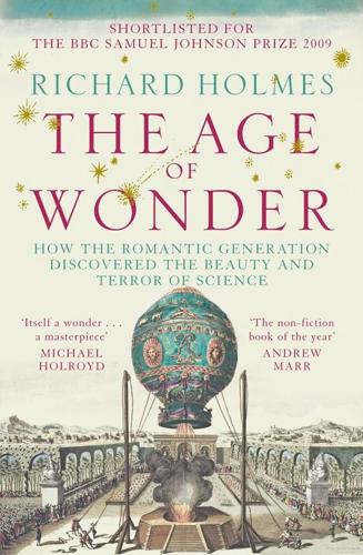
The Age of Wonder
by Richard Holmes · 15 Jan 2008 · 778pp · 227,196 words
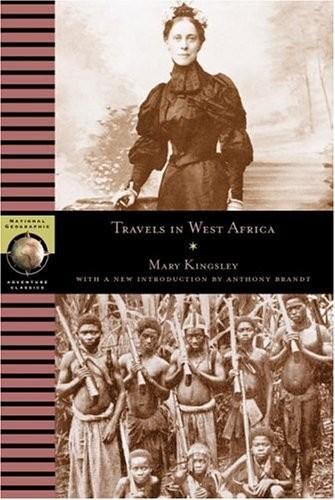
Travels in West Africa
by Mary Henrietta Kingsley · 1 Jan 1897 · 523pp · 195,307 words
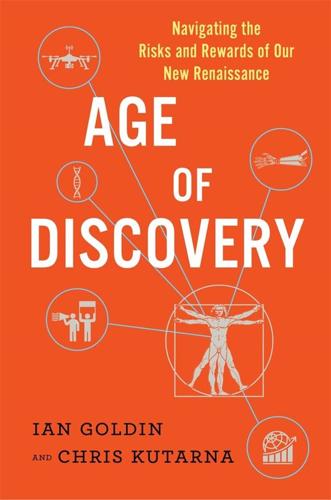
Age of Discovery: Navigating the Risks and Rewards of Our New Renaissance
by Ian Goldin and Chris Kutarna · 23 May 2016 · 437pp · 113,173 words
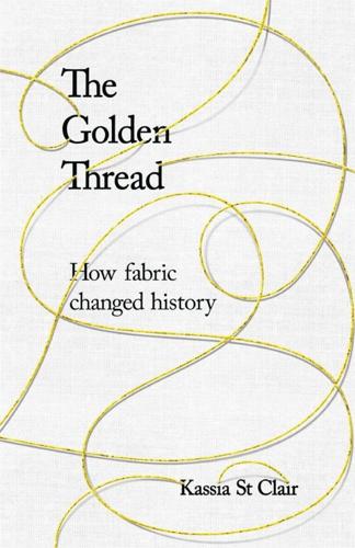
The Golden Thread: How Fabric Changed History
by Kassia St Clair · 3 Oct 2018 · 480pp · 112,463 words
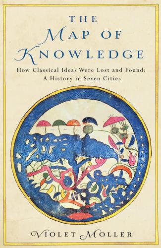
The Map of Knowledge: How Classical Ideas Were Lost and Found: A History in Seven Cities
by Violet Moller · 21 Feb 2019

Disrupt and Deny: Spies, Special Forces, and the Secret Pursuit of British Foreign Policy
by Rory Cormac · 14 Jun 2018 · 407pp
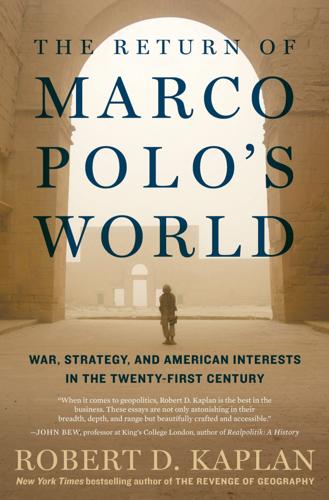
The Return of Marco Polo's World: War, Strategy, and American Interests in the Twenty-First Century
by Robert D. Kaplan · 6 Mar 2018 · 247pp · 78,961 words
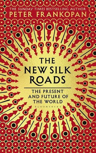
The New Silk Roads: The Present and Future of the World
by Peter Frankopan · 14 Jun 2018 · 352pp · 80,030 words
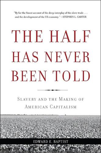
The Half Has Never Been Told: Slavery and the Making of American Capitalism
by Edward E. Baptist · 24 Oct 2016
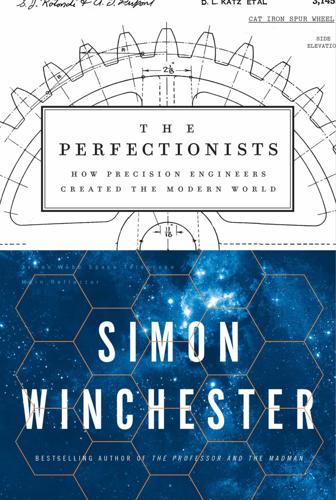
The Perfectionists: How Precision Engineers Created the Modern World
by Simon Winchester · 7 May 2018 · 449pp · 129,511 words
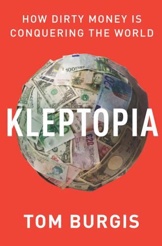
Kleptopia: How Dirty Money Is Conquering the World
by Tom Burgis · 7 Sep 2020 · 476pp · 139,761 words
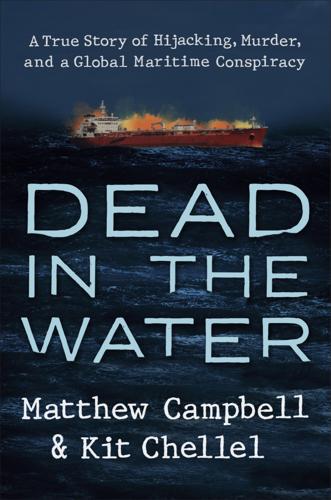
Dead in the Water: A True Story of Hijacking, Murder, and a Global Maritime Conspiracy
by Matthew Campbell and Kit Chellel · 2 May 2022 · 363pp · 98,496 words

The Warhol Economy
by Elizabeth Currid-Halkett · 15 Jan 2020 · 320pp · 90,115 words
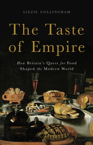
The Taste of Empire: How Britain's Quest for Food Shaped the Modern World
by Lizzie Collingham · 2 Oct 2017 · 452pp · 130,041 words
Power and Progress: Our Thousand-Year Struggle Over Technology and Prosperity
by Daron Acemoglu and Simon Johnson · 15 May 2023 · 619pp · 177,548 words
Chokepoints: American Power in the Age of Economic Warfare
by Edward Fishman · 25 Feb 2025 · 884pp · 221,861 words
El Paso: Five Families and One Hundred Years of Blood, Migration, Race, and Memory
by Jazmine Ulloa · 3 Mar 2026 · 395pp · 116,052 words

Shady Characters: The Secret Life of Punctuation, Symbols, and Other Typographical Marks
by Keith Houston · 23 Sep 2013
Open Space: From Earth to Eternity--the Global Race to Explore and Conquer the Cosmos
by David Ariosto · 24 Mar 2026 · 433pp · 116,344 words
1947: Where Now Begins
by Elisabeth Åsbrink · 31 Jul 2016 · 215pp · 60,489 words
Wonderland: How Play Made the Modern World
by Steven Johnson · 15 Nov 2016 · 322pp · 88,197 words
The World for Sale: Money, Power and the Traders Who Barter the Earth’s Resources
by Javier Blas and Jack Farchy · 25 Feb 2021 · 565pp · 134,138 words
The Elements of Power: A Story of War, Technology, and the Dirtiest Supply Chain on Earth
by Nicolas Niarchos · 20 Jan 2026 · 654pp · 170,150 words
The Case for Israel
by Alan Dershowitz · 31 Jul 2003
Everything Is Tuberculosis: The History and Persistence of Our Deadliest Infection
by John Green · 18 Mar 2025 · 158pp · 49,742 words
The Regency Revolution: Jane Austen, Napoleon, Lord Byron and the Making of the Modern World
by Robert Morrison · 3 Jul 2019
Why the Dutch Are Different: A Journey Into the Hidden Heart of the Netherlands: From Amsterdam to Zwarte Piet, the Acclaimed Guide to Travel in Holland
by Ben Coates · 23 Sep 2015 · 300pp · 99,410 words
The Survival of the City: Human Flourishing in an Age of Isolation
by Edward Glaeser and David Cutler · 14 Sep 2021 · 735pp · 165,375 words
The Looting Machine: Warlords, Oligarchs, Corporations, Smugglers, and the Theft of Africa's Wealth
by Tom Burgis · 24 Mar 2015 · 413pp · 119,379 words
Smart Cities: Big Data, Civic Hackers, and the Quest for a New Utopia
by Anthony M. Townsend · 29 Sep 2013 · 464pp · 127,283 words
Liberalism at Large: The World According to the Economist
by Alex Zevin · 12 Nov 2019 · 767pp · 208,933 words
Physics of the Future: How Science Will Shape Human Destiny and Our Daily Lives by the Year 2100
by Michio Kaku · 15 Mar 2011 · 523pp · 148,929 words
Ashes to Ashes: America's Hundred-Year Cigarette War, the Public Health, and the Unabashed Triumph of Philip Morris
by Richard Kluger · 1 Jan 1996 · 1,157pp · 379,558 words
Ghosts of Empire: Britain's Legacies in the Modern World
by Kwasi Kwarteng · 14 Aug 2011 · 670pp · 169,815 words
A Swamp Full of Dollars: Pipelines and Paramilitaries at Nigeria's Oil Frontier
by Michael Peel · 1 Jan 2009 · 241pp · 83,523 words
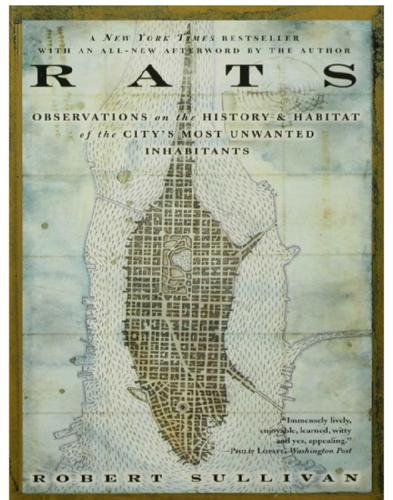
Rats
by Robert Sullivan · 8 May 2009 · 307pp · 96,974 words
The Last Lingua Franca: English Until the Return of Babel
by Nicholas Ostler · 23 Nov 2010 · 484pp · 120,507 words
Life Inc.: How the World Became a Corporation and How to Take It Back
by Douglas Rushkoff · 1 Jun 2009 · 422pp · 131,666 words
Collapse
by Jared Diamond · 25 Apr 2011 · 753pp · 233,306 words
Pathfinders: The Golden Age of Arabic Science
by Jim Al-Khalili · 28 Sep 2010 · 467pp · 114,570 words
High-Frequency Trading: A Practical Guide to Algorithmic Strategies and Trading Systems
by Irene Aldridge · 1 Dec 2009 · 354pp · 26,550 words
Culture & Empire: Digital Revolution
by Pieter Hintjens · 11 Mar 2013 · 349pp · 114,038 words
Empire: How Britain Made the Modern World
by Niall Ferguson · 1 Jan 2002 · 469pp · 146,487 words

Drinking in America: Our Secret History
by Susan Cheever · 12 Oct 2015 · 263pp · 81,542 words
Capitalism in America: A History
by Adrian Wooldridge and Alan Greenspan · 15 Oct 2018 · 585pp · 151,239 words

Technological Revolutions and Financial Capital: The Dynamics of Bubbles and Golden Ages
by Carlota Pérez · 1 Jan 2002
The Darkening Age: The Christian Destruction of the Classical World
by Catherine Nixey · 20 Sep 2017
The City: A Global History
by Joel Kotkin · 1 Jan 2005
Empires of the Weak: The Real Story of European Expansion and the Creation of the New World Order
by Jason Sharman · 5 Feb 2019 · 265pp · 71,143 words
Amazon: How the World’s Most Relentless Retailer Will Continue to Revolutionize Commerce
by Natalie Berg and Miya Knights · 28 Jan 2019 · 404pp · 95,163 words
The Future Is Asian
by Parag Khanna · 5 Feb 2019 · 496pp · 131,938 words
World Cities and Nation States
by Greg Clark and Tim Moonen · 19 Dec 2016
Smart Cities, Digital Nations
by Caspar Herzberg · 13 Apr 2017
The Quiet Coup: Neoliberalism and the Looting of America
by Mehrsa Baradaran · 7 May 2024 · 470pp · 158,007 words
Pocket Rough Guide Hong Kong & Macau
by Rough Guides · 18 Jul 2024
Rocket Dreams: Musk, Bezos and the Trillion-Dollar Space Race
by Christian Davenport · 6 Sep 2025 · 441pp · 127,950 words

A Second Chance
by Jodi Taylor · 31 Dec 2012
The Horse, the Wheel, and Language: How Bronze-Age Riders From the Eurasian Steppes Shaped the Modern World
by David W. Anthony · 26 Jul 2010 · 658pp · 195,182 words
Capital
by Rana Dasgupta · 14 May 2014 · 506pp · 158,215 words
Why Nations Fail: The Origins of Power, Prosperity, and Poverty
by Daron Acemoglu and James Robinson · 20 Mar 2012 · 547pp · 172,226 words
Grave New World: The End of Globalization, the Return of History
by Stephen D. King · 22 May 2017 · 354pp · 92,470 words
A History of Future Cities
by Daniel Brook · 18 Feb 2013 · 489pp · 132,734 words
The Musical Human: A History of Life on Earth
by Michael Spitzer · 31 Mar 2021 · 632pp · 163,143 words

The Fallen Blade: Act One of the Assassini
by Jon Courtenay Grimwood · 27 Jan 2011 · 470pp · 118,051 words
Stakeholder Capitalism: A Global Economy That Works for Progress, People and Planet
by Klaus Schwab · 7 Jan 2021 · 460pp · 107,454 words
Baghdad Without a Map and Other Misadventures in Arabia
by Tony Horwitz · 1 Jan 1991 · 302pp · 91,517 words
An Island to Oneself: The Story of Six Years on a Desert Island
by Tom Neale and Noel Barber · 31 Aug 1990
How We Got Here: A Slightly Irreverent History of Technology and Markets
by Andy Kessler · 13 Jun 2005 · 218pp · 63,471 words
In the Plex: How Google Thinks, Works, and Shapes Our Lives
by Steven Levy · 12 Apr 2011 · 666pp · 181,495 words
The Big Ratchet: How Humanity Thrives in the Face of Natural Crisis
by Ruth Defries · 8 Sep 2014 · 342pp · 88,736 words
How I Became a Quant: Insights From 25 of Wall Street's Elite
by Richard R. Lindsey and Barry Schachter · 30 Jun 2007
The World of Caffeine: The Science and Culture of the World's Most Popular Drug
by Bennett Alan Weinberg and Bonnie K. Bealer · 5 Dec 2000 · 559pp · 174,054 words

Unfamiliar Fishes
by Sarah Vowell · 22 Mar 2011 · 208pp · 64,113 words
Owning the Earth: The Transforming History of Land Ownership
by Andro Linklater · 12 Nov 2013 · 603pp · 182,826 words
The Default Line: The Inside Story of People, Banks and Entire Nations on the Edge
by Faisal Islam · 28 Aug 2013 · 475pp · 155,554 words
Pacific: Silicon Chips and Surfboards, Coral Reefs and Atom Bombs, Brutal Dictators, Fading Empires, and the Coming Collision of the World's Superpowers
by Simon Winchester · 27 Oct 2015 · 535pp · 151,217 words
Nobody's Perfect: Writings From the New Yorker
by Anthony Lane · 26 Aug 2002 · 879pp · 309,222 words
Empire of Things: How We Became a World of Consumers, From the Fifteenth Century to the Twenty-First
by Frank Trentmann · 1 Dec 2015 · 1,213pp · 376,284 words
A Concise History of Modern India (Cambridge Concise Histories)
by Barbara D. Metcalf and Thomas R. Metcalf · 27 Sep 2006
Origin Story: A Big History of Everything
by David Christian · 21 May 2018 · 334pp · 100,201 words
If Mayors Ruled the World: Dysfunctional Nations, Rising Cities
by Benjamin R. Barber · 5 Nov 2013 · 501pp · 145,943 words
The Deluge: The Great War, America and the Remaking of the Global Order, 1916-1931
by Adam Tooze · 13 Nov 2014 · 1,057pp · 239,915 words
Inglorious Empire: What the British Did to India
by Shashi Tharoor · 1 Feb 2018 · 370pp · 111,129 words
Tobacco: A Cultural History of How an Exotic Plant Seduced Civilization
by Iain Gately · 27 Oct 2001 · 434pp · 124,153 words

Posh Boys: How English Public Schools Ruin Britain
by Robert Verkaik · 14 Apr 2018 · 419pp · 119,476 words

The Cigarette: A Political History
by Sarah Milov · 1 Oct 2019
Horizons: The Global Origins of Modern Science
by James Poskett · 22 Mar 2022 · 564pp · 168,696 words

A Place for Everything: The Curious History of Alphabetical Order
by Judith Flanders · 6 Feb 2020 · 404pp · 110,942 words
A Half-Built Garden
by Ruthanna Emrys · 25 Jul 2022 · 431pp · 127,720 words
England: Seven Myths That Changed a Country – and How to Set Them Straight
by Tom Baldwin and Marc Stears · 24 Apr 2024 · 357pp · 132,377 words
Capitalism and Its Critics: A History: From the Industrial Revolution to AI
by John Cassidy · 12 May 2025 · 774pp · 238,244 words
The Outcast Blade
by Jon Courtenay Grimwood · 26 Mar 2012 · 444pp · 103,367 words
The Great Convergence: Information Technology and the New Globalization
by Richard Baldwin · 14 Nov 2016 · 606pp · 87,358 words
Stakeholder Capitalism: A Global Economy That Works for Progress, People and Planet
by Klaus Schwab and Peter Vanham · 27 Jan 2021 · 460pp · 107,454 words
The Sovereign Individual: How to Survive and Thrive During the Collapse of the Welfare State
by James Dale Davidson and William Rees-Mogg · 3 Feb 1997 · 582pp · 160,693 words
The Metropolitan Revolution: How Cities and Metros Are Fixing Our Broken Politics and Fragile Economy
by Bruce Katz and Jennifer Bradley · 10 Jun 2013
The WikiLeaks Files: The World According to US Empire
by Wikileaks · 24 Aug 2015 · 708pp · 176,708 words
Cheese and Culture: A History of Cheese and Its Place in Western Civilization
by Paul Kindstedt · 31 Mar 2012 · 297pp · 89,176 words
Reminiscences of a Stock Operator
by Edwin Lefèvre and William J. O'Neil · 14 May 1923 · 650pp · 204,878 words

The Price of Everything: And the Hidden Logic of Value
by Eduardo Porter · 4 Jan 2011 · 353pp · 98,267 words

Culture Shock! Costa Rica 30th Anniversary Edition
by Claire Wallerstein · 1 Mar 2011
In Pursuit of Privilege: A History of New York City's Upper Class and the Making of a Metropolis
by Clifton Hood · 1 Nov 2016 · 641pp · 182,927 words

Alcohol: A History
by Rod Phillips · 14 Oct 2014 · 531pp · 161,785 words
The Great Surge: The Ascent of the Developing World
by Steven Radelet · 10 Nov 2015 · 437pp · 115,594 words
Raw Data Is an Oxymoron
by Lisa Gitelman · 25 Jan 2013
Thieves of State: Why Corruption Threatens Global Security
by Sarah Chayes · 19 Jan 2015 · 352pp · 90,622 words
Blood, Sweat, and Pixels: The Triumphant, Turbulent Stories Behind How Video Games Are Made
by Jason Schreier · 4 Sep 2017 · 297pp · 90,806 words
A United Ireland: Why Unification Is Inevitable and How It Will Come About
by Kevin Meagher · 15 Nov 2016
Lost Kingdom: The Quest for Empire and the Making of the Russian Nation
by Serhii Plokhy · 9 Oct 2017 · 476pp · 138,420 words
Future Tense: Jews, Judaism, and Israel in the Twenty-First Century
by Jonathan Sacks · 19 Apr 2010 · 305pp · 97,214 words
Sapiens: A Brief History of Humankind
by Yuval Noah Harari · 1 Jan 2011 · 447pp · 141,811 words
Open: The Story of Human Progress
by Johan Norberg · 14 Sep 2020 · 505pp · 138,917 words
Money in the Metaverse: Digital Assets, Online Identities, Spatial Computing and Why Virtual Worlds Mean Real Business
by David G. W. Birch and Victoria Richardson · 28 Apr 2024 · 249pp · 74,201 words
QI: The Book of General Ignorance - The Noticeably Stouter Edition
by Lloyd, John and Mitchinson, John · 7 Oct 2010 · 624pp · 104,923 words

Saveur New American Comfort Food
by James Oseland · 20 Apr 2011
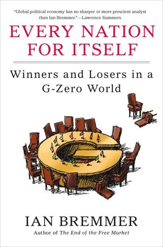
Every Nation for Itself: Winners and Losers in a G-Zero World
by Ian Bremmer · 30 Apr 2012 · 234pp · 63,149 words
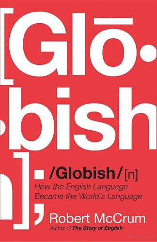
Globish: How the English Language Became the World's Language
by Robert McCrum · 24 May 2010 · 325pp · 99,983 words
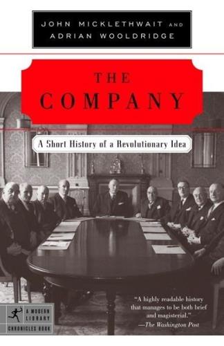
Company: A Short History of a Revolutionary Idea
by John Micklethwait and Adrian Wooldridge · 4 Mar 2003 · 196pp · 57,974 words
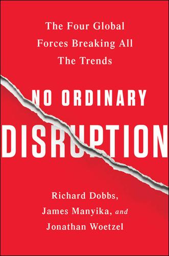
No Ordinary Disruption: The Four Global Forces Breaking All the Trends
by Richard Dobbs and James Manyika · 12 May 2015 · 389pp · 87,758 words
The End of Work
by Jeremy Rifkin · 28 Dec 1994 · 372pp · 152 words
Cocaine Politics: Drugs, Armies, and the CIA in Central America
by Peter Dale Scott and Jonathan Marshall · 1 Jan 1991
The Word for World Is Forest
by Ursula K. le Guin · 1 Mar 1972 · 125pp · 40,678 words
Move Fast and Break Things: How Facebook, Google, and Amazon Cornered Culture and Undermined Democracy
by Jonathan Taplin · 17 Apr 2017 · 222pp · 70,132 words
The Age of Em: Work, Love and Life When Robots Rule the Earth
by Robin Hanson · 31 Mar 2016 · 589pp · 147,053 words
The Truth Machine: The Blockchain and the Future of Everything
by Paul Vigna and Michael J. Casey · 27 Feb 2018 · 348pp · 97,277 words
The Third Pillar: How Markets and the State Leave the Community Behind
by Raghuram Rajan · 26 Feb 2019 · 596pp · 163,682 words
The WEIRDest People in the World: How the West Became Psychologically Peculiar and Particularly Prosperous
by Joseph Henrich · 7 Sep 2020 · 796pp · 223,275 words
A History of the World in Seven Cheap Things: A Guide to Capitalism, Nature, and the Future of the Planet
by Raj Patel and Jason W. Moore · 16 Oct 2017 · 335pp · 89,924 words
Hammer's German Grammar and Usage
by Martin Durrell · 15 Feb 2021 · 1,233pp · 239,919 words
Pax Technica: How the Internet of Things May Set Us Free or Lock Us Up
by Philip N. Howard · 27 Apr 2015 · 322pp · 84,752 words
Crack-Up Capitalism: Market Radicals and the Dream of a World Without Democracy
by Quinn Slobodian · 4 Apr 2023 · 360pp · 107,124 words
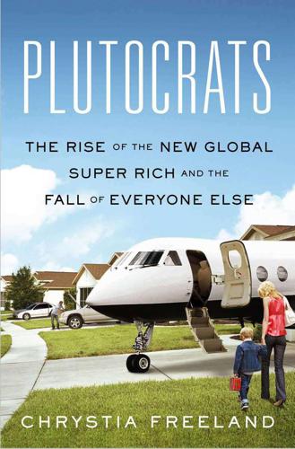
Plutocrats: The Rise of the New Global Super-Rich and the Fall of Everyone Else
by Chrystia Freeland · 11 Oct 2012 · 481pp · 120,693 words
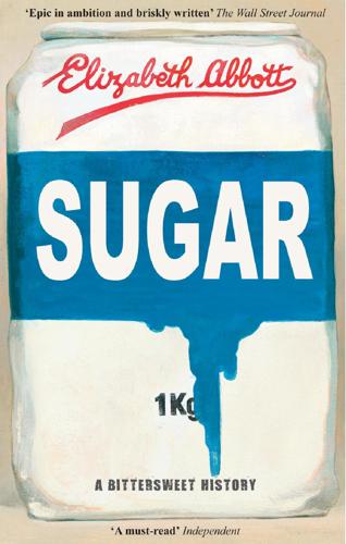
Sugar: A Bittersweet History
by Elizabeth Abbott · 14 Sep 2011 · 522pp · 144,511 words
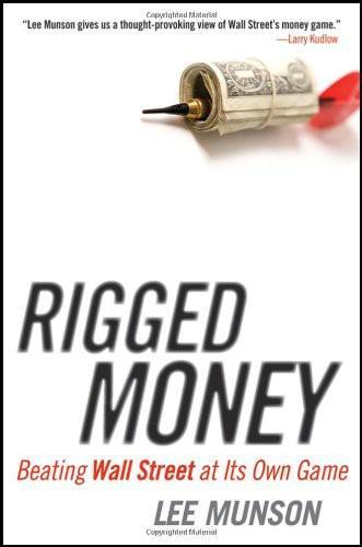
Rigged Money: Beating Wall Street at Its Own Game
by Lee Munson · 6 Dec 2011 · 236pp · 77,735 words
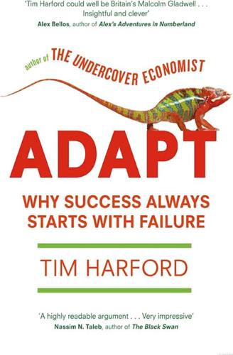
Adapt: Why Success Always Starts With Failure
by Tim Harford · 1 Jun 2011 · 459pp · 103,153 words
The Rational Optimist: How Prosperity Evolves
by Matt Ridley · 17 May 2010 · 462pp · 150,129 words
The Making of an Atlantic Ruling Class
by Kees Van der Pijl · 2 Jun 2014 · 572pp · 134,335 words
A History of the World in 6 Glasses
by Tom Standage · 1 Jan 2005 · 231pp · 72,656 words
When the Money Runs Out: The End of Western Affluence
by Stephen D. King · 17 Jun 2013 · 324pp · 90,253 words
White Trash: The 400-Year Untold History of Class in America
by Nancy Isenberg · 20 Jun 2016 · 709pp · 191,147 words
Red Flags: Why Xi's China Is in Jeopardy
by George Magnus · 10 Sep 2018 · 371pp · 98,534 words
The Reckoning: Financial Accountability and the Rise and Fall of Nations
by Jacob Soll · 28 Apr 2014 · 382pp · 105,166 words
The Pineapple: King of Fruits
by Francesca Beauman · 22 Feb 2011 · 324pp · 101,552 words
Enemy of All Mankind: A True Story of Piracy, Power, and History's First Global Manhunt
by Steven Johnson · 11 May 2020 · 299pp · 79,739 words
The Last Kings of Shanghai: The Rival Jewish Dynasties That Helped Create Modern China
by Jonathan Kaufman · 14 Sep 2020 · 415pp · 103,801 words

Four Battlegrounds
by Paul Scharre · 18 Jan 2023
How to Invent Everything: A Survival Guide for the Stranded Time Traveler
by Ryan North · 17 Sep 2018 · 643pp · 131,673 words
The Key Man: The True Story of How the Global Elite Was Duped by a Capitalist Fairy Tale
by Simon Clark and Will Louch · 14 Jul 2021 · 403pp · 105,550 words
Age of the City: Why Our Future Will Be Won or Lost Together
by Ian Goldin and Tom Lee-Devlin · 21 Jun 2023 · 248pp · 73,689 words
The Story of Work: A New History of Humankind
by Jan Lucassen · 26 Jul 2021 · 869pp · 239,167 words
Paper Promises
by Philip Coggan · 1 Dec 2011 · 376pp · 109,092 words
Money: 5,000 Years of Debt and Power
by Michel Aglietta · 23 Oct 2018 · 665pp · 146,542 words
The Technology Trap: Capital, Labor, and Power in the Age of Automation
by Carl Benedikt Frey · 17 Jun 2019 · 626pp · 167,836 words
Family Trade
by Stross, Charles · 6 Jan 2004 · 359pp · 98,396 words
QI: The Second Book of General Ignorance
by Lloyd, John and Mitchinson, John · 7 Oct 2010 · 469pp · 97,582 words
Bad Money: Reckless Finance, Failed Politics, and the Global Crisis of American Capitalism
by Kevin Phillips · 31 Mar 2008 · 422pp · 113,830 words

Fewer, Better Things: The Hidden Wisdom of Objects
by Glenn Adamson · 6 Aug 2018 · 220pp · 64,234 words
The Despot's Accomplice: How the West Is Aiding and Abetting the Decline of Democracy
by Brian Klaas · 15 Mar 2017
The Lessons of History
by Will Durant and Ariel Durant · 1 Jan 1968 · 133pp · 31,263 words
We the Corporations: How American Businesses Won Their Civil Rights
by Adam Winkler · 27 Feb 2018 · 581pp · 162,518 words

The Big Nine: How the Tech Titans and Their Thinking Machines Could Warp Humanity
by Amy Webb · 5 Mar 2019 · 340pp · 97,723 words
A Very Strange Way to Go to War: The Canberra in the Falklands
by Andrew Vine · 30 Jun 2012 · 367pp · 122,140 words
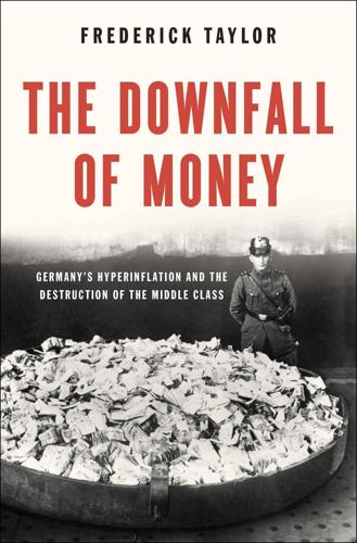
The Downfall of Money: Germany's Hyperinflation and the Destruction of the Middle Class
by Frederick Taylor · 16 Sep 2013 · 473pp · 132,344 words
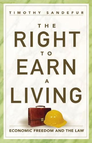
The Right to Earn a Living: Economic Freedom and the Law
by Timothy Sandefur · 16 Aug 2010 · 399pp · 155,913 words

Affluenza: The All-Consuming Epidemic
by John de Graaf, David Wann, Thomas H Naylor and David Horsey · 1 Jan 2001 · 378pp · 102,966 words
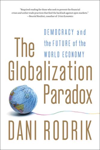
The Globalization Paradox: Democracy and the Future of the World Economy
by Dani Rodrik · 23 Dec 2010 · 356pp · 103,944 words
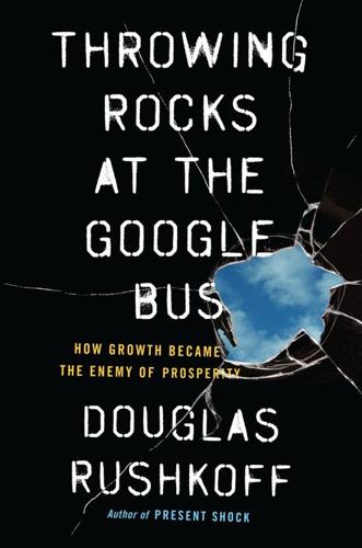
Throwing Rocks at the Google Bus: How Growth Became the Enemy of Prosperity
by Douglas Rushkoff · 1 Mar 2016 · 366pp · 94,209 words
The Future of Money
by Bernard Lietaer · 28 Apr 2013
The Internet of Money
by Andreas M. Antonopoulos · 28 Aug 2016 · 200pp · 47,378 words
China's Disruptors: How Alibaba, Xiaomi, Tencent, and Other Companies Are Changing the Rules of Business
by Edward Tse · 13 Jul 2015 · 233pp · 64,702 words
Apocalypse Never: Why Environmental Alarmism Hurts Us All
by Michael Shellenberger · 28 Jun 2020
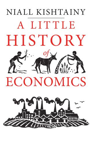
A Little History of Economics
by Niall Kishtainy · 15 Jan 2017 · 272pp · 83,798 words

This Is Your Country on Drugs: The Secret History of Getting High in America
by Ryan Grim · 7 Jul 2009 · 334pp · 93,162 words
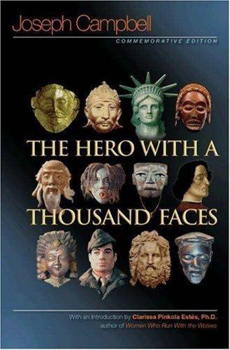
The Hero With a Thousand Faces
by Joseph Campbell · 14 Apr 2004
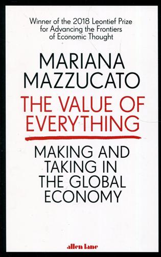
Value of Everything: An Antidote to Chaos The
by Mariana Mazzucato · 25 Apr 2018 · 457pp · 125,329 words
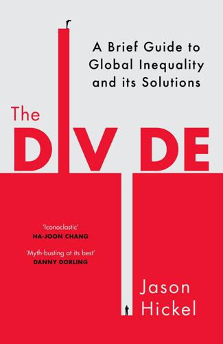
The Divide: A Brief Guide to Global Inequality and Its Solutions
by Jason Hickel · 3 May 2017 · 332pp · 106,197 words
The Coming of Neo-Feudalism: A Warning to the Global Middle Class
by Joel Kotkin · 11 May 2020 · 393pp · 91,257 words
Coffeeland: One Man's Dark Empire and the Making of Our Favorite Drug
by Augustine Sedgewick · 6 Apr 2020 · 668pp · 159,523 words

Other Pandemic: How QAnon Contaminated the World
by James Ball · 19 Jul 2023 · 317pp · 87,048 words
The Evolution of God
by Robert Wright · 8 Jun 2009
Seven Crashes: The Economic Crises That Shaped Globalization
by Harold James · 15 Jan 2023 · 469pp · 137,880 words
Four Lost Cities: A Secret History of the Urban Age
by Annalee Newitz · 2 Feb 2021 · 290pp · 82,220 words

The Wake-Up Call: Why the Pandemic Has Exposed the Weakness of the West, and How to Fix It
by John Micklethwait and Adrian Wooldridge · 1 Sep 2020 · 134pp · 41,085 words
Limitless: The Federal Reserve Takes on a New Age of Crisis
by Jeanna Smialek · 27 Feb 2023 · 601pp · 135,202 words
The People's Platform: Taking Back Power and Culture in the Digital Age
by Astra Taylor · 4 Mar 2014 · 283pp · 85,824 words
China into Africa: trade, aid, and influence
by Robert I. Rotberg · 15 Nov 2008 · 651pp · 135,818 words
The Age of Stagnation: Why Perpetual Growth Is Unattainable and the Global Economy Is in Peril
by Satyajit Das · 9 Feb 2016 · 327pp · 90,542 words
Nuclear War and Environmental Catastrophe
by Noam Chomsky and Laray Polk · 29 Apr 2013
Foundation
by Isaac Asimov · 31 May 2004
The Code of Capital: How the Law Creates Wealth and Inequality
by Katharina Pistor · 27 May 2019 · 316pp · 117,228 words
Team Human
by Douglas Rushkoff · 22 Jan 2019 · 196pp · 54,339 words
Space 2.0
by Rod Pyle · 2 Jan 2019 · 352pp · 87,930 words

Searches: Selfhood in the Digital Age
by Vauhini Vara · 8 Apr 2025 · 301pp · 105,209 words
Starbucked: A Double Tall Tale of Caffeine, Commerce, and Culture
by Taylor Clark · 5 Nov 2007 · 304pp · 96,930 words
The Death of Money: The Coming Collapse of the International Monetary System
by James Rickards · 7 Apr 2014 · 466pp · 127,728 words
Silk Road
by Eileen Ormsby · 1 Nov 2014 · 269pp · 79,285 words
Shadows of Empire: The Anglosphere in British Politics
by Michael Kenny and Nick Pearce · 5 Jun 2018 · 215pp · 64,460 words
After the Fall: Being American in the World We've Made
by Ben Rhodes · 1 Jun 2021 · 342pp · 114,118 words
Essential: How the Pandemic Transformed the Long Fight for Worker Justice
by Jamie K. McCallum · 15 Nov 2022 · 349pp · 99,230 words
The End of Cheap China: Economic and Cultural Trends That Will Disrupt the World
by Shaun Rein · 27 Mar 2012 · 251pp · 63,630 words
Blindside: How to Anticipate Forcing Events and Wild Cards in Global Politics
by Francis Fukuyama · 27 Aug 2007
Against the Gods: The Remarkable Story of Risk
by Peter L. Bernstein · 23 Aug 1996 · 415pp · 125,089 words
Tyler Cowen-Discover Your Inner Economist Use Incentives to Fall in Love, Survive Your Next Meeting, and Motivate Your Dentist-Plume (2008)
by Unknown · 20 Sep 2008 · 246pp · 116 words
Seasteading: How Floating Nations Will Restore the Environment, Enrich the Poor, Cure the Sick, and Liberate Humanity From Politicians
by Joe Quirk and Patri Friedman · 21 Mar 2017 · 441pp · 113,244 words
Global Inequality: A New Approach for the Age of Globalization
by Branko Milanovic · 10 Apr 2016 · 312pp · 91,835 words

DIY Kombucha: 60 Nourishing Homemade Tonics for Health and Happiness
by Katherine Green and Rana Chang · 2 Mar 2015 · 207pp · 27,556 words
Who Rules the World?
by Noam Chomsky
Losing Control: The Emerging Threats to Western Prosperity
by Stephen D. King · 14 Jun 2010 · 561pp · 87,892 words
The Participation Revolution: How to Ride the Waves of Change in a Terrifyingly Turbulent World
by Neil Gibb · 15 Feb 2018 · 217pp · 63,287 words
The Long Good Buy: Analysing Cycles in Markets
by Peter Oppenheimer · 3 May 2020 · 333pp · 76,990 words
Survival of the Friendliest: Understanding Our Origins and Rediscovering Our Common Humanity
by Brian Hare and Vanessa Woods · 13 Jul 2020

The Market for Force: The Consequences of Privatizing Security
by Deborah D. Avant · 17 Oct 2010 · 872pp · 135,196 words
The Age of Turbulence: Adventures in a New World (Hardback) - Common
by Alan Greenspan · 14 Jun 2007
Double Entry: How the Merchants of Venice Shaped the Modern World - and How Their Invention Could Make or Break the Planet
by Jane Gleeson-White · 14 May 2011 · 274pp · 66,721 words

The Hidden Family
by Charles Stross · 2 May 2005 · 344pp · 100,046 words
Two Nations, Indivisible: A History of Inequality in America: A History of Inequality in America
by Jamie Bronstein · 29 Oct 2016 · 332pp · 89,668 words
How Boards Work: And How They Can Work Better in a Chaotic World
by Dambisa Moyo · 3 May 2021 · 272pp · 76,154 words
The Human City: Urbanism for the Rest of Us
by Joel Kotkin · 11 Apr 2016 · 565pp · 122,605 words
Ten Lessons for a Post-Pandemic World
by Fareed Zakaria · 5 Oct 2020 · 289pp · 86,165 words
Doppelganger: A Trip Into the Mirror World
by Naomi Klein · 11 Sep 2023
The Hidden History of Burma
by Thant Myint-U
Kill Switch: The Rise of the Modern Senate and the Crippling of American Democracy
by Adam Jentleson · 12 Jan 2021 · 400pp · 108,843 words
The Accidental Theorist: And Other Dispatches From the Dismal Science
by Paul Krugman · 18 Feb 2010 · 162pp · 51,473 words
Servant Economy: Where America's Elite Is Sending the Middle Class
by Jeff Faux · 16 May 2012 · 364pp · 99,613 words
Empireland: How Imperialism Has Shaped Modern Britain
by Sathnam Sanghera · 28 Jan 2021 · 430pp · 111,038 words
The Great Turning: From Empire to Earth Community
by David C. Korten · 1 Jan 2001
How to Be Idle
by Tom Hodgkinson · 1 Jan 2004 · 354pp · 93,882 words
The Year Without Pants: Wordpress.com and the Future of Work
by Scott Berkun · 9 Sep 2013 · 361pp · 76,849 words
Rocket Billionaires: Elon Musk, Jeff Bezos, and the New Space Race
by Tim Fernholz · 20 Mar 2018 · 328pp · 96,141 words
Blood and Oil: Mohammed Bin Salman's Ruthless Quest for Global Power
by Bradley Hope and Justin Scheck · 14 Sep 2020 · 339pp · 103,546 words
The Extreme Centre: A Warning
by Tariq Ali · 22 Jan 2015 · 160pp · 46,449 words
The Post-American World: Release 2.0
by Fareed Zakaria · 1 Jan 2008 · 344pp · 93,858 words
How to Fix Copyright
by William Patry · 3 Jan 2012 · 336pp · 90,749 words
Consumed: How Markets Corrupt Children, Infantilize Adults, and Swallow Citizens Whole
by Benjamin R. Barber · 1 Jan 2007 · 498pp · 145,708 words
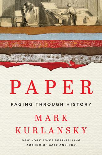
Paper: A World History
by Mark Kurlansky · 3 Apr 2016 · 485pp · 126,597 words
The End of the Free Market: Who Wins the War Between States and Corporations?
by Ian Bremmer · 12 May 2010 · 247pp · 68,918 words
The Great Economists Ten Economists whose thinking changed the way we live-FT Publishing International (2014)
by Phil Thornton · 7 May 2014
The Middleman Economy: How Brokers, Agents, Dealers, and Everyday Matchmakers Create Value and Profit
by Marina Krakovsky · 14 Sep 2015 · 270pp · 79,180 words

Digital Bank: Strategies for Launching or Becoming a Digital Bank
by Chris Skinner · 27 Aug 2013 · 329pp · 95,309 words
The Inner Lives of Markets: How People Shape Them—And They Shape Us
by Tim Sullivan · 6 Jun 2016 · 252pp · 73,131 words
Britain's Europe: A Thousand Years of Conflict and Cooperation
by Brendan Simms · 27 Apr 2016 · 380pp · 116,919 words
Tulipomania: The Story of the World's Most Coveted Flower & the Extraordinary Passions It Aroused
by Mike Dash · 10 Feb 2010 · 263pp · 84,410 words
In Defense of Global Capitalism
by Johan Norberg · 1 Jan 2001 · 233pp · 75,712 words
The Great Transformation: The Political and Economic Origins of Our Time
by Karl Polanyi · 27 Mar 2001 · 495pp · 138,188 words

The Song Machine: Inside the Hit Factory
by John Seabrook · 4 Oct 2015 · 388pp · 106,138 words
The Coming Anarchy: Shattering the Dreams of the Post Cold War
by Robert D. Kaplan · 1 Jan 1994 · 225pp · 189 words
Stuff Matters: Exploring the Marvelous Materials That Shape Our Man-Made World
by Mark Miodownik · 5 Jun 2013 · 281pp · 72,885 words
The Cult of Smart: How Our Broken Education System Perpetuates Social Injustice
by Fredrik Deboer · 3 Aug 2020 · 236pp · 77,546 words
Apollo's Arrow: The Profound and Enduring Impact of Coronavirus on the Way We Live
by Nicholas A. Christakis · 27 Oct 2020 · 475pp · 127,389 words
Stubborn Attachments: A Vision for a Society of Free, Prosperous, and Responsible Individuals
by Tyler Cowen · 15 Oct 2018 · 140pp · 42,194 words

The Voice of Reason: Essays in Objectivist Thought
by Ayn Rand, Leonard Peikoff and Peter Schwartz · 1 Jan 1989 · 411pp · 136,413 words
The Richest Man in Babylon
by George S. Clason · 10 Jun 2019 · 127pp · 39,771 words
The Autonomous Revolution: Reclaiming the Future We’ve Sold to Machines
by William Davidow and Michael Malone · 18 Feb 2020 · 304pp · 80,143 words
Woke, Inc: Inside Corporate America's Social Justice Scam
by Vivek Ramaswamy · 16 Aug 2021 · 344pp · 104,522 words
Nexus: A Brief History of Information Networks From the Stone Age to AI
by Yuval Noah Harari · 9 Sep 2024 · 566pp · 169,013 words
Where Does Money Come From?: A Guide to the UK Monetary & Banking System
by Josh Ryan-Collins, Tony Greenham, Richard Werner and Andrew Jackson · 14 Apr 2012
Age of Anger: A History of the Present
by Pankaj Mishra · 26 Jan 2017 · 410pp · 106,931 words
Economics Rules: The Rights and Wrongs of the Dismal Science
by Dani Rodrik · 12 Oct 2015 · 226pp · 59,080 words
Capitalism: the unknown ideal
by Ayn Rand · 15 Aug 1966 · 400pp · 129,841 words