transit-oriented development
description: urban development that maximizes the amount of residential, business, and leisure space within walking distance of public transport
38 results

Road to ruin: an introduction to sprawl and how to cure it
by
Dom Nozzi
Published 15 Dec 2003
If bicycle and pedestrian speeds differ too widely on a path, pedestrians feel uncomfortable; high car speed on a street makes both pedestrians and bicyclists feel unsafe.) PUBLIC TRANSIT AND TRANSIT-ORIENTED DEVELOPMENT Generally, the intent of a transit-oriented development (TOD) or transit village is a transit stop or station surrounded by relatively high-density residential and commercial development, which transitions toward lower densities in concentric rings further from the center of the TOD. Examples of TODs include the Sunnyside Transit Village near downtown Portland, Oregon; TODs in Redmond, Renton, Seattle, and Shoreline, Washington; and SkyTrain stations in Vancouver, British Columbia.9 To promote use of transit, cities sometimes set a goal that strives to locate much of the region’s new housing within a quarter mile of a transit route.
…
Some development that incorporates features of New Urbanism—traffic calming, mixed-use development, and traditional neighborhood design—goes a step further by making public transit stations and transit stops a key design element. Communities incorporating this design, known to planners as “transit-oriented developments” (TODs) or “transit villages,” strive to make pedestrian, bicycle, and drop-off trips to a transit stop convenient, safe, and enjoyable. Such a design needs a critical mass of commercial, civic, residential, recreational, and school development within walking distance (one-quarter-mile radius) of the transit stop.
…
Department of Transportation, Measures to Overcome Impediments, 43 . 6. U.S. Department of Transportation, Reasons Why Bicycling, 59. 7. U.S. Department of Transportation, The National Bicycling and Walking Study, 30. 8. Burden, Bike Lanes. 9. Litman, “Transit Oriented Development,” 5. 10. “Shorts.” 11. Lincoln Institute of Land Policy, Making the Land Use, 4. 12. Corbett, Portland’ s Livable Downtown. 13. Belzer and Autler, “Transit-Oriented Development,” ii, 4, 5, 8, 14. 14. Moore and Thorsnes, The Transportation/Land Use Connection, 72, 106, 112. 15. But excluding land, lighting, security, parking enforcement, increased air pollution, increased water pollution, increased noise pollution, reduced aquifer recharge, and discouragement of pedestrians and bus riders.
The Option of Urbanism: Investing in a New American Dream
by
Christopher B. Leinberger
Published 15 Nov 2008
In downtown Newark a boulevard is being redesigned to encourage pedestrian travel instead of adding traffic lanes. Although New Jersey is a home-rule state, the collaborative and funded planning process fosters local buy-in. The NJDOT is also actively promoting transit with its Transit Village program, which offers technical assistance plus capital for transit-oriented developments. Watch this video to see how this can be discussed in a way that is attractive to communities: http://www.nj.gov/transportation/works/njfit/video.shtm. The political agency for managing the metropolitan transportation infrastructure already exists; it is the metropolitan planning organization (MPO).
…
Regional-serving places can also include housing, which can provide a base of support for commercial and entertainment uses as well as eyes and ears on the street, which increase safety. Many readers familiar with recent trends in the built environment will notice that I have not used some terms common over the past fifteen years, such as “transit-oriented development,” “New Urbanism,” and “traditional neighborhood development” (TND). The description “transit-oriented development” can and does apply to most regional-serving, walkable urban places. (It is possible, but not ideal, to be nontransit-served and still create 118 | THE OPTION OF URBANISM walkable urbanism, as some of the examples below demonstrate).
…
HT384.U5L45 2008 307.760973—dc22 2007026186 Printed on recycled, acid-free paper Manufactured in the United States of America 10 9 8 7 6 5 4 3 2 1 Search terms: urban, suburban, sprawl, auto-dependent, real estate product development types, transportation, Futurama, affordable housing, inclusionary zoning, impact fees, New Urbanism, transit-oriented development, American Dream, S&L crisis, walkable urbanism, drivable sub-urbanism, global warming, carbon load, obesity, asthma, favored quarter, metropolitan, regionalism, urbanization, population growth, REIT For Helen, Lisa, and Tom Also for Bob, Gadi, Joe, Pat, and Robert C ONTENTS Preface | ix INTRODUCTION 1 FUTU RAMA | AND THE 1 2 0 TH- C E N T U RY AMERICAN DREAM | 12 2 TH E R I S E 3 T H E S TA N D A R D R E A L E S TAT E OF D R I VA B L E S U B - U R B I A | P R O D U C T TY P E S : W H Y E V E R Y P L A C E LO O K S L I K E EV E RY PL AC E EL S E 4 CONSEQUENCES OF D R I VA B L E SUB - URBAN GROW TH 5 63 TH E M A R K E T R E D I S C OV E R S WA L K A B L E U R B A N I S M 6 | | 86 D E F I N I N G WA L K A B L E U R B A N I S M : WH Y M O R E IS BETTER | 113 vii | 45 31 viii | CONTENTS 7 UNINTENDED CONSEQUENCES WA L K A B L E U R B A N I S M 8 ACH I EVI NG LEVELING THE THE | OF 13 8 NEX T AMERICAN DREAM : P L AY I N G F I E L D AND I M P L E M E N T I N G WA L K A B L E U R B A N I S M N OT ES INDEX | | 177 2 01 | 15 0 P REFACE When I was a young child my mother took me to Center City, Philadelphia from our inner-suburban home to visit my father in his office and to go shopping.
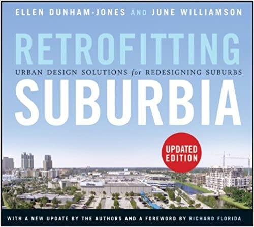
Retrofitting Suburbia, Updated Edition: Urban Design Solutions for Redesigning Suburbs
by
Ellen Dunham-Jones
and
June Williamson
Published 23 Mar 2011
Families who live in transitrich neighborhoods spend just 9%. This is according to a 2007 report by Reconnecting America’s Center for Transit-Oriented Development funded by the Federal Transit Administration and the U.S. Department of Housing and Urban Development, titled “Realizing the Potential: Expanding Housing Opportunities near Transit.” 86 Transit design experts distinguish between transit-oriented design and transit-adjacent design and point to higher ridership levels associated with the former. See Dena Belzer and Gerald Autler, “Transit-Oriented Development: Moving from Rhetoric to Reality,” 2002 report for the Brookings Institution’s Center for Urban and Metropolitan Policy and the Great American Station Foundation, http://www.reconnectingamerica.org/public/reports. 87 Although much of the redeveloped properties to date have been underused industrial properties, artists and unique local bars using those spaces have been evicted, contributing to general concerns about rising property values triggering further displacement through gentrification.
…
Paul (Minnesota) stacked flats stacked maisonettes Stanford Industrial Park (Palo Alto, California) Starbucks static tissues Belmar defined Downtown Kendall/Dadeland Mashpee Commons University Town Center Stiff, David Stone, Edward Durell stormwater Storrs, Douglas streetcar streets Belmar classification system Cottonwood Mall Downtown Kendall/Dadeland Perimeter Place University Town Center walkable design streetscaping strip corridors. see also commercial strips; corridors strip malls. see also commercial strips; Mashpee Commons Stripscape project (Phoenix, Arizona) structured parking. see also car parking student housing subdistricts subdivisions. see residential subdivisions suburban demographics. see demographic entries suburban downtowns suburban form suburban morphology. see morphological analysis suburban myth suburban tissues Belmar defined Downtown Kendall/Dadeland Mashpee Commons University Town Center suburban workplace retrofits Cloud 9 Sky Flats overview Upper Rock Westwood Station suburbia demographic changes in revised history of Sugrue, Thomas Sunny Brook Meadows (Atlanta, Georgia) Suozzi, Tom superregional centers supply-and-demand analysis Surrey Central City (Surrey, British Columbia) sustainability sustainable urbanism Sweetnam, Jan Swope, Christopher synergy TAD (tax allocation district) talent Target target market analysis tax allocation district (TAD) tax-increment financing (TIF) taxpayer strips technoburbs technology technology office parks Temple Terrace (Florida), Ten Principles for Reinventing America’s Suburban Business Districts, book Tennessee. see Nashville, Tennessee Texas Addison Circle Dallas Denton Public Library North Branch Galleria District Garland Greenway Plaza Gulfton Las Colinas Legacy Town Center Plano Woodlands Town Center Texas donuts Texas Instruments (TI) theme centers “third place” Third Street Promenade (Santa Monica, California) Thornton Place Thorsen, Mark TI (Texas Instruments) TIF (tax-increment financing) time and value gap tissues. see campus tissues; elastic tissues; static tissues TOD (transit-oriented development) tolerance Toll Brothers Torti Gallas and Partners Towers apartment building (Prince George’s County, Maryland) town centers townhouses traffic commuting to office parks Cottonwood Mall infilling edge cities time spent in Upper Rock transect concept transit boulevards transit systems. see mass transit transit-oriented development (TOD) Tri-State Metropolitan New York Region Trooien, Jerry troubleshooting Tukwila Urban Center (Tukwila, Washington) Twinbrook Commons (Rockville, Maryland) “Two-Family Senior Residence” permits Tysons Corner (Virginia) UDA (Urban Design Associates) ULI (Urban Land Institute) underperforming asphalt uniformity University Avenue Industrial Park (Westwood, Massachusetts) University of Vanderbilt Medical Center University Town Center (Hyattsville, Maryland) demographic analysis infill development morphological analysis overview Upper Rock (Rockville, Maryland) Uptown District (San Diego, California) Urban Design Associates (UDA) Urban Design Center (Miami-Dade County, Florida) urban design tactics urban fabric urban form Urban Land Institute (ULI) urban morphology. see morphological analysis Urban Network system urban sprawl urban-to-rural transect. see rural-to urban-transect urbanism, walkable U.S.
…
A fear of blight often trumps Not in My BackYard (NIMBY) resistance and may lead to the creation of public-private development partnerships and the provision of tax-increment financing (TIF) for regeneration initiatives. Booming New Agglomerations in Edge Cities or “Edgeless Cities” Concern over traffic and air quality triggers transit-oriented developments (TODs), planning for mass transit, and a market for more intown locations. “Underperforming asphalt” is replaced with a mix of uses, dwellings, and businesses organized on walkable streets and blocks. Changing Locational and Economic Identity of the Suburbs The so-called “bedroom suburbs,” peripheral to the core city when first built, now occupy relatively central locations in their vastly expanded regions.
Straphanger
by
Taras Grescoe
Published 8 Sep 2011
Only a couple of years ago, 1600 Vine was just a surface park-and-ride lot; now it is a bustling urban community, one that is bringing riders to transit rather than more drivers to the road. As Metro’s Roger Moliere sees it, “There’s a catalytic effect with transit-oriented development. The people who own the Pantages Theatre across the street from Hollywood and Vine are now going to develop the whole block. There’s an old office building next door, and a private developer did an adaptive reuse and made it into high-end condos.” But Metro is getting one crucial aspect of the equation wrong: they are building too much free parking into their transit-oriented development. Every apartment at 1600 Vine includes one off-street parking space per bedroom. (Even the project’s salesman told me, “This is Los Angeles, man.
…
By diminishing public space, the automobile has made once great cities terrible places to live. This book also tells the story of some very good ideas. Around the world, energetic and idealistic people are working hard to reclaim neighborhoods once left for dead. The movement goes under a variety of names: transit-oriented development, smart growth, new urbanism. In the wrong mouths, these are just buzzwords; in the wrong hands, they can serve as the justification for boondoggles as bad as any hastily thrown-up boomburg. But the advocates of livable cities and walkable small towns may be on to something—by investing in development that includes well-conceived transit, we can create more sustainable and, crucially, more civil communities.
…
President Obama welcomed the plan, calling it “a template for the nation.”* For a city known around the world as a car-addicted basket case, I pointed out, this is striking progress. “Look, man,” said Villaraigosa, “we’ve got to join the rest of the world. And we’re doing it. In the quintessential city of sprawl, we’re seeing transit-oriented development. We’re moving vertical now. Not anywhere like New York or Chicago—but it’s only been a few years. The reason Los Angeles became the epicenter of the single-passenger automobile is that until now we’ve listened to every naysayer who said ‘no’ to new transit. And we’re now focused on ‘yes.’
Human Transit: How Clearer Thinking About Public Transit Can Enrich Our Communities and Our Lives
by
Jarrett Walker
Published 22 Dec 2011
See also Stops Stop spacing, 61–62, 63 Stops coverage of, 59–64, 60f, 62f, 63f, 102 density measurement and, 112–113 express, rapid, and local, 64–66, 65f importance of location of, 26, 27f shift towards rapid, 66–71 Strategic Pubic Transport Network Plan (Canberra, Australia), 92–93 Subsidies, 13–14, 135–137 Suburbs, new, 192–196, 194f Surrey, Canada, 178–179, 179f Sustainability feedback loops and, 133–134 rapid vs. local service and, 70–71 residential density and, 111, 112 transit lanes and, 106 Switzerland, 164 Sydney, Australia, 54, 139, 153–156, 154f, 158, 160, 220 Syntagma Square (Athens), 178 Taxis, 14 Technology, as tool vs. goal, 6–7, 216–217, 226 Telecommunications, 20 Terminology, 8, 44–46 Thatcher, Margaret, 42 Time of travel, 28–29, 141 Timing, connections and, 163 TOD. See Transit-Oriented Development Tolls, 135 Tourism, 58 To/via problem, 54 Traffic delays, 99, 101, 167 Trains. See Rail transit Transfer slips, 142 Transfers, 153 Transit, defined, 13–15 244 | INDEX Transit centers, 153 Transit lanes, 104–107, 105t, 107f Transit-activated gates, 188 Transit-dependent riders, 43 Transit-friendly places, recognizing, 182–184 Transit-Oriented Development (TOD), 176–179, 179f, 193–196 Transport for London, 219 Transport for Suburbia (Mees), 111–112, 112t Travel time, 28–29, 141 TriMet (Portland), 8, 74, 80–81 Trip attraction, 125 Trip generation, 125 Uncertainty, 37 Understanding, 34 Unfortunate connotations, 44–46 Unions, 79, 80 Universities, 137, 190–192, 191f U.S.
…
A single location is provided with especially direct transit access to many other locations, due to the services converging there for the connection. This location may enjoy dramatically better transit mobility than anywhere else nearby, so it becomes a logical point to locate for people or institutions that value such mobility. The third point is the biggest: connection points are the logical places to make big investments in transit-oriented development. If you want to enjoy the riches of your city without owning a car, and you explore your mobility options through a tool like the WalkScore.com or Mapnificent.net travel time map, you’ll discover that you’ll have the best mobility if you locate at a connection point.1 If a business wants its employees to get to work on transit, or if a business wants to serve transit-riding customers, the best place to locate is a connection point where many services converge.
…
In other cases, however, the proposed site of a development may be so unworkable for transit that it’s simply the wrong place for anything that aims to be transit friendly. In that case, the best transit outcome may be to build low-density, car-based development on such a site, so that the market for transit-friendly denser housing can be encouraged to locate in more transit-friendly places. That’s the case with one of the most famous early efforts at “Transit-Oriented Development” (TOD). Designed in the late 1980s by Peter Calthorpe, Laguna West, south of Sacramento, featured the now-familiar neo-traditional ideals for new suburbs. A gridded town center would consist of offices or housing over retail on pleasant, walkable streets, all surrounding a station for attractive rapid transit.
Key to the City: How Zoning Shapes Our World
by
Sara C. Bronin
Published 30 Sep 2024
See Nashville, TN “Tennessee Whiskey” (song), 119 Texas Crosby, 17, 34, 71–73 Dallas, 104 Newport, a subdivision in Crosby, 19–20, 28 Senate Bill 30 (to remove racially restrictive covenants), 181 Shenandoah, 181 Supreme Court of, 74–75 weather in, 72, 133 See also Austin, TX; Galveston, TX; Houston, TX Texas Monthly, 57 “third places,” 50–52 Thomas Hooker Brewery, Hartford, 35–37 Times Square, 67, 161 topography, 54 tourism, 24–25, 62, 64, 65, 68, 88, 90–91, 157, 158, 161 hotels, 47, 54–55, 57–58, 64, 68, 101, 152–54, 161–63 traffic management, 2, 24, 44, 58, 65, 108, 137–39, 146–47, 204 transferable development rights (TDRs), 51–52, 171 “transit-oriented development,” 12, 104–7, 171 transportation, 90–108 building Austin’s new airport, 56, 186–87 call for a new infrastructure of “active transportation,” 101, 104 carpooling, 101, 197 Disney Transport, 107 security, 10, 93–94 “transit-oriented” development, 12, 101, 104–7, 171 transportation security, 94 walking distance and access to, 106, 127 See also automobiles; bicycling; pedestrians; public transportation Tucson, AZ, 11, 130, 131, 132, 134–35, 202 Twain, Mark, 2–3, 10 U.S.
…
.” __________ Zoning, like many other arts of governance, is a matter of carrots and sticks, deploying regulations to encourage some kinds of development and to discourage others. Once cities erase parking minimums and their attendant terrible consequences, and zone for active transportation, they can round out their reforms by enabling dense development around transit lines and stations. Called “transit-oriented development,” this strategy creates mixed-use, medium-to-high-density development around nodes of transit, which tend to thrive in densely developed areas. Buses can successfully operate along many commercial and residential thoroughfares, in busy cities and suburban areas, and even through and between smaller towns.
…
Light rail and trams, which depend on fixed tracks, require more clustered development to ensure ridership, though some car-dependent places like Dallas, Atlanta, and Seattle have laid light rail tracks first, with density coming after. Subways and monorails, colossally expensive, have only worked in our very densest cities, including Washington, D.C., New York, and Boston. Cities interested in transit-oriented development can pull several different zoning levers. Focusing on fixed stations (rather than, say, ordinary bus stops, which move as routes change), they can identify the areas around the station to be rezoned; a half-mile radius from the station, about a ten-minute walk, is a good place to start.

Ghost Road: Beyond the Driverless Car
by
Anthony M. Townsend
Published 15 Jun 2020
Unlike old-fashioned suburban sprawl, microsprawl has the potential to both increase the supply of affordable housing and reduce carbon emissions. But realizing these benefits will require us to rethink current assumptions about transit, walkability, and good urban design. The first concept that will need a major overhaul is what urban planners call transit-oriented development, or TOD for short. TOD revives the way things were done before the car arrived. And it’s a straightforward idea—build a train, and then put up buildings nearby, ideally within walking distance. This form never went out of style in Europe, and is widely deployed throughout Asia. But the practice took some time to come back into fashion in North America, beginning in the 1990s.
…
Microsprawl. An improvement over its low-density predecessor (bottom half), microsprawl (upper half) is defined by large tracts of higher-density housing accessed by personal rovers and software-train mass transit. DASH MARSHALL. At first glance, automation looks like a force multiplier for transit-oriented development. Prominent urban planners like Peter Calthorpe, a founder of the Congress for the New Urbanism, have embraced the synergy of software trains and compact neighborhoods. It’s easy to imagine driverless shuttles playing a role in linking satellite neighborhoods designed without cars in mind—boasting more footpaths and less parking, for instance.
…
Roping off safe spaces for humans avoids the dilemmas created by AVs and people living in close proximity. It also considerably simplifies the engineering of self-driving software. This is a short-sighted tactic, a turn away from the very best ideas of the recent past, like complete streets and transit-oriented development. Instead, it paves ghost roads—spaces dominated by machines where humans fear to pass—right through the heart of tomorrow’s new communities. * For instance, in Pontiac, Michigan, the site of the Silverdome, demolished in 2017, will become the home of a $250 million Amazon distribution hub.
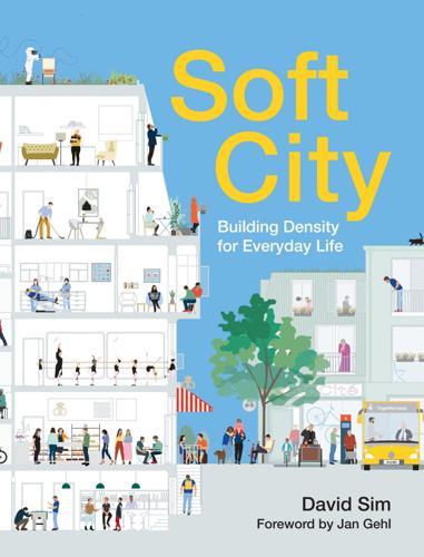
Soft City: Building Density for Everyday Life
by
David Sim
Published 19 Aug 2019
Spending more time outdoors, apart from the obvious health benefits, increases people’s proficiency in reading the weather, learning from others, seeing how they dress and behave, and can help us better live the weather we have. Much lauded Transit-Oriented Development projects use efficient engineering to connect higher-density, built-up areas to mass transit. In this way, they connect people efficiently with other places. However, I think the real challenge of mobility is as much about better connecting people to the place where they are. Rather than Transit-Oriented Development, we need Neighborhood-Oriented Transit. Perhaps, ultimately, it all comes down to the basics of health and well-being—fresh air, exercise, and meeting people.
…
One way in the morning The other way in the afternoon Pedestrian street at lunchtime and holidays Kagurazaka Dori, Tokyo, Japan. In the lively Kagurazaka neighborhood, the local main street goes one way during the morning. It is closed for an hour at lunchtime, and the traffic goes in the other direction in the afternoon. The street is also closed on holidays. TOD (Transit-Oriented Development) is about concentrating high-density development close to public transportation hubs to connect them efficiently to other places. Every moment spent moving between buildings presents an opportunity to connect people with place, with planet, and with other people. We should consider the overlapping and integrated experiences of mobility, part of what is ideally a seamless journey as you change modes of transportation: how you go from your apartment to the street, dropping into in a shop on the way; how you cross the street while interacting with other forms of traffic; how and where you park your bike; how you get to the bike lane from the sidewalk; where and how you wait for the bus; how you get on a tram; and then how you experience the neighborhood as you move about.
The Rent Is Too Damn High: What to Do About It, and Why It Matters More Than You Think
by
Matthew Yglesias
Published 6 Mar 2012
And, indeed, building densely in places where demand for housing is high can be a highly profitable undertaking. But rather than seeing this as a potential triumph of the market, Holt characterized the idea as a “gross violation of property rights” favored by “eco-extremists” who want to “move you into high-density feudalistic transit villages.” Conservative icon and presidential contender Michele Bachmann, a member of Congress from the Minneapolis suburbs, explained in 2008 that liberals “want Americans to move to the urban core, live in tenements, and take light rail to their government jobs.” The reality, as explored here, is that Americans want to move to the urban core.
Public Places, Urban Spaces: The Dimensions of Urban Design
by
Matthew Carmona
,
Tim Heath
,
Steve Tiesdell
and
Taner Oc
Published 15 Feb 2010
The Congress for New Urbanism During the 1990s in the United States, New Urbanism (see chapter 2) developed from two earlier sets of ideas:• ‘Neo-traditional neighbourhoods’ (NTDs) and ‘traditional neighbourhood development’ (TNDs), where the central idea was to design complete new neighbourhoods that would be similar to traditional neighbourhoods (e.g. Duany & Plater-Zyberk 1991). • ‘Pedestrian pockets’ and ‘transit-oriented development’ (TOD), where the central idea was to design neighbourhoods explicitly related to transport connections and of a sufficient density to make public transport viable (e.g. Calthorpe 1989, 1993). Formalised through the creation of the Congress for New Urbanism (CNU) in 1993, a Charter for New Urbanism (www.cnu.org) was published advocating restructuring public policy and development practices to support the following:• Neighbourhoods diverse in use and population
…
Notably New Urbanism has sought to engage, to transform and to offer alternatives to contemporary regulatory systems – what Brain (2005: 230) refers to as ‘the substantive irrationalities of technically rational regulatory structures’ – and conventional (suburban) development practices in ways that support and promote, inter alia, better places. There is nonetheless a gap between theory and aspiration, and the outcomes on the ground. Projects may, for example, claim to be New Urbanist, but feature few of the Charter principles; they may adopt New Urbanist layouts but not be mixed-use, mixed-income, and mixed-tenure, nor be transit-oriented development (see Sohmer & Lang 2000) (Figure 2.8). FIGURE 2.8 Seaside, Florida (Image: Steve Tiesdell). Many projects (self-)described as ‘New Urbanist’, including some of the best known (e.g. Seaside, Florida and Kentlands, Maryland), do not conform with the core principles outlined in the CNU Charter.
…
The preferred area is often limited to what is considered to be a comfortable walking distance – this is either 5 minutes or 10 minutes or 300–800m (1000–2000 feet) (see Chapter 8). The preferred size is sometimes derived from the catchment's population for a primary or elementary school or, in the case of transit-oriented development (TOD), the population required to make public transit viable. The population size has also been derived from that of smaller – supposedly more social – communities in small towns and villages. Jacobs (1961), however, highlighted the fallacy of trying to establish a rigid threshold population, arguing that a population of 10 000 in a large city would not have the innate cross-connections that would occur among the same population in a small town.
The Great Inversion and the Future of the American City
by
Alan Ehrenhalt
Published 23 Apr 2012
Belmar may come as close to the model of retrofitted suburbia as anything that has been completed so far. There is only one component that it lacks: It has no transit system, and it is unlikely ever to get one. OF THE NEARLY DOZEN SUBURBAN RETROFITS designed or planned in the metropolitan Denver area, only one really qualifies as a transit-oriented development, and that is CityCenter Englewood, on the east side of metropolitan Denver, not too far from Stapleton. One can ride a light-rail train right to the entrance of the town center, cross over a pedestrian bridge with impressive metal trusses, and stand in a civic courtyard in which the town hall has taken the place of an old department store in the middle of Cinderella City, an enclosed mall built in 1968 and dead by the last of the 1990s.
…
The amount of pedestrian-oriented retail shopping is very small, about seven thousand square feet in all. A few hundred yards beyond the impressive civic building is a power center with Walmart and the usual giant big-box tenants. This center is an enormous help in paying the taxes of a community of about thirty-two thousand people, but it turns its back on the light-rail station and on transit-oriented development in general. Walking from the station to the Walmart is not only a difficult experience, it is barely a feasible one. CityCenter Englewood is essentially a small, pleasant enclave masking oceans of asphalt. Perhaps the most remarkable thing about the project is that a few blocks beyond all of it, beyond the town green and the town hall, the power center with the big-box stores, there is an old, slightly seedy, but interesting prewar downtown, with locally owned businesses still open.
…
A shopping center was eventually built just across the road from Kentlands, and the residents could walk to it, but it was everything the New Urbanism abhors: cookie-cutter, strip mall–type retail units separated from the street by acres of parking lot. Kentlands hasn’t been a failure by any means. As the years went by, it regrouped in an increasingly urbanist direction and attracted a larger pedestrian-friendly retail component. But it is not a transit-oriented development: The way to get there is by car, and only by car. By 2005, the New Urbanists had demonstrated that they could build successful residential projects on greenfield suburban land. But they had not demonstrated that they could comfortably put together all the pieces that genuinely urbanizing suburbia would need: residential, retail, offices, and public transportation.
City on the Verge
by
Mark Pendergrast
Published 5 May 2017
Service improved; time between trains and buses lessened. Adding more police, Parker instituted a “Ride with Respect” campaign, ejecting annoying panhandlers. He began to plan for free Wi-Fi, first in buses and MARTA stations, then on the trains. Parker hired Amanda Rhein to negotiate transit-oriented developments on the sea of underused parking lots surrounding many MARTA stations, which would add businesses and residential density (with 20 percent affordable housing), swelling the agency’s bottom line while increasing ridership. For the first time in years MARTA began to get positive press, and many of the mostly white Millennials moving back to the city preferred to use public transit over automobiles.
…
I’ll be a little too old to walk the whole BeltLine.” Armour/Ottley and Piedmont Heights It isn’t entirely clear where the BeltLine trail will head once it skirts north of Brookwood Hills. The BeltLine transit is supposed to take a kind of detour north to the Lindbergh MARTA station, site of a botched transit-oriented development at Lindbergh Center, where Lindbergh crosses Piedmont Road. There are far too many parking garages and not enough amenities close to the station. There’s no compelling reason for the trail (or transit) to extend that far north, other than to connect to a rapid transit station. It would make more sense to follow Peachtree Creek east between the Peachtree Hills neighborhood to the north and Brookwood Hills to the south, then turn south and enter the odd little Armour Drive Industrial Park, also known as Armour/Ottley.
…
Stanton Park Starr, Ashlee and Caleb, 200–202 Steele, Carrie, 66 Stockett, Kathryn, 291 Stokes, Jim and Esther, 233–234 Stone, Clarence, 274 Stone Mountain, 17, 76, 78, 183, 192, 254, 257–259 Storrs School, 65 Street Railway Journal, 36–37 streetcar suburbs, 7, 34–42 streetcars, 91, 100, 102, 109 Atlanta Streetcar, 158, 166–167, 192, 277, 281 Brian Leary and, 121–122, 127 C-Loop, 25 cost projection, 158 criticism of plans for, 58–59 downtown loop, 158, 166–167, 192, 277, 282 Ed McBrayer and, 280 electricity for, 36–37 Fred Yalouris and, 127 funding, 132–133, 158, 280–281, 281, 285 history in Atlanta, 34–42, 67 importance to the BeltLine concept, 282–283 Joel Hurt and, 67 Kasim Reed and, 125, 132, 166–167, 281 Northside Trail, 231–232, 235 racial tensions and, 67, 73, 79–80 Ryan Gravel and, 9, 15, 18–23, 51, 280 in Strategic Implementation Plan, 158 streetcar suburbs, 7, 34–42 Tim Keane and, 277, 283 Wayne Mason property and, 58, 94 Westside Trail, 157–158, 280 Street-to-Home program, 112 Studioplex, 15, 182, 252 suburbs automobile transport and, 41–43 new urbanism in, 269 streetcar, 34–38 See also specific locations subway system, 44 Summerhill neighborhood, 71, 195, 208, 219 sustainability, 144–145 Sutherland, Kit and Stuart, 176–177 Sutton, Starling, 14–15, 182 Suwanee, 246–247 Swaney, Lee, 255–256 Sweet, John and Midge, 183 SweetWater Brewing Company, 9, 235–236 SweetWater Design District, 236 Sylvan Hills, 41 Syphoe, Michael, 252–253 Tanyard Creek, 8, 100, 103, 126, 142–143, 228 Tanyard Creek Park, 229 Tapp, Helen, 99 tax allocation district (TAD), 54, 58–62 affordable housing and, 61–62, 92, 182, 274–275, 284–285 Alycen Whiddon and, 26–27, 29, 47 Atlanta Public Schools and, 93, 156, 164–166, 284–285 authorization, 85, 89 poor acceptance of issue, 97, 99, 122–123 revenue projections, 156, 165 tenth anniversary, 155 voter referendum (2008), 93 Woodham opposition to TAD bonds, 90–93, 156, 164 Tax Allocation District Advisory Committee (TADAC), 96, 103 Teasley, William, 198 Terminal Station, 43–44, 43 (photo), 191, 264 Terminus, 31–32, 64 Terry, Ted, 256 Thadani, Dhiru, 271 Them (McCall), 177 TIGER (Transportation Investment Generating Economic Recovery) grant, 125, 157, 160, 280 Toro, Mark, 123, 168–169, 269–270 Torpy, Bill, 243 Toton, Sarah, 194 Toxic Charity: How Churches and Charities Hurt Those They Help (and How to Reverse It) (Lupton), 193 traffic problems, 18, 39–42, 45, 60, 107, 132, 140–141, 167–168, 236, 243, 245–246, 277, 282 transit-oriented development (TOD), 168, 235 Travon Wilson Park, 252 Trees Atlanta, 128, 146, 175, 232, 239 Trolley Barn, 185 trolleys, 34–41 see also streetcars Trubey, J. Scott, 243 Truly Living Well, 151 Trust for Public Land (TPL), 16, 47–52, 88–89 Emerald Corridor LLC, 144 land acquisition strategy, 99 Proctor Creek and, 223 Wayne Mason, negotiation with, 95 T-SPLOST, 132–134, 233, 281, 283 Tuggle, Florine, 293 Turner, Henry McNeal, 65, 69, 71 Turner Field, 144, 162, 270, 277 Tuskegee Institute, 70 Underground Atlanta, 44, 162, 263–265, 270, 277 Union Depot, 43–44, 74 United Way Regional Commission on Homelessness, 112, 114 Up Ahead: A Regional Land Use Plan for Metropolitan Atlanta, 42–43 Upper Chattahoochee Riverkeeper, 143 Urban Parks and Open Spaces (Garvin), 48 Veiled Visions: The 1906 Atlanta Race Riot and the Reshaping of American Race Relations (Godshalk), 75 Vine City neighborhood, 163, 215, 270–272, 288, 294 Virginia-Highland neighborhood, 41, 94, 176–177 voting rights, 65, 68, 79, 81, 254 Vulcan Material Company, 51, 85–87 Wakefield, Kakhi, 230 Walton, Shawn, 204 Warbington, Chuck, 245–247 Wardlaw, B., 116 Warren, Rick, 275–276 Washington, Booker T., 70, 71, 75 Washington Park neighborhood, 7, 48, 77, 157, 211–214 water system, 142–143, 225–226 Waters, Lucius, 208 watersheds, 35, 142–144, 222 Waterworks Park, 227 (illustration), 228, 284 Wedemeyer, Micah, 194 Weeks, Ray, 55–60, 85–86, 89, 91, 93, 278–279 Atlanta BeltLine Inc.
Mobility: A New Urban Design and Transport Planning Philosophy for a Sustainable Future
by
John Whitelegg
Published 1 Sep 2015
Second, if travel distances are short, then it becomes more attractive to walk and cycle- particularly if space is allocated for exclusive rights of way- and to use public transport, and this in turn reduces the energy use and the environmental impacts of transport.” “Accessibility as a priority rather than transport.” “Recasting the sector’s primary objective as one of enhancing accessibility invariably lead to a different set of policies and strategies, like transit-oriented development and the provision of highly interconnected bikeway networks. These strategies not only conserve, land, energy and financial resources, but also help the poor and those without privatized motorised vehicles to access goods and services within the city. In short, accessible cities are inclusive, resourceful and pro-poor.”
…
The rationale Spatially dispersed, car dependent cities are expensive to build and maintain, require large amounts of energy to sustain normal life, produce large amounts of pollution and greenhouse gases and increase vulnerability to energy shocks and food availability. Cities should be managed to achieve high densities, transit-oriented development, high modal share for walk and cycle and low levels of car ownership and use. The consequences of urban sprawl are financially ruinous. Sheehan has summarised some work in this area: “A number of studies in the US have quantified the extra infrastructure costs required by unfocussed development….if 25 million units of new housing in the US were to be accommodated between 2000-2025 in a more space efficient way, the nation would preserve more than 1.2 million hectares of land, require 3000 fewer miles of state roads and need 4.7 million fewer water and sewer “laterals.”
Arbitrary Lines: How Zoning Broke the American City and How to Fix It
by
M. Nolan Gray
Published 20 Jun 2022
For example, there is now a consensus on the need to condition major grants like the Community Development Block Grant and Surface Transportation Block Grant—major sources of revenue for local community development programs and transportation infrastructure, respectively—on local governments adopting meaningful zoning reforms, such as those discussed previously.19 A similar proposal has called on the Federal Transportation Administration to condition funds for new transit investments on zoning liberalization.20 After all, why should the federal government pay for the construction of new transit in municipalities that will use zoning to block any and all transit-oriented development? Restrictive zoning persists in large part because its political coalition at the local level—typically vocal minorities of incumbent property owners—is rock solid, particularly in the small, homogenous suburbs where the misuse of zoning has been most egregious. One way to resolve this issue is to shift at least some oversight powers to the state and federal levels, where policymakers and public servants can take a more holistic approach.
…
CHAPTER 6: SPRAWL BY DESIGN • For an environmental defense of cities, Green Metropolis by David Owen is without a doubt the essential text (Riverhead Books, 2009). • On the flip side, The Environmental Protection Hustle by Bernard J. Frieden examines the misuse of environmental rhetoric to thwart the growth of cities (MIT Press, 1979, out of print). • In Zoned Out, Jonathan Levine examines how land-use regulation thwarts walkable and transit-oriented development, against clear market signals (RFF Press, 2005). CHAPTER 7: TOWARD A LESS BAD ZONING • For a great survey of the early YIMBY movement—the spark of the current housing reform moment—see Golden Gates by Conor Dougherty (Penguin Press, 2020). • For a useful set of reforms to the substance and process of zoning, see A Better Way to Zone by Donald L.
World Cities and Nation States
by
Greg Clark
and
Tim Moonen
Published 19 Dec 2016
The central government now fully recognises Tokyo’s role as Japan’s world city and is prepared to support its regeneration and repositioning in order to drive the national economy. Japan also positions Tokyo and other Japanese cities as pioneers of smart urban development, which attracts a great deal of interest from other national governments. Japanese smart city concepts (such as Kashiwa‐no‐ha, transit‐oriented development and urban area management) are welcomed by the national ministries, and are demonstrated to other countries in eastern and southern Asia for how cities can embed disaster 88 World Cities and Nation States prevention, health innovation and new cluster incubation (Kashiwa‐No‐Ha Smart City, 2015).
…
Since 2015, central government has also put pressure on the Maharashtra state government to consider the ‘odd/ even’ car rule that restricts vehicles to travelling every other day, a policy that has been implemented in Delhi (Business Insider India, 2015; Dhoot, 2015; Nair, 2015; Sikarwar, 2015; Singh, 2015; The Financial Express, 2015; Business Standard, 2016). Central government is also encouraging the monetisation of land assets, similar to the Chinese model, to raise funds for urban development – although this must be handled carefully to limit speculation and unaffordability. Transit Oriented Development is also being encouraged by the central government, with the forthcoming Mumbai Metro’s two new lines and other initiatives across India as flagship schemes. Mumbai’s metro extensions are to be half financed by the state of Maharashtra, with the remaining capital supplied by international financial institutions (for example, the Asian Development Bank) and potentially Japanese government assistance.
…
Published 2017 by John Wiley & Sons, Ltd. 278 Index Egypt, 19 Europe, 15, 19, 20, 36, 46, 47, 52, 55, 127, 164, 234 European Investment Bank, 46 European Union, 15, 43, 220, 224, 227 Federal systems, 9–10, 13, 16, 30, 62, 95, 210, 237, 239 Federation of Canadian Municipalities, 143–144, 147, 237 Fiscal redistribution, 90, 225, 229 Forum for Consultations, 88, 93, 237 France, 8, 10, 20, 21, 55, 57, 58, 60–63, 66, 67, 211, 216, 222, 229, 231, 232, 236 performance of second cities, 231 Frankfurt, 7, 46 Friedmann, John, 23 Fukuyama, Francis, 23 Gatwick Airport, 50 Geneva, 7 Germany, 20, 230 Giuliani, Rudy, 113 Global cities, see World Cities Globalisation, 5–9, 18, 19, 25, 28–30, 36, 43, 75, 85, 100, 179, 181, 203, 216, 221, 224, 227, 231, 237, 239 Greater Manchester, 44, 52, 233, 236 Guangzhou, 21, 155, 157, 159, 180, 184, 230, 231 Haddad, Fernando, 126 Hamburg, 11, 206 Hanseatic League, 20 Heathrow Airport, 50 High Speed 3 (HS3), 46, 234 Holland, 21 Hollande, Francois, 58, 60 Hong Kong, 7, 9, 11–14, 17, 24, 25, 29, 85, 91, 149–162, 184, 186, 190, 199, 204, 206, 208, 210, 211, 213–215, 220–222, 226, 227, 233, 234, 239 advocacy, 221 Chief Executive, 161–162 Closer Economic Partnership Arrangement (CEPA), 155 Consultative Committee on Economic and Trade co-operation, 161 density, 13, 157 economic sector output, 25 economic transformation, 154–155 empowerment and centralisation, 211 Financial Services Development Council, 161 future political arrangements, 159 government system, 9, 208 growth and performance data, 152 national tradition in globalisation, 29 in One Belt, One Road initiative, 158 one country, two systems, 152 Pearl River Delta (PRD), 154, 156, 157, 159 population and visitor growth, 204 regional governance, 213 relationship with Beijing, 154–156 size, 12 India, 10, 16, 30, 98–108, 134, 166, 210, 231, 234, 236 Jawaharlal Nehru National Urban Renewal Mission (JNNURM), 103–104 Make in India Week, 103 performance of second cities, 231 Indus Valley, 19 Inter‐governmental conflict, 13, 235 Istanbul, 21, 50, 227 Italy, 20 Japan, 10, 71, 82–94 Meiji era, 83 National Planning Act, 85 performance of second cities, 231 Jinping, Xi, 185 Johannesburg, 8 Johnson, Boris, 41, 42, 92 Khan, Sadiq, 49, 51 King James I, 38 Korea, 69–80, 183, 192, 210, 212, 216, 228, 229, 231, 232, 233, 235 performance of second cities, 16, 231 Lahore, 20 Lastman, Mel, 210 Latin America, 4, 21, 123, 128, 133, 134, 238 Leiden, 21 Lisbon, 21 Lister, Sir Edward, 48 Livingstone, Ken, 41, 210 London, 5, 6, 9, 11–15, 21–27, 29, 30, 33–53, 59, 63, 67, 69, 92, 93, 108, 123, 134, 145, 154, 155, 204–208, 210–216, 220–222, 226–229, 231, 233, 234, 236, 238 Abercrombie Plan, 39 advocacy, 221 air capacity, 50 ‘Big Bang,’ 40 boroughs, 42, 45, 48, 236 Brexit, 36, 42, 46–48, 52, 220 business leadership, 93 Canary Wharf, 39 Channel Tunnel Rail Link, 40 city leadership, 220 Index City of London, 38, 40, 42 city‐state, 27 collaboration with other cities, 236 Crossrail, 1, 2, 37, 51, 205, 216, 221 Davies Commission, 50 de‐industrialisation, 39 density, 13 diversity, 227 Docklands regeneration, 40, 216 economic sector output, 25 empowerment and centralisation, 211 escalator region, 226 fiscal devolution, 48–49, 69, 145, 212, 216 fiscal outflows, 215 Government Office for London, 22, 36, 40 government system, 9, 208 Greater London Authority (GLA), 40, 41, 50, 209, 210 Greater London Council (GLC), 26, 39, 40 Greater South East, 36, 39, 50, 52, 213, 214 green belt, 39, 52 growth and performance data, 36 High Speed 2 (HS2), 46, 234 Home Counties, 39 housing, 49–50, 206 Jubilee Line, 37, 40 London Assembly, 37 London County Council, 39 London Development Agency, 41 London Docklands Development Corporation, 39 London Enterprise Panel (LEP), 42, 51 London Finance Commission, 48–49, 216 London First, 40, 108, 134, 221, 222 London Land Commission, 50 Mayor, 42, 51, 221, 236 mayoral system, 36, 210, 233 Metropolitan Board of Works, 39 Millennium projects, 37, 40 national tradition in globalisation, 29, 30 performance of second cities, 231 population and visitor growth, 204 regional governance, 50–51, 213 size, 12, 211 South Bank, 40 system of cities, 13, 229–230 Transport for London (TfL), 41, 51 2012 Olympics, 37, 215, 218 world city literature, 23, 24, 27 Los Angeles, 7, 23, 195, 231 Luzhkov, Yuri, 166, 210 Lyon, 21, 61, 231, 232 Madrid, 7, 13 Masuzoe, Yoichi, 92–93 McLoughin, Patrick, 51 279 Mediterranean, 19, 20 Melbourne, 8 Mercantilism, 21 Merv, 20 Mesopotamia, 19 Metropolitan areas, 7, 53, 61, 76, 104, 106, 108, 115, 133, 135, 234, 236 Metropolitan government, 9, 15, 16, 36, 52, 56, 67, 72, 123, 208, 212 Milan, 13, 227 Modi, Narendra, 103 Montreal, 8, 14, 138, 139, 143, 231 Moscow, 9, 11, 13, 14, 17, 18, 24, 25, 29, 30, 163–176, 204, 205, 208, 210, 212, 215, 216, 220, 221, 226, 229, 236, 237, 239 Central Federal District, 175, 237 city and federal government relationship, 165–169 density, 13, 172 economic sector output, 25 empowerment and centralisation, 211 financial services, 168 geopolitical tensions, 168 government system, 9, 208 growth and performance data, 164 higher education, 166 mayoral system, 210 Moscow River, 172 Moscow Urban Forum (MUF), 175, 237 national tradition in globalisation, 29, 30 New Moscow, 167, 173 oblast, 166 1980 Olympic Games, 166 patterns of development, 164 population and visitor growth, 204 Rail and road investments, 172 regional governance, 213 Russian spatial hierarchy, 170 size, 12 Skolkovo innovation district, 165, 172 Soviet model, 165–167 tax revenue, 164, 167 transition after 1991, 166–169 transport, 205 2018 football World Cup, 165, 174 Mughal Empire, 20 Mumbai, 14, 16, 30, 97–109, 123, 206, 207, 210, 212, 217, 226, 227 advocacy, 221 Bollywood, 98 Bombay First, 103, 106, 108 Delhi Mumbai Industrial Corridor (DMIC), 106 density, 13, 101 economic sector output, 25 empowerment and centralisation, 211 280 Index Mumbai (cont’d) fiscal imbalances, 102 fragmented governance, 105–106 government system, 9, 208 Greater Mumbai, 98 Greater Mumbai Development Plan, 102–103 growth and performance data, 98 High Powered Expert Committee, 101 intergovernmental conflict, 101 investment capacity, 106 Maharashtra state government, 98, 100–102 Mumbai Metropolitan Regional Development Authority (MMRDA), 99, 214 Municipal Corporation of Greater Mumbai (MCGM), 99, 100 national tradition in globalisation, 29, 30 Navi Mumbai, 107 constitutional amendment, 100 population and visitor growth, 204 regional governance, 213 relationship with higher tiers of government, 99–101 size, 12, 14 Smart City Mission, 103, 105 Transit Oriented Development, 104 weak growth management, 98, 100 Munich, 7 crime, 113 density, 13 economic sector output, 25 empowerment and centralisation, 211 fiscal crisis, 113 government system, 9, 208 growth and performance data, 111 housing, 118 Housing Authority (NYCHA), 114 Hurricane Sandy, 114, 119 immigration, 116 Metropolitan Transportation Authority (MTA), 113 national tradition in globalisation, 29, 30 New York State, 111, 115 9/11, 112, 114 performance of second cities, 231 population and visitor growth, 204 regional governance, 213 Regional Plan Association (RPA), 120 size, 12 transport infrastructure, 117 tri-state area, 111, 119–120 Urban Development Action Grant, 113 New Zealand, 10 North America, 4, 17, 19, 107, 137, 146, 227 Northern Powerhouse, see North of England North of England, 21, 229 North East, 236 Northern Powerhouse, 45, 228, 234 National Conference of Cities (ConCidades), 128, 134, 237 National frameworks, 29–30, 207, 231–237 National governments, 4–6, 8, 10, 11, 22, 25–32, 46–51, 57–58, 62–64, 70, 72–74, 76–79, 86–92, 99–100, 102–107, 116–119, 130–134, 143–147, 167, 168, 171–175, 183–187, 204, 220–224, 227–229, 231–239 National urban policy, 7, 67, 103, 112, 128, 157, 165, 171, 233, 237 Nation states, 3–4, 6–8, 13, 14, 20–32, 38, 48, 196, 204, 210–212, 220, 225, 229, 231, 236 age of, 3, 6 century of, 6, 239 Netherlands, see Holland New York City, 5, 7, 10, 14, 16, 24, 26, 27, 30, 63, 67, 92, 93, 110–121, 123, 137, 155, 206, 210, 212, 214, 215, 220, 222, 227, 229, 239 advocacy, 221 airport system, 117–118 Bloomberg, Michael, 114, 119 city and nation state relationship, 113–115 Ohmae, Kenichi, 23 One country, two systems, 11, 52, 152, 155, 210 Organisation for Economic Co-operation and Development (OECD), 22, 26, 30, 74, 75 Osborne, George, 45, 222, 236 Ottoman Empire, 20 Paris, 13, 15, 22, 23, 25, 27, 32, 46, 50, 54–67, 92, 205–207, 211, 212, 214–218, 222, 232, 238 advocacy, 221 APUR (Paris Urban Planning Agency), 67 Chirac, Jaques, 57 density, 13 division of responsibilities, 60 economic sector output, 25 empowerment and centralisation, 211 fragmentation, 56, 62 government system, 9, 208 Grand Paris Express, 56, 59, 64–66 growth and performance data, 204 Ile de France (Regional Council), 56–58, 60, 64 Law for Solidarity and Urban Renewal, 59 Index Maptam law, 61, 66 mayoral system, 210 Metropole du Grand Paris, 56, 59–60, 62 Mobilisation Plan for Development and Housing, 63 national tradition in globalisation, 29 NOTRe bill, 64 Paris‐Saclay, 56, 59 population and visitor growth, 204 regional governance, 213 relationship with national government, 57–60 size, 12 state-region contracts, 63 territorial development contracts, 59, 63, 66 Pearl River Delta, 7, 11, 12, 17, 152, 157, 159, 161, 211, 213 Persia, 20 Provincial governments, see State governments Putin, Vladimir, 167 Rayy, 20 Regional policies, 22, 28 Republic of Ireland, 10 Rio de Janeiro, 6, 123, 129, 130, 231 Russia, 8, 17, 18, 21, 30, 31, 164–172, 174–176, 210, 212–213, 229, 236–237 Rust Belt, 21 Samarkand, 20 San Francisco, 7, 231 São Paulo, 13, 14, 17, 30, 122–135, 206, 207, 212, 215–217, 220, 226, 229, 231, 235 advocacy, 221 business climate, 132–133 density, 13, 124, 133 economic sector output, 25 empowerment and centralisation, 211 fiscal constraints, 130–132 fiscal outflows, 215 government system, 9, 209 growth and performance data, 123 housing, 133 Minha Casa Minha Vida, 126 national tradition in globalisation, 29, 30 performance of second cities, 231 Plano de Aceleracao de Crescimiento, 129 population and visitor growth, 204 regional governance, 213 relationship with its nation state, 125–127 revenue sources, 129–130 São Paulo 2040, 126–127 São Paulo State, 123, 125 size, 12 Urban Mobility Pact, 126 281 Sassen, Saskia, 24 Seoul, 6, 9, 13, 15, 24, 27, 68–80, 85, 210, 215, 218, 227, 231, 235, 238 advocacy, 221 capital region, 69 Cheonggyechoen River regeneration, 72, 73 de-concentration, 68, 71, 75, 76, 80 density, 13 economic sector output, 25 empowerment and centralisation, 211 fiscal devolution, 77–78 fiscal outflows, 215 government system, 9, 209 growth and performance data, 69 jaebol, 71, 72, 76 mayoral system, 210 metropolitan government, 73, 78 national tradition in globalisation, 29 1988 Summer Olympics, 72 population and visitor growth, 204 regional governance, 213 relationship with central government, 70–74 segyehwa, 72 self‐government, 72 Seoul Republic, 71 size, 12 Shanghai, 7, 11, 14, 18, 27, 153, 154, 157, 159, 160, 177–188, 207, 216, 217, 220, 226, 227, 230, 233, 239 advocacy, 221 bond issuance programme, 184 de-centralisation, 181 density, 13, 184 economic sector output, 25 empowerment and centralisation, 211 free trade zones, 182, 186 government system, 9, 209 growth and performance data, 178 hukou, 184–185 internationalisation, 181–182 land leasing, 183 national tradition in globalisation, 29 performance of second cities, 231 population and visitor growth, 204 Pudong New Area, 181 region, 7 regional governance, 213 relationship with central government, 179–183 revenues, 187 size, 12 state owned enterprises, 180 treaty port, 180 2010 World Expo, 182, 218 Yangtze River Delta (YRD), 178, 181, 184 282 Index Sheffield, 43, 45, 52, 231, 236 Silk Road, 20, 158 Singapore, 11, 18, 30, 85, 91, 189–200, 206, 207, 215, 219 advocacy, 221 Civil Service, 196 Concept Plan, 192 density, 13, 198, 200 Economic Development Board (EDB), 191, 194 economic development model, 198 economic sector output, 25 empowerment and centralisation, 211 governance history, 191–193 government linked companies, 194–195 government system, 9, 209 growth and performance data, 191 Housing Development Board (HDB), 191 independence, 191–192 internationalisation, 191–192 land management, 195 Ministry of National Development (MND), 195–196 National Trade Unions Congress (NTUC), 193 national tradition in globalisation, 29 National Wages Council, 193 People’s Action Party (PAP), 191, 195–196 performance of second cities, 231 population and visitor growth, 204 regional governance, 213 self‐rule, 191 size, 12 water management, 195 Smith, Adam, 21 Sobyanin, Sergei, 167 Soon, Cho, 210 South Africa, 8, 134 Sovereignty, 15, 16, 19, 20, 26, 152 Soviet Union, 23, 166 Special cities, 9, 17, 239 State governments, 7, 10, 100–103, 105, 111, 114, 124, 127, 216, 217, 234 St Petersburg, 21, 164, 168, 170, 175, 236 Sun Yat‐Sen, 154 Switzerland, 7, 20 Sydney, 8, 25 Systems of Cities, 4, 7, 13–14, 28 Taylor, Peter, 21 Territorial development, 8, 22, 73 30 Years’ War, 20 Tokyo, 5, 6, 11, 16, 23–25, 27, 74, 77, 81–94, 207, 210, 215, 220, 226, 227, 235, 238 advocacy, 221 aging population, 92 business climate, 91–92 de‐centralisation, 84, 85 de‐concentration, 84, 88 density, 13 devolution, 89 economic sector output, 25 empowerment and centralisation, 211 fiscal redistribution, 90 government system, 9, 209 growth and performance data, 82 industrialisation, 84–85 metropolitan government, 82, 84, 87, 89, 93 National Strategic Special Zones, 86, 90 national tradition in globalisation, 29 population and visitor growth, 204 regional governance, 213 relationship with central government, 83–88 size, 12 Tokyo Metropolitan Government, 84–85, 88 Tokyo Problem, 88 2020 Olympics, 86, 87, 91 2002 Urban Regeneration Law, 85–86 Urban Renaissance HQ, 87 Toronto, 8, 13, 14, 17, 23, 25, 136–149, 207, 210, 212, 215, 216, 218–220, 222, 227, 231, 234 advocacy, 221 density, 13 economic sector output, 25 empowerment and centralisation, 211 fiscal vulnerability, 145 government system, 9, 209 Greater Toronto Area, 137 Greater Toronto Civic Action Alliance, 147 growth and performance data, 137 immigration, 141, 146 infrastructure investment, 144–146 mayoral system, 210 Metrolinx, 140 national tradition in globalisation, 29 1998 City of Toronto Act, 139, 140 Ontario, 137 population and visitor growth, 204 regional governance, 213 relationship with the nation state, 138–143 size, 12 Smart Track, 140 Toronto Board of Trade, 147–148 universities, 137, 141 US–Canada Auto Pact, 139 Waterfront Toronto, 141–142 Trade, 5–7, 20–22, 99, 128, 146, 152, 161, 186, 205, 225–226 Index Travers, Tony, 49 Treaty of Westphalia, 20 Trudeau, Justin, 143 Turkmenistan, 20 UKIP, 46 Unitary systems, 9–10, 15, 21, 238 United Kingdom, 10, 21, 24, 36, 37, 154, 210, 231, 238 United Nations, 21 United States, 7, 10, 21, 24, 26, 71, 112, 231, 235 Advisory Commission on Intergovernmental Relations (ACIR), 115 US federal reserve, 24 War on Poverty, 113 Uzbekistan, 20 Wallerstein, Immanuel, 24 Washington, 27, 113, 114, 116–117, 119–120, 231 The West, 27, 69 Western liberal democracy, 23 West Midlands, 52, 228, 236 Won-sun, Bak, 74 World Bank, 30–31, 157, 174, 196 World cities advantages and disadvantages, 225–231 age of, 5–6, 203–223 collaboration between world cities and other cities, 236–237 definition, 3–4 in the future, 237–239 literature, 22–24, 27–28 typology, 29–31 Xiaoping, Deng, 180 Valls, Manuel, 66 Vancouver, 8, 143, 231 Zurich, 7, 227 283
The End of the Suburbs: Where the American Dream Is Moving
by
Leigh Gallagher
Published 26 Jun 2013
The suburbs are built for life with kids, and we’re not having nearly as many of them. There are a variety of reasons for this that we’ll explore later, but the implication is the same: “The whole Ozzie and Harriet day has passed,” says Peter Calthorpe, the San Francisco–based architect and urban planner who pioneered the notion of transit-oriented development and who, as a cofounder of the New Urbanism movement, is one of the leading thinkers on alternative growth models to conventional suburban development. Millennials hate the burbs . . . America’s eighty million so-called millennials, defined for the purposes of this book as those born between 1977 and 1995, are an enormous group—bigger than the baby boomers.
…
See New Urbanism; Walkable communities varieties of, 9, 13, 15–16 Suburbs, The (album), 51, 79 Suburgatory (TV series), 91 Susanka, Sarah, 137, 139–140 Swank, Larry, 7 Target, 18, 172 Taxation mortgage interest deduction, 35, 61, 74–75 property, limitations for community, 58–59 Taylor, Kate, 51 Thompson, Boyce, 6 Tinyhouseblog.com, 138 Tiny House movement, 138 Toll, Bob, 68–70 Toll Brothers future projects, 198, 207–8 outer suburban development by, 68–69 urban developments by, 6, 18, 23, 163–66, 172, 190 walkable community by, 129 Top Tier Towns, 204 Touraine, New York City, 164–65 Tragedy of the Commons, The (Whitney), 59 Transit-oriented development, 19 Transportation automobile dependence. See Automobiles; Commuting costs, and household budget, 100–101 mode split, 82 and suburban development, 29–34, 62 Treehugger.com, 139 Tribeca, New York City, 17, 151, 169 Tucker, Raymond, 48 Tumlin, Jeffrey, 93 Twitter, 51 Unleashed (store), 18 Ur (Mesopotamia), 27 Urbanized suburbs.
Walkable City: How Downtown Can Save America, One Step at a Time
by
Jeff Speck
Published 13 Nov 2012
As celebrated on their website in the (stereotypically effeminate) voice of the fictional Biff Fantastic: Urban planners and metrosexuals agree that suburbs make you fat! With the Compactorizer, you’ll move out of boring and subtly racist suburban homes and into smallish apartments in high-density transit-oriented developments. Only the Compactorizer uses a patented planning doctrine to create noisy nights, random crimes, and panhandler harassment, triggering the high-stress and abnormal dietary patterns so important for rapid weight loss.18 As both an urban planner and a purported metrosexual, I can feel my credibility tanking here.
…
It is very possible that much of the new growth around DART stations would have happened elsewhere without it, which throws into question the system’s economic impact. However, it is likely that this development would have occurred at lower densities, and probably at greater distance from downtown. Some Texas scrubland was saved, and some gasoline, too. But there is no getting around the fact that all this new transit-oriented development has not increased the percentage of people taking transit. Even the biggest transit fan—me, perhaps?—would have a hard time considering the DART system anything but a failure. Which raises the question: What is Dallas doing wrong? For an answer, we turn to Yonah Freemark, the sagacious blogger behind The Transport Politic and probably the best-informed source on transit today.
Supertall: How the World's Tallest Buildings Are Reshaping Our Cities and Our Lives
by
Stefan Al
Published 11 Apr 2022
With commuters having the option to take a train instead of a car, the city gradually removed parking spaces in the urban center. These spaces were transformed into open-air cafés and neighborhood parks. Social activities increased fourfold.15 While cities such as Copenhagen were initially outliers, as the twentieth century progressed, city planners adopted transit-oriented developments more widely as a model for urban development. In Portland, Oregon, for example, planners brought back streetcars, strengthened in their convictions by studies proving that designing communities around transit hubs promotes the use of public transit, bringing health benefits. Nine separate studies from across the world showed that people walked between eight and thirty-three minutes more a day when using public transit, since it typically requires walking to a bus stop or a train station.16 While Copenhagen’s and Portland’s approaches work for midsized cities, the needs of a larger city like Hong Kong come with unique challenges and efficient solutions.
…
See also urbanization as engines of civilization, 148–49, 208–9 environmental benefits of, 269–71 highways cutting through, 220 historic meandering layouts of, 216 industrialization of, 154–55 land for streets and parking, 214, 220 as magnet for young people, 146–47 population increase by 2050, 265, 270 problems exacerbated by, 209–10 size constrained by transport speed, 234 transportation before cars, 215–19 city planning. See also building regulations; zoning greening of Singapore and, 240, 254–55 history of, 150–52 Hong Kong version of, 233 social intermingling and, 203 transit-oriented development and, 221–22 climate change. See also carbon emissions; global warming concrete and, 48 elevators’ energy use and, 110 Passivhaus standards and, 136 skyscraper design and, 81, 268 supertall as marker of, 17 clinkers, 28–29, 32 cluster of towers, 76–77, 86 Colosseum, Roman, 55, 90–91 Commerzbank, Frankfurt, 133 commute, 162, 217–18, 219, 220–22, 234–35 computer simulations of loads, 9, 83–84 concrete.
Order Without Design: How Markets Shape Cities
by
Alain Bertaud
Published 9 Nov 2018
The ways that planners now attempt to reverse past controls and restrictions likely best highlight why this is folly: • Planners use new regulations to allow mixed land use in many residential areas, where past regulations were aiming precisely at segregating various uses, like commerce and residence. • Planners use transit-oriented development (TOD) aimed at increasing FAR around transit stations. If FAR had not been regulated around the stations in the first place, they would have long ago reached the level corresponding to demand in these areas. However, TOD could benefit from coordinated urban design to provide better pedestrian access to public transport.
…
See Indonesia; Kampungs Sustainability in Amsterdam, 338–339 as objective functions, 344–346, 345f–346f sustainable cities for, 113–114, 131–133, 134f theory of, 326–329, 328f, 345–346, 345f–346f Sustainable cities, 113–114, 131–133, 134f Taleb, Nassim Nicholas, 308–309 Taxes congestion pricing, 23–24, 30 policy for, 279–280, 280f property taxes, 355, 393n16 for rentals, 283–284 tax credits, 267 tax incentives, 284–285, 377–378 in urban economics, 349 Technology affordability and, 345–346, 346f in Buenos Aires (Argentina), 389n12 in China, 386n11 culture and, 384n6 for data, 3, 101–102, 102f, 145, 156–158, 158f economics and, 367–368 environment and, 204–208, 206f–207f for government, 369 Internet as, 383n2 for land development, 380–381 for land use, 10–11 microcomputers, 21 mobility and, 149–152, 151f, 214–216, 215f, 216t Nissan Leaf for, 208–210, 209f for policy, 97–198, 208–211, 209f–210f, 214–218, 215f, 216t, 217f sustainable cities as, 113–114, 131–133, 134f for transport, 51–52, 161–162, 162f, 176 in urban economics, 352 in urban planning, 239–240, 380–381 in US, 199–200 Telecommuting, 42 Thailand, 256 Theory of adequate housing, 269–270 of affordability, 49, 219, 301 of affordable housing, 276–277 of alternative urban shapes, 307–310, 329–330, 333, 346–347 of city-states, 366 of congestion, 201 of containment policy, 337–339, 341–344 of data, 146–147 of demographic projection, 212–213 of density gradients, 97–100, 98f–99f, 103t, 107–111, 111f density in, 108–109, 109f of design, 8–9 in economics, 240–241, 253–254 of engineering, 322–323 of GHG emissions, 40, 201–202, 334–335, 338 Gibrat’s law, 21–22 of growth, 27–28 for Hanoi (Vietnam), 138–139 of height regulations, 311–312, 311f of household income, 221 of housing consumption, 302–303 of incentives, 328–329 of incentive zoning, 329–330 of inclusionary zoning, 276–278, 278f, 282–287 of income-consumption relation, 249 of informal settlements, 127–130, 129f, 288 KIP, 267–268 of labor markets, 45, 46t, 47–48, 219–220, 314–315 of land development, 383n4 of land markets, 96 of land price, 304–305 of markets, 303–304 of master plans, 4, 8, 11, 394n2 of minimum standards, 222–224 of mobility, 48–49 of negative externalities, 18, 55, 73, 86, 159–161, 165, 171, 199, 284 of PIR, 224–228, 225f, 227f–228f, 244 of policy, 332–333 of poverty, 16 proportionate effect, 21–22 of regulatory leverage, 320–321 of sanctuary cities, 376 science and, 2–3 of smart growth, 334 of spatial data, 30, 39–45, 39f, 44f–45f of spatial distribution, 126–130, 127f, 129f of standard urban model, 95–97, 98f–99f, 99, 335–336 of sustainability, 326–329, 328f, 345–346, 345f–346f of telecommuting, 42 for transport modes, 212–217, 216t trickle-down theory, 240–241, 391n10 of urban economics, 2–3, 13, 17 of urban planning, 27–33, 32f of urban spatial structures, 52–53 of wasteful use, 344 Tianjin (China), 114–116, 115t, 339 TOD. See Transit-oriented development Tolls, 387n6 as congestion pricing, 23–24, 49, 201, 217 land price and, 97, 100 mobility and, 357f in New York, 170–172 in Singapore, 387n6 in urban planning, 61–62, 349–350 Topography density, 84f of environment, 202 in land supply, 344 in PIR, 224–225, 225f in Rio de Janeiro, 103–104 road networks and, 61 in urban planning, 43–44, 44f in zoning, 308, 312 Tourism, 313–314 Tour Montparnasse (Paris), 310 Toyama (Japan), 373, 376–379, 378f Toyota, 216–217, 217f Traditional externalities, 311–312, 317–319 Trains.
…
See Transit; Transport Transit, 390n21 in Beijing (China), 173–175, 174f in CBDs, 311 data for, 361–362 economics of, 158–160, 362 GTFS for, 156, 389n10 investments in, 362–363 in London, 176–177 mobility and, 165–168, 166f–168f, 191–196, 192f, 194f, 196f in New York, 186–188, 188f in Paris, 176–177 in South Africa, 274–275 transit bonuses, 333 transport modes and, 156, 158, 160–161, 209f, 211–212 travel time and, 358–359 Transit-oriented development (TOD), 70–71 Transport. See also Bus rapid transit in Beijing (China), 162–165, 163f, 166–168, 167t CO2-e and, 208–211, 209f–210f composite model, 39f, 40 data on, 31–33, 32f, 355 demographic projection and, 169–170, 170t dispersed model for, 39–40, 39f economics of, 19–20 in France, 31–33, 32f growth and, 49 in Hanoi (Vietnam), 162–165, 163f indicators for, 361 labor markets and, 34, 35f–36f, 36–41, 38f–39f master plan for, 28–30 in Mexico City, 162–165, 163f mobility and, 143–149, 160–165, 162f–163f, 175–185, 178t, 179f, 180t, 182f–183f, 185t, 211–214, 214f monocentric model for, 39, 39f in Paris, 44, 44f, 164–165 public space for, 311–312 RELU-TRAN for, 95 in Seoul (Korea), 38 technology for, 51–52, 161–162, 162f, 176 telecommuting and, 42 travel time and, 184–185, 185t, 384n17 urban village model for, 39f, 40–41 Transport modes BRT as, 191–196, 192f, 194f, 196f data for, 157f, 161–162, 162f, 184t–185t, 188–191, 188f–189f government and, 148, 152, 274–275 in London, 147–148 mobility and, 92, 143, 160–165, 162f–163f in New York, 165–167, 166f, 167t in Paris, 165–167, 166f, 167t policy for, 211–213 in South Africa, 167–168, 168f theory for, 212–217, 216t transit and, 156, 158, 160–161, 209f, 211–212 urban economics of, 176–181, 178t, 179f, 180t Travel time data for, 165–171, 166f, 167t, 168f–169f, 170t motorcycles and, 167–168 in policy, 363 transit and, 358–359 transport and, 184–185, 185t, 384n17 urban planning for, 213–214, 214f Travel time index (TTI), 172–175, 174f Trickle-down theory, 240–241, 391n10 TTI.
The Gated City (Kindle Single)
by
Ryan Avent
Published 30 Aug 2011
Intense development pressure due to soaring real estate costs, and the determination in London to keep the financial center competitive, no doubt encouraged a more tolerant attitude to height in the City and its immediate environs. But perhaps Canary Wharf also inured Londoners to the spectacle of clusters of tall buildings, easing the path for developers of land in the City itself. The second flavor of the strategy is one that’s been deployed more frequently in America: transit-oriented development (TOD). Rather than focus on just one or a few alternative central cities, TOD uses new transit lines to create opportunities for increased density in places previously oriented around automobiles. While residential areas can often be difficult places to pursue new density, the common (and bleaker) elements of urban and semi-urban landscapes, like old industrial land and strip malls, are more fertile ground for redevelopment.
Aerotropolis
by
John D. Kasarda
and
Greg Lindsay
Published 2 Jan 2009
We want to live near airports, even if we don’t care to admit it—even to ourselves. Stapleton, Reunion, and the Mesas offer compelling evidence. We flock to them because that’s where the jobs are, next door or at the end of a flight. So how do we build a better aerotropolis than the ones we have now? One of the best tools in our kit is something called “transit oriented development,” an idea coined by Peter Calthorpe the same year he helped found the Congress for the New Urbanism. The name says it all: neighborhoods and cities built along the splines of public transit. Sometimes that can be buses, but typically it means trains. Denver is doing exactly that with its $7 billion investment in FasTracks, which will have fifty-seven stations dotting 119 miles of track when it’s finished.
…
Strung along a thirty-mile stretch of highway are three universities—Michigan, Eastern Michigan, and Wayne State— with one hundred thousand students among them. The first already spends nearly $1 billion a year on basic research and is busy hiring two thousand scientists to fill a new campus furnished and then abandoned by Pfizer. Plans are afoot to connect all three to the airport via commuter trains and light rail, sowing the seeds for transit-oriented developments. In between are rivers, lakes, and hiking trails—not a bad foundation for your own private Portland. But the question then becomes what to build … and where to build it. And by whom, to what ends? The site is a jumble of jurisdictions. The airports are under Ficano’s thumb, but everyone else is free to thumb his or her nose at him.
…
They operate on the principle that you can solve any conundrum if enough deadline pressure, caffeine, and sleep deprivation are applied. The participants were divided into three teams, each charged with plotting the entire site. One was led by Douglas Kelbaugh, the dean and former partner of Peter Calthorpe, with whom he’d invented transit-oriented development. He brought a battery of faculty, students, architects, and urban planners to assist him, including two of the consultants later tasked with drafting the actual master plan. And then there was Kasarda, who flew in to brief them all on what exactly it was they were building. They left and got to work.

Stuck: How the Privileged and the Propertied Broke the Engine of American Opportunity
by
Yoni Appelbaum
Published 17 Feb 2025
Although some longtime opponents are back for this latest round, their ranks have thinned. Most of the younger people who stand to testify have come to support the proposal. Evan Yeats, the new ANC commissioner from Green’s district, delivers a ringing endorsement of affordable housing, density, and transit-oriented development. A newly elected city councillor from Takoma Park reluctantly relays the objections of his constituents, before hastening to add that while he worries about the loss of long-term parking, he does not share any reservations about density. “We are well aware of the need for affordable housing all over, and we are well aware of the prospects for density in increasing opportunity, as opposed to disquiet, among immediately adjacent neighborhoods.”
…
The otherwise baffling decision to declare a fast-food franchise historic was explained by the fact that the property owner had been pursuing a plan to redevelop the site, which sits next to a major intersection and a subway station, as a multistory building. All sorts of structures become historically significant when the alternative is transit-oriented development—even the cookie-cutter architecture of failed, knockoff burger joints. As American cities revived, bringing the professional classes back into urban areas, they brought with them their penchant for designating their residential neighborhoods as historic districts. In Manhattan, 27 percent of all lots are now located in historic districts or otherwise landmarked, predominantly in the borough’s most affluent areas.
Happy City: Transforming Our Lives Through Urban Design
by
Charles Montgomery
Published 12 Nov 2013
gas prices doubled: Cortright, Joe, “Driven to the Brink: How the Gas Price Spike Popped the Housing Bubble and Devalued the Suburbs,” white paper, CEOs for Cities, 2008. At the time: “Welcome to Stockton: Foreclosure Capital USA,” China Daily, September 17, 2007, www.chinadaily.com.cn/world/2007-09/17/content_6111808.htm (accessed January 7, 2011). spends twice as much: Center for Transit-Oriented Development and Center for Neighborhood Technology, “The Affordability Index: A New Tool for Measuring the True Affordability of a Housing Choice,” Washington, DC: Brookings Institution, 2006; Center for Neighborhood Technology, “Penny Wise Pound Fuelish: New Measures of Housing + Transportation Affordability,” Chicago, 2010.
…
segregated by income class: Fry, Richard, and Paul Taylor, “The Rise of Residential Segregation by Income,” Pew Research Center, August 1, 2012. www.pewsocialtrends.org/2012/08/01/the-rise-of-residential-segregation-by-income (accessed October 14, 2012). Seattle’s Rainier Valley: Greenwich, Howard, and Margaret Wykowski, “Transit Oriented Development That’s Healthy, Green & Just,” Puget Sound Sage, May 14, 2012. www.pugetsoundsage.org//downloads/TOD%20that%20is%20Healthy,%20Green%20and%20Just.pdf (accessed October 11, 2012). lightning-fast gentrification: Moss, Jeremiah, “Disney World on the Hudson,” New York Times, August 21, 2012, A25.
Hot: Living Through the Next Fifty Years on Earth
by
Mark Hertsgaard
Published 15 Jan 2011
"Entry-level workers couldn't afford to live within thirty miles of the place, so they were all driving their junkers every day, spewing pollution." The Village at Overlake Station was the first transit-oriented development of its kind in the United States, said Norman. Completed in 2002, it added 308 affordable housing units near the Overlake bus transit center. "We now average 0.6 cars per household in that neighborhood, compared to 1.2 cars in similar neighborhoods," said Norman. "That's what transit-oriented development can do to fight climate change." "The Future Ain't What It Used to Be" The first time Ron Sims had tried to rally his hometown against global warming, they laughed at him.

EcoVillage at Ithaca Pioneering a Sustainable Culture (2005)
by
Liz Walker
Published 20 May 2005
Sixty presenters from around the world gave fascinating presentations (translated simultaneously into English, French, and Wolof) on topics pertaining to each day’s theme. We heard about Curritiba, Brazil, a model of ecological planning, and about traditional villagers in the Sarawakian rainforest of Malaysia, who are struggling to keep their identity in the face of logging, Westernized education, and the economic lures of the city. There were talks about “transit villages” on new urban rail lines (allowing residents to conveniently hop on the train to go to work, shop, or play) and urban development patterns from Perth to Vancouver. And we heard an analysis of the political and economic context of Africa — a continent still struggling to emerge from 500 years of slavery, colonialism, and exploitation.
Grand Central: How a Train Station Transformed America
by
Sam Roberts
Published 22 Jan 2013
In 2006, his Midtown Trackage Ventures bought the property, which includes 75 miles of track to Poughkeepsie and 82 miles to Wassaic, from American Premier Underwriters; its parent, American Financial Group (which acquired the bankrupt Penn Central’s real estate); and the Owasco River Railway for about $80 million. The sale included 1 million square feet of air rights (the lease grants the MTA another 100,000, but they cannot be sold until Midtown TDR Ventures sells or uses their air rights). “We’re basically a tenant, but it’s effectively ours,” said Robert Paley, the MTA’s director of transit-oriented development, who has never met Penson. Metro-North pays $2.24 million annually to its landlord under the extended lease that expires on February 28, 2274 (which, when the lease was made, was as far in the future as the mid-1700s was in the past). The $2.24 million, which is not so much rent as a mortgage payment, will remain the same until 2019, when the MTA has an option to buy the terminal and track right-of-way (and intends to, although the owner has an option to extend the date to 2032).

One Billion Americans: The Case for Thinking Bigger
by
Matthew Yglesias
Published 14 Sep 2020
The fact that each route makes multiple city center stops also means there isn’t such a crush of passengers at any one station, again facilitating faster operations. Higher frequency, cheaper fares, and comprehensive integration with other modes means S-Bahn stations are appropriate locations for transit-oriented development rather than park-and-ride lots. Compared with the American model, the S-Bahn model does require more investment—neither the downtown tunnel nor the electrification of suburban tracks is free—but the investment unlocks incredible value by turning the entire legacy rail network into useful mass transit.

Once the American Dream: Inner-Ring Suburbs of the Metropolitan United States
by
Bernadette Hanlon
Published 18 Dec 2009
The statewide goals are specifically aimed at curbing metropolitan growth and preventing the loss of farmland and open space. They also provide access to affordable housing in local jurisdictions, and statewide land-use control is similarly linked to planning metropolitan-wide transportation, deemphasizing the use of the automobile, and embracing public transit and transit-oriented development. As Carl Abbott (1997: 28) states in his examination of the politics of Portland’s growth management, “Oregon . . . operates with a system of strong local planning carried on within enforceable state guidelines that express a vision of the public interest.” The ability of the state to force local jurisdictions to comply with measures that alleviate sprawl and ensure the stability of older areas is a key element of success.

How Cycling Can Save the World
by
Peter Walker
Published 3 Apr 2017
CHAPTER 3 1 Peter Walker, “Utrecht’s Cycling Lessons for Migrants: ‘Riding a Bike Makes Me Feel More Dutch,’” The Guardian, April 28, 2016, https://www.theguardian.com/cities/2016/apr/28/utrecht-cycling-lessons-refugees-riding-bike-feel-dutch. 2 Interview with the author. 3 UK Office for National Statistics. 4 Center for Transit Oriented Development, 2008 study. 5 2011 UK census, car or van availability by local authority. 6 Enrique Peñalosa TED talk, September 2013. http://www.ted.com/talks/enrique_penalosa_why_buses_represent_democracy_in_action. 7 UK National Travel Survey. 8 League of American Bicyclists. 9 John Pucher and Ralph Buehler, City Cycling (Cambridge, MA: The MIT Press), 2012. 10 2011 census, analysis: cycling to work. 11 Pucher and Buehler, City Cycling. 12 TransAlt, “Fifth and Sixth Avenue Bicycle and Traffic Study,” 2015, https://www.transalt.org/sites/default/files/news/reports/2015/TransAlt_5th_6th_Avenue_Report.pdf. 13 Rosamund Urwin, “Why Are Female Cyclists More Vulnerable to London’s Lorries?”
Building the Cycling City: The Dutch Blueprint for Urban Vitality
by
Melissa Bruntlett
and
Chris Bruntlett
Published 27 Aug 2018
“We also saw some examples where it was integrated with a bike shop or café, where you could drop off your bike and have it maintained during the day, as a way to establish the ‘park and ride’ not just as a place to get to, but as a place in and of itself.” Atlanta already has a model for this, with the Metropolitan Atlanta Rapid Transit Authority’s (MARTA) Transit-Oriented Development Program, whereby the agency sells all or a portion of its surface lots to developers for mixed-use developments sharing public space. Figure 8-4: A design concept for a raised/floating bus stop, which incorporates bicycle parking and mitigates bike–bus conflicts. (Credit: Alta Planning + Design) In a huge, diverse region with complications presented by a variety of urban, suburban, and rural settings, Maines has no illusions about which development pattern presents the biggest obstacle to their goal of growing active transportation: “I think the primary challenge is the suburban context.
Suburban Nation
by
Andres Duany
,
Elizabeth Plater-Zyberk
and
Jeff Speck
Published 14 Sep 2010
The code is broken down into two sections: Urban Infill, which addresses existing neighborhoods, and Greenfield Development, which deals with the creation of new neighborhoods from scratch. In both cases, new growth is modeled on the old patterns that people cherish. The TND is not the only instrument of its kind. Other groundbreaking zoning ordinances include Sacramento County’s Transit Oriented Development Ordinance, Pasadena’s City of Gardens Code, and Loudon County, Virginia’s Rural Village Ordinance. Municipalities that are currently making use of customized TND-style ordinances include Miami-Dade County, Orlando, Columbus, Santa Fe, and Austin. These ordinances demonstrate the TND’s adaptability to a wide range of local conditions.
Life as a Passenger: How Driverless Cars Will Change the World
by
David Kerrigan
Published 18 Jun 2017
The car parks will occupy 325,000 square metres.[49] The impact of regulation on parking was highlighted in a 2016 White House report[50] which identified parking as one of the “local policies acting as barriers to housing supply. Parking requirements generally impose an undue burden on housing development, particularly for transit-oriented or affordable housing. When transit-oriented developments are intended to help reduce automobile dependence, parking requirements can undermine that goal by inducing new residents to drive, thereby counteracting city goals for increased use of public transit, walking and biking. Such requirements can also waste developable land, and reduce the potential for other amenities to be included; a recent Urban Land Institute study found that minimum parking requirements were the most noted barrier to housing development in the course of their research.”[51] If given the opportunity to reducing parking and by designing more connected, walkable developments, cities can reduce pollution, traffic congestion and improve economic development.
Road to Nowhere: What Silicon Valley Gets Wrong About the Future of Transportation
by
Paris Marx
Published 4 Jul 2022
The third and final piece of the puzzle is the Boring Company’s imagined system of tunnels that turned out to be little more than narrow underground roads for expensive vehicles with autonomous driving systems—if they are ever truly realized. These two aspects also display Musk’s preference for sprawling suburbs of single-family homes over dense, transit-oriented development. Putting these three elements together and considering them alongside the current trajectory of our capitalist society reveals a different kind of urban future than the one Musk wants us to believe will solve our problems. Without altering the underlying social relations, these technologies are likely to reinforce the trends of growing tech billionaire wealth and their desire to close themselves off from the rest of society.
Dawn of Detroit
by
Tiya Miles
Published 13 Sep 2017
That is a modern map, developed long after Detroit was settled by Euro-Americans and the grinding process of westward expansion gave some Americans a new West from which to turn back and view a “Middle West” and an “Old Northwest.” In the 1600s, Bkejwanong (an Anishinaabe place name) was a hunting ground and transitional village site for the many indigenous groups who peopled the lake country, expertly moving across this wetland terrain to suit their subsistence needs from season to season. At the end of that century, French explorers associated this spot with another name, Détroit, or “strait,” a narrow channel joining two bodies of water.
Better, Stronger, Faster: The Myth of American Decline . . . And the Rise of a New Economy
by
Daniel Gross
Published 7 May 2012
Seattle’s light-rail offering, which debuted in July 2009, attracts about 25,000 daily users. When Norfolk’s small light-rail system opened in September 2011, officials thought it would attract about 2,900 riders per day, but in its opening months the Tide attracted about 5,000 daily riders. In these and other cities construction of light rail has spurred transit-oriented development and generally boosted the local interest in and appetite for expansion. Again, the payoff isn’t in the jobs created to build the rail or to set up express bus systems. Rather, it’s in the rent that landlords will get, the ability to attract more workers for employers, and the benefit to homeowners.
The Metropolitan Revolution: How Cities and Metros Are Fixing Our Broken Politics and Fragile Economy
by
Bruce Katz
and
Jennifer Bradley
Published 10 Jun 2013
Sustain the Gain The full impact of transformative visions and game-changing initiatives is achieved only over time. Innovations generated in an applied sciences campus need to be commercialized and produced for mass markets. 09-2151-2 ch9.indd 200 5/20/13 6:56 PM A REVOLUTION REALIZED 201 Transit systems built in a Los Angeles or Denver metro need to be maintained and their full potential for transit-oriented development realized. Manufacturing firms in Northeast Ohio and elsewhere grow by having constant and reliable access to advice and capital to retool their facilities and skilled workers to operate their plants. In communities like Houston there is a never-ending supply of immigrants to serve, children to teach, and communities (particularly suburban ones) to revive.
The Human City: Urbanism for the Rest of Us
by
Joel Kotkin
Published 11 Apr 2016
Transport Canada research indicates that fuel consumption per kilometer (and thus GHG emissions) rises nearly 50 percent as arterial street traffic conditions deteriorate.173 Still, some areas, such as California, continue to restrict suburban growth in an effort to combat climate change. California’s policies have had mixed results. Attempts to promote “transit-oriented” developments have proven notably ineffective in reducing automobile travel, a Los Angeles Times report found. Relatively few of those living in these buildings actually took transit.174 In addition, these strict policies may have the unintended effect of driving people, jobs, and factories from California’s mild climate to areas in the United States and abroad where extreme weather, as well as weaker regulations, lead to greater energy consumption, all but wiping out any greenhouse gas reductions achieved by California’s policies.175 BACK TO THE ROOTS: RECONNECTING WITH NATURE Suburbia’s poor image among environmentalists belies the fact that suburbanization, at least initially, was driven by what H.

Lonely Planet Peru
by
Lonely Planet
The third sector, covering the southeastern area, is the zona cultural (cultural zone, rebranded as the cultural history zone), where most other visitor activity is concentrated. To travel between the zona cultural and the zona reservada, you’ll need to take the Río Alto Madre de Dios to the park’s main transit village, Boca Manu. Finally, outside the national park boundaries southeast of Boca Manu are, ironically, some of the very best wildlife-watching opportunities, especially at the macaw and tapir salt licks around the Manu Wildlife Center. 4Sleeping There are a couple of lodges within the park, plus a tented camp: you can’t stay at any of these independently, but all are included on tours – with the owners or with other agencies.